Researchers have reconstructed, for the first time, continent-scale river drainage systems on Mars and identified 16 mega-basins, each at least 100,000 km². These networks once covered about 4 million km² (~5% of ancient Mars) and likely transported nearly half of the planet's river-eroded sediment. Because long-distance water flow increases rock–water interaction and potential preservation of chemical biosignatures, these basins are priority targets for future life-detection missions and sample-return planning.
Scientists Map 16 Ancient Mega-Basins on Mars — New Roadmap in the Hunt for Past Life

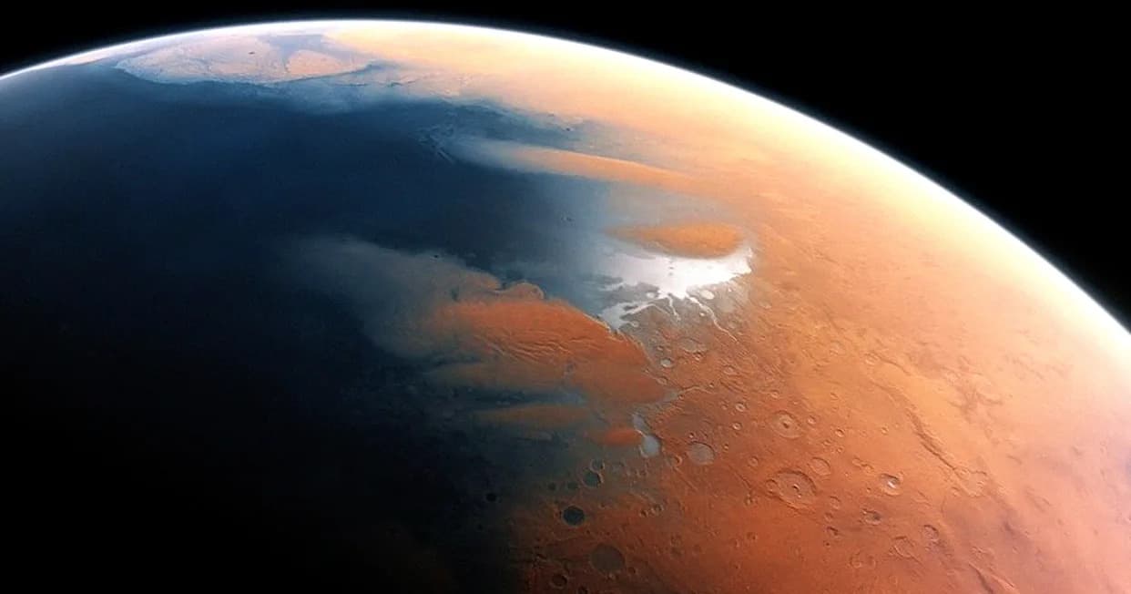
A complex valley network near Idaeus Fossae on Mars, captured by the Mars Reconnaissance Orbiter. New mapping shows such networks were once part of vast, connected river basins that carried nearly half the sediment moved by Martian rivers, and may be among the most promising places to search for evidence of ancient life. . | Credit: NASA/JPL-Caltech/University of Arizona
For the first time, researchers have reconstructed continent-scale river drainage systems on Mars, revealing ancient networks that could be among the most promising places to search for chemical traces of past life.
Billions of years ago, before Mars froze into the cold, dry planet we see today, flowing water reshaped much of its surface. Scientists had long cataloged thousands of dried-up channels, valley networks and paleolake basins, but it was unclear how many of these features formed integrated, basin-scale drainage systems comparable to major river basins on Earth.
In a new study led by postdoctoral fellow Abdallah Zaki and assistant professor Timothy Goudge (Department of Geological Sciences, University of Texas at Austin), the team compiled decades of orbital observations and previously published maps of valleys, lakebeds and outlet canyons. They relied heavily on datasets from NASA's Mars Odyssey spacecraft, which has imaged more than 90% of the planet, and traced how individual fluvial features once connected to form coherent basins.
"We did the simplest thing that could be done — we just mapped them and pieced them together," Zaki said. Where impact craters or billions of years of erosion obscured the original topography, researchers inferred former river paths by analyzing local topography and the orientations of surrounding valleys.
Key Findings
The team identified 16 major drainage basins, each at least 38,610 square miles (100,000 square kilometers) — the same minimum size used to define large river basins on Earth. Together these megabasins once covered roughly 1.5 million square miles (4 million square kilometers), about 5% of ancient Mars' surface. The authors caution this is likely a conservative estimate because later impacts and wind erosion have erased parts of the fluvial record.
Although Mars lacks the plate tectonics that create many of Earth’s mountain-built drainage networks, these few basins appear to have dominated Martian sediment transport. The 16 basins likely carried nearly half of all river-eroded sediment on Mars. One basin that drained into the large canyon Ma'adim Vallis may have accounted for roughly 15% of the total transported sediment.
Why It Matters
On Earth, long-lived river systems are often biodiversity hotspots: water traveling long distances interacts with diverse rock types, producing chemically rich environments conducive to life and preserving potential biosignatures. The study's authors argue that Mars' megabasins — where water flowed long distances and carried sediments from wide catchments — would have been especially favorable for producing and concentrating chemical evidence of past life.
As a result, the new megabasin map provides a practical roadmap for future exploration, including robotic missions searching for chemical traces of life and planning sample-return campaigns. "The longer the distance, the more you have water interacting with rocks, so there's a higher chance of chemical reactions that could be translated into signs of life," Zaki said. Goudge added that the map could help prioritize landing sites and sampling strategies.
The research is described in a paper published Nov. 24 in the Proceedings of the National Academy of Sciences (PNAS).
Bottom line: These 16 reconstructed mega-basins concentrate much of Mars' ancient fluvial activity and are prime targets for missions seeking preserved chemical traces of past life.
Help us improve.