AI-driven, parcel-level risk models are revealing thousands of U.S. homes face higher wildfire danger than federal, coarse-scale maps indicate. ZestyAI’s analysis found 3,000+ Los Angeles properties labeled low risk by FEMA actually faced elevated danger (about $2.4 billion in value) and flagged roughly 1.2 million California properties worth ~$940 billion as riskier than federal indexes suggested. While these finer-grained tools can improve mitigation and insurance decisions, social, economic, and regulatory barriers — from insurance and market impacts to inequality in rebuilding capacity — complicate real-world responses.
AI Risk Maps Show Millions Of U.S. Homes Are More Vulnerable To Wildfires Than FEMA Data Indicates

Burned trees stand next to the ruins of a house in Altadena, California. | Ali Matin/Middle East Images/AFP via Getty Images
Wildfire danger is expanding faster and closer to where people live than many official maps suggest. Recent AI-driven analyses show thousands of homes classified as "low risk" by federal datasets actually faced elevated danger during the historic 2025 Los Angeles fires — raising urgent questions about how we measure and manage fire risk.
Parcel-Level Models Expose Gaps In Federal Data
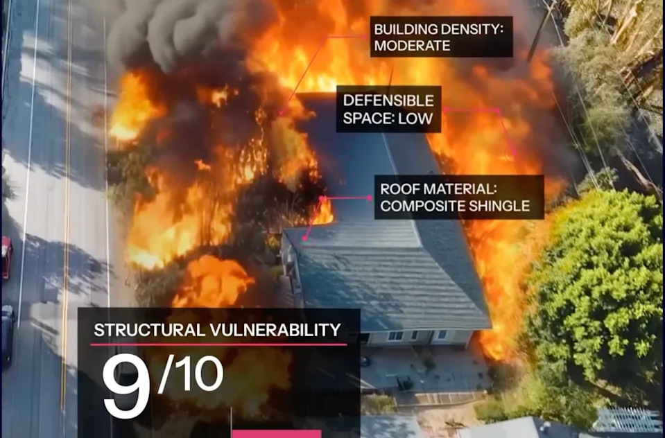
Traditional wildfire-risk tools such as FEMA’s National Risk Index (now migrated into the Resilience Analysis and Planning Tool) typically estimate hazard at coarse scales like census tracts or counties. Those aggregated units can group lower- and higher-risk structures together, obscuring the differences that matter at the property level: roof material, siding, nearby vegetation, fences, topography and defensible space.
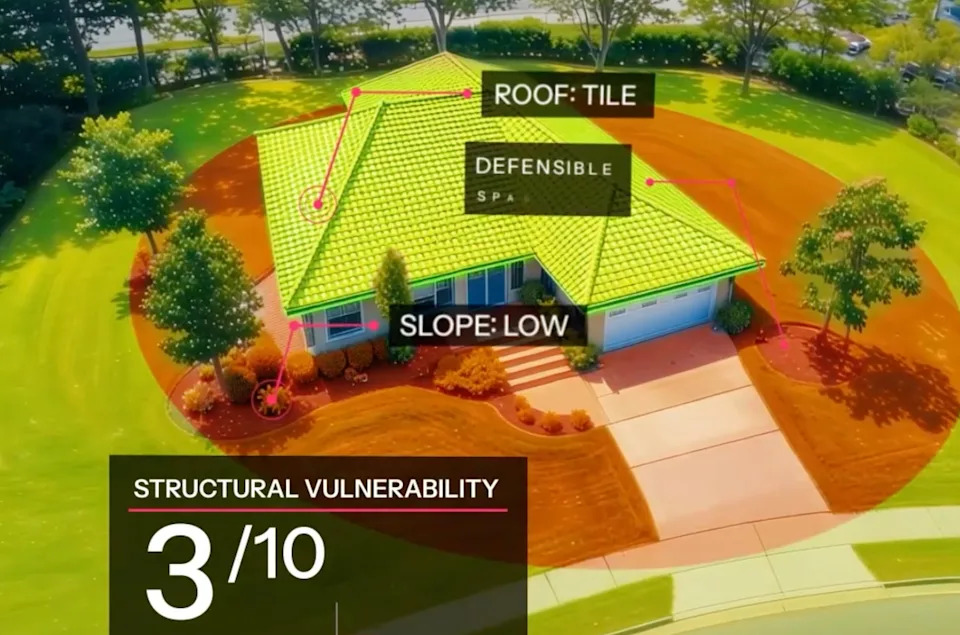
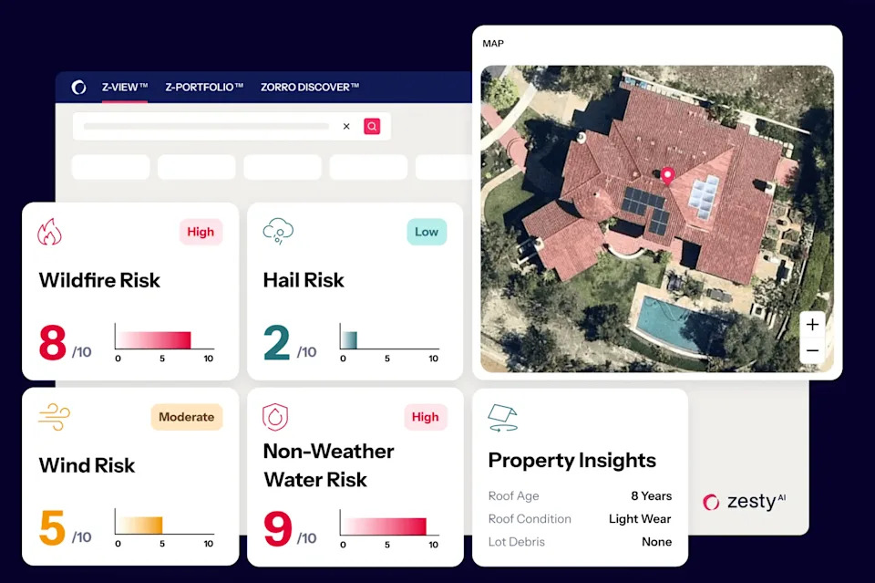
Newer, AI-powered models estimate risk at the parcel or building scale. One company, ZestyAI, used satellite imagery plus historical fire records and climate variables to train a model that evaluates individual homes. When ZestyAI applied its model to areas burned in the 2025 Los Angeles wildfires, it found more than 3,000 properties FEMA had labeled as "low" or "no risk" actually showed elevated fire danger. Those properties represent an estimated $2.4 billion in value. Extending the comparison across California, ZestyAI identified about 1.2 million properties — roughly $940 billion in estimated value — that FEMA’s coarser index classified as low risk but which appear more vulnerable under parcel-level analysis.
How The AI Model Works
ZestyAI combined high-resolution satellite and aerial images with data on vegetation, building footprints, roof and siding characteristics, local terrain, historical fire perimeters, and climate inputs to derive parcel-level risk scores. As Kumar Dhuvur, Chief Product Officer at ZestyAI, explained: "You’ve got to be very granular in your assessment of risk." Insurers historically relied on agent or homeowner questionnaires rather than uniformly observed, measurable attributes — an approach that can miss important ignition pathways and exposures.
Limits And Tradeoffs
Experts caution that parcel-level AI models are a major advance but not a complete solution. Hussam Mahmoud of Vanderbilt University notes that fire risk is a neighborhood-scale phenomenon: a single poorly defended property can create a path for fire to spread through an otherwise protected community. Even highly fire-resistant homes can be overwhelmed by prolonged ember storms and extreme winds, as seen in 2025.
On-the-ground inspections can produce the most accurate individual assessments, but they are costly, intrusive, and still do not fully capture how a fire will propagate across a landscape. There is a tradeoff between precision and scale: remote sensing and AI can cover millions of parcels quickly, while field surveys provide depth at far greater expense.
Screengrabs from ZestyAI’s Z-Fire platform. | Courtesy Zesty.ai
Why This Matters
The stakes are enormous. In 2025, wildfires worldwide burned roughly 390 million hectares — an area comparable to or greater than about 90% of the combined land area of European Union countries — and the Los Angeles fires may rank among the costliest disasters in U.S. history. Better risk maps can help direct mitigation work, shape building codes, guide insurance underwriting, and inform where investments in fuels management or defensible space will do the most good.
But more precise risk scores also have economic and political consequences. Developers and homeowners fear higher risk ratings could depress property values or trigger insurance losses. Zillow removed climate-risk scores from listings after pressure from California real estate interests concerned about resale impacts; insurers might similarly increase premiums or reduce availability based on refined data.

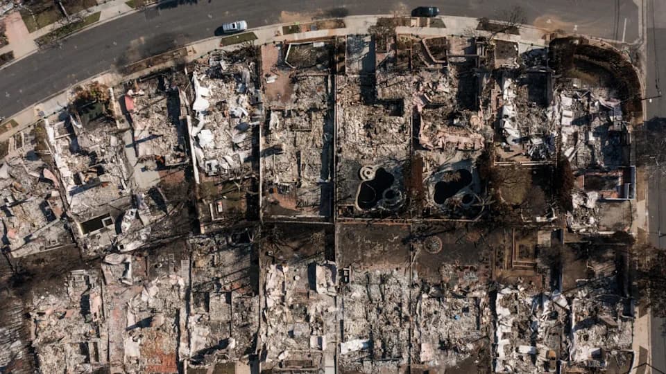
A view of the damaged entrance of the Altadena Public Library in California The fire destroyed over 9,000 structures.|Ali Matin/Middle East Images/Middle East Images via AFP via Getty Images
Equity, Policy, And The Path Forward
Regulatory changes matter: until 2023, California restricted insurers from using forward-looking catastrophe models, limiting the sector’s ability to price future climate-driven risk. Now that forward-looking tools are allowed, some insurers are returning to the market, and targeted mitigation programs can help lower premiums for improved parcels.
Yet social and economic barriers remain. Wealthier households displaced by fires often can relocate temporarily or rebuild to higher standards; lower-income residents frequently lack those options and may rebuild in the same vulnerable conditions. As UCLA urban planning scholar Minjee Kim observed, financial capacity shapes who can avoid future risk and who is forced back into harm’s way.
AI-driven, parcel-level risk maps are a powerful new tool — they can reveal previously hidden vulnerabilities and help prioritize mitigation. But technology alone cannot resolve the political, economic, and social tradeoffs required to stop building and rebuilding homes in areas that are growing more hazardous. Policymakers, insurers, developers and communities will need to act on the data, and do so equitably.
"Wildfires have very complex dynamics, and a backward-looking approach is not sufficient," said Firas Saleh, Director of North America Wildfire Models at Moody’s.
Photo caption: After the 2025 fires, more than 9,000 structures were reported destroyed in parts of Los Angeles County, illustrating how parcel-level variation can determine who survives and who loses everything.
Help us improve.