NOAA's CPC says La Niña is likely to dissipate by spring 2026, with ENSO-neutral conditions expected through at least late spring. A modeled burst of westerly winds in mid–late January should push warmer Pacific waters eastward, weakening La Niña's influence. For Connecticut and the Northeast, expect milder mid-January weather, a brief return of cold late in the month, and a trend toward slightly above-normal temperatures in Feb–Mar. If El Niño develops later in 2026, it could suppress Atlantic hurricane activity by increasing wind shear.
NOAA: La Niña Fading — What That Means for Connecticut’s 2026 Seasonal Outlook

As of January 7, 2026, La Niña was still holding on in the equatorial Pacific Ocean, with below-normal sea surface temperatures represented by the blue shading on the map. (NOAA / Climate Prediction Center)
NOAA's Climate Prediction Center (CPC) reports that La Niña is still present this winter but is likely to dissipate by spring 2026, shifting conditions toward ENSO-neutral across much of the Northern Hemisphere.
What Is La Niña?
La Niña is the cool phase of the El Niño–Southern Oscillation (ENSO). It occurs when stronger trade winds push warm surface water westward across the tropical Pacific, allowing cooler water to upwell in the central and eastern Pacific. These ocean temperature changes alter atmospheric circulation and can influence seasonal weather patterns worldwide — from Southeast Asia to New England.
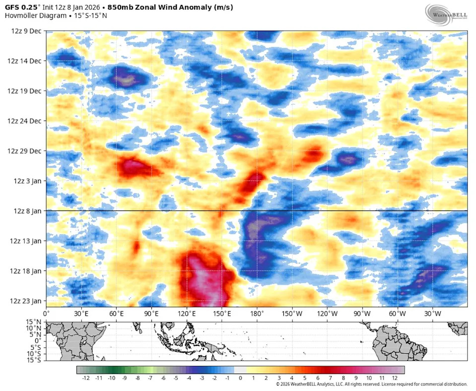
An exceptionally strong burst of westerly winds (seen in red shading in the bottom half of the image) are forecast to reach the central Pacific Ocean in mid to late January. (WeatherBELL)
Why It's Fading
"La Niña persists, followed by a 75 percent chance of a transition to ENSO-neutral during January–March 2026. ENSO-neutral is likely through at least Northern Hemisphere late spring 2026," the CPC said on Jan. 8.
Forecasters point to a pronounced shift in central Pacific winds as the primary reason La Niña is weakening. Model guidance indicates a burst of westerly winds developing in mid to late January, which will nudge warmer sea surface temperatures eastward toward South America and erode La Niña's influence heading into February. Some models show ENSO-neutral conditions extending into summer, though the strongest consensus is for neutral conditions through at least late spring.
What This Means For Connecticut And The Northeast
Locally, the CPC outlook suggests a milder middle portion of January following a cold, snowy start to winter in the Northeast. A brief return to colder-than-normal readings is possible late in the month, especially across the Midwest and parts of the Northeast. Beyond January, seasonal guidance currently favors slightly above-normal temperatures for February and March, with long-range projections indicating a heightened probability of warmer-than-average conditions across the Northeastern U.S. into spring and summer 2026.
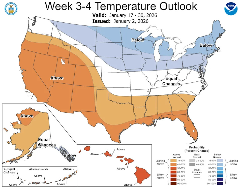
Colder-than-normal temperatures are likely from the Midwest to the Northeast during the second half of January, according to the Climate Prediction Center. (NOAA / Climate Prediction Center)
Impacts On The 2026 Atlantic Hurricane Season
If ENSO shifts toward El Niño later in 2026, that pattern typically increases upper-level wind shear over the tropical Atlantic, which suppresses the organization and development of hurricanes. Conversely, an ENSO-neutral or weak La Niña state tends to produce a more typical range of Atlantic activity. The CPC's current outlook does not guarantee an El Niño later in the year, but it notes the possibility and the associated implications for tropical development.
Forecast Confidence And What To Watch Next
Forecast models and observations have improved substantially, increasing confidence in seasonal outlooks, but atmospheric and oceanic systems remain complex and inherently uncertain. Key indicators to watch over the coming weeks include continued weakening of La Niña-related ocean temperature anomalies and verification of the modeled westerly wind burst in the central Pacific.
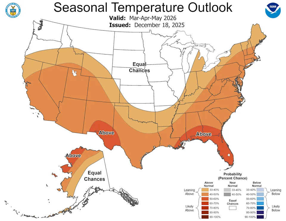
Warmer-than-normal temperatures are likely to build in during the spring months across much of the country, including Connecticut. (NOAA / Climate Prediction Center)
Bottom line: La Niña is expected to wane by spring 2026, bringing ENSO-neutral conditions for at least the Northern Hemisphere's late spring. For Connecticut and the broader Northeast, expect some short-term variability in January, then a tilt toward slightly warmer-than-average conditions through late winter and into spring; any later development of El Niño could reduce Atlantic hurricane activity by increasing wind shear.
Source: NOAA Climate Prediction Center (CPC) Jan. 8 update.
Help us improve.