
MiCO is a free, interactive 2025 map that compiles tracking data from 1,304 studies to model migratory connectivity for 109 marine species across 1,787 important sites. Developed by international research teams, the platform links every mapped point to its original study and offers downloadable datasets. MiCO reveals diverse migration strategies — from basin-bound green turtles to globally roaming sperm whales — and is already informing international conservation policy toward conserving 30% of well-connected areas by 2030.
Inside MiCO: The Interactive Map Linking 109 Marine Species and 1,787 Critical Sites

Blue fin tuna© Guido Montaldo/Shutterstock.com
With the 2025 launch of the Migratory Connectivity in the Ocean (MiCO) interactive map, researchers have produced the first comprehensive, free tool that visualizes how the migratory routes of more than 100 marine species interconnect worldwide. MiCO synthesizes tracking records from 1,304 studies to model movements for 109 species and to identify 1,787 biologically important sites.

The MiCO interactive map unveils the secret, interconnected global highways of 109 marine species, offering a critical roadmap to conserve 30% of marine areas and halt biodiversity loss by 2030.© A-Z Animals
What MiCO Shows
MiCO — developed by teams at the University of Queensland, Duke University, the Smithsonian Institution and the Global Ocean Biodiversity Initiative — consolidates disparate datasets so policymakers, conservationists and the public can see where animals travel, where habitats overlap, and how migration routes cross national boundaries. The online map displays nearly 2,000 distinct habitats and covers the migration of fish, marine mammals, seabirds and sea turtles.
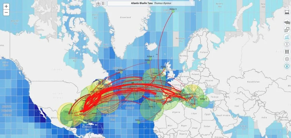
The new map shows the migratory paths of the bluefin tuna.©Liz Wegerer –Original/License
Data And Methods
The companion paper describing the map’s methods was published on May 8, 2025. For that analysis, researchers synthesized data collected from 1990 through 2017 across 1,304 individual studies. The team aggregated records, removed duplicates, and modelled migratory pathways; every mapped point links back to its original published study. Many source studies relied on satellite tags and other tracking technologies to produce precise location records across entire migration cycles.
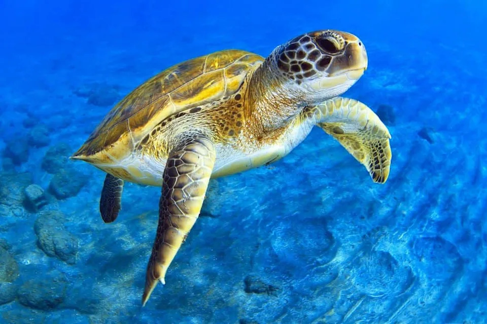
Green turtles are one of the 109 species included on the map.©David Carbo/Shutterstock.com
Examples Of Migration Strategies
MiCO highlights the diversity of marine movement strategies. For example, green turtles typically remain within a single ocean basin for breeding and foraging, even when individuals travel hundreds of miles between key sites. In contrast, sperm whales exhibit far more global distributions, with movements that can span ocean basins.
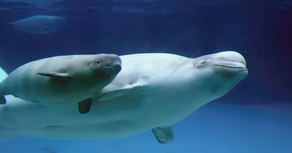
The migratory patterns of beluga whales are also included on the map.©CampCrazy Photography/Shutterstock.com
Scope And Species Coverage
The map includes migration tracks for 40 fish species, 28 marine mammals, 43 seabirds and seven sea turtle species — 109 species in total. Users can toggle species layers in the map’s interface, compare distributions, and download datasets for further analysis. At present the public map has dense coverage of the Atlantic and eastern Pacific Oceans, especially around North America and the Mediterranean; the developers plan incremental updates as new tracking records become available.
Policy And Conservation Relevance
By consolidating scattered movement studies into a single, accessible resource, MiCO helps policymakers and conservation managers quickly inspect source studies, identify connected habitats, and plan cross-jurisdictional protections. MiCO data have already been used by seven United Nations conventions or agencies and have informed international ocean conservation discussions. The project’s creators hope the dataset will be incorporated into the Convention on Migratory Species’ Atlas of Animal Migration at its March 2026 session.
How To Use The Map
The MiCO platform is free and interactive. Users can select any species to display its tracked range, follow links from each mapped point to the original study, and download underlying datasets for independent analysis. A full list of contributors — including government agencies, conservation groups, national parks and universities — is available on the MiCO website.
Why It Matters: Clarifying how migrations connect distant habitats can accelerate coordinated conservation action and contribute to the Kunming–Montreal Global Biodiversity Framework target of conserving 30% of well-connected marine, terrestrial and coastal areas by 2030.
Help us improve.


