Summary: A disturbance of the polar vortex could push Arctic air south and produce colder, potentially snowier conditions across parts of the United States in the weeks after Thanksgiving. Sudden stratospheric warming (SSW) events can trigger larger disruptions, but they are relatively uncommon and not guaranteed this season. NOAA's outlook favors below-average temperatures from late November into December, with elevated snow potential—especially near the Great Lakes—while short-term variability remains likely.
Polar Vortex Disruption Could Send Arctic Cold and Snow into U.S. After Thanksgiving

A notable shift in the upper atmosphere raises the chance that the weeks following Thanksgiving will be colder and possibly snowier across parts of the United States. The change stems from a disturbance of the polar vortex, a band of strong mid-level winds that normally holds frigid Arctic air near the poles.
What’s happening?
Our atmosphere is layered: weather occurs in the troposphere, and above it lies the stratosphere. Around each pole, a rotating ring of winds known as the polar vortex helps contain very cold, sub-Arctic air. There are related vortexes in both the troposphere and the stratosphere; the stratospheric vortex contains colder air and only occasionally influences surface weather.
How a disturbance changes things
When the polar vortex is strong, Arctic air stays locked near the poles. But if the vortex weakens, stretches, or is disrupted, that cold air can spill southward and reach lower latitudes. One particularly influential type of disturbance is a sudden stratospheric warming (SSW), a rapid warming high in the stratosphere that can weaken the vortex and set off weeks-long changes in the pattern of cold and storminess across the Northern Hemisphere.
What meteorologists are watching
Scientists are still refining their understanding of what triggers these disturbances and how each event unfolds. SSWs tend to occur roughly every other winter, but only one or two major late-November events appear in the record since 1958, according to Dr. Amy Butler, leader of the Stratospheric Modeling & Analysis program at NOAA.
"We have this unprecedented disruption in the polar architecture where it's so early in the season ... There aren't many past analogs to draw from and say with confidence how this will play out," said Dr. Judah Cohen, a climatologist at MIT and director of seasonal forecasting for Atmospheric and Environmental Research.
Cohen noted that a full SSW is not certain; the vortex might merely stretch this season. Even that would likely result in a noticeable shift toward colder and potentially more wintry conditions across parts of the U.S.
Other factors and the forecast
Large-scale patterns in the Pacific also influence North American winters. With a weak La Niña currently present and other Pacific features in place, experts say the odds of a colder December are elevated. Long-range guidance from NOAA's Climate Prediction Center leans toward below-average temperatures for much of the United States from late November into December.
That outlook reflects average conditions over several weeks and does not preclude short-lived warm or cold spells. In other words, the period could still include brief warm-ups or isolated cold snaps even if the overall mean is cooler than normal.
Implications for snow
When polar vortex disturbances push cold air southward, they can increase the chance of wintry precipitation. The relationship between vortex behavior and snowfall is complex, however: colder air alone does not guarantee snow — moisture and storm tracks matter too.
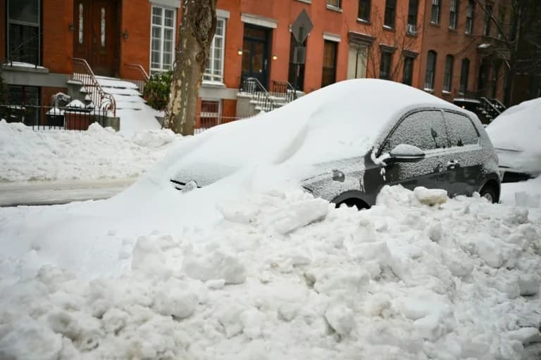
NOAA highlights an increased potential for winter-like conditions across the central U.S. and a greater risk of heavy snow in some areas, particularly around the Great Lakes, where lake-effect snow can become intense when cold air moves over relatively warm water.
Bottom line
There is a credible possibility that late November into December will be colder and somewhat snowier than average in parts of the U.S., driven by disruption of the polar vortex and influenced by a weak La Niña. However, forecasts remain uncertain: whether the vortex merely stretches or undergoes a major sudden stratospheric warming will shape how strong and widespread any cold or snowy spells become.
Help us improve.