This article explains why abrupt, severe cold waves are harder to predict than longer-lasting extremes and why that matters now as a major Arctic air mass moves into the United States. It describes how polar dynamics, atmospheric waves, and distant signals from regions like Eurasia and the Kara Sea combine to produce sudden cold surges. The piece also highlights new AI-driven subseasonal models that are improving forecasts and notes concerns that cuts to U.S. weather research and data collection could weaken preparedness.
Why Forecasters Missed Signs of This Extreme Arctic Cold Surge

The National Weather Service on Thursday warned that “dangerously cold and very dry Arctic air” will spill into the continental United States and lead to “life-threatening risk of hypothermia and frostbite.”
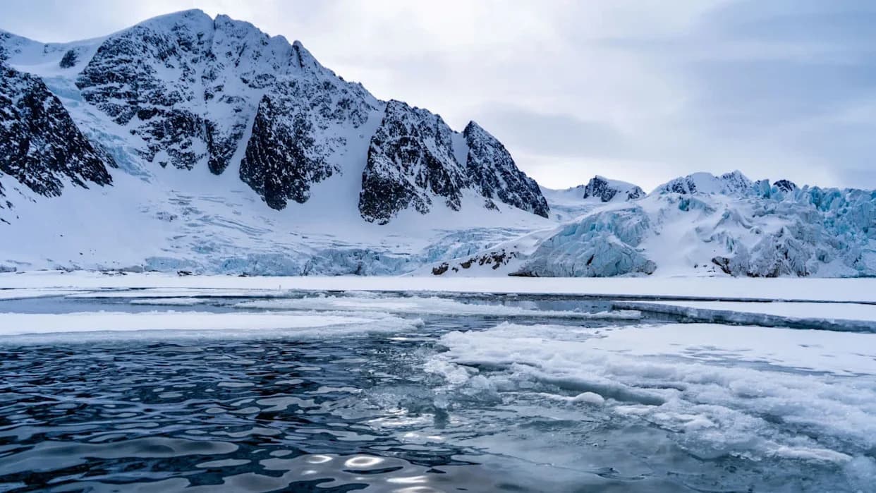
A severe surge of Arctic air is already gripping much of the United States and is expected to reach at least 45 states, covering roughly two-thirds of the country. Meteorologists warn this event ranks among the most intense winter storms in recent years and poses life-threatening risks of hypothermia and frostbite.
How This Cold Blast Unfolded
The National Weather Service warned that "dangerously cold and very dry Arctic air" will move into the continental U.S., driving temperatures far below seasonal norms in many locations. Schools closed, grocery stores saw long lines, and power operators in states like Texas issued winter warnings as they prepared for higher electricity demand and potential icing and outages.
Why Short Cold Snaps Are Hard To Predict
Cold waves can develop quickly and often arrive with little advance notice compared with longer-lasting extremes such as heat waves. "Oftentimes, longer-duration signals, such as heat waves, can be more predictable, whereas short bursts of cold are more difficult to predict," said Matthew Rosencrans, a meteorologist at the National Weather Service's Climate Prediction Center.
"It always ends up colder than the models initially predict, and the models are always playing catch-up," said Judah Cohen, a research scientist at MIT who studies weather prediction.
Atmospheric Mechanics At Work
Many cold outbreaks trace back to the Arctic. A fast-spinning band of frigid winds high above the North Pole, the polar vortex, typically keeps Arctic air confined. When atmospheric waves interact with that circulation and with the polar jet stream, they can deform the circulation into lobes that dip into lower latitudes and usher frigid Arctic air southward.
These interactions are influenced by a host of distant factors: sea-ice conditions and air-sea exchanges in the Arctic, weather patterns over Eurasia, and large-scale ocean oscillations such as El Niño–Southern Oscillation. Pinpointing which signals reliably presage a major cold surge remains a major forecasting challenge.
New Tools And Ongoing Debate
To improve skill in the two-to-six-week subseasonal window, the European Centre for Medium-Range Weather Forecasts ran an AI-focused contest. Judah Cohen's team won the most recent challenge for the 2025–26 winter season by training models on decades of Northern Hemisphere data and identifying far-flung precursors, such as October patterns in Eurasia and ocean temperatures in the Kara Sea.
At the same time, scientists continue to debate the role of Arctic warming in these events. The Arctic is warming much faster than the global average in many places, which may change atmospheric dynamics and occasionally contribute to cold surges. Other researchers argue that, overall, global warming has reduced the frequency of extreme cold at lower latitudes.
Data, Funding, And Preparedness
Forecast accuracy depends on high-quality observations and well-supported research programs. Critics warn that recent budget and personnel cuts affecting agencies and research centers can reduce data collection and analysis capacity, potentially weakening forecast skill and lead time when rapid preparation is essential.
Better subseasonal forecasts could give utilities, emergency managers, and communities crucial extra time to prepare — issuing alerts, shoring up critical infrastructure, and pre-positioning supplies. As extremes grow more complex in a changing climate, improving models, expanding observations, and supporting forecasting institutions are key to reducing harm.
What To Do Now: Follow local National Weather Service advisories, limit outdoor exposure in extreme cold, check on vulnerable neighbors, and take basic winter-preparedness steps such as ensuring backup heat sources and keeping phones charged.
Help us improve.