An international team used seismic imaging and geodynamic modeling to propose that a detached lithospheric "drip" pulled down part of Utah’s Uinta Mountains 2–5 million years ago, creating a low corridor that allowed the younger Green River to cut through and merge with the Colorado River. Seismic data reveal a cold, rounded anomaly about 125 miles deep and 22–31 miles across, interpreted as the remnant of that drip. Modeling shows the crust under the range is thinner than expected and that rebound calculations match the river system’s >1,312-foot elevation change. The finding challenges longer-standing capture hypotheses and offers a template for resolving similar geomorphic puzzles elsewhere.
Why the Green River Appears to Flow 'Uphill' — An Ancient Lithospheric 'Drip' May Explain It
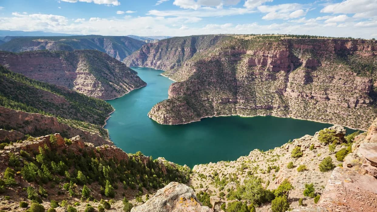
The Green River carves a wide path through the Uinta mountain range, despite being far younger than the geologic formation.
The Green River carves a nearly 2,300-foot-deep canyon through Utah’s Uinta Mountains, yet the range itself rises to almost 2.5 miles above sea level (≈13,200 ft) and was uplifted roughly 50 million years ago. That makes it puzzling that a much younger river — the Green began forming less than eight million years ago — could cut through the range and join the Colorado River. A new international study combining seismic imaging and geodynamic modeling proposes a surprising explanation: a detached fragment of dense lower crust and upper mantle — a lithospheric "drip" — temporarily pulled the surface down, letting the river link across the divide.
Seismic Evidence Points to a Buried Drip
Researchers examined previously published seismic images (effectively CT scans of Earth’s interior) beneath the Uinta region and identified a relatively cold, rounded anomaly about 125 miles (≈200 km) below the surface with a diameter roughly 22–31 miles (35–50 km). The team interprets that anomaly as a broken, sinking fragment of lithosphere — a lithospheric drip — which detached and sank into the mantle.
“We think that we’ve gathered enough evidence to show that lithospheric drip…is responsible for pulling the land down enough to enable the rivers to link and merge,” said coauthor Adam Smith of the University of Glasgow.
Modeling Matches River Timing and Elevation Change
Using the estimated descent rate and present depth of the anomaly, the authors estimate the drip detached between about 2 and 5 million years ago. That timing aligns with earlier work suggesting the Green River incised into the Uinta range and connected with the Colorado system. Geological models that account for crustal thinning under the range and the expected surface rebound produce a pattern of uplift and subsidence that matches the river system’s observed elevation change of more than 1,312 feet (≈400 m).
Why This Explains a Longstanding Puzzle
The lithospheric-drip hypothesis offers a coherent alternative to other explanations that have been debated for more than a century — including the ideas that the river predated the mountains, that sediment buildup overtopped the range, or that erosion from the south captured the Green. In this scenario, temporary subsidence created a low corridor that the Green River exploited; when the drip finally detached and sank deeper, the surface rebounded, leaving the modern topography and the river connection intact.
Broader Implications
Beyond solving a regional mystery, the study suggests a general approach: searching seismic datasets for deep, cold anomalies and testing whether inferred lithospheric detachments can explain unexpected surface drainage patterns and elevation histories. If similar drips are identified elsewhere, they could clarify other cases where rivers and landscapes appear to defy standard geomorphic expectations.
Bottom line: Seismic imaging, timing constraints, and modeling together make a strong case that an ancient lithospheric drip temporarily lowered the Uinta Mountains and enabled the Green River to breach the range and join the Colorado — a process that reshaped the continental divide and regional habitats.
Help us improve.