East Africa was much wetter during the African Humid Period (≈9,600–5,300 years ago), but millennia of drying have dramatically reduced lake levels and reshaped the landscape. Researchers led by Christopher Scholz show that falling lake levels — especially at Lake Turkana — have lowered crustal pressure, allowing faults in the East African Rift to slip faster. Sediment cores and computer simulations link the end of the Humid Period to increased fault expansion and magmatic activity; locally, rifting has accelerated by roughly 3% over the last 5,000 years, while the Somali plate drifts from the Nubian plate at about 0.25 inches (6.35 mm) per year.
Drying Lakes Are Widening the East African Rift — How Climate Shift Is Tearing the Continent

Africa Is Drying Up and Tearing in Two—LiterallyEmad aljumah - Getty Images
Thousands of years ago the eastern half of Africa was far greener than it is today. During the African Humid Period (roughly 9,600–5,300 years ago), landscapes now dominated by desert resembled savannas and supported abundant wildlife. Rock art across the Sahara depicts animals gathering at rivers and lakes, and early Egyptian civilization arose along a much wetter Nile.
As the climate shifted toward aridity, lakes shrank and in many places vanished. Human populations concentrated along fertile riverbanks, and evidence in Saharan rock art — including the arrival of camels — suggests animals and people migrated in response to shrinking water resources. That long-term drying is now influencing the continent's deep geology: falling lake levels reduce the weight on Earth’s crust and allow faults in the East African Rift System to move more freely.
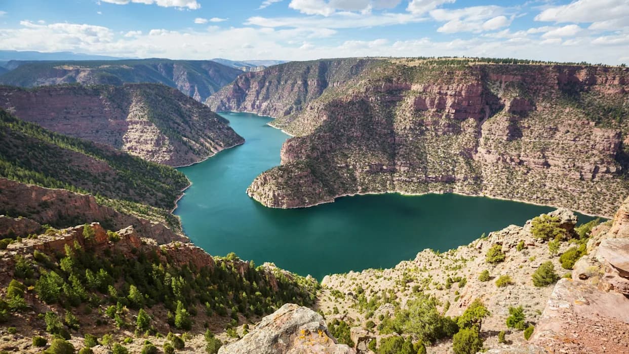
Lake Turkana: A Window Into Millennia of Change
Columbia University geologist Christopher Scholz and his colleagues used Kenya's Lake Turkana to quantify how hydrology and tectonics interact. Today, Lake Turkana is roughly 155 miles (250 km) long, 19 miles (30 km) wide, and up to about 400 feet (120 m) deep. But sediment records show the lake was substantially deeper at the end of the Humid Period — in places nearly an additional 1,000 feet. Large lakes exert substantial downward pressure on the crust, which tends to inhibit fault motion; Scholz's team combined sediment-core dating, field observations, and computer simulations to show that declining lake levels reduce that load and accelerate fault slip.
This study provides the first quantitative link between long-term fault slip rates and climate-driven lake level changes in the East African Rift System by tracking how Lake Turkana transitioned from high to low stands at the end of the African Humid Period.
How Water Loss Accelerates Rifting
When lake water evaporates and weight on the crust decreases, the mantle beneath the rift undergoes decompression. That decompression can increase melting, feeding magma chambers beneath local volcanoes — for example, features beneath Lake Turkana's islands — and swelling those chambers. Increased magmatic pressure compounds tectonic stresses on surrounding faults, further encouraging rift widening. Scholz and colleagues show these combined mechanical and magmatic effects can meaningfully change rift behavior over thousands of years.
Today the Somali tectonic plate is moving away from the Nubian plate at about 0.25 inches (6.35 mm) per year. In the Lake Turkana region, the researchers estimate that long-term water loss has increased the local rate of rifting by roughly 3% (about 0.007 inches) over the past 5,000 years. Over geological time, continued rifting could contribute to the eventual opening of a new ocean basin where the plates finally separate.
Why This Matters Now
These processes are not only of academic interest: changing lake levels can affect earthquake and volcanic hazards, water availability, and ecosystems that sustain millions of people and diverse wildlife. Understanding the link between climate-driven hydrology and deep Earth processes helps scientists anticipate geohazards and supports better regional planning for water resources and land use under a warming, drying climate.
Help us improve.