This study delivers the most detailed bedrock map of Antarctica so far by merging satellite surface imagery, ice-thickness data and ice-flow physics into a continent-wide topographic model. The map reveals features 1.2–18.6 miles (2–30 km) beneath the ice — including ancient river-like channels, deep valleys, ridges and mountain ranges. These findings clarify how subglacial terrain guides ice flow and will improve models used to forecast ice loss and sea-level rise.
Continent-Scale Bedrock Map Reveals Rivers, Valleys and Mountain Ranges Hidden Beneath Antarctica's Ice

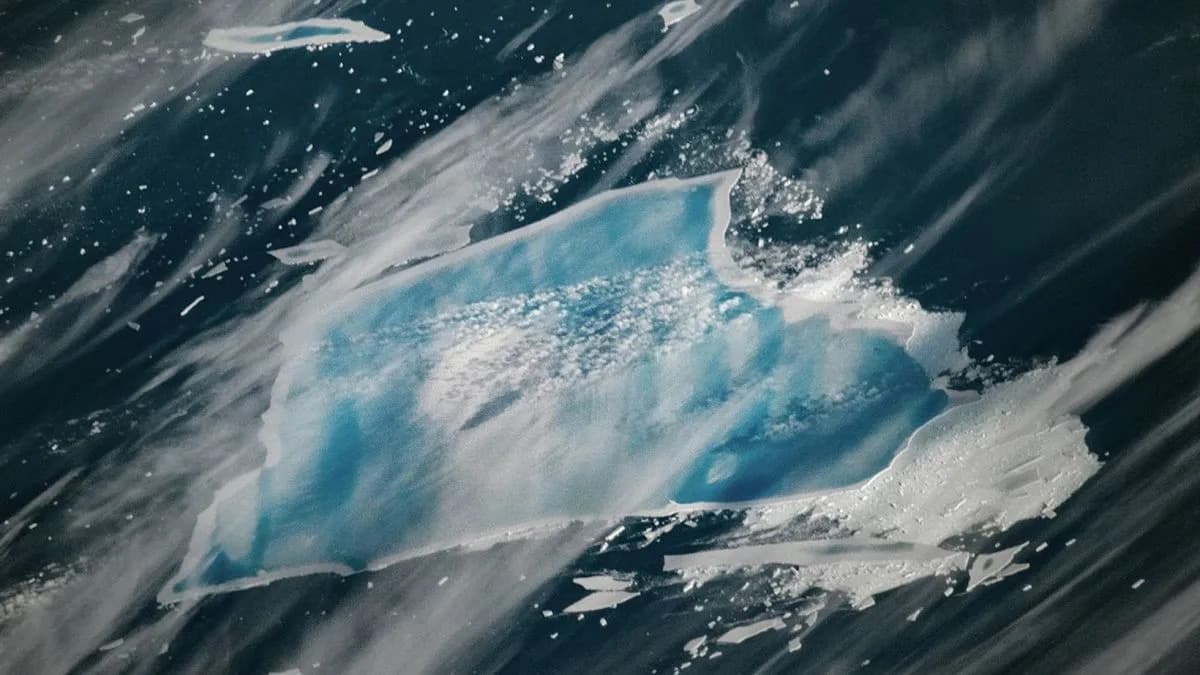
It's easy to see features like Stonington Island off the west coast of Graham Island, Antarctica, but now a new map shows scientists what lies beneath in unprecedented detail. | Credit: kitz-travellers/Getty Images
Scientists have produced the most detailed map to date of the bedrock lying beneath Antarctica's vast ice sheet, uncovering previously hidden lakes, valleys, ridges and mountain ranges that lie under miles of ice. The new study, published in Science on Jan. 15, combines multiple data sources and physical ice-flow modeling to reveal the continent-scale topography that shapes how Antarctic ice moves.
The Antarctic ice sheet covers more than 5.4 million square miles (14 million square kilometers) and conceals a polar landscape that until now remained one of the least well-charted surfaces in the inner Solar System. Buried geological features — from deep valleys to high ridges — control how ice flows and how glaciers respond to warming, so mapping them is essential for improving projections of ice loss and sea-level rise.
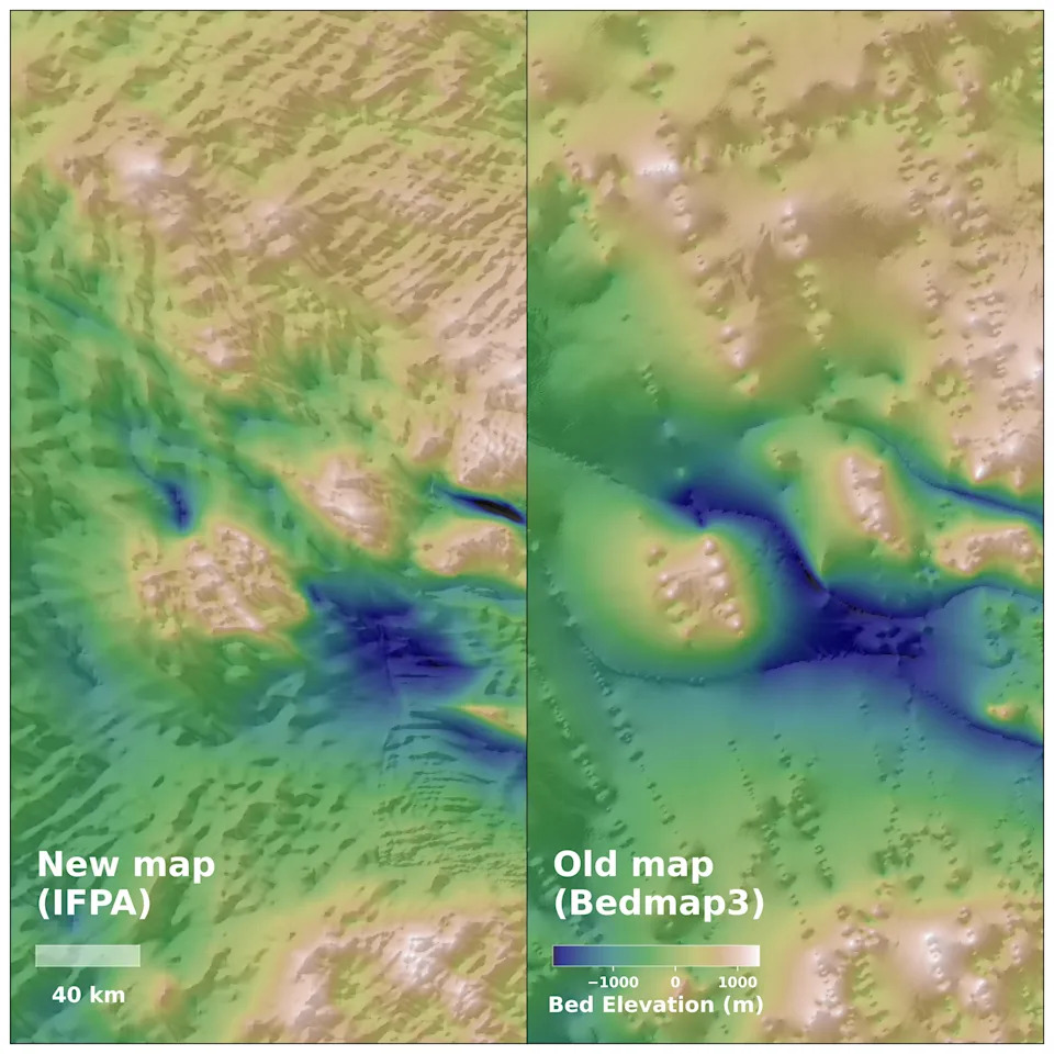
The new IFPA topography map reveals new features in the landscape beneath Antarctica, from hills and ridges to details of entire mountain ranges, and fills in gaps between radar survey lines.
Mapping the bedrock has long been challenging because ground and airborne surveys are difficult and sparse in this remote region. To overcome these gaps, the research team fused high-resolution satellite images of the ice-sheet surface with ice-thickness measurements and an ice-flow analysis grounded in the physics of ice motion over bedrock. Integrating these datasets produced a unified, continent-scale topographic map beneath the ice.
The resulting map exposes features located between 1.2 and 18.6 miles (2 and 30 kilometers) below the surface that were previously unknown or poorly resolved. Discoveries include river-like channels stretching for hundreds of miles — possible remnants of landscapes that predate the ice sheet — as well as lakes, ridges and entire mountain ranges hidden under kilometers of ice.
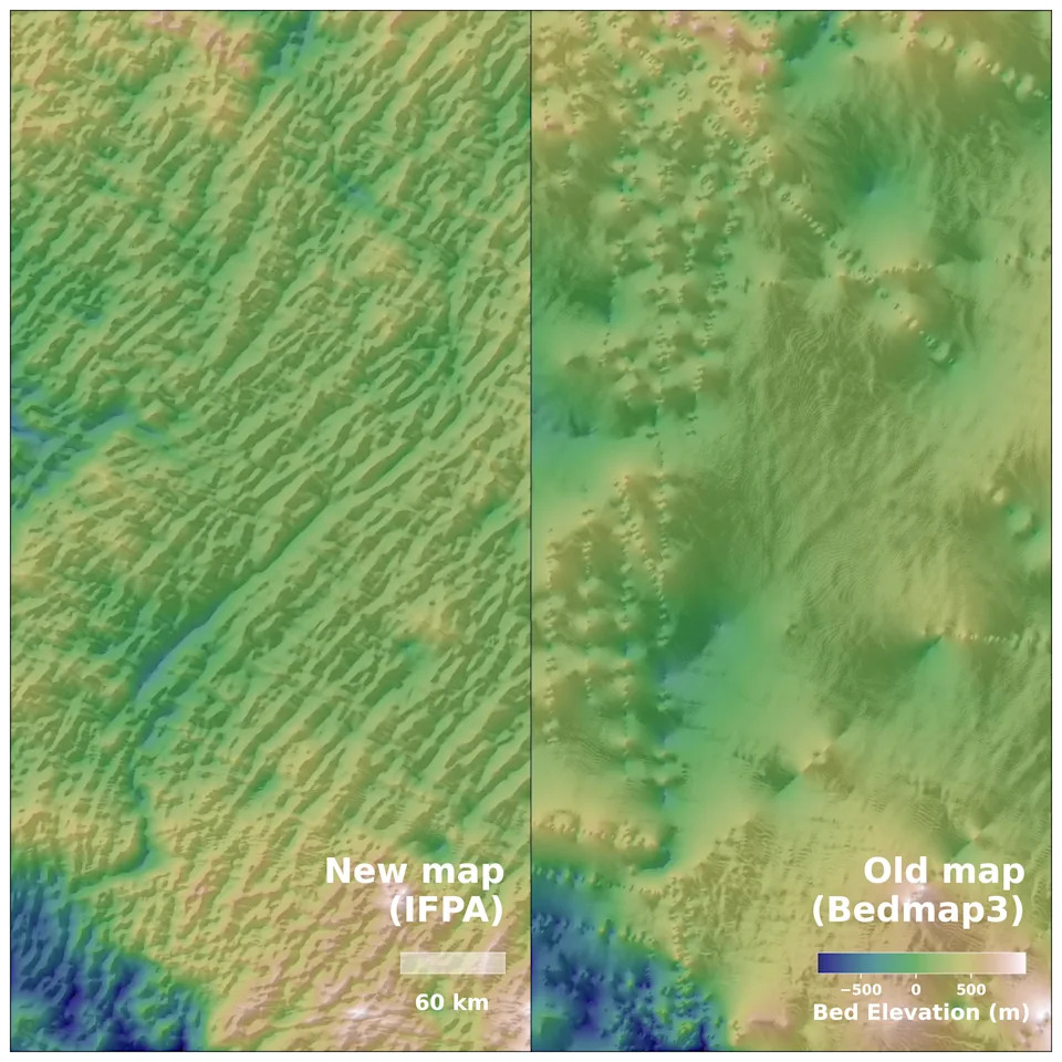
The new IFPA topography map reveals new features in the landscape beneath Antarctica, from hills and ridges to details of entire mountain ranges, and fills in gaps between radar survey lines.
Researchers also identified abrupt transitions between uplands and lowlands that suggest tectonic boundaries, and in at least one area where earlier airborne surveys suggested a subdued river plain, the new map instead reveals deep, previously undetected valleys that help steer ice flow.
By making subglacial topography visible at high resolution, the map lets scientists better visualize and quantify how the ice sheet has evolved and interacted with the terrain beneath it. These improved datasets and visualizations will refine ice-sheet models, reduce uncertainties in projections of climate-driven ice loss, and produce more accurate forecasts of future sea-level rise.
Why it matters: Knowing the shape of the ground beneath Antarctica is crucial for predicting where ice is stable and where it may be vulnerable to rapid change.
Help us improve.