Forecasters say a winter storm developing off the Southeast coast could intensify into a bomb cyclone this weekend, bringing heavy snow, strong winds and coastal flooding from North Carolina to New England. The system is expected to organize Friday into Saturday, with peak impacts possible Sunday before moving away by Monday. Parts of North Carolina could see their heaviest snow in decades, while coastal areas face flood and power-outage risks at high tide. Exact impacts depend on how quickly the storm strengthens and its coastal track.
Bomb Cyclone Threatens East Coast This Weekend — Heavy Snow, High Winds and Coastal Flooding Possible

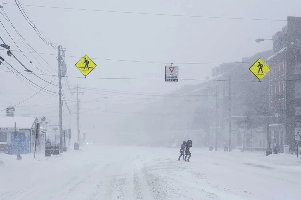
Residents in South Boston after more than a foot of snow fell on Jan. 26.(Charles Krupa/AP)
Forecasters warn a winter storm developing off the Southeast coast could strengthen into a bomb cyclone this weekend, bringing heavy snow, blizzard-like conditions, strong onshore winds and coastal flooding from North Carolina to New England, according to AccuWeather and the National Weather Service.
Overview
This system follows a massive storm last weekend that left hundreds of thousands without power and created hazardous travel. Meteorologists expect the new storm to organize near the Southeast coast on Friday into Saturday, then track northward along the Atlantic Seaboard with peak impacts possible on Sunday before exiting by Monday.
"This is not just another storm. It is another setback to a region that has already been under stress from ice, snow and prolonged freezing temperatures," said AccuWeather senior meteorologist Scott Homan, noting that back-to-back winter hazards can compound impacts—especially in parts of the Southeast where winter-weather resources are limited.
Timeline and Expected Impacts
Friday Night
As the storm organizes off the Southeast coast, snow will spread from the southern Appalachians into portions of southern Virginia, the Carolinas and northeast Georgia, forecasters at The Weather Channel say.
Saturday
The system is expected to strengthen along the Southeast coast, producing heavier snow and stronger winds that could push northward along the Eastern Seaboard into southeast New England overnight.
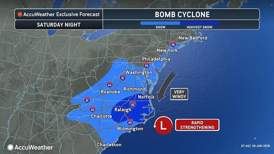
Map of forecasted bomb cyclone over the weekend.
Sunday
The storm may reach peak intensity on Sunday. Heavy snow is possible in parts of eastern and southern New England. Snow should taper by midday from the Delmarva Peninsula through Virginia and the Carolinas, but high winds and coastal flooding at high tide could impact the coastline from the Outer Banks of North Carolina up to New England. The system could linger over parts of New England Sunday night before moving away on Monday.
Regional Concerns
- Southern Appalachians and Carolinas: Increasing confidence for significant heavy snow across much of the Southern Appalachians, the Carolinas and the southern Mid-Atlantic Friday into Sunday.
- North Carolina: Some areas could see their heaviest snowfall in decades.
- Coastal Areas (Outer Banks to New England): Strong onshore winds raise the risk of power outages and coastal flooding at high tide.
- Eastern New England: Elevated odds for heavy snowfall in parts of eastern New England.
Forecast Uncertainty and What Determines Impacts
Forecasters emphasize that the storm's exact track and intensity remain uncertain several days out. As AccuWeather long-range expert Paul Pastelok explained, "How fast the storm strengthens will be a determining factor in the final track of the storm this weekend and whether or not it moves up the East Coast." A storm that deepens quickly is more likely to pivot north sooner, bringing snow and wind inland; a weaker, slower storm may track closer to the Gulf Coast and move out to sea before turning north.
The National Weather Service's Prediction Center also warned that the eastern half of the country will remain cold into next week, maintaining the potential for additional winter impacts even after this system passes.
Preparation Tips
- Monitor local forecasts and official advisories from the National Weather Service and local emergency management.
- Prepare for dangerous travel conditions, power outages and high-tide flooding in coastal areas.
- Have an emergency kit ready, including food, water, medications and alternate heat/light sources if power is lost.
Stay tuned to updates from AccuWeather, The Weather Channel and the National Weather Service as models and observations refine the storm's track and intensity through the weekend.
Help us improve.