
Forecasters say a major winter storm may form this weekend as Arctic air from Canada collides with Gulf moisture, raising the risk of widespread ice from Texas through the Carolinas. An atmospheric river could funnel heavy precipitation eastward, increasing the chance of significant ice accumulations, especially across parts of Georgia. Travel and power infrastructure are at risk, with major hub airports and southern highways likely to face disruptions. Officials caution that timing and exact locations of freezing precipitation remain uncertain.
Major Winter Storm Could Coat Roads With Ice From Texas To The Carolinas

Vehicles are driven through whiteout conditions along Lake Michigan Drive during a winter storm warning in Ottawa County, Mich. on Monday, Jan. 19, 2026. (Joel Bissell/Kalamazoo Gazette via AP)(ASSOCIATED PRESS)
Forecasters warn a major winter storm may develop this weekend as frigid Arctic air collides with moisture from the Gulf, creating a significant risk of freezing rain and ice across the southern United States from Texas through the Carolinas.
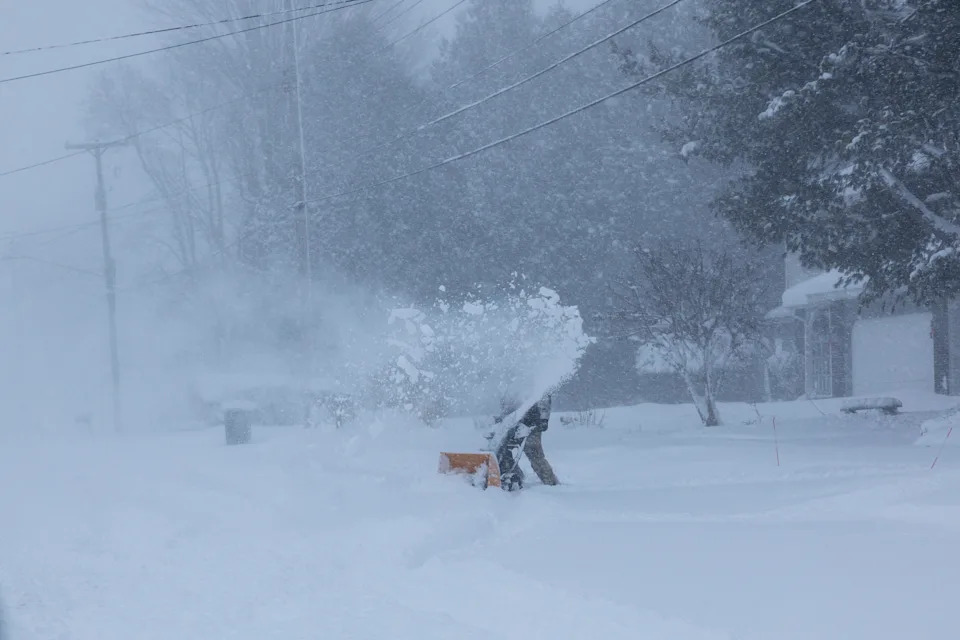
A person clears snow from their driveway during a winter storm warning in Walker, Mich. on Monday, Jan. 19, 2026. (Joel Bissell/Kalamazoo Gazette via AP)(ASSOCIATED PRESS)
Cold Air Meets Gulf Moisture
An extremely cold Arctic air mass is expected to plunge south from Canada and encounter precipitation streaming eastward across the southern states. When that cold air meets warm, moist air from the Gulf, the result can be prolonged periods of freezing rain and ice accumulation.
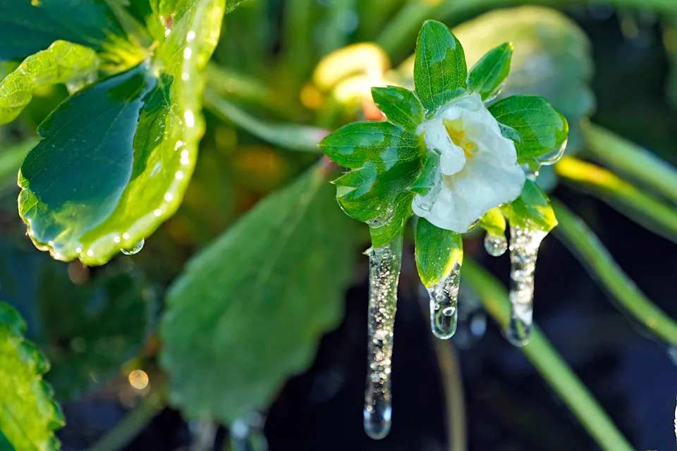
A protective coating of ice clings to a strawberry flower in sub-freezing temperatures at a field Friday, Jan. 16, 2026, in Plant City, Fla. (AP Photo/Chris O'Meara)(ASSOCIATED PRESS)
"This is extreme, even for this being the peak of winter," National Weather Service meteorologist Bryan Jackson said of the unusually frigid air.
Atmospheric River Could Funnel Heavy Precipitation
Forecasters are monitoring the potential for an atmospheric river to form by the weekend, channeling moisture across Texas and along the Gulf Coast into Georgia and the Carolinas. The National Weather Service in Atlanta said global models are increasingly signaling ice storm potential across North Georgia and parts of central Georgia.
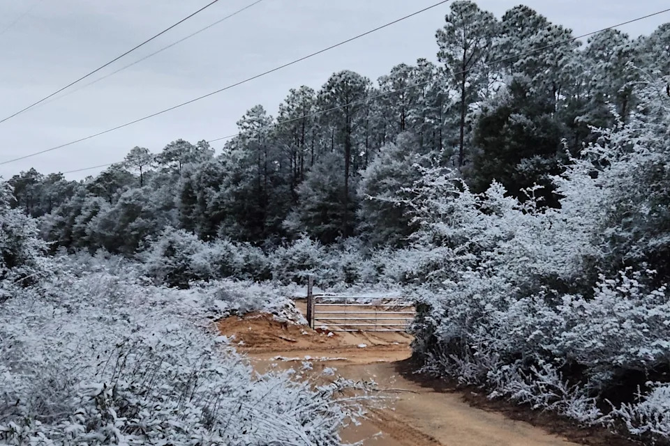
A rare snow is seen in Holt, Florida, on Sunday, Jan. 18, 2026. (Danielle Brahier via AP)(ASSOCIATED PRESS)
Impacts To Expect
- Ice Accumulation: Heavy ice could build on roads, trees and power lines, increasing the risk of widespread outages and hazardous travel.
- Prolonged Freezing Temperatures: Slow warming is expected in many areas, so ice on roads and sidewalks may persist for days rather than hours.
- Travel Disruptions: Southern states typically have less snow-and-ice clearing equipment, so highways and major hubs such as Dallas, Atlanta, Memphis and Charlotte could see significant delays and cancellations.
Where And When
Some of the storm's earliest impacts may arrive in Texas on Friday as the Arctic air pushes south and rain moves in. Lows could fall into the 20s or even the teens in parts of Texas by Saturday, creating a risk of freezing precipitation in the northern parts of the state. Forecasters stressed uncertainty about the precise timing and where rain will transition to freezing rain or sleet.

A visitor to Lake Eola Park in downtown Orlando, Fla., walks past the flock-of-seagulls "Take Flight" sculpture on a chilly morning, Friday, Jan. 16, 2026. (Joe Burbank /Orlando Sentinel via AP)(ASSOCIATED PRESS)
Metro Atlanta could be especially vulnerable: forecasters warned that significant ice accumulations there would be problematic because overnight lows near 22 degrees Fahrenheit (about -5.6 C) and daytime highs only around 35 F (about 1.7 C) would limit melting.
Wider Pattern: Polar Air Keeps North In A Deep Freeze
Much of the northern tier of the U.S. is already unusually cold, and the incoming Arctic blast is expected to be among the coldest so far this season. Forecasters pointed to a sprawling vortex of low pressure over Hudson Bay that is helping to drive the frigid air southward.
Uncertainty Remains: Meteorologists emphasize that predicting the exact boundary between rain and freezing precipitation is challenging. Small shifts in the storm track or temperature profile could change which communities see mainly rain versus damaging ice.
Panjwani reported from Washington, D.C.
Help us improve.


