SWOT, the NASA–CNES Surface Water and Ocean Topography mission, has produced the first global, space-based estimates of river discharge and suspended sediment for rivers wider than about 160 ft (50 m). Using the KaRIn radar from 554 miles (891 km) altitude on a 21‑day repeat, SWOT delivers broad, repeated coverage that fills gaps where ground gauges are sparse. These satellite-derived estimates improve flood forecasting, water-resource planning and our understanding of sediment, nutrient and pollutant transport.
SWOT Maps River Flow From Space — First Global Estimates of Discharge and Sediment

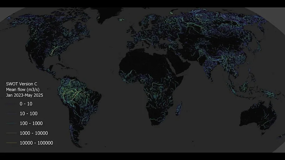
A map made with SWOT data describing estimated discharge for rivers around the world. . | Credit: (NASA/JPL/UMass)
Scientists measure river discharge — the volume of water passing a fixed point each second — to turn vague observations like "the river is high" into concrete warnings such as "this could flood downstream." New maps built from NASA and CNES's Surface Water and Ocean Topography (SWOT) mission show estimated discharge and suspended sediment for rivers worldwide, helping fill critical monitoring gaps where ground gauges are sparse.
This map gives the first-ever global estimate of sediment suspended in rivers and the rivers' overall discharge. | Credit: (NASA/JPL/UMass)
About the SWOT Mission
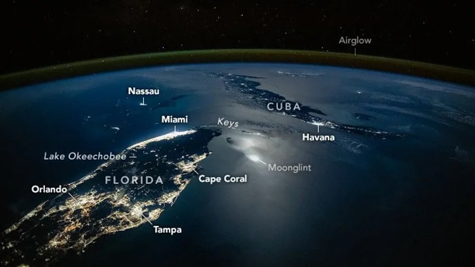
SWOT carries a wide-swath radar instrument called KaRIn (Ka-band Radar Interferometer) to measure water-surface height across oceans, lakes, reservoirs and rivers. The satellite operates from an altitude of 554 miles (891 km), passes over Earth multiple times per day and repeats its ground track every 21 days, providing broad, repeated coverage that complements in‑situ gauges.
What the New Map Shows
The new "rivers of Earth" visualization is built from SWOT observations and provides the first global, space-based estimates of both river discharge and suspended sediment concentration for every river wider than about 160 ft (50 m). On the map, continents are lit by blue-to-green threads that trace flowing water; brighter, denser networks correspond to larger river reaches and higher estimated flows.
Why This Matters
Discharge is the backbone of flood forecasting and water-resource planning. Satellite-derived discharge measurements help fill monitoring gaps in remote basins, fast-changing watersheds and politically sensitive border rivers where ground gauges are sparse or inconsistent. These estimates support reservoir operators, irrigation planners, utilities and emergency managers by improving situational awareness and seasonal planning.
Suspended sediment concentration matters because rivers carry sediments, nutrients and pollutants that shape deltas, influence water quality and affect downstream ecosystems. Combining discharge and sediment observations from space improves our ability to study erosion, sediment transport, pollutant movement and long-term changes to river systems at global scales.
How Researchers Can Use the Data
With SWOT as a backbone, science teams are producing data products and models that feed flood forecasts, inform water management decisions and support environmental research. Researchers and the public can monitor SWOT's orbit and explore mission data to better understand water availability, flood risk and sediment dynamics worldwide.
Other Satellite Observations
Beyond rivers, recent satellite imagery has captured dramatic natural events — for example, late‑November volcanic plumes and temperature contrasts within hurricanes — illustrating how Earth‑observing missions provide vital insights across many environmental hazards.
Help us improve.