Quick Facts
Where Is It? Beni River, Bolivia (approx. -11.2379, -66.2671)
Without using the Biomass satellite's polarizing radar tech, it is much harder to distinguish between the different types of vegetation surrounding the Beni River. | Credit: ESA/Biomass satellite
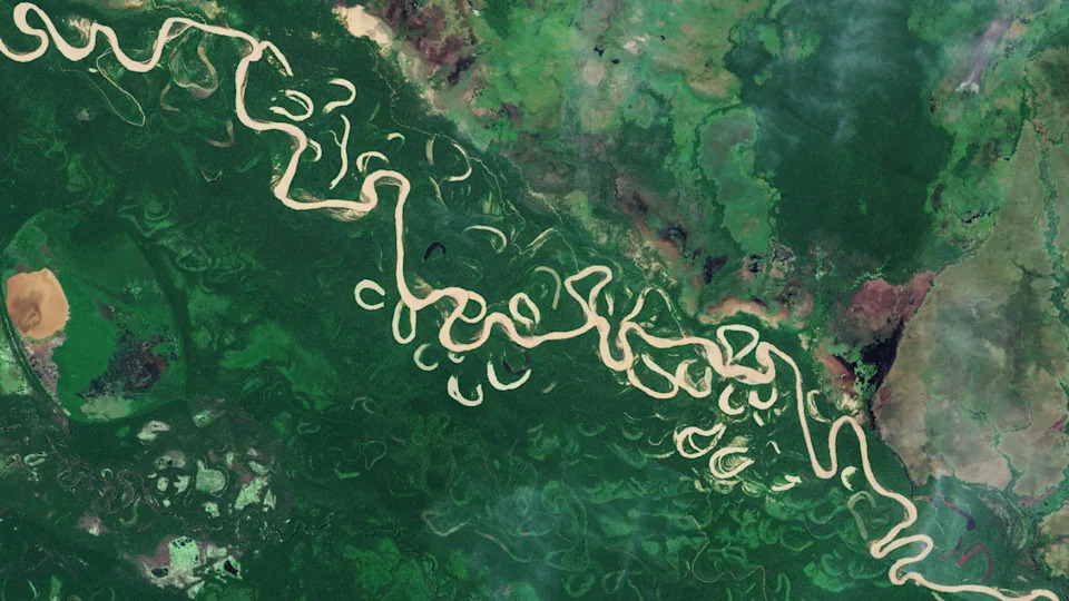
What’s In The Photo? False-color map showing varying levels of biomass (carbon-rich vegetation and wetlands) along the river
Which Satellite? European Space Agency's Biomass satellite
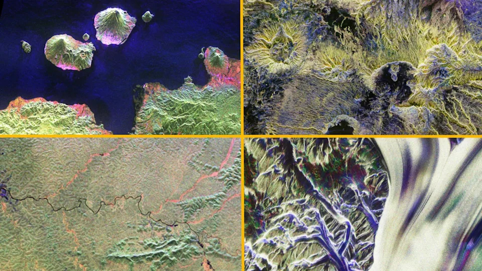
Other initial Biomass photos include snaps of Mount Gamkonora in Indonesia (top left), the Tibesti Mountains in Chad (top right), the Ivindo River in Gabon (bottom left) and the Nimrod Glacier in Antarctica (bottom right). | Credit: ESA/Biomass satellite
Image Released: June 23, 2025
This vivid, false-color satellite image provides the first detailed look at how biomass — the carbon-rich plant material that stores atmospheric carbon — is distributed along a winding stretch of the Beni River in northern Bolivia. The frame covers roughly a 56-mile (90-kilometer) by 37-mile (60-kilometer) area beside the river; the Beni itself runs about 680 miles (1,095 kilometers) from Andean headwaters north of La Paz into Brazil and on to the Amazon basin.
An astronaut photo of two islands in the Bahamas surrounded by twisting ribbons of shining blue sand banks
ESA's Biomass satellite, launched on April 29, 2025, captured the scene using polarized synthetic-aperture radar that is sensitive to differences in vegetation structure and density. In the processed view, dense rainforest appears green, grasslands register as purple, wetlands glow reddish, and open water — including the river and nearby lakes — appears black. The published image has been rotated so that north is shown to the right.
“The first images are nothing short of spectacular — and they're only a mere glimpse of what is still to come,”
— Michael Fehringer, ESA scientist and Biomass project manager
Astronaut photo of the point where a glacier, green river and blue lake meet in a valley system in Patagonia
A primary goal of the Biomass mission is to quantify how carbon-rich ecosystems are changing under human pressures like deforestation and climate change. Conventional optical images can blur boundaries where forests, grasslands and wetlands intermix; Biomass’s radar-derived false-color maps help separate these land types and reveal where carbon is stored or being lost.
ESA has already published additional striking Biomass scenes from around the world — including Mount Gamkonora (Indonesia), the Ivindo River (Gabon), the Tibesti Mountains (Chad) and the Nimrod Glacier (Antarctica) — illustrating the satellite's global reach.
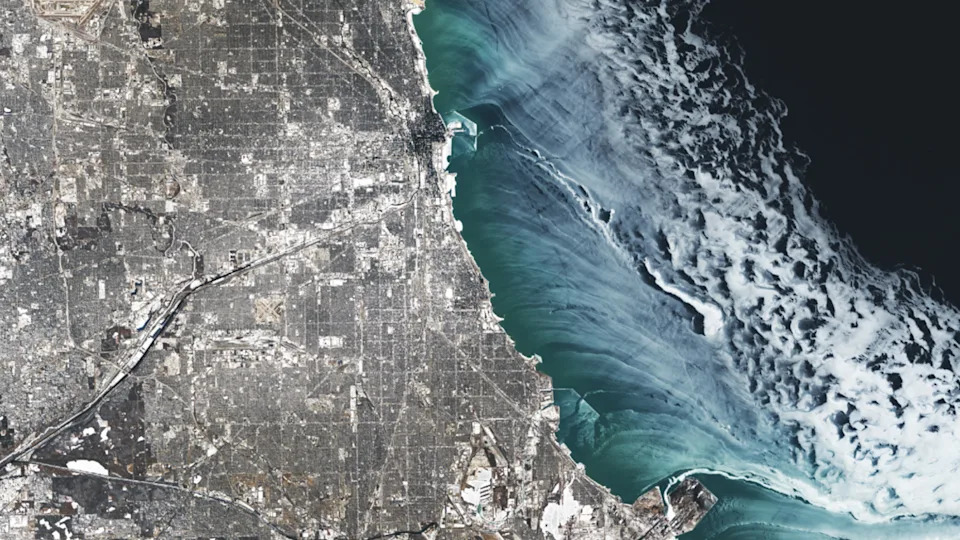
A satellite photo showing ethereal ice swirls along the shoreline of Chicago in Winter
Mission Status and Data Access
The satellite is now fully operational and will survey the world’s forests approximately every six months. Biomass’s radar is also well suited to probing ice structure, making polar and glacial monitoring an important secondary objective.
On Jan. 26, ESA announced that Biomass data would be made openly available to researchers and the public. “This collaborative release will unlock vital insights into carbon storage, climate change, and the health of our planet’s precious forest ecosystems,” said Simonetta Cheli, ESA Director of Earth Observation Programmes.
By combining frequent, radar-derived maps with open data access, the Biomass mission aims to accelerate research into carbon stocks, support better land-management decisions, and improve global monitoring of deforestation and ecosystem change.
Additional Notes: The image coordinates and color scheme are provided by ESA; the false-color rendering is designed to highlight vegetation types rather than represent natural color.