Light snow flurries moved through parts of the Florida Panhandle on Sunday, Jan. 18, with reports before 8 a.m. in DeFuniak Springs, Ponce de Leon and Walton County. Winter storm warnings were issued as the system approached, and the National Weather Service kept a freeze warning and cold-weather advisory in effect until 9 a.m. the following morning. Last January’s Gulf Coast Blizzard (Storm Éowyn) produced 8–10 inches in places; historical records show snow has been reported in Florida since 1774 and in roughly 80 months since 1886.
Rare Snow Dusts Florida Panhandle: Flurries Reported in DeFuniak Springs, Ponce de Leon and Walton County

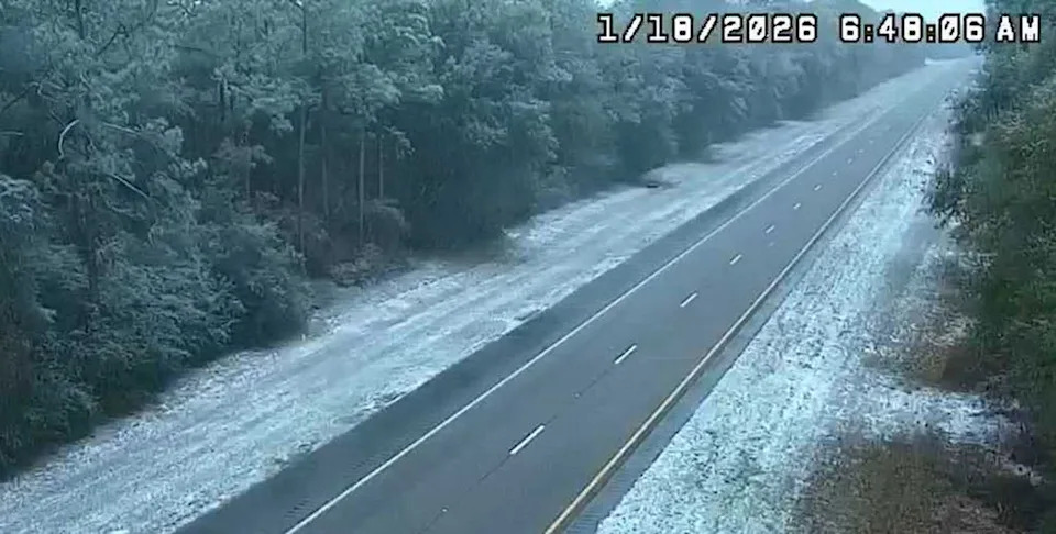
FDOT.GOVSnow in Florida on Jan. 18.
Snow flurries briefly fell across parts of the Florida Panhandle on Sunday, Jan. 18, producing a rare winter scene for the Sunshine State. Reports of light snowfall came in just before 8 a.m. local time from locations including DeFuniak Springs, Ponce de Leon (Holmes County) and portions of Walton County, according to the Florida Department of Transportation's FL511 service.
What Happened
A cold-air system moving through the Gulf Coast brought wintry precipitation to select coastal and inland areas. Similar flurries and wintry conditions were reported in parts of neighboring Alabama and Georgia over the same weekend.
Warnings and Advisories
Authorities had issued winter storm warnings as the system approached; The Weather Channel noted alerts were in place on Saturday, Jan. 17. The National Weather Service said a freeze warning and a cold weather advisory remained in effect for parts of Florida until 9 a.m. local time the following morning, keeping concerns about low temperatures and icy surfaces active after the snowfall.
FDOT.GOVSnow in Florida on Jan. 18.
Context And History
While brief snow events in Florida are uncommon, they are not unprecedented. Florida State University’s Climate Center records the first documented report of snow in the state in 1774. Since 1886, snow has been reported somewhere in Florida in roughly 80 separate months.
Last January the Panhandle experienced a much larger event, known initially as the Gulf Coast Blizzard and later named Storm Éowyn, which dropped 8–10 inches of snow in some locations between Jan. 20 and Jan. 22, 2025. That event remains the state’s record-setting recent winter event for the region.
Local Impact
Local transportation and weather services monitored conditions and roadways as residents and officials assessed any impacts from the brief wintry episode. While accumulation from this event was light, travelers were advised to exercise caution during the cold snap and to follow updates from FL511 and the National Weather Service.
Help us improve.