
More than 30 million people in the Midwest and Northeast face winter alerts as a major storm brings blizzard conditions and 40–60 mph winds, creating whiteout dangers for motorists. Over 9,000 U.S. flights were delayed and 700+ canceled, Chicago O'Hare experienced a brief ground stop, and I-35 was closed in portions of Iowa. Tornado watches and reported damage in Illinois compounded impacts, while more than 115,000 customers lost power across the Upper Midwest and Great Lakes.
Blizzard Warnings, 60‑mph Winds and Tornadoes Snarl Holiday Travel Across Midwest and Northeast

Photos show property damage and fallen trees after a tornado rips through Tazewell County, Illinois. - Tazewell County Emergency Management
More than 30 million people across the Midwest and Northeast are under winter weather alerts as a powerful storm system brings blizzard conditions, high winds and a separate line of severe thunderstorms that spawned tornadoes in parts of Illinois and surrounding states.
Situation Overview
At least 2 million people are covered by blizzard warnings in the Midwest, where winds of 40–60 mph are expected to blow heavy snow and create whiteout conditions. Flight-tracking data showed over 9,000 U.S. flight delays and more than 700 cancellations on Sunday, while the Federal Aviation Administration briefly issued a ground stop at Chicago O'Hare because of thunderstorms.
Tazewell County Emergency Management
Transportation and Power Impacts
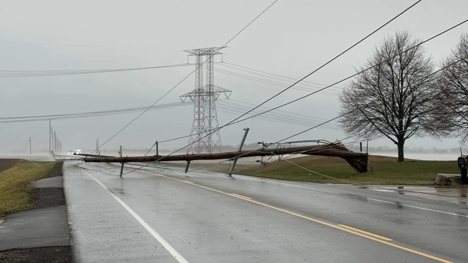
Highways and interstates are affected: a long stretch of I-35 is closed from Ames, Iowa, north to the Minnesota border, and Minnesota officials list I-35 as Travel Not Advised. Late Sunday, more than 115,000 customers were without power across the Upper Midwest and Great Lakes, with Michigan accounting for nearly half of those outages.
Severe Storms and Tornado Damage
A separate line of strong thunderstorms developed along an intense cold front sweeping the central U.S. Tornado watches covered parts of Illinois, Indiana, Kentucky and Missouri. Local emergency officials reported significant damage in Tazewell County and Mount Zion, Illinois, after storms and at least one confirmed tornado rolled through Sunday afternoon. Video from the scene showed debris and residents moving toward first responders.
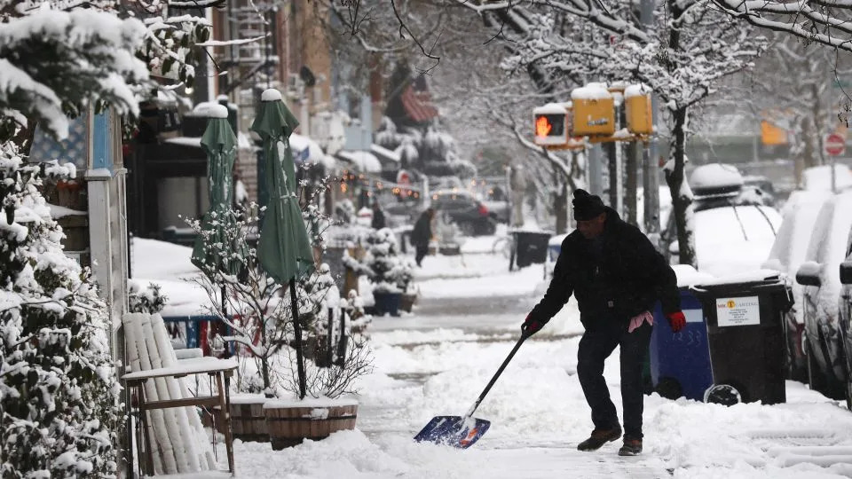
A man shovels snow in Brooklyn on Saturday after an overnight storm. - Spencer Platt/Getty Images
Dangerous travel is expected for much of the next 24 hours. Blowing snow will lead to whiteout conditions over northern Iowa Sunday and Sunday night. Travel in this area is discouraged.
Weather Dynamics
Meteorologists say the storms were fueled by a sharp clash of warm, spring‑like air and a reinforcing cold front. Temperatures behind the front plunged rapidly — Springfield, Illinois, dropped from the 70s into the 40s within about two hours — and forecasters warned winds and isolated tornadoes could persist across the lower Ohio Valley into the evening.
Outlook and Safety Tips
Forecasters expect the worst conditions Sunday afternoon into the overnight hours across the Midwest. Travelers should avoid nonessential trips where advisories are in effect, check flight and road conditions before departing, carry emergency supplies in vehicles, and follow local guidance from the National Weather Service and state transportation agencies.
Sources: National Weather Service, FlightAware, Federal Aviation Administration, PowerOutage.com, AAA.
Help us improve.


