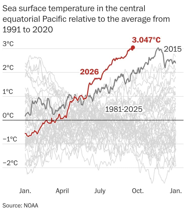
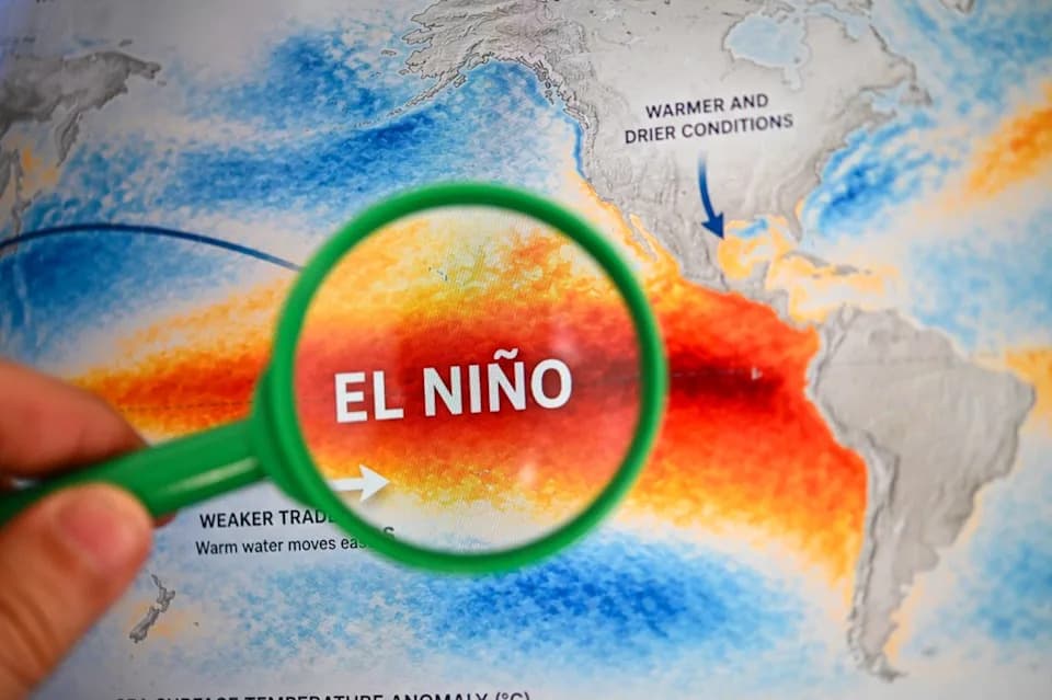
Sea surface temperatures in the central Pacific Niño 3.4 region—a roughly 2.4-million-square-mile area scientists monitor to track El Niño—hit an unprecedented daily average of 85.73°F on Sept. 29, according to preliminary NOAA data. Temperatures rose further on Sept. 30, and buoy readings along a roughly 1,000-mile stretch near the 140th meridian that day ranged from 83.8°F to 87.8°F, NOAA’s National Data Buoy Center reported.
What Happened
NOAA cautions that the Sept. 29 value is preliminary and may be revised as additional ship, buoy and other observations are integrated. Still, the reading surpassed the previous daily record of 85.68°F set in November 2015 during one of the strongest recorded El Niño events.
Why It Matters
The Niño 3.4 region is central to how NOAA measures the El Niño–Southern Oscillation (ENSO). NOAA’s three-month smoothed metric, the Relative Oceanic Niño Index (RONI), compares central-to-eastern equatorial Pacific warmth against the broader tropical oceans. By NOAA standards, a RONI of 2.7°F–3.6°F is classed as “strong,” and 3.6°F or higher is “very strong.” Once September’s monthly numbers are finalized in early October, the current El Niño is expected to qualify as “strong” and could still be intensifying.
Scientific Perspectives
“We are seeing a perfect storm of climate change and a super El Niño that is maturing so fast,” said Ben Kirtman, dean of the University of Miami’s Rosenstiel School of Marine, Atmospheric and Earth Science. Kirtman and other researchers have noted the event developed earlier and strengthened faster than expected.
Veteran El Niño researcher Michael McPhaden of the University of Washington says earlier thinking placed an upper bound on sustainable average sea temperatures near 86°F (about 30°C) because higher temperatures should trigger evaporation that cools the surface. But with background ocean warming from climate change, scientists now question whether that limit is itself rising.
Impacts And Concerns
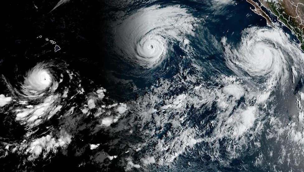
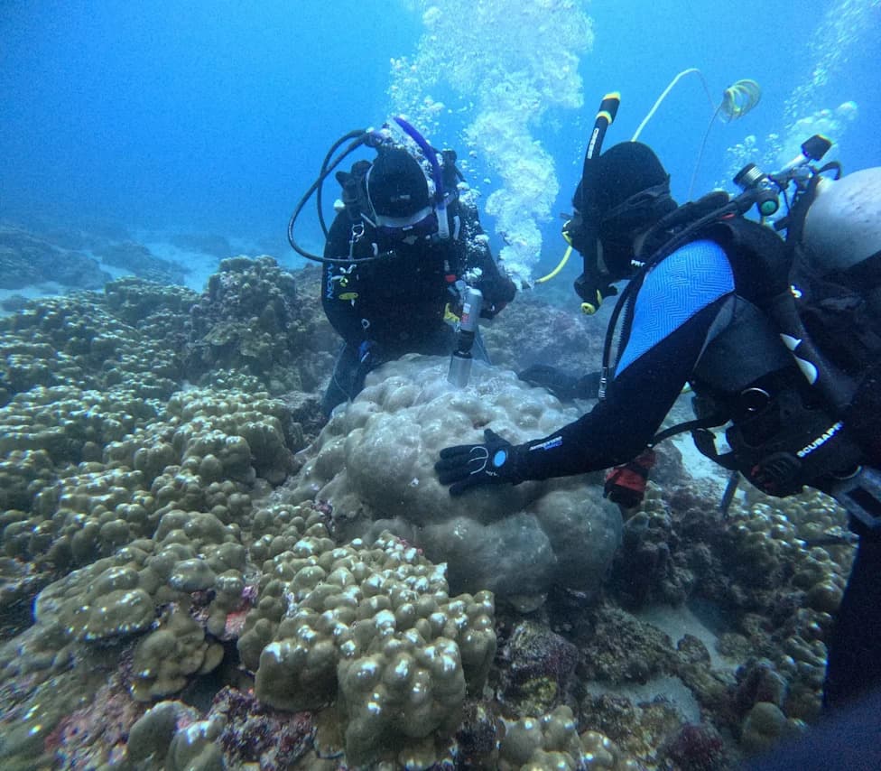
Experts warn that record sea-surface warming in Niño 3.4 layered on top of long-term climate warming could have severe ecological and economic consequences: intensified coral bleaching, disrupted fisheries, shifts in species ranges, and an altered hurricane season in the Pacific.
Doug McCauley of the Benioff Ocean Initiative at UC Santa Barbara has cited reports of typically tropical species, such as yellow sea snakes and hammerhead sharks, appearing off Southern California. Reuters and other outlets have reported disrupted food chains and seabird declines off South America. Coral scientist Bill Precht warns that coastal communities dependent on fisheries and tourism—such as those off Ecuador, the Galápagos and Panama—face acute risks.
Global Context
The Niño 3.4 record is part of a broader pattern of ocean warming. Global daily average sea-surface temperatures have set daily records since June, with August reaching a new all-time daily high, according to the Climate Reanalyzer at the University of Maine’s Climate Change Institute. The Gulf of Mexico has also been experiencing consecutive daily record highs.
What To Watch Next
Scientists expect Niño 3.4 temperatures may continue to climb into November, and many forecast the El Niño event may not peak until later in 2026. NOAA will finalize monthly sea-surface numbers in early October, after which the RONI will provide a clearer classification of this El Niño’s strength.
Key Takeaway: Preliminary NOAA data show record heat in the Niño 3.4 region, signaling a rapidly strengthening El Niño superimposed on long-term ocean warming—an overlap that raises serious ecological, economic and weather-related risks worldwide.
Reporting contributed by USA TODAY; this version has been edited for clarity and flow.
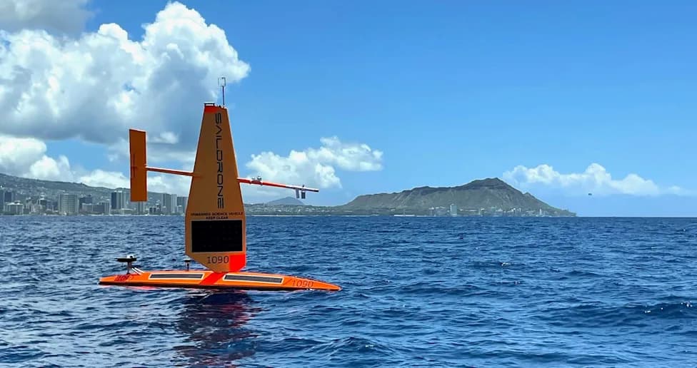
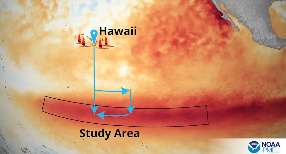
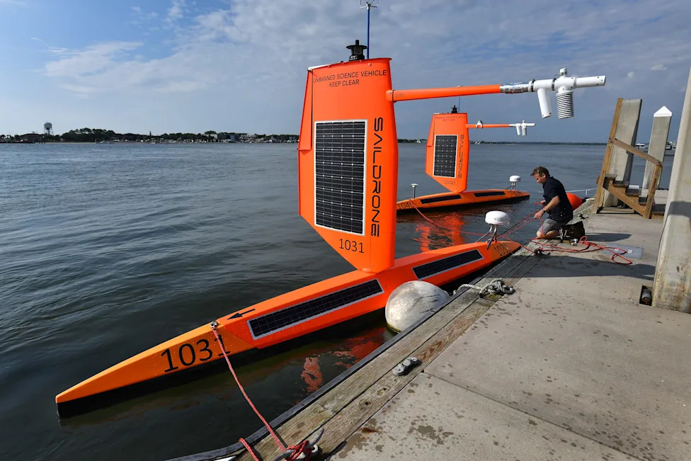
A small fleet of Saildrones are headed into the El Niño region of the Pacific Ocean on a mission for NOAA's Pacific Marine Environmental Laboratory to learn more about conditions during the event.(Provided by NOAA/Pacific Marine Environmental Laboratory)
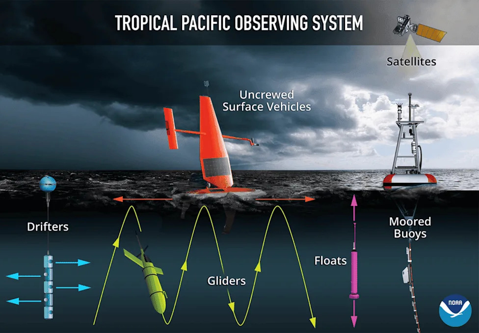
A depiction of the instruments used in the Tropical Pacific Observing System to help monitor El Niño and La Niña events.(Provided by NOAA/Pacific Marine Environmental Laboratory)
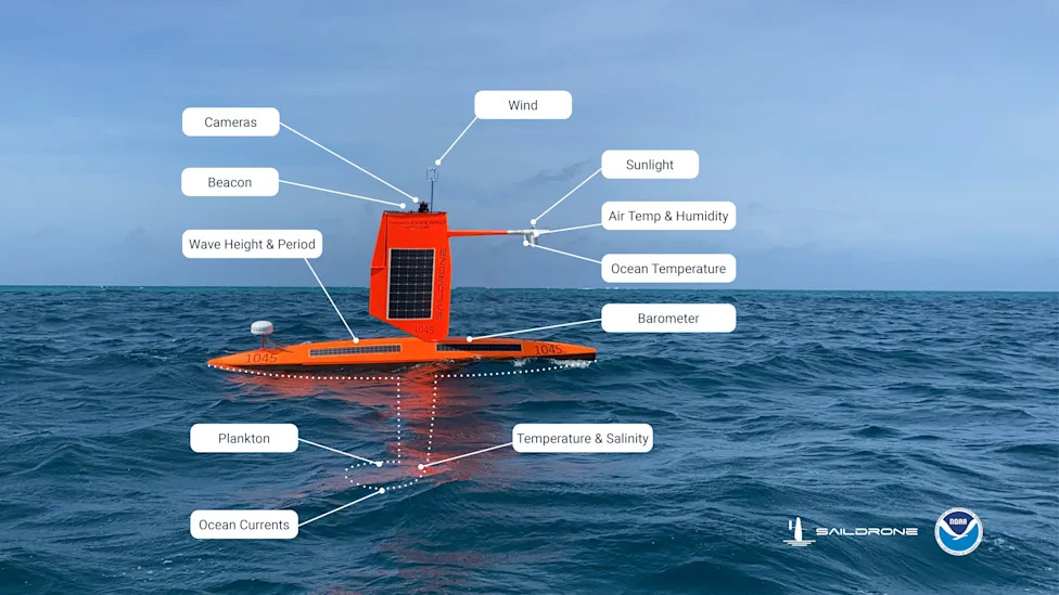
This graphic illustration shows the sensors carried by Saildrone explorers during their research missions.(Provided by Saildrone and NOAA)
A Saildrone on display in NOAA's aviation hangar in Lakeland, Florida.(Dinah Voyles Pulver)
Richard Jenkins, founder and CEO of Saildrone, readies two drones to be towed into the Atlantic Ocean from a dock in Florida on July 23, 2021, hoping to measure conditions at the ocean's surface inside the eye of a hurricane in the Atlantic Ocean.(Bob Self/Florida Times-Union)
Hurricane Ernesto's big waves are captured on camera August 16 by a Saildrone Explorer about 126 miles south of Bermuda. Significant wave height (average height of the highest third of the waves) was more than 33 feet and wind gusts were roughly 63 mph.(Provided by Saildrone and NOAA.)
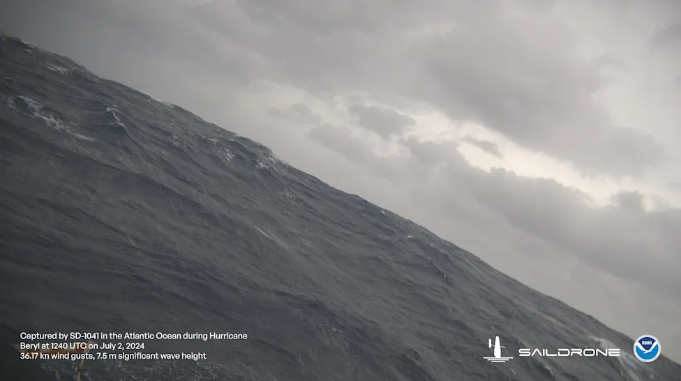
This Saildrone, sometimes called a robot surfboard, was sent to intercept the northern edge of powerful Hurricane Beryl on July 2, about 115 miles south of Puerto Rico.(Provided by Saildrone and NOAA)
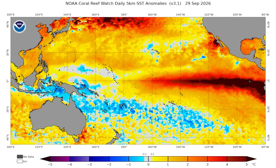
Sea surface temperature anomalies above the long-term average across the Pacific Ocean on Sept. 29, 2026, the day the ocean temperature in the Niño region reached its all-time record high.
Pelicans and gulls gather on the shore of a fishing port in Chorrillos, Peru on Sept. 27, 2026, as environmental groups warn that El Niño-driven warming of Pacific waters and shifts in marine ecosystems are reducing the availability of fish for seabirds along Peru's coast.
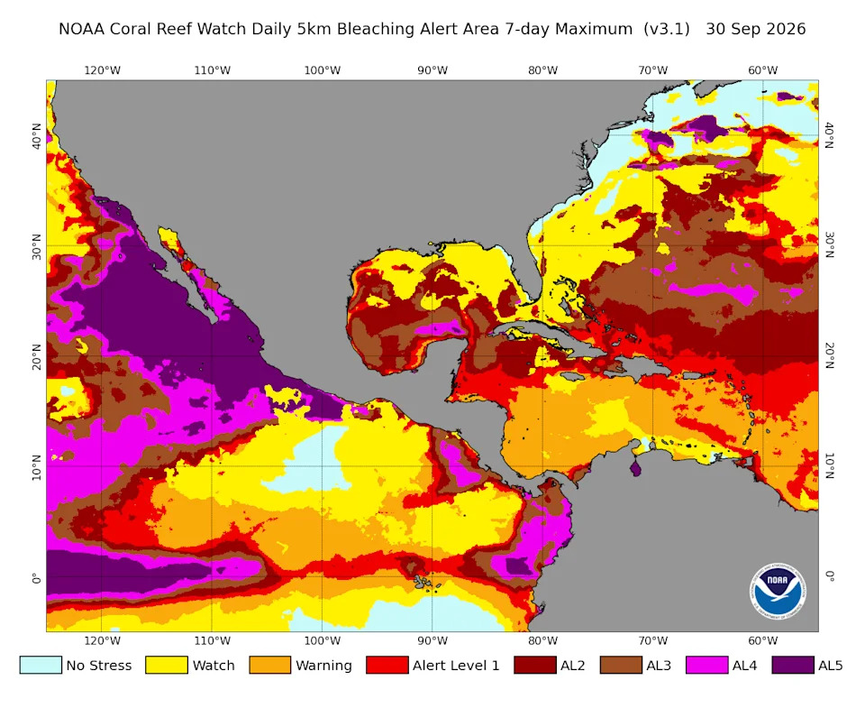
Coral reef heat stress alerts are at some of their highest levels along the coast of the eastern Pacific, according to NOAA's Coral Reef Watch.