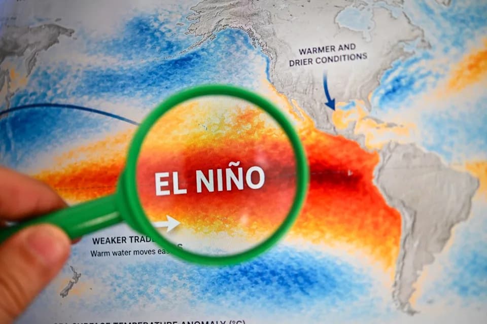
Record-Breaking El Niño: The Niño 3.4 region has registered a sea surface temperature anomaly of +3.05°C (5.49°F), the highest peak on record in NOAA's OISST dataset. This peak arrived earlier than the 2015 maximum and surpasses historically large events in 1997, 1982 and 1877. The event is expected to strengthen through December and is already reshaping global weather patterns, with notable impacts likely across the U.S. this winter.
Record-Breaking El Niño Surpasses Historic Events as Niño 3.4 Hits +3.05°C
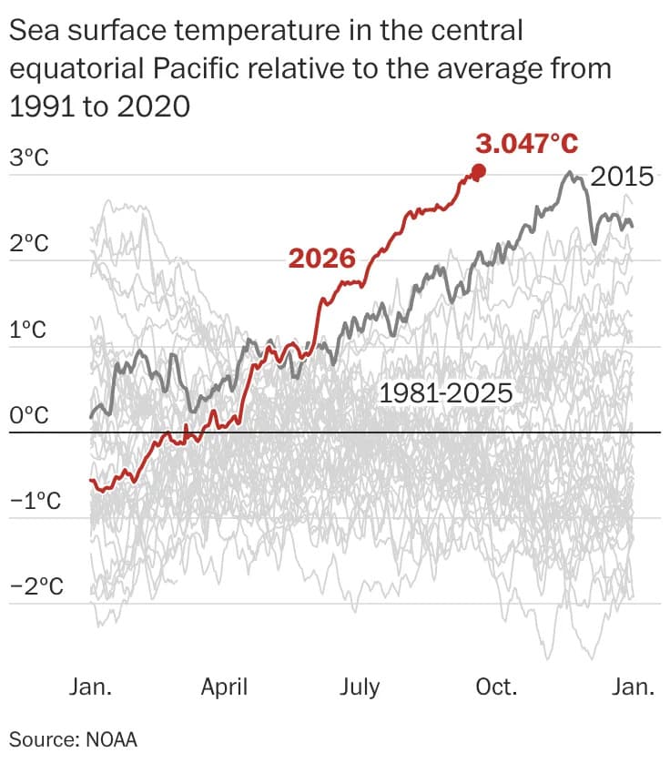
What began nine months ago as a shift in winds over a remote stretch of the western Pacific has developed into an El Niño of unprecedented strength. In the sparsely populated Niño 3.4 region of the central equatorial Pacific, average sea surface temperatures reached +3.05°C (5.49°F) above the long-term mean — the largest peak anomaly on record in NOAA's OISST dataset.
This peak arrived roughly two months earlier than the 2015 maximum and exceeds historically significant events from 1997 and 1982. It also surpasses an 1877 episode that contributed to a global famine estimated to have killed 3–4% of the world’s population.
What To Expect Next
The current El Niño is expected to strengthen for about three more months and is likely to reach its maximum around December. If it continues on this trajectory, conditions could reach levels without modern historical precedent, with widespread consequences for global weather patterns.
How the Ocean Is Changing the Atmosphere
Unusually warm sea surface temperatures fuel intense convection — towering thunderstorms that transfer heat and moisture from the ocean to the atmosphere. This process can energize and reposition the storm-steering jet stream, altering precipitation and temperature patterns around the globe.
Observed And Expected Impacts
Some El Niño-related shifts are already being observed worldwide. In the United States, the most pronounced effects typically occur from late fall through winter, including:
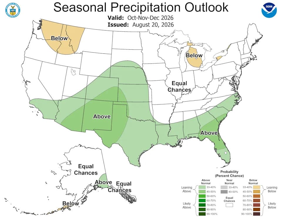
- Increased storminess and rainfall across the southern United States
- Milder and drier conditions across parts of the Pacific Northwest and northern Plains
- Altered storm tracks that can change regional flooding and drought risks
Regional impacts will vary and depend on how the atmosphere responds as the event evolves.
About this story: This El Niño has reached the highest daily peak sea surface temperature anomaly in NOAA's Optimum Interpolation Sea Surface Temperature (OISST) dataset. Peak values can differ among datasets because they use different observations, methods and climatological baselines.
If you follow climate and weather, this event is important because it will influence seasonal forecasts, agricultural planning, water resource management and disaster preparedness across many regions.
Help us improve.