
The "yellow line" marking Israel's withdrawal under October's ceasefire is often unclear on the ground, and Palestinians say that ambiguity has led to near-daily shooting and deaths. Gaza officials report at least 77 of 447 post-ceasefire fatalities occurred near the line, including 62 who crossed it; Israel says it has killed 57 people there and that most were militants. Geolocation analysts and satellite imagery indicate markers and demolitions sometimes extend deeper into Gaza than official maps show, intensifying fears that the temporary buffer could become a permanent boundary.
Vague ‘Yellow Line’ In Gaza Leaves Civilians Vulnerable as Israeli Troops Fire

A yellow block demarcating the "Yellow Line," which has separated the Gaza Strip's Israeli-held and Palestinian zones since the October ceasefire, is visible in Jabalia, northern Gaza Strip. where Hamas militants are searching for the remains of hostages, Monday, Dec. 1, 2025. (AP Photo/Jehad Alshrafi)(ASSOCIATED PRESS)
A barely visible dividing line in Gaza — the so-called "yellow line" that Israeli forces say marks their withdrawal under October's ceasefires — has become a deadly hazard for civilians, residents, medics and mapping experts say. Near-daily fire and unclear markings mean people who stray near the line risk being shot, wounded or killed.
Who’s Being Hurt
According to the Gaza Health Ministry, of 447 Palestinians killed between the ceasefire taking effect and Tuesday, at least 77 died from Israeli gunfire near the yellow line, including 62 who reportedly crossed it. The casualties include teenagers and young children. The Israeli military has acknowledged killing 57 people around the yellow line, saying most were militants, and says troops follow rules of engagement and mark the line on the ground to "reduce friction and prevent misunderstandings."
Why The Line Is Confusing
Though the military has placed yellow barrels and concrete barriers in some locations, the demarcation is absent or inconsistent in others. Palestinians and open-source geolocation analysts say markers in several urban areas sit nearly half a kilometer (about 0.3 miles) deeper into Gaza than the ceasefire map specified, effectively expanding areas under Israeli control.
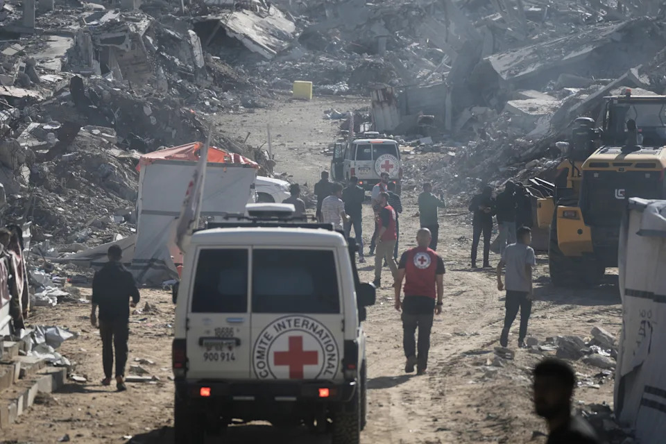
A yellow block demarcating the "Yellow Line," which has separated the Gaza Strip's Israeli-held and Palestinian zones since the October ceasefire, is visible in Jabalia, northern Gaza Strip during searching for the remains of hostages, Monday, Dec. 1, 2025. (AP Photo/Jehad Alshrafi)(ASSOCIATED PRESS)
Maps provided by the Israeli military and by the White House do not always match one another, and neither always aligns with the markers troops place on the ground. That mismatch, experts say, creates dangerous ambiguity for civilians trying to navigate where it is safe to shelter, collect belongings or move between damaged neighborhoods.
Firsthand Accounts
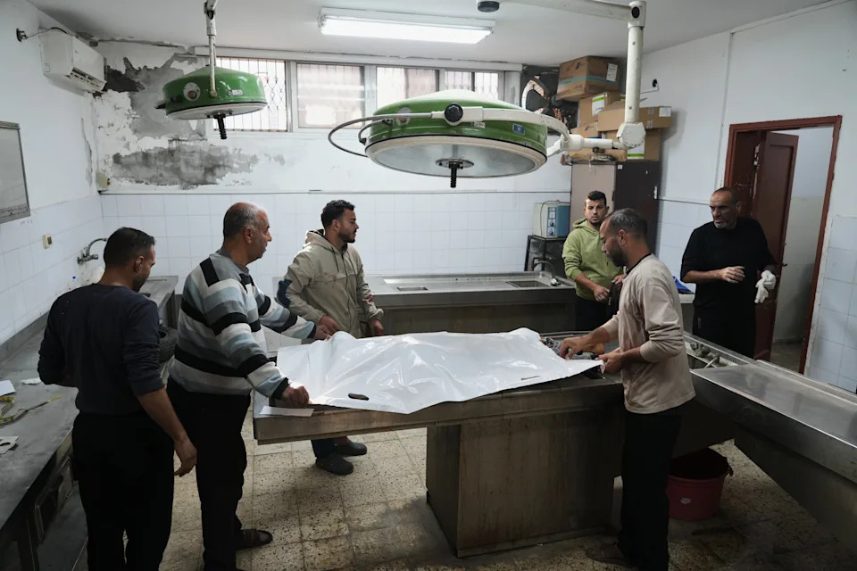
Residents and medical staff describe near-daily casualties from straying near the line. Fadel Naeem, director of Gaza City's Al-Ahli hospital, said people of all ages arrive regularly with gunshot wounds from being too close to the demarcation. In some cases, people reported they did not realize they were near the line because visible cues were missing amid widespread destruction.
"We stay away from the barrels. No one dares to get close," said Gaza City resident Ahmed Abu Jahal, noting markers near his home sit less than 100 meters (110 yards) away instead of the roughly 500 meters (546 yards) shown on the military's map.
Notable Tragic Incidents
Zaher Shamia, 17, who lived about 300 meters (330 yards) from the line in Jabaliya refugee camp, was playing with friends on Dec. 10 when witnesses say soldiers advancing with an armored bulldozer fired on the group. Zaher was later found dead; doctors said he suffered gunshot wounds and was crushed by the bulldozer. The military said it knew Shamia was a civilian and that it is investigating.
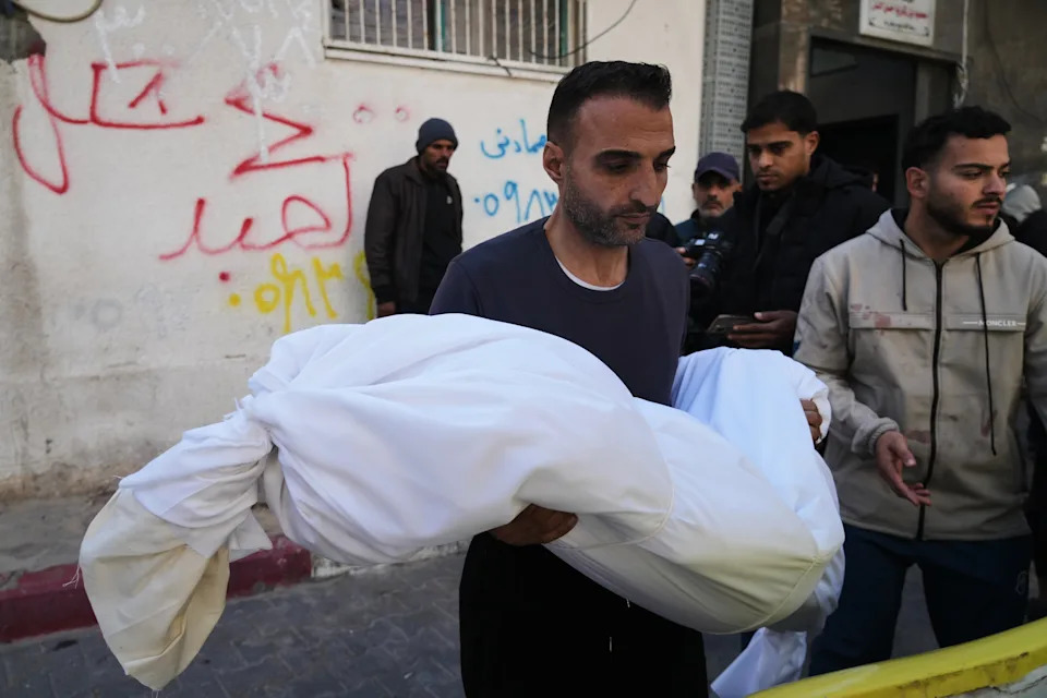
FILE - The body of 11-year-old Palestinian girl Hamsa Hosou, killed by Israeli fire in Jabalia, is brought to Shifa Hospital in Gaza City Thursday, Jan. 8, 2026. (AP Photo/Jehad Alshrafi, File)(ASSOCIATED PRESS)
On Dec. 7, Maram Atta said her 3-year-old daughter, Ahed al-Bayouk, was struck and killed by a stray projectile while playing near the yellow line on Gaza's southern coast. Atta said she heard aircraft overhead and then gunfire; the child died before reaching a clinic. A military official denied responsibility for the killing.
Mapping, Satellite Evidence And Dispute
Open-source analyst Chris Osiek geolocated several yellow blocks from social media videos and found at least four urban areas where physical markers sit several hundred meters inside Gaza compared with the military's map. Planet Labs satellite imagery cited by analysts shows recent demolitions in Gaza City's Tuffah neighborhood extending roughly 300 meters (330 yards) beyond the officially held zone.
The Israeli military disputes claims of major deviations, saying any differences from the map amount to only a few meters. Palestinians and experts counter that even small shifts can mean the loss of homes and shelter in an already shrinking territory.
FILE - The body of 11-year-old Palestinian girl Hamsa Hosou, killed by Israeli fire in Jabalia, is brought to Shifa Hospital in Gaza City Thursday, Jan. 8, 2026. (AP Photo/Jehad Alshrafi, File)(ASSOCIATED PRESS)
Wider Context And Concerns
Under the ceasefire, Israel withdrew to a buffer zone that can be up to 7 kilometers (4 miles) deep, containing much of Gaza's arable land, high ground and all border crossings — confining more than 2 million Palestinians into a narrow coastal and central strip. The ceasefire says forces should remain at the yellow line only until a fuller withdrawal, but it does not set a timeline.
With subsequent steps stalled and troops fortifying positions, some Palestinians fear the yellow line could become a de facto permanent boundary. In December, Israel’s defense minister described the yellow line as "a new border line — serving as a forward defensive line for our communities and a line of operational activity."
Human Toll
Residents report continued demolitions and new markers appearing closer to homes, pushing families from damaged houses and raising fears of permanent displacement. As one resident put it, "The line is getting very close." For civilians navigating rubble and destruction, the combination of unclear markings, differing maps and active military operations has a deadly human cost.
Help us improve.


