The Cardones ignimbrite in northern Chile — emplaced about 21.9 million years ago — buried and preserved a gentle foothill landscape. By modeling 560 synthetic pre‑eruption topographies, researchers constrained the long‑term average rock uplift to below 0.26 km/Myr (≈2.6 cm per century). The result supports slow, sustained Andean growth in this region and introduces a geometric method for bounding ancient tectonic activity where large ignimbrites preserve broad surfaces.
Pompeii‑Scale Eruption Preserved an Ancient Andean Landscape — Revealing 21.9 Million Years of Slow Uplift
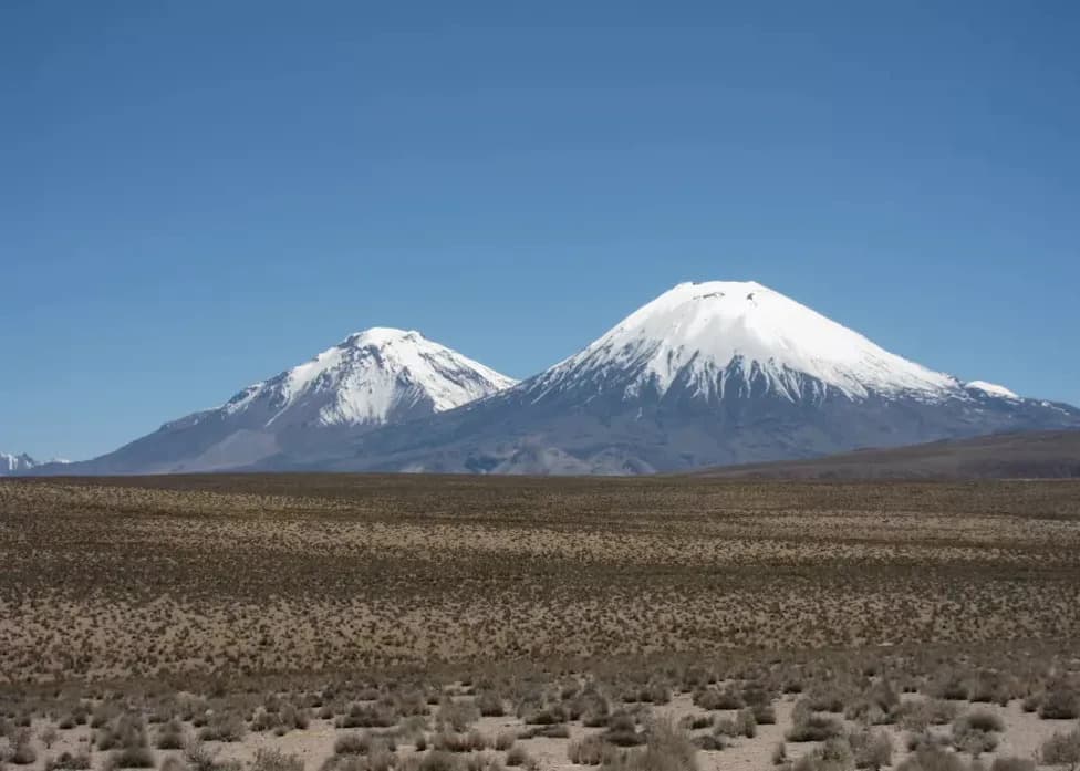
A 21.9-million-year-old volcanic blanket preserved clues showing part of the Andes may have risen slowly for millions of years. (CREDIT: Frances J. Cooper)
A colossal Miocene eruption buried a broad swath of the Central Andes beneath the Cardones ignimbrite about 21.9 million years ago, effectively freezing the shape of an earlier foothill landscape and giving scientists a rare geometric way to estimate long‑term mountain uplift.
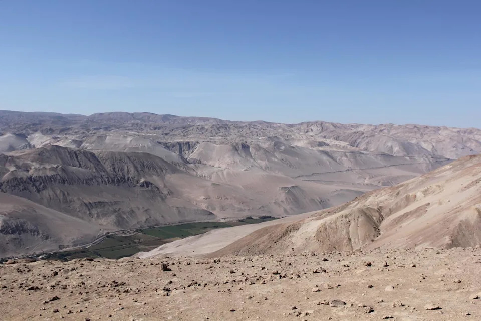
Cardones ignimbrite deposits incised by the Lluta River in northern Chile. (CREDIT: Frances J. Cooper
What the Cardones Ignimbrite Reveals
The Cardones deposit in northern Chile, linked to the Lauca Caldera, contains more than 1,260 cubic kilometres of material and locally exceeds a kilometre in thickness. The volcanic surface preserved by the deposit is unusually broad and gently sloping: researchers estimate the original ignimbrite surface dipped about 1.5° ± 0.3°. That modest slope is key — if the buried terrain had been substantially steeper, major ridges would have projected through the ignimbrite.
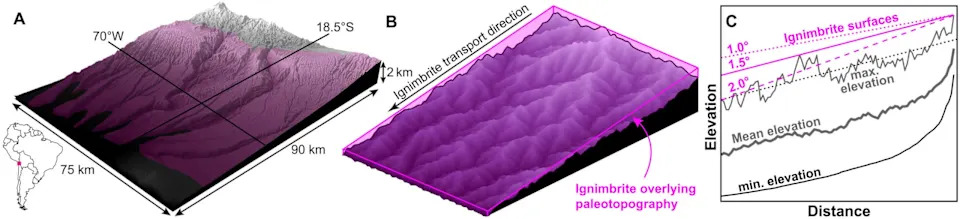
Burial of a mountainous landscape beneath a large-volume ignimbrite. (CREDIT: Dr Byron Adams et al, Science Advances)
Modeling Buried Landscapes
Using this geometric constraint, the team (including Byron Adams and Frances Cooper of UCL Earth Sciences) ran two‑dimensional landscape‑evolution models to generate a population of plausible pre‑eruption terrains. They produced 560 synthetic landscapes, exploring rock uplift rates from 0.1 to 2.0 km/Myr and a range of river erodibility values (for example, a representative case used K = 8 × 10⁻⁹ m⁻¹ year⁻¹).
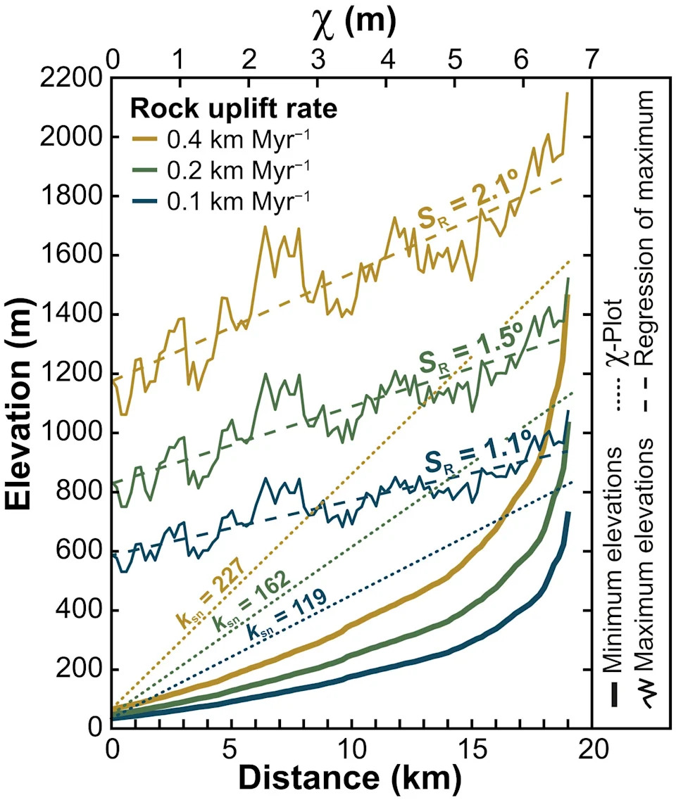
Swath profiles from three 2D synthetic landscapes with the same erodibility (K = 8 × 10⁻⁹ m−1 year−1) and different rock uplift rates. (CREDIT: Dr Byron Adams et al, Science Advances)
Faster uplift produces steeper channels and higher relief; slower uplift gives rivers more time to incise and smooth terrain into gentle foothills that could be fully buried by the ignimbrite. Comparing models to the ignimbrite's ~1.5° limit — and restricting erosion parameters to values plausible for the region's bedrock and climate — the team found that landscapes compatible with complete burial require an average rock uplift below about 0.26 km/Myr.
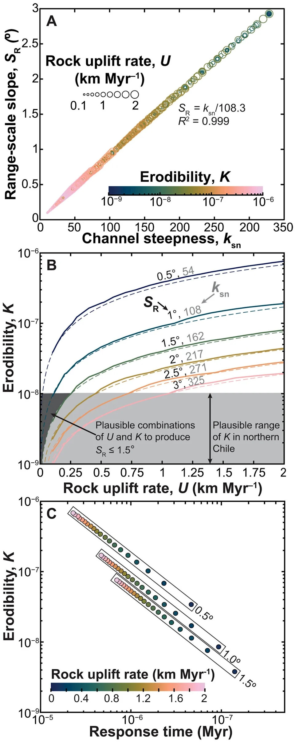
Results of 2D landscape evolution modeling. (CREDIT: Dr Byron Adams et al, Science Advances)
Implications and Timescales
That upper bound corresponds to roughly 2.6 cm per century, supporting a picture of slow, sustained Andean growth in this part of the range rather than a late, rapid surge in elevation. The models also indicate that producing the subdued relief inferred beneath the ignimbrite would have taken millions of years; in one representative scenario, reaching ≈95% of the modeled steady‑state relief required on the order of 14 million years.
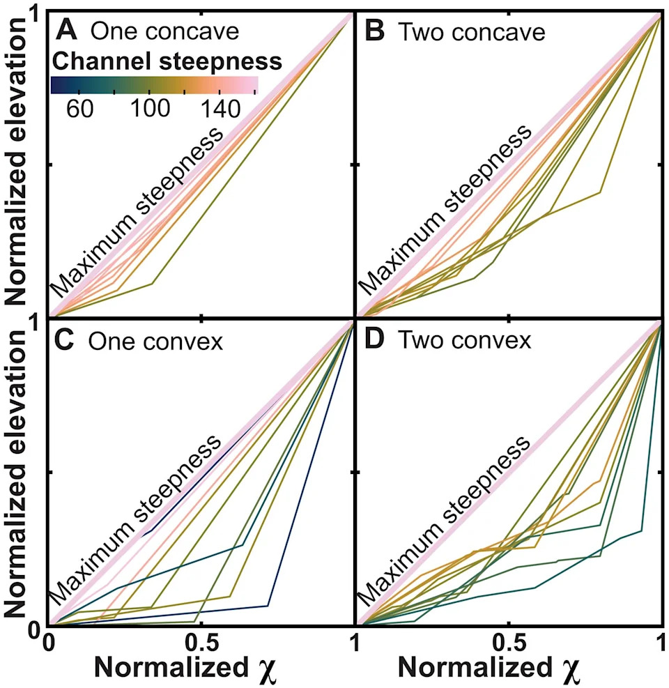
Ten simulations from a population of 3 million are shown in each panel, colored by mean channel steepness value (see fig. S3 for histograms of all simulations). (CREDIT: Dr Byron Adams et al, Science Advances)
Method Strengths, Limits, and Broader Use
The volcanic‑blanket approach provides an independent, geometric constraint on long‑term uplift that complements thermochronology (mineral cooling histories). Unlike chemical clocks, it asks what topography could physically have been buried under a dated ignimbrite.
Limitations: Erosion efficiency depends on climate and rock type, and ancient landscapes may not have been at equilibrium when buried. The result therefore offers a robust upper bound on long‑term average uplift rather than a detailed chronology of every tectonic episode.
Why It Matters
Where large, low‑angle ignimbrites preserve their original geometry, this technique can turn catastrophic eruptions into geological archives of vanished terrain. Applied more widely, it could help constrain tectonic histories in volcanic provinces across the globe.
Published: The full study and model details are available in Science Advances.
Help us improve.