Green Oceans reports that wreckage believed to be the 52-foot F/V Mistress — which sank on Jan. 1, 2019 — has been located about 92 feet deep and roughly 50 feet from a Block Island Wind Farm turbine. Divers documented key features consistent with the vessel and say apparent human remains were observed. The nonprofit has provided evidence to federal authorities and requested the site be secured for forensic analysis. The find prompts questions about how fixed offshore infrastructure may affect navigation and search-and-rescue efforts.
Seven-Year Mystery Solved: Wreck Believed To Be F/V Mistress Found Near Block Island Wind Farm
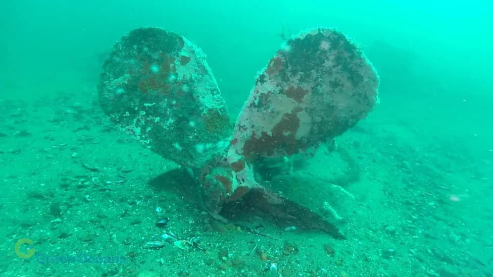
Multiple vessel features were photographed on August 30, 2026, by a team of scientific divers. Vessel features were aligned with images of the FV Mistress contained within the USCG investigation to verify its identity.
A Rhode Island nonprofit says a long-lost fishing vessel believed to be the F/V Mistress has been located on the seafloor near the Block Island Wind Farm, and investigators report what appear to be human remains at the site.
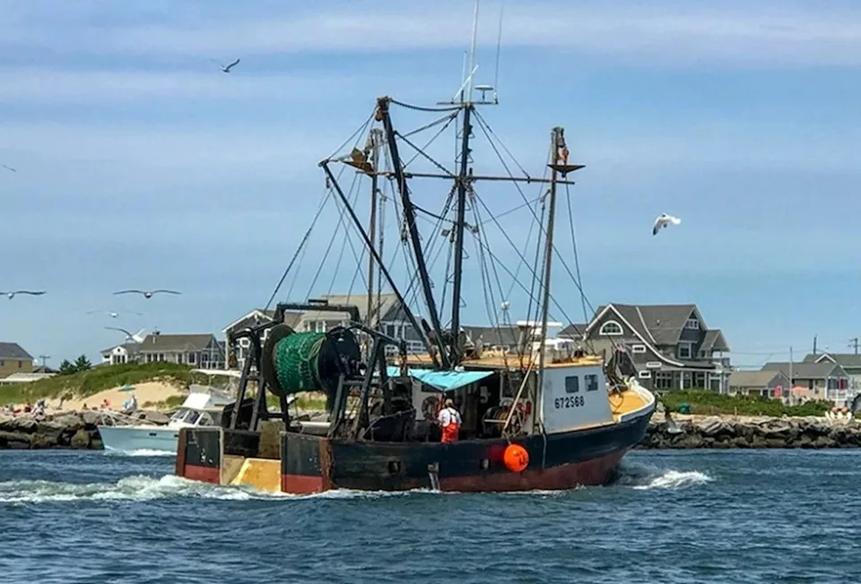
F/V Mistress was a 52-foot wooden trawler operating out of Pt. Judith, Rhode Island. The vessel tragically sunk on January 1, 2019 in proximity to the Block Island Wind Farm, claiming the lives of two fishermen.
The 52-foot wooden trawler, which operated out of Pt. Judith, sank on Jan. 1, 2019 while working near the offshore turbines. Two fishermen were lost in the incident; a third crew member, the captain’s son, was rescued from a life raft by a nearby boat. At the time, the U.S. Coast Guard and other agencies conducted an extensive search but ultimately suspended recovery efforts without locating the vessel or the two missing crew members.
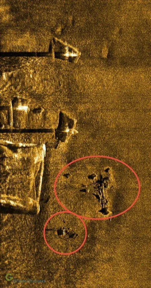
A July 27, 2026 sidescan sonar image captured a detailed image of wreckage within 50 linear feet of the base of one of the Block Island Wind turbines (the square). The long black shadows are from the jackup barge on location during the survey. The sonar image is a relative linear feet of the base of one of the Block Island Wind turbines (the square). The long black shadows are from the jackup barge on location during the survey. The sonar image is a relative top-down view, which uses soundwave reflections to create imagery through the water.
Search, Sonar And Diver Investigation
Seven years after the sinking, the nonprofit Green Oceans assembled a multidisciplinary team of marine professionals to search and document the area. On July 27, 2026, a sidescan sonar survey produced detailed imagery showing wreckage roughly 50 linear feet from the base of turbine No. 1 of the Block Island Wind Farm. The sonar image — a top-down view created from reflected sound waves — also showed pronounced shadows cast by a jackup barge that was on site during the survey.
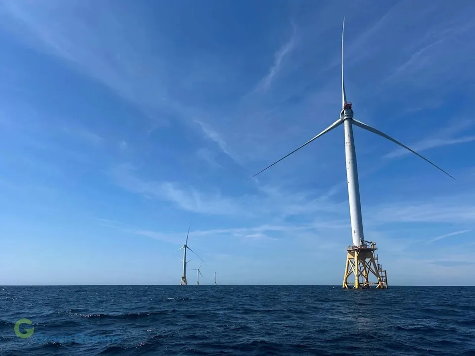
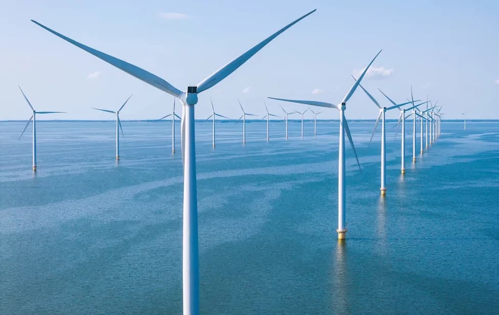
The Block Island Wind Farm is located to the south and east of Block Island, RI, and consists of 5 offshore wind turbines.
Following the sonar detection, scientific divers performed an underwater assessment in late August. According to Green Oceans, divers documented numerous features consistent with the F/V Mistress, including the propeller and shaft, fuel tanks, a net drum, a deck hatch and processing equipment. The wreck reportedly rests in about 92 feet of water.
"We hope this discovery provides answers and some measure of closure for the fishermen's families," said Michael Lombardi, president of Green Oceans. The nonprofit has turned its findings and any recovered evidence over to federal authorities and requested that the site be secured for an appropriate forensic analysis.
Broader Safety Questions
Green Oceans emphasized that the discovery raises broader questions about how permanent offshore infrastructure may affect visibility, radar navigation, vessel maneuverability, emergency access and search-and-rescue operations. Final identification of the wreck and any forensic conclusions will be made by the responsible federal agencies.
Green Oceans is a Rhode Island-based nonprofit focused on ocean protection and marine science outreach. The organization says it will continue to cooperate with authorities and provide information to the public as investigations proceed.
Help us improve.