Georgia officials and conservation groups are promoting "living shorelines" — restoring native marsh grasses instead of building hard seawalls — to halt erosion and bolster coastal resilience. An action plan maps more than 56,000 acres where marshes are likely to migrate but are currently open to development. With sea levels projected to rise 1–2 meters over the next 75 years, allowing marsh migration and protecting adjacent lands is essential to reduce future storm and flood risk.
Give Georgia’s Marshes Room To Move: A New Plan Uses Living Shorelines And Land Conservation
A new plan to preserve Georgia’s marshes: Give them space to migrate
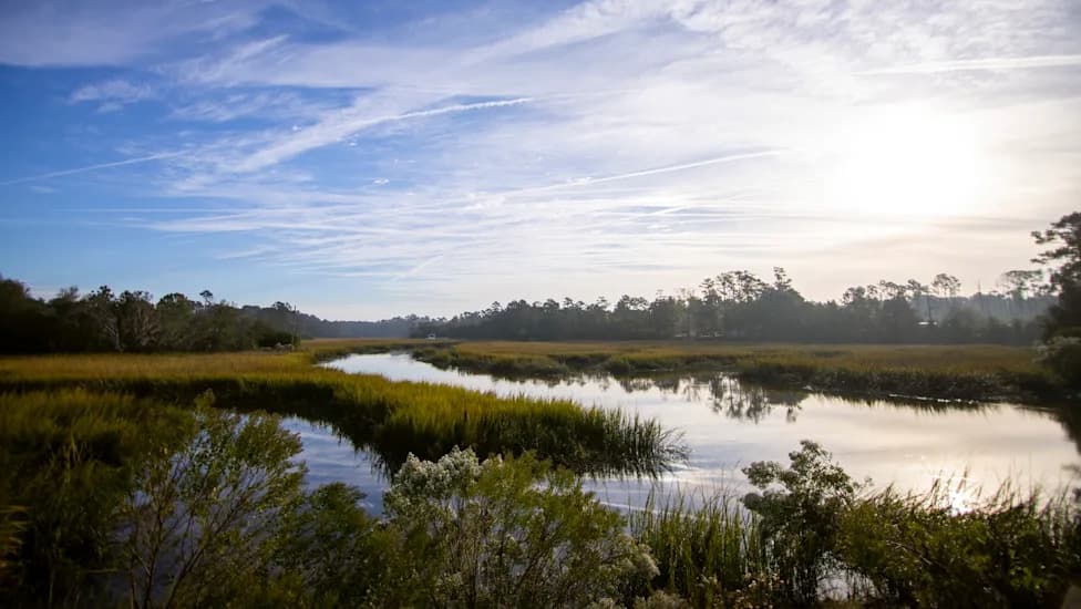
Decades ago, crews digging to build a stable base for I-95 near Midway, Georgia — roughly 50 miles south of Savannah — left behind a deep dredge pit. That excavation is now part of a public park bounded by a tidal creek on one side and the old pit on the other. Although the park sits more than 15 miles inland from the open ocean, high tides push up the creek twice daily. Lush marsh grass grows between solid ground and the creek, while along the opposite bank salt water has steadily eaten away the shoreline and deposited sediment into the basin.
The pit, once deep, has largely filled in to become a shallow mudflat dotted with small islands of marsh grass as vegetation naturally recolonizes ground that has become suitable for it. Yet the grasses stop abruptly at the muddy cliff where the tide undercuts the bank.
"If we walk that way, you'll be able to see some of the, well, just plain erosion," said Phil Odom, chairman of Liberty County's Consolidated Planning Commission. "This is how much it has collapsed. We've lost about six, eight feet right here."
Local officials are trying a different approach to halt shoreline loss — one informed by past mistakes, including the very excavation that created the pit. Rather than building hard barriers or dumping concrete, the county is restoring native marsh grasses. The plants' roots help bind and stabilize soil, and their presence promotes natural sediment deposition.
"We hope for it to replicate nature," said Shannon Marino of Zulu Marine, a firm that constructs so-called living shorelines. "When our solutions are done, you should look at it and not really recognize it as a repair or a bulkhead or a solution. It should just look like nature."
Why Migration Space Matters
Living shorelines are an increasingly popular, ecologically minded alternative to seawalls as coastal communities confront rising seas. Georgia contains more than one-third of the contiguous salt marsh habitat along the southeastern U.S. coast — amounting to hundreds of thousands of acres. These tidal wetlands act as crucial buffers against storms and are broadly protected under state law. But preserving existing marsh plants is only part of the challenge.
Projections indicate sea level on Georgia's coast could rise by roughly 1 to 2 meters over the next 75 years. To persist, salt marshes must be able to migrate inland. Wetland scientist Lori Sutter of the University of North Carolina explains that marshes are adapted to frequent tidal flooding, but that adaptation only works if the marsh has space to move.
"Because of the magic of salt marshes," Sutter said, "they're able to persist in this environment where they're flooded twice a day, every day."
When migrating marshes encounter roads, buildings, or other hard infrastructure, they reach a hard edge and cannot establish new vegetation. That forces an advancing tide to inundate wetlands and the built environment behind them, increasing flood risk.
A Roadmap For The Future
A coalition of conservation organizations, scientists, government agencies, and coastal communities has produced an action plan that recommends protecting not only existing marshes but also the adjacent lands where marshes are likely to migrate. The plan identifies more than 56,000 acres in Georgia that are both likely migration zones and currently open to development.
"That creates this really vast area that you're trying to conserve, which can be overwhelming," said Courtney Reich, coastal director at Georgia Conservancy, which is coordinating the state's work under the South Atlantic Salt Marsh Initiative. The plan is presented as a nonbinding roadmap designed to help landowners, planners, and public officials make informed, long-term choices about development at the water's edge.
Short-term pressures and economic incentives often steer land-use decisions. The action plan aims to shift part of the conversation toward a multi-decade view: leave room for marsh migration where possible, use living shorelines instead of hard armoring, and prioritize conservation for areas that provide the biggest benefit to people and nature.
Odom, who has watched Georgia's coast change over the past 75 years, describes deep salt water moving into areas that once teemed with marsh grass, new marshes appearing in different places, and tides creeping higher to leave behind salt-stressed tree skeletons. Climate-driven sea level rise is accelerating those shifts — and increasing urgency. If marshes cannot move inland, Georgia's coast will be more exposed to storms, erosion, and flooding.
What This Means: Restoring native marsh vegetation and conserving adjacent lands can both stabilize shorelines now and preserve natural defenses for the future. The plan gives communities tools and maps to make smarter, longer-term decisions — but it does not force anyone to give up property or stop development. It simply highlights where leaving space could protect people, property, and the marshes that sustain coastal resilience.
Help us improve.