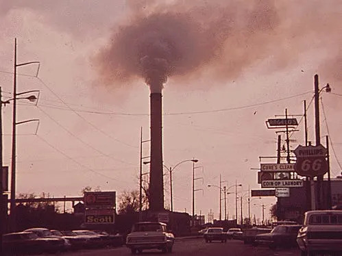
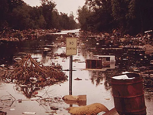
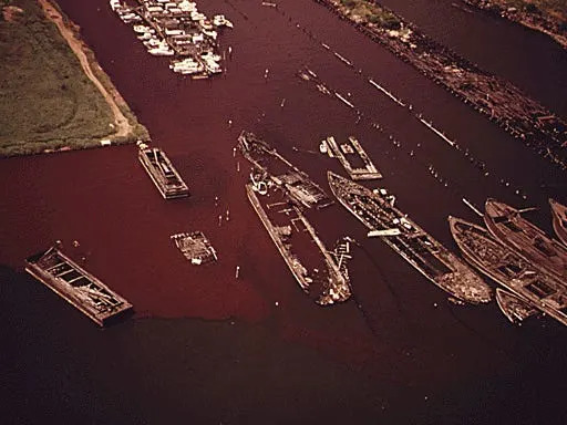
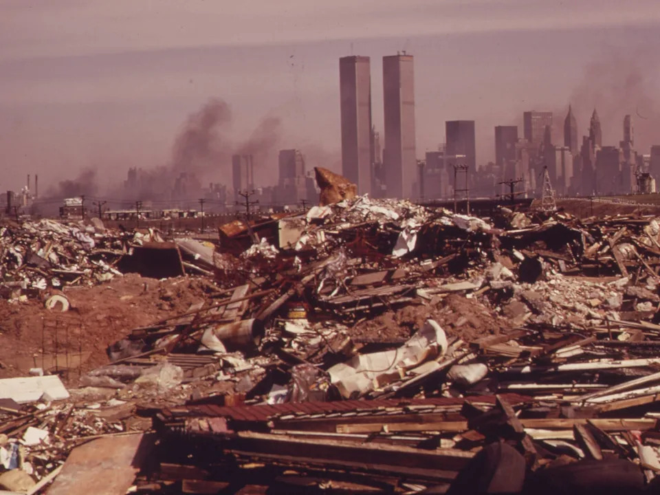
Don't be fooled by the soft, sepia tones of these archival photos: for decades before the federal government prioritized environmental protection, many American cities were routinely beset by dangerous air and water pollution.
A Turning Point: The EPA and Major Environmental Laws
When President Richard Nixon established the Environmental Protection Agency in 1970, pollution control moved to the national stage. The EPA — together with landmark laws such as the Clean Air Act (1970) and the Clean Water Act (1972) — created the regulatory framework that began to curb industrial discharges, sewage dumping and unregulated emissions that had been common across the country.
Documerica: A Photographic Record
Between 1971 and 1974 the EPA's Documerica Project hired roughly 100 freelance photographers to document everyday life and environmental conditions across the United States. By 1974 they had taken about 81,000 photographs; the National Archives has digitized thousands of those images, preserving a vivid visual record of polluted bays, smoky skylines, open dumps and other environmental harms that helped spur reform.
Photos That Tell a Story — City Highlights
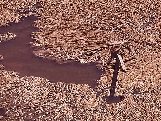
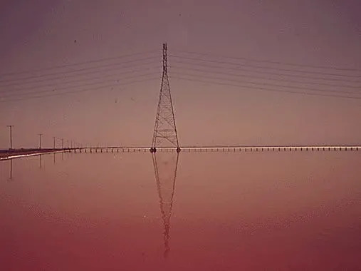
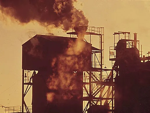
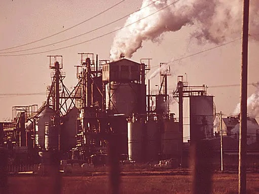
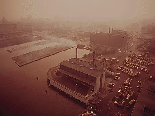
San Francisco Bay: In the late 1960s and early 1970s, municipal and industrial wastewater entered the bay from more than 80 documented points of discharge. Photographs show industrial stacks and salt ponds, and contemporaneous reports warned of foul odors and severe contamination. Legal fights over responsibility for the bay's water quality continued into the 2020s, including a 2019 EPA decision about Cargill Salt and a March 2025 Supreme Court ruling that narrowed the agency's authority over water quality in a 5–4 decision.
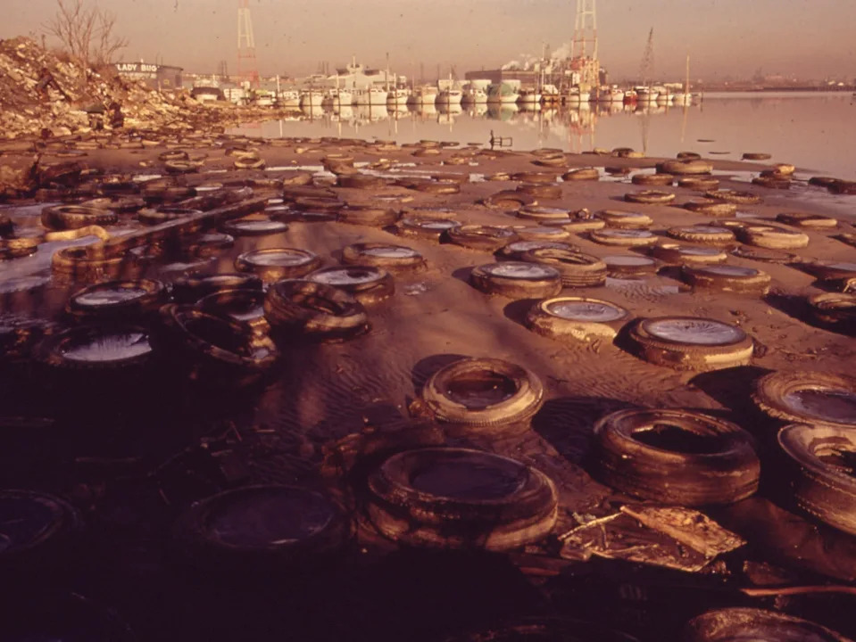
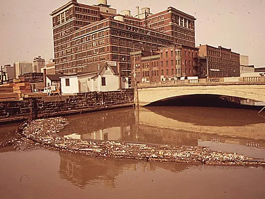
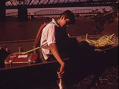
Baltimore: Images from 1973 show tires and trash along the Middle Branch of the harbor. Local crews sometimes used floating screens to trap debris — a simple but fragile countermeasure that required regular maintenance.
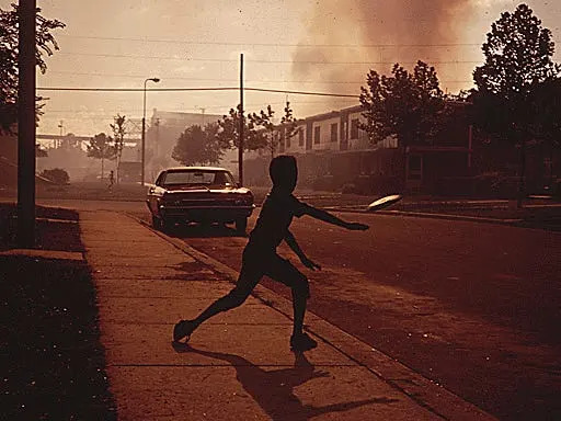
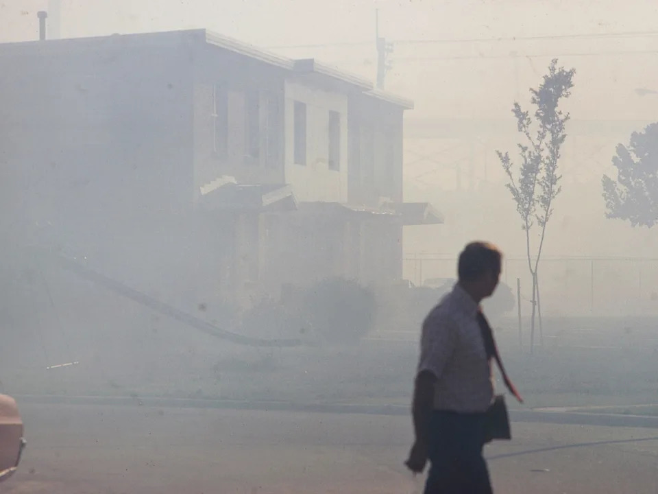
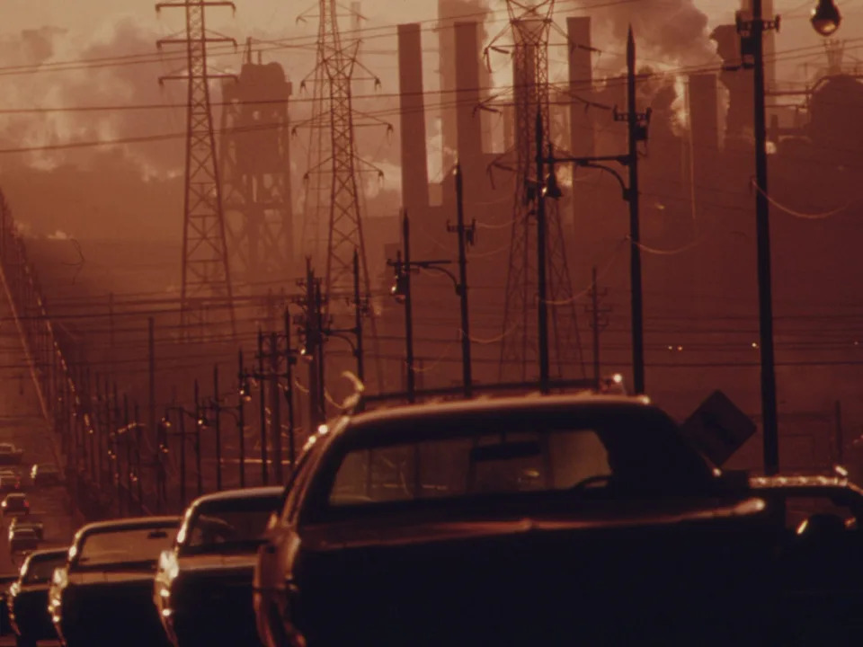
Birmingham: Nicknamed in earlier decades by some truckers as "Smoke City," North Birmingham was captured under heavy industrial haze. Photographs show neighborhoods and homes barely visible from soot and emissions.
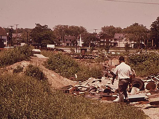
Cleveland: As a major industrial center, Cleveland appears in the archive with heavy smoke, polluted waterways and vacant lots used as informal dumps — a reminder of how industry shaped urban environments before modern controls.
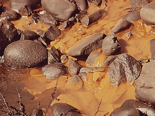
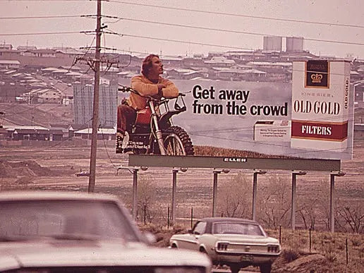
Denver: Archive images document light-brown sewage entering the South Platte River and a pervasive brown haze over the city. By the late 1980s local authorities even began using visibility as a benchmark for air quality improvements.
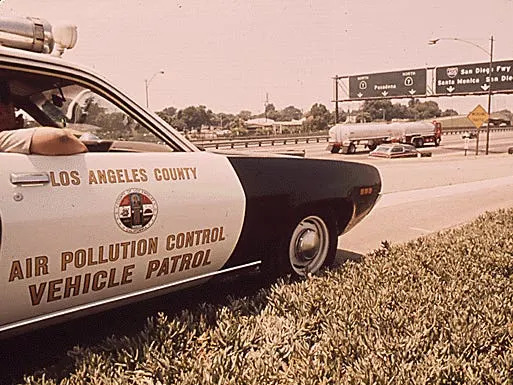
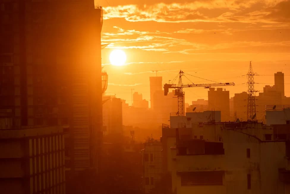
Los Angeles: Smog frequently softened the sun's outline and created hazardous conditions that prompted local and state actions decades before federal standards took full effect. Photographs show air-pollution officers conducting roadside checks for violators as early control efforts took shape.
New Orleans: Photos record fumes from industrial plants and illegal dumps that turned to sludge after floods. A 1970 EPA assessment identified dozens of contaminants in the city's water supply.
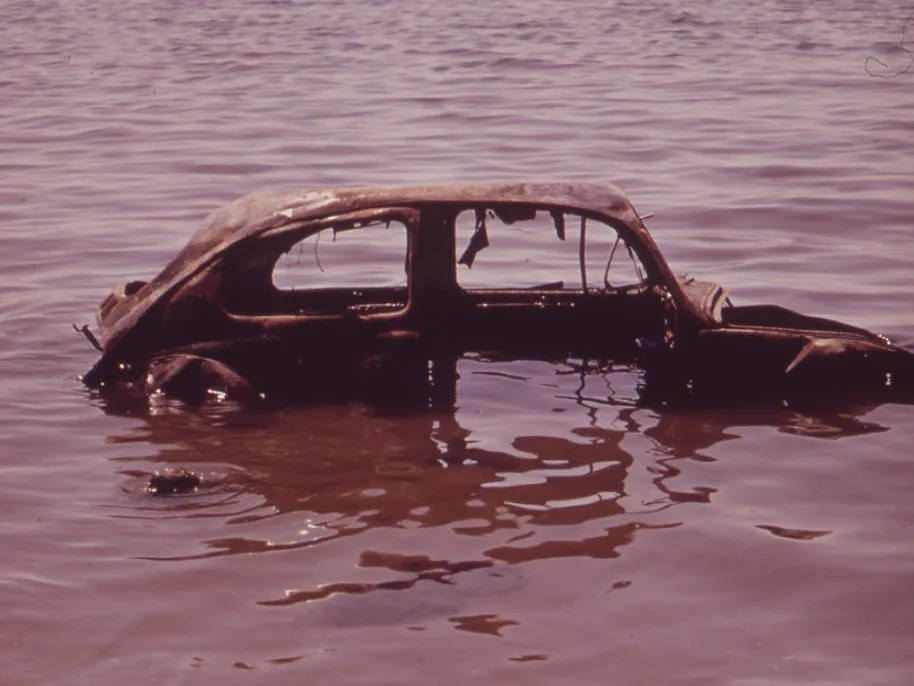
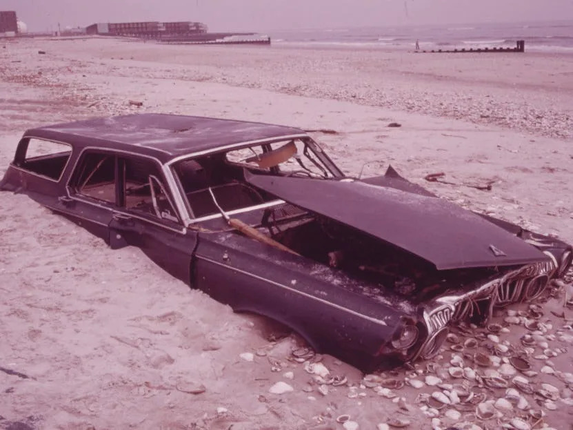
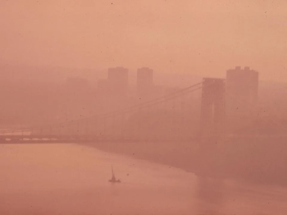
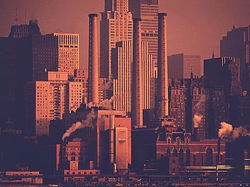
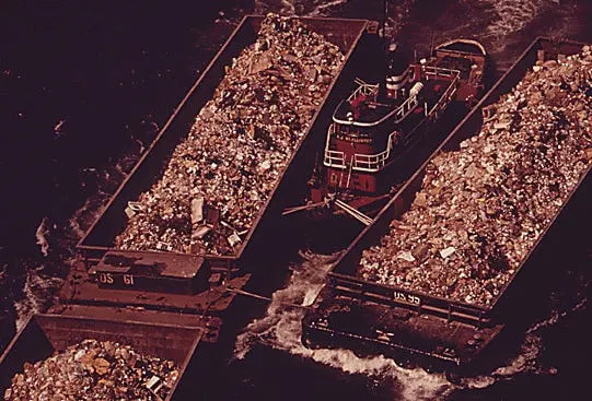
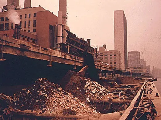
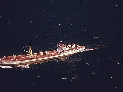
New York City: The Documerica collection includes images of illegally dumped refuse, waterlogged and abandoned cars in Jamaica Bay, thick smog around the George Washington Bridge, and extensive offshore dumping of sludge and industrial waste in the New York Bight. In the early 1970s New York produced tens of thousands of tons of solid waste per day and used barges to transport rubble and sludge to offshore disposal sites.
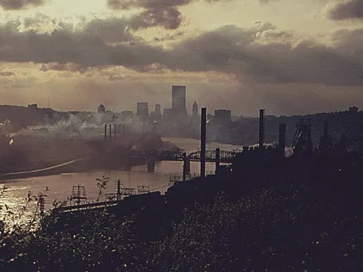
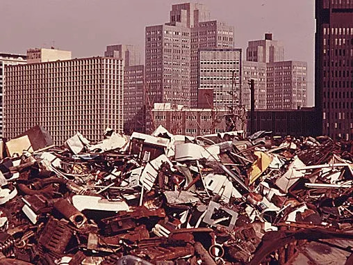
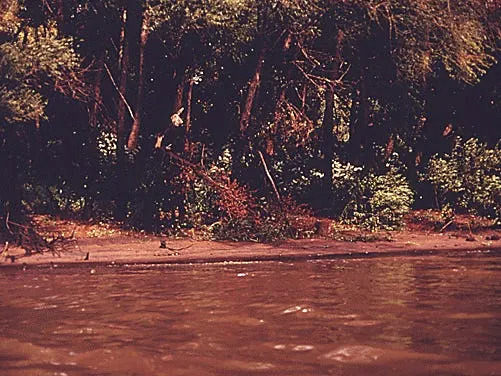
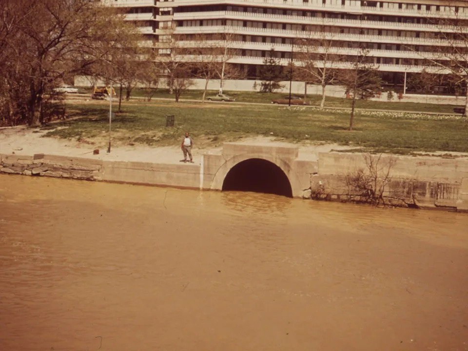
Other Cities: Kansas City, Philadelphia, Pittsburgh and Washington, D.C., also appear in the archive with photos of dying fish, smoky skylines, oil‑coated riverbanks and raw sewage entering waterways such as the Potomac. These images illustrate widespread problems that the Clean Water Act and Clean Air Act were designed to address.
Recent Policy Shifts and Continued Debate
Decades after the initial cleanup efforts, federal policy again shifted. Following the 2025 change in administration, the EPA under Administrator Lee Zeldin announced a series of deregulatory actions. In March 2025 the agency proposed reconsidering the 2009 "endangerment finding" that allowed greenhouse gases to be regulated under the Clean Air Act; in February 2026 the agency said it had finalized rescinding that finding. The administration framed these moves as economic relief and deregulatory reform, while critics warned they would increase climate and public-health risks. The March 2025 Supreme Court decision further complicated the federal regulatory landscape by narrowing the EPA's reach over certain water-quality issues.
Legacy and Takeaways
The Documerica photographs provide a stark visual record of the pollution that motivated federal regulation. Since the 1970s, air and water quality have improved in many places, rivers and bays have recovered significantly in some regions, and visible urban pollution has declined. Yet the recent policy shifts, court rulings and ongoing local controversies underscore that the work of protecting air and water remains contested and unfinished.
Editor’s note: This article was originally published in August 2019 and updated in April 2026 to reflect later policy developments and court decisions.
In San Francisco, LESLIE SALT PONDS AT SUNSET. "WATER STINKS," WRITES THE PHOTOGRAPHER ABOUT THIS SCENEBelinda Rain / EPA
INDUSTRY HAS TAKEN OVER THE SAN FRANCISCO BAY AREA FOR ITS OWN PURPOSESBelinda Rain / EPA
MASSIVE CONCENTRATION OF INDUSTRY IN THE SAN FRANCISCO BAY AREA HAS RESULTED IN SEVERE POLLUTION PROBLEMSBelinda Rain / EPA
Trash and Old Tires Litter the Shore at the Middle Branch of Baltimore Harbor, 01/1973.Jim Pickerell / EPA
A SCREEN PLACED ACROSS JONES FALLS TRAPS TRASH AND KEEPS IT OUT OF BALTIMORE HARBOR. ALTHOUGH NOT FOOLPROOF-A HEAVY RAIN CAN BREAK THE SCREEN-IT IS EFFECTIVE WHEN CLEANED REGULARLYJim Pickerell/EPA
TOSSING A FRISBEE ON A SMOKE-FILLED STREET IN NORTH BIRMINGHAM, MOST HEAVILY POLLUTED AREA OF THE CITYLeRoy Woodson/EPA
Industrial Smog Blacks Out Homes Adjacent to North Birmingham Pipe Plant, this is the Most Heavily Polluted Area of the CityLeRoy Woodson/EPA
Clark Avenue and Clark Avenue Bridge. Looking East from West 13th Street, Are Obscured by Smoke from Heavy Industry, 07/1973.Frank Aleksandrowicz / EPA
EMPTY LOT IN CLEVELAND INNER CITY, ON SUPERIOR AVENUE, BECOMES A DUMPING GROUNDFrank Aleksandrowicz/EPA
CITY INCINERATOR ON THE DELAWARE RIVERDick Swanson/EPA
THE DENVER METRO SEWAGE TREATMENT PLANT DISCHARGES INTO THE SOUTH PLATTE RIVERBruce McAllister/EPA
A billboard in Denver.Bill Gillette / EPA
LOCAL EPA WORKER ON A FIELD TRIP POINTS OUT A DYING FISH AT THE INNER CITY VIADUCT AREA JOINING KANSAS CITY, KS, AND KANSAS CITY, MOKenneth Paik / EPA
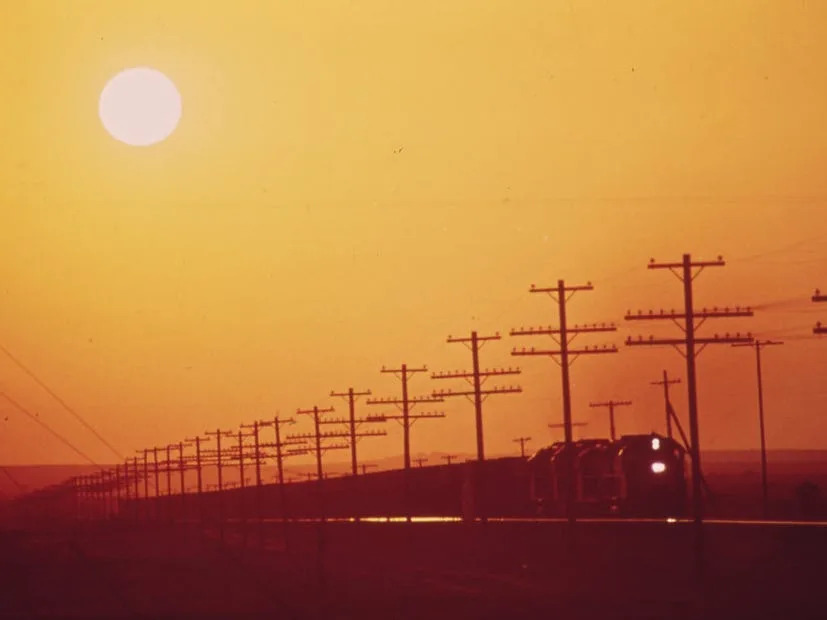
Los Angeles sun above a railroad near the Salton Sea.Charles O'Rear/Documerica
AIR POLLUTION CONTROL DEPARTMENT OFFICERS CHECKING FOR VIOLATORS ON HIGHWAYGene Daniels / EPA
New Orleans KAISER ALUMINUM PLANT SMOKESTACK SPREADS FUMES ABOVE ST CLAUDE AVENUE IN THE CHALMETTE SECTIONJohn Messina / EPA
New Orleans, LAKE PONTCHARTRAIN SPILLS OVER ONTO ILLEGAL DUMPING GROUND THE LAKE IS OVER FULL FROM HEAVY RAINS AND WATER DIVERTED FROM THE FLOODING MISSISSIPPI RIVER BY THE OPENING OF THE BONNET CARRE SPILLWAYJohn Messina / EPA
INDUSTRIAL CONTAMINATION OF THE ARTHUR KILL RIVER AT BAYONNE, NEW JERSEY IN THE NEW YORK METROPOLITAN AREA. RIVERS IN THE REGION CARRY RAW AND PARTIALLY DIGESTED SEWAGE, AND CHEMICAL AND INDUSTRIAL WASTES INTO THE WATERS OF THE BIGHT. ACCUMULATION OF THESE WASTES INTO THE WATERS BORDERING THE BIGHT PRESENT ONE OF THE MOST CRITICAL STRESSES TO ITS ENVIRONMENTAlexander Hope / EPA
Illegal Dumping Area off the New Jersey Turnpike, Facing Manhattan Across the Hudson River. Nearby, to the South, Is the Landfill Area of the Proposed Liberty State Park, 03/1973.Gary Miller / EPA
An abandoned car sits in Jamaica Bay in New York City in 1973. Landfills and auto salvage yards fall under the EPA's regulations now, though improper disposal still occurs.Arthur Tress/Documerica The
All kinds of trash used to be dumped outside New York City, like this car at Breezy Point, south of Jamaica Bay. The EPA helped institute regulations for how the city disposed of trash to prevent dumping in the Atlantic.Arthur Tress / Documerica
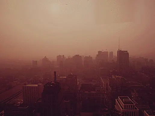
The George Washington Bridge in Heavy Smog. View toward the New Jersey Side of the Hudson River.Chester Higgins / EPA
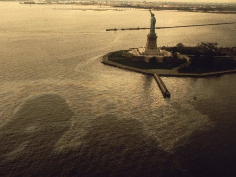
An oil slick surrounding the Statue of LibertyChester Higgins / Documerica
CONSOLIDATED EDISON POWER PLANT IN MANHATTAN, NEW YORK. IT HAS BEEN ESTIMATED THAT ALL ITS PLANTS DUMP SOME SIX MILLION GALLONS PER YEAR OF RESIDUAL COAL INTO THE NEW YORK BIGHT. STRESS FACTORS GENERATED ON THE BIGHT INCLUDE AIR AND WATER POLLUTION DESTRUCTION OF WETLANDS WHICH ARE NURSERIES FOR MARINE LIFE COASTAL OVER-DEVELOPMENT, AND OCEAN DUMPING OF MUNICIPAL AND INDUSTRIAL WASTESAlexander Hope / EPA
PART OF THE 26,000 TONS OF SOLID WASTE THAT NEW YORK CITY PRODUCES EACH DAY. TUGS TOW HEAVILY-LADEN BARGES DOWN THE EAST RIVER TO THE OVERFLOWING STATEN ISLAND LANDFILLGary Miller / EPA
CONSTRUCTION RUBBLE IS LOADED ON BARGES IN THE EAST RIVER IN MANHATTAN, NEW YORK. IT WILL BE DUMPED AT A CONSTRUCTION DEBRIS DUMP SITE OFFSHORE IN THE NEW YORK BIGHT. SLUDGE IS DUMPED 12 MILES OFFSHORE, WASTE ACID 15 MILES AND CHEMICAL WASTES 106 MILES. DREDGE SPOILS AND DERELICT VESSELS ALSO ARE DISPOSED OF IN THE BIGHTAlexander Hope / EPA
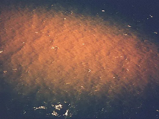
ONE OF FOUR NEW YORK CITY OWNED VESSELS DUMPING SLUDGE INTO WATERS OF THE BIGHT. IN 1973 THERE WERE 5.8 MILLION CUBIC YARDS OF SEWAGE SLUDGE DUMPED IN THE BIGHT. THE VOLUME IS EXPECTED TO TRIPLE IN THE NEXT FEW YEARS. DREDGE SPOILS ARE DUMPED SIX MILES FROM SHORE SLUDGE 12 MILES, WASTE ACID 15 MILES AND CHEMICAL WASTES 106 MILES CONSTRUCTION DEBRIS AND DERELICT VESSELS ALSO ARE DISPOSED OFFSHOREAlexander Hope / EPA
CLOSEUP OF ACID WASTES DUMPED 15 MILES OFFSHORE IN THE NEW YORK BIGHT. THEY MAKE UP 90 PER CENT OF ALL INDUSTRIAL WASTES DUMPED INTO THE BIGHT. MORE THAN THREE MILLION CUBIC YARDS OF ACID WASTES WERE DUMPED IN THE BIGHT DURING 1974. DREDGE SPOILS ARE DUMPED SIX MILES FROM SHORE, SLUDGE 12 MILES AND CHEMICAL WASTES 106 MILESAlexander Hope / EPA
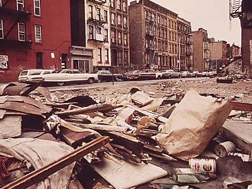
EMPTY LOT STREWN WITH TRASH AT 108TH STREET AND LEXINGTON AVENUE, MANHATTANGary Miller / EPA
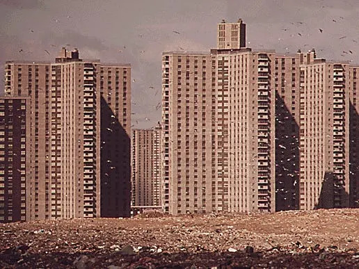
APARTMENTS OF "CO-OP CITY," A VAST HOUSING DEVELOPMENT IN THE BRONX, NOT FAR FROM PELHAM. THESE BUILDINGS STAND ON THE EDGE OF A LANDFILL DUMP, WHERE GARBAGE CONTINUES TO PILE UP ALTHOUGH THE AREA HAS ALREADY EXCEEDED ITS DUMPING CAPACITYGary Miller / EPA
CENTER CITY, PHILADELPHIA AT SUNSETDick Swanson / EPA
SMOKE FROM INDUSTRY CREATES A HAZE WHICH LINGERS OVER THE CITY OF PITTSBURGH, PENNSYLVANIA, ON THE HORIZON. IN THE FOREGROUND ON BOTH SIDES OF THE MONONGAHELA RIVER, ARE PLANTS OWNED BY THE JONES AND LAUGHLIN STEEL CORPORATION. THE POLLUTION HAS CONTINUED SINCE THIS PICTURE WAS TAKEN. CLEANUP EFFORTS HAVE BEEN SCHEDULED AT THE JONES AND LAUGHLIN PLANTSJohn Alexandrowicz / EPA
JUNKYARD ACROSS THE MONONGAHELA RIVER CONTRASTS WITH THE MODERN OFFICE BUILDINGS AND SEEMS TO BRING THE TWO LOCATIONS CLOSER THAN REALITY BECAUSE OF THE USE OF A TELEPHOTO LENS. THE URBAN RENEWAL RENAISSANCE PROGRAM WAS BEGUN IN THE CITY IN THE EARLY 1950'SJohn Alexandrowicz / EPA
SCENE SHOWING THE HIGH WATER MARK WHICH REVEALS EVIDENCE OF TREES BEING COATED BY OIL ALONG THE SHORE OF THE OHIO RIVER NEAR PITTSBURGH, PENNSYLVANIA. BOOMS HAVE BEEN PLACED NEAR VARIOUS OUTFALLS TO TRAP POLLUTION WITH OIL ACIDITY CONTENT AND LOW PHJohn Alexandrowicz / EPA
The Goergetown Gap, Through Which Raw Sewage Flows into the Potomac. Watergate Complex in the Rear, 04/1973.John Neubauer / EPA