The International Space Station captured Jubbah on Nov. 26, 2020, showing circular center-pivot fields and a settlement inside a 12.5 x 2.5 mile paleolake depression. Jabal Umm Sinman, the nearby 4,144-foot "two camel-hump" mountain, casts a wind shadow that helps protect the oasis. The surrounding foothills contain roughly 5,500 inscriptions and 2,000 animal carvings, some at least 10,000 years old, and the sites are part of a UNESCO World Heritage listing.
ISS Photo Reveals Oasis Town and Circular Fields in Saudi Arabia's Ancient Lakebed

From space, the Saudi Arabian town of Jubbah looks like a long tail of crop circles trailing behind a hefty mountain in the middle of the harsh Nafud desert. | Credit: NASA/ISS program
This striking image, taken from the International Space Station on Nov. 26, 2020, shows the oasis town of Jubbah and its distinctive circular irrigated fields tucked into the shadow of Jabal Umm Sinman in Saudi Arabia's Nafud Desert.
Jabal Umm Sinman is named due to its resemblance to a resting camel. From ground level, Jubbah isnot visible due to its position within the paleolake. | Credit: Matti&Keti/Wikimedia
Location and Photograph
Jubbah lies about 415 miles (670 km) northwest of Riyadh (approximate coordinates: 28.01186939, 40.95907106). The photo — credited to an unidentified astronaut aboard the ISS — captures center-pivot irrigation circles, settlement patterns, and the silhouette of a two-humped mountain that shelters the town from prevailing westerly winds.
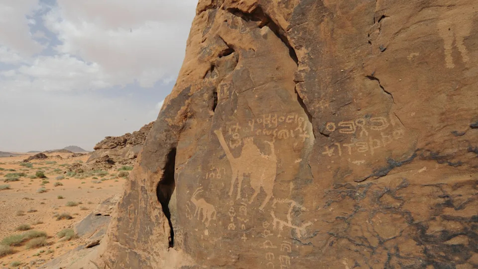
The rock art surrounding Jubbah contains thousands of depictions of animals, including ibex and camels. | Credit: Saudi Commission for Tourism and Antiquities/UNESCO
Ancient Lakebed and Local Geology
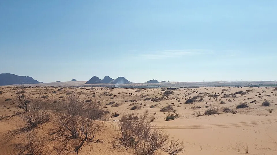
The town sits inside a bowl-like depression left by a paleolake roughly 12.5 miles (20 km) long and 2.5 miles (4 km) wide. Parts of Jubbah lie "hundreds of feet" below surrounding dunes, according to NASA's Earth Observatory. A subsurface aquifer beneath the basin has helped sustain human activity here long after many regional lakes dried up about 5,000 years ago.
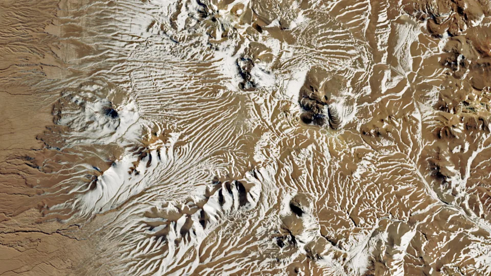
A satellite photo of a desert covered in streaks of white snow
Agriculture From Space: The Crop Circles
Many of the green rings visible from orbit are the product of center-pivot irrigation systems. These circular fields concentrate scarce groundwater in an otherwise hyperarid landscape and are clearly visible against the pale sands of the Nafud.
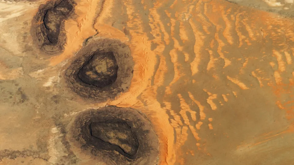
An astronaut photo of three dark mesas, partially surrounded by orange sand dunes
Jabal Umm Sinman and the Wind Shadow
Rising about 4,144 feet (1,264 meters) at the western edge of the paleolake, Jabal Umm Sinman is locally likened to a "two camel-hump" mountain. Its mass creates a wind shadow that reduces the amount of blowing sand reaching the settlement, helping preserve both cultivable land and archaeological sites nearby.
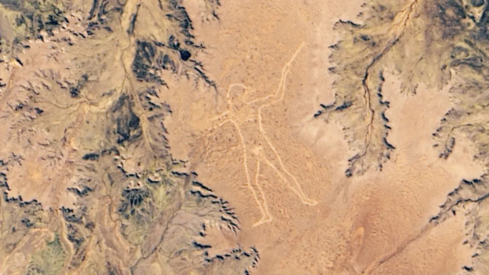
A satellite photo of the Australian outback with a human figure carved into the ground
Rock Art and Archaeological Significance
The foothills around Jabal Umm Sinman preserve an extraordinary concentration of prehistoric rock art: roughly 5,500 inscriptions and about 2,000 animal depictions, including ibex, leopards, ostriches, dogs on leashes and more than 1,000 camels. Much of this art dates back at least 10,000 years, and the Jubbah sites, together with nearby Shuwaymis locations, form a UNESCO World Heritage Site recognizing their Paleolithic engravings.
Regional Context
Jubbah is part of a broader archaeological landscape. About 155 miles (250 km) to the southwest lies Al Naslaa, a large prehistoric sandstone slab famously split in two, and the region also contains monumental "kite" structures — massive stone alignments roughly 8,000 years old — that hint at early large-scale landscape planning.
Why It Matters: The ISS photo is more than a scenic snapshot — it highlights how geology, hydrology and human ingenuity combined to create an enduring oasis and one of the world's richest concentrations of prehistoric rock art.
Photo date: Nov. 26, 2020. Image source: International Space Station / NASA Earth Observatory (astronaut photographer not identified).
Help us improve.