Permafrost—ground that stays at or below 0°C—contains large volumes of ice; when that ice thaws, roads can sag, buildings can tilt, pipelines can fail and shorelines can retreat. Drone-mounted geophysics (like VLF-EM), ground sensors and digital twins let engineers map vulnerable ground and forecast future damage. A 2026 analysis projects that under a high-emissions pathway late-century risks are severe—up to ~80% of buildings and 90% of pipelines on Alaska's Arctic Coastal Plain could be threatened by subsidence. Accessible monitoring and predictive tools give communities time to reinforce, relocate or adapt infrastructure.
Drones and Digital Twins Expose Where Permafrost Thaw Will Damage Arctic Infrastructure
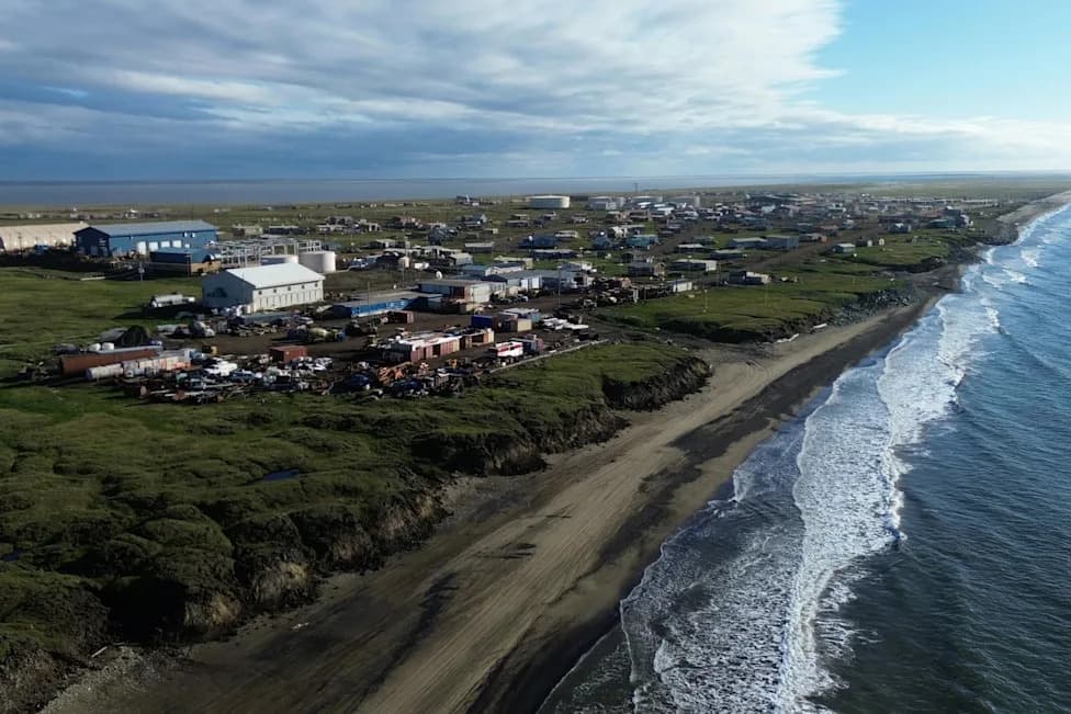
A view of Wainwright, Alaska, which sits on low-lying coastal terrain underlain by permafrost. Ming Xiao
From the air, Wainwright, Alaska, looks like a neat band of homes and roads between the Chukchi Sea and a broad, flat tundra. But beneath that surface lie large bodies of ground ice, and along eroding coastal bluffs that buried ice is becoming exposed and melting.
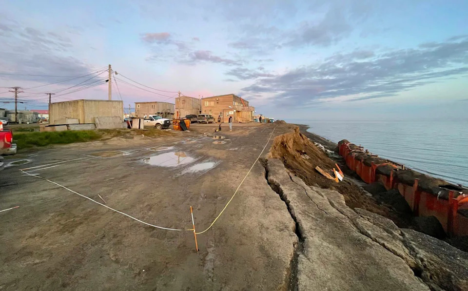
A coastal bluff failure in Utqiaġvik, Alaska, in August 2024 shows cracks and the narrow distance between the eroding edge and buildings. Ming Xiao
Why Thawing Permafrost Threatens Infrastructure
Permafrost is ground that remains at or below 32°F (0°C) for at least two consecutive years. Where soils are rich in ice, thawing can sharply reduce their strength. As ground ice melts and water drains away, the surface can subside, causing roads to sag, buildings to tilt, pipelines to crack and shorelines to retreat. A 2025 study estimated that permafrost thaw could cost Alaska roughly US$37 billion to $51 billion in building and road damage alone.
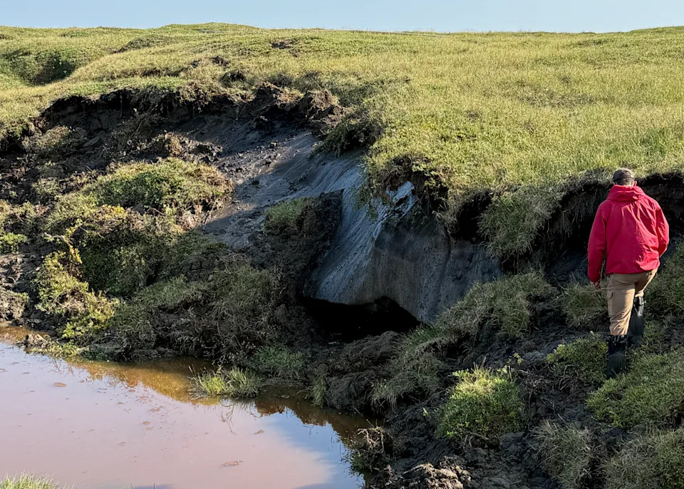
Large thawing ice wedges like this can be found in the permafrost along the Arctic coastline at Wainwright and other Alaska towns. As the ice melts, the ground can slump and erode. Ming Xiao
The thaw process is highly heterogeneous. Areas only a city block apart can contain very different amounts of ground ice and unfrozen water. Human structures and roads also change snow accumulation and drainage patterns, altering subsurface thermal and hydrological conditions and creating local hot spots of vulnerability.
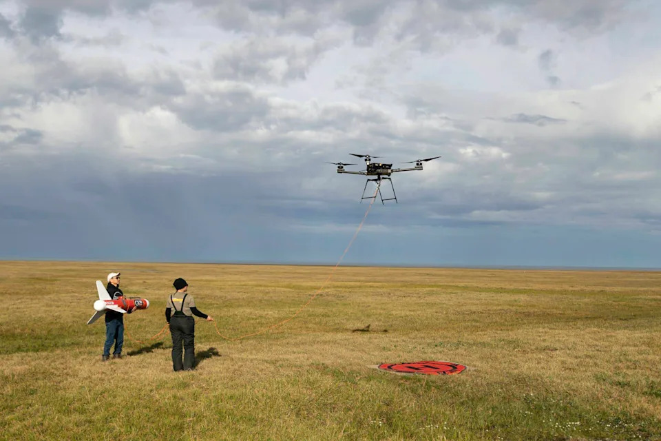
Researchers operate a drone-borne geophysical system over Arctic tundra near Utqiaġvik, Alaska, in August 2024. Suspending the sensor below the aircraft enables them to survey wet and thaw-sensitive ground that is hard to reach. Emma Kappel
Mapping the Hidden Threat: Drones and Geophysics
Most information critical to siting and designing infrastructure lies underground. Dense grids of boreholes are expensive, disruptive and time-consuming, especially in remote Arctic terrain. Geophysical imaging helps fill those gaps.
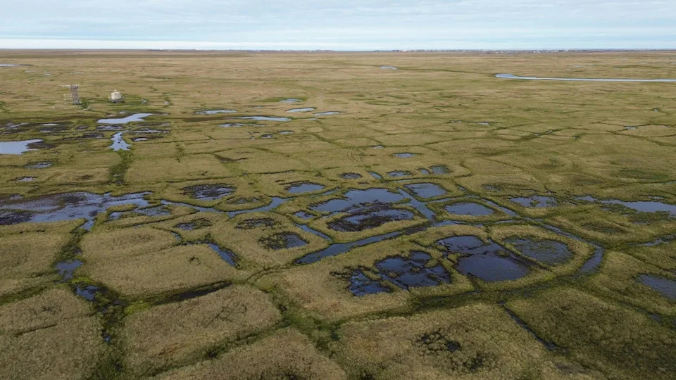
Polygon shapes where the ground has sunk are clear signs of permafrost thaw. This landscape of ponds, wet areas and polygonal ground near the Barrow Environmental Observatory in Utqiaġvik, Alaska, on Aug. 11, 2026, shows how surface and subsurface conditions can vary over short distances. Ming Xiao
One effective technique is very low frequency electromagnetic surveying (VLF-EM). VLF-EM measures how the ground responds to electromagnetic signals from distant transmitters. Because the sensors can be suspended beneath drones, teams can survey wetlands and thaw-prone tundra that are otherwise hard to access. Saline, unfrozen water conducts electricity far better than ice-rich frozen ground, so electromagnetic contrasts often reveal where thaw has already occurred or is advancing.
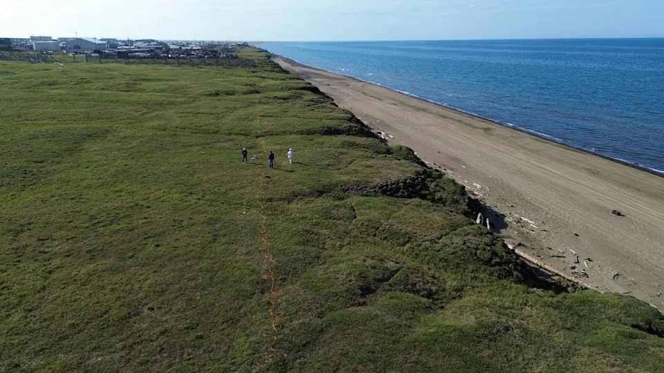
Electrical resistivity tomography along the Arctic coast in Wainwright, Alaska, on Aug. 13, 2026. Ground-based measurements provide detailed comparison data for airborne geophysical surveys. Ming Xiao
Complementary methods such as electrical resistivity tomography and ground-based measurements provide higher-resolution snapshots where detailed comparisons are needed. For example, a resistivity cross-section can indicate layers likely dominated by ice (high resistivity) versus zones of unfrozen, saline water (low resistivity).
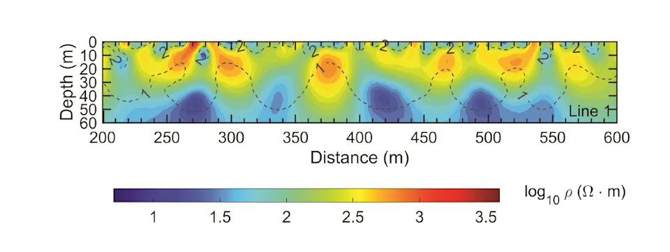
A cross-section of ground from the electrical resistivity tomography survey lines shows variations in the permafrost below. Red color means the ground material doesn't conduct electricity easily and is likely to be ice. Xueyang Wang, et al., 2026
From Data to Forecasts: Digital Twins and Sensors
Mapping today's conditions is necessary but not sufficient: infrastructure is expected to last decades. Engineers and planners need tools that forecast how subsurface conditions and asset performance will evolve. My team is developing digital twins—computer models that mirror real-world environments and infrastructure—to do exactly that.
At a road embankment in Utqiaġvik, we deployed fiber-optic cables to record temperature and seismic data along a roughly 330-foot (100-meter) section. Those measurements were used to update a model that couples heat-transfer physics with machine learning. As fresh data arrive, the digital twin self-adjusts, improving forecasts of permafrost temperature changes and how much the ground will settle or how much load a foundation can safely bear.
Projected Risks and Timelines
In a 2026 analysis of Alaska's Arctic Coastal Plain—a region that includes Prudhoe Bay and much of the state's oil infrastructure—we found that, under a high greenhouse-gas emissions scenario, the share of infrastructure at risk remains below 10% through around mid-century, then rises quickly between the 2060s and 2080s. By the 2090s, roughly 80% of buildings, 60% of roads and 90% of pipelines could be at risk of damage from subsidence and thaw-related processes.
What Communities and Engineers Can Do
Our approach combines airborne geophysics to map subsurface variability, in-situ sensors to monitor change, and digital twins to forecast impacts on specific assets. Communities need accessible tools that identify where hazards are likely to emerge, how risks may evolve over coming decades, and which pieces of infrastructure are most exposed.
Permafrost thaw is not only an environmental issue—it is an engineering challenge. The better engineers can see what is happening beneath the surface and anticipate what comes next, the more time communities have to monitor, reinforce, relocate, or adapt critical infrastructure.
Author note: This article was written by Ming Xiao, Penn State. Research images were taken in 2024 and 2026 at sites including Wainwright and Utqiaġvik. Funding for related research has come from the U.S. National Science Foundation and the U.S. Department of Defense.
Help us improve.