The National Weather Service has issued blizzard warnings for New York City and nearby parts of New Jersey and Connecticut as a major East Coast storm approaches. Up to 1.5 feet (46 cm) of snow is possible, accompanied by 25–35 mph winds and gusts to 45–55 mph, increasing the risk of coastal flooding and power outages. Washington, D.C., and Baltimore are on winter storm watch. Residents should expect hazardous travel and monitor local advisories.
Blizzard Warnings Issued For New York Area As Major East Coast Storm Approaches
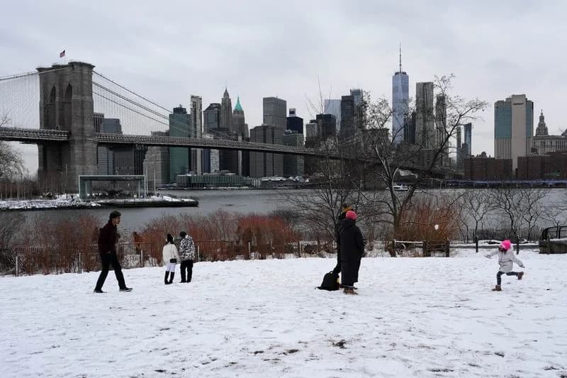
A child plays in the snow in front of Brooklyn Bridge and the Manhattan skyline in the Brooklyn Borough of New York City, U.S., February 16, 2026. REUTERS/Adam Gray/File Photo
Blizzard warnings were issued Saturday for New York City and parts of New Jersey and Connecticut as a major storm is forecast to sweep a large portion of the U.S. East Coast, the National Weather Service (NWS) said.
Snow and storm alerts extend from the Mid-Atlantic into the Northeast, with heavy snowfall and strong winds expected from Sunday into Monday. The NWS warned that the strongest impacts will be along the coast, where high winds and high tides could produce coastal flooding and widespread travel disruptions.
Key Details
- Snow: Up to 1.5 feet (46 cm) is possible in and around New York City, including Long Island.
- Winds: Sustained winds of 25–35 mph (40–56 kph) with gusts of 45–55 mph are expected Sunday night.
- Blizzard Warning: This is the first blizzard warning issued for New York City since 2017.
- Coastal Flooding: Minor to widespread coastal flooding is possible in vulnerable areas, especially at high tide.
- Power Outages: Strong winds raise the risk of downed trees and power interruptions.
- Regional Watches: Washington, D.C., and Baltimore areas are under a winter storm watch as the system moves northward.
What Residents Should Do
Expect hazardous travel conditions; avoid non-essential travel during peak storm hours. Secure outdoor items, prepare emergency supplies in case of power loss, and monitor local NWS updates and advisories for time-sensitive changes.
Reporting by Doina Chiacu; editing by Rod Nickel.
Help us improve.