The latest Google Earth images reveal extensive destruction across Gaza, showing flattened neighborhoods in Rafah and heavy damage around Al Shifa Hospital. UNOSAT and U.N. reports estimate about 82% of structures were damaged and roughly 1.9 million people displaced. Analysts and public figures say the new imagery underscores the humanitarian toll and could shape international reaction.
New Google Earth Images Reveal Wide-Scale Destruction Across Gaza
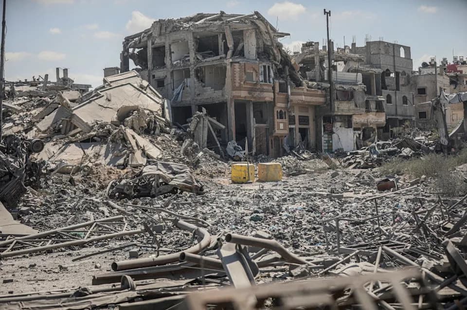
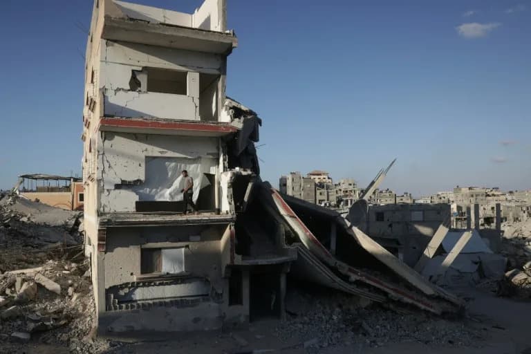
A view shows collapsed concrete, twisted metal and heavily damaged homes in the Al-Tuffah neighborhood of Gaza City on September 22, 2026.
Updated Google Earth satellite imagery of Gaza has prompted renewed international attention by documenting widespread damage across the Gaza Strip following the October 7, 2023, attacks and the subsequent military campaign.
Google has not publicly confirmed the exact upload dates for the images, and some reports indicate portions of the new imagery were captured during this year. News outlets have sought comment from Google and the Israeli military.
What the Images Show
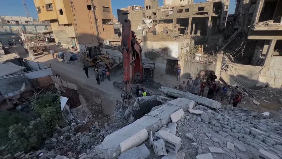
The satellite views circulating online show entire neighborhoods reduced to rubble, large swaths of cleared urban blocks, and makeshift shelters where homes once stood. One image dated September 22, 2026, displays collapsed concrete, twisted metal and heavily damaged residences in the Al-Tuffah neighborhood of Gaza City.
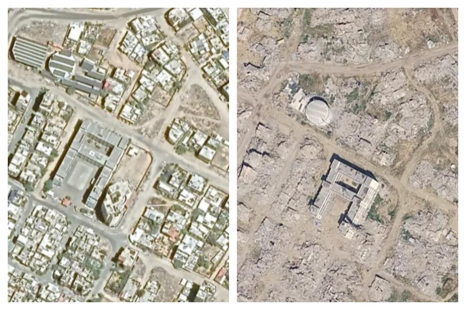
This combined image compares the area shown on Google Earth near the Qadisiyah School in Rafah, Gaza, in 2026 with August 2023.
"The updated Google satellite images of Gaza are quite incredible, for all to see," wrote Barry Andrews, an Irish Member of the European Parliament, in a widely shared post on X.
Data and Context
Independent analyses and U.N. assessments align with the imagery. On August 12, the U.N. Satellite Centre (UNOSAT) reported that roughly 82% of Gaza’s structures — an estimated 200,000 buildings — had suffered some damage, with about two-thirds of those classified as destroyed. A recent U.N. report estimated around 1.9 million people in Gaza had been displaced, and more than 60% of the population had lost their homes.
The Associated Press, citing Gaza’s Health Ministry, reported high Palestinian casualties during the conflict; those figures have been widely cited in international coverage. The October 7, 2023, Hamas attacks killed at least 1,200 people and resulted in more than 250 hostages, according to earlier reporting.
Voices and Reactions
Analysts and humanitarian experts say the imagery underscores the humanitarian and infrastructural toll of the campaign. Chris Doyle of the Council for Arab-British Understanding described the photos as "yet another record of the systematic destruction of Gaza," while Nathan Ruser of the Australian Strategic Policy Institute said the images "show the reality of Gaza in shocking resolution." Rebecca Wolfe, a conflict and humanitarian response expert at the University of Chicago, highlighted the operational challenges of conducting strikes in a densely populated territory and questioned the choice of certain tactics and weapons.
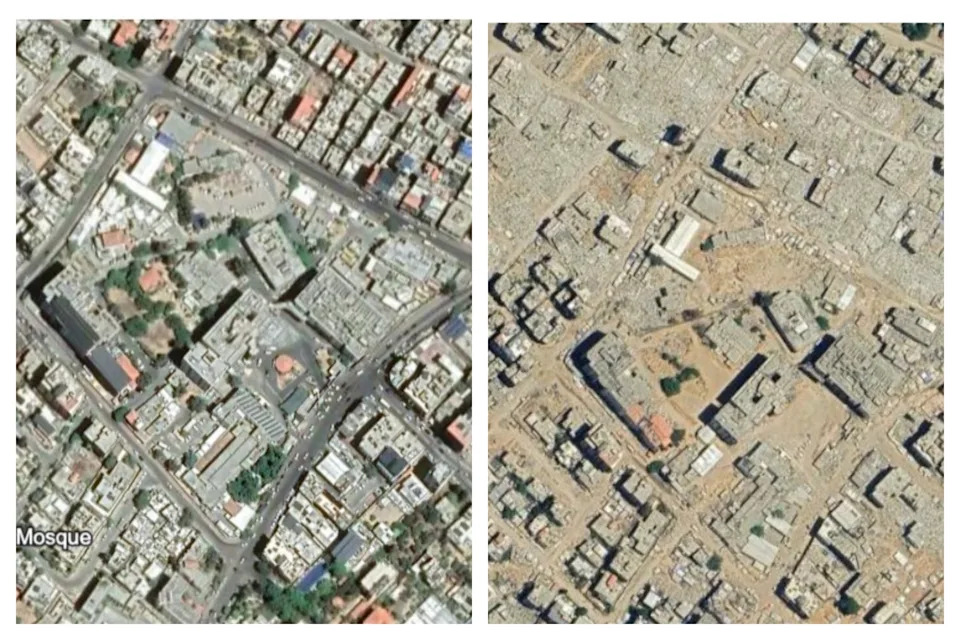
This combined image shows the latest Google Earth image of the area around El Shifa hospital with satellite imagery taken in August 2023.
Locations Highlighted
The southern city of Rafah is prominently featured in the images, with areas that once contained continuous rows of homes now largely cleared and dotted with temporary shelters. Imagery around Al Shifa Hospital in Gaza City shows extensive destruction in the surrounding urban area; Israel has accused Hamas of operating military facilities in the compound, an allegation denied by both Hamas and hospital staff.
A ceasefire that took effect on October 10, 2025, halted the most intense phase of fighting, although Israeli officials have said some strikes have continued in response to attacks and perceived threats.
Why It Matters
Updated high-resolution imagery makes the scale of damage visually undeniable, reinforcing numerical assessments from U.N. agencies and health authorities. Observers say such visual documentation can influence public opinion and political debate about reconstruction, humanitarian access and longer-term accountability.
Sources: Google Earth imagery releases and social posts; UNOSAT assessments; Associated Press reporting citing Gaza’s Health Ministry; statements from public figures and analysts.
Help us improve.