Multinational researchers have begun coring the 515-foot Durupınar Formation south of Mount Ararat, a landform some say could be Noah's Ark. Preliminary radar data reportedly do not show a simple homogeneous rock signature, and cores recovered to nearly 60 feet include layers of organic material. Those findings are preliminary: laboratory analyses and a full report are pending, and fieldwork is planned next year. The effort aims to test competing interpretations, including a 1996 study that called the feature a natural formation.
International Team Begins Drilling Into 515‑Foot 'Boat' Formation in Turkey — 'We're Going In'
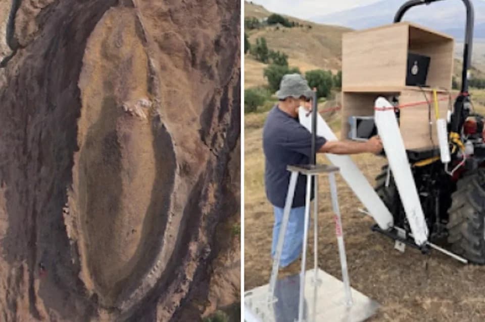
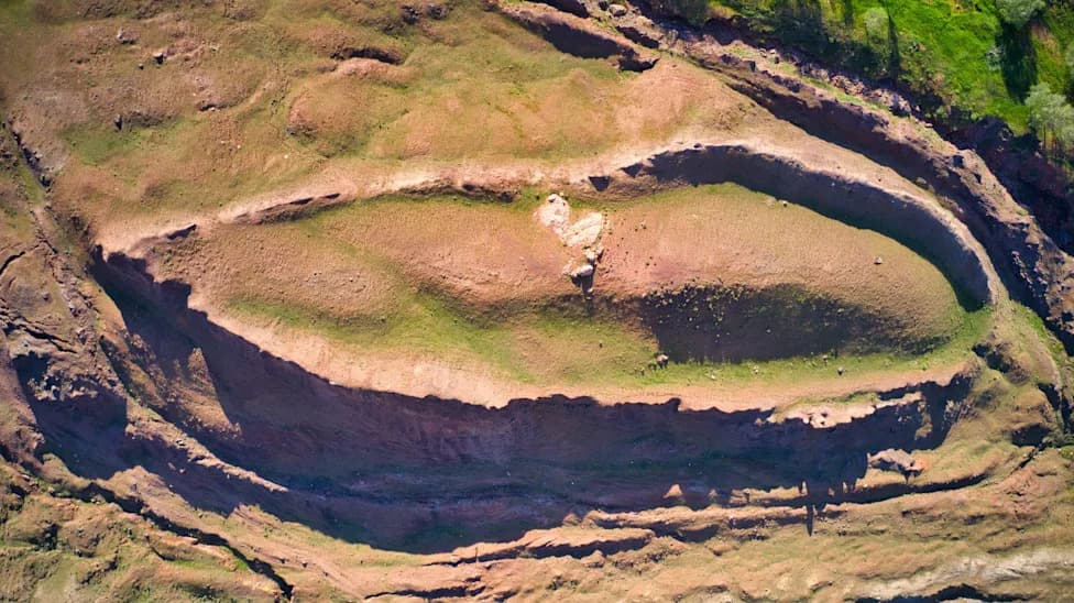
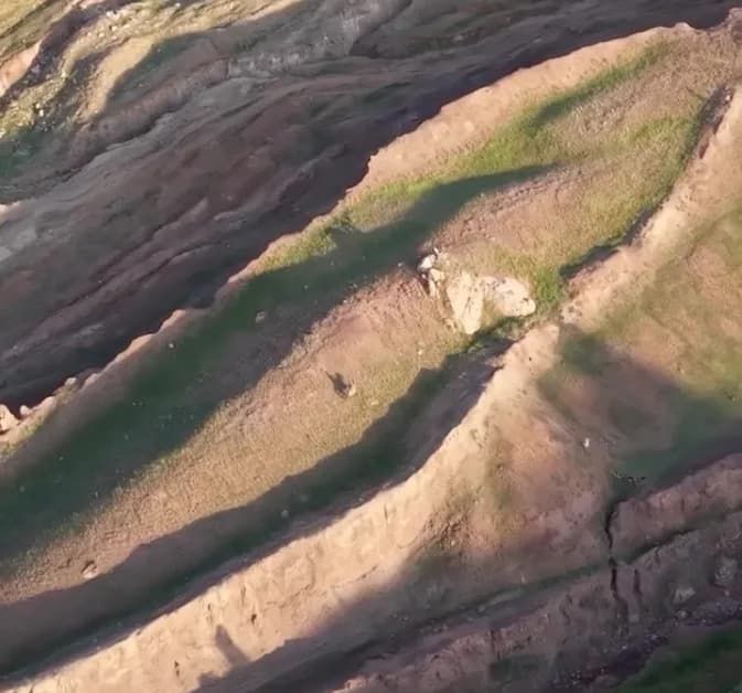
Drone imagery of the Durupınar Formation, with an undated image of Dr. Khosrow Bakhtar deploying his specialized radar at the site.
A multinational team of archaeologists, geologists and soil scientists has begun coring a 515-foot, boat-shaped feature in eastern Turkey that some investigators believe could contain the remains of Noah's Ark.
The investigators say they have started taking core samples from the Durupınar Formation, a landform south of Mount Ararat that drew attention after its ship-like outline was first described in 1959.
What the Team Has Found So Far
Andrew Jones, founder of Noah's Ark Scans, said preliminary ground-penetrating radar results "do not show a simple homogeneous solid-rock signature." The U.S.-based Noah's Ark Scans group is working with Bakhtar Research and Engineering LLC (radar led by Dr. Khosrow Bakhtar) and field operations are overseen by archaeologist Cenker Atila of Sivas Cumhuriyet University.
The team reports that coring has reached nearly 60 feet below the surface and that some cores contain layers of rich organic material. "No bedrock or solid limestone has so far been identified in the holes drilled inside the formation," Jones said, adding that these are preliminary field observations that require laboratory confirmation.
Tools and Methods
Noah's Ark Scans shared an image of what appears to be a tethered subterranean robot called "Gopher," described by the team as an underground robot equipped with a high-resolution camera designed to enter spaces people cannot. Drone imagery and specialized radar surveys have been used to guide coring locations.
Context and Caveats
The idea that the Durupınar Formation might be the remains of Noah's Ark has been debated for decades. A 1996 study by geologist Lorence Collins and explorer David Fasold concluded the feature is "a completely natural rock formation" and called the ark interpretation "bogus." The current project is explicitly framed as a test of competing explanations: is the formation a single homogenous block of natural stone, or does it contain internal structures or human-made materials?
"We're going in," Noah's Ark Scans wrote on social media, underscoring the team's intent to subject the site to direct scientific testing.
Team leaders caution that the findings published so far are preliminary. Core samples and other recovered materials still need laboratory analysis—carbon dating, petrographic study and other tests—before any firm conclusions can be drawn. The team says a fuller report is expected in the coming weeks and that additional fieldwork is planned next year.
This investigation highlights how modern surveying tools and subsurface sampling can be used to evaluate long-standing archaeological and geological claims, while also illustrating the need for careful, peer-reviewed analysis before extraordinary claims are accepted.
Help us improve.