Satellite observations from Sentinel-6 Michael Freilich show a large Kelvin wave of warm water stretching hundreds of miles along the equator as the newly declared El Niño strengthens. Some equatorial areas are more than 6 inches (15 cm) higher than normal, reflecting expanding warm water. The wave formed after wind shifts in the western Pacific allowed warm water to move east and has reached the western coast of South America. Scientists note similarities to the strong 1997 El Niño but say more data are needed to determine how intense this event will become.
NASA Satellite Reveals Massive Kelvin Wave Hundreds of Miles Long as El Niño Intensifies
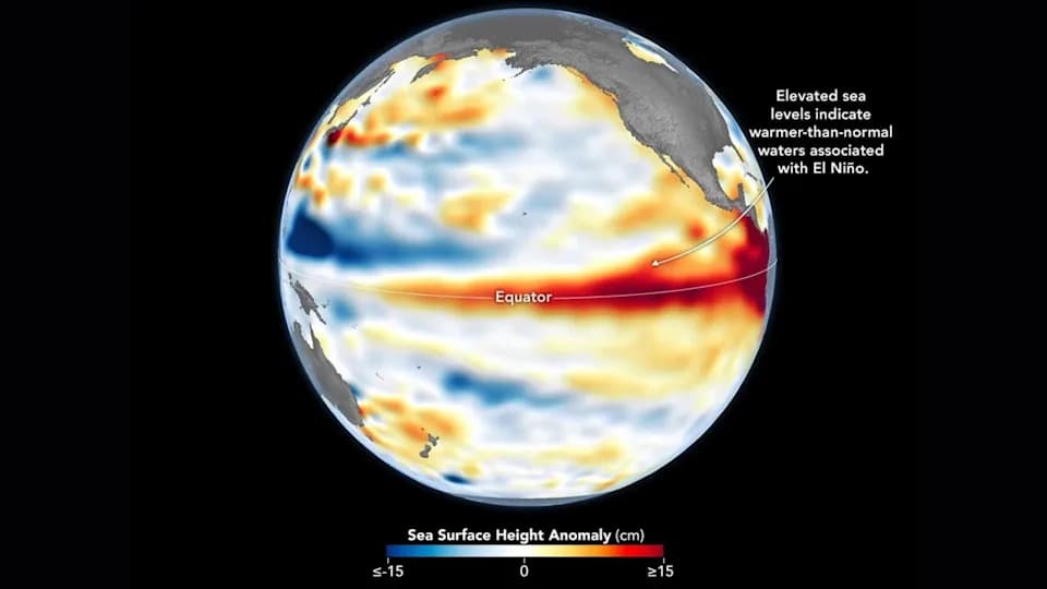
A wave of warm water and higher-than-usual sea surfaces (red) stretches across the Pacific, a few days before El Niño was declared. | Credit: Data for the map were acquired by the Sentinel-6 Michael Freilich satellite and processed by scientists at NASA’s Jet Propulsion Laboratory (JPL).NASA Earth Observatory/Lauren Dauphin
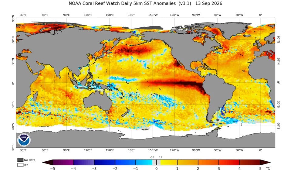
A massive band of unusually warm water is sweeping across the Pacific Ocean as the newly declared El Niño gains strength, satellite data show. The wave — a Kelvin wave — stretches hundreds of miles along the equator and is visible in sea surface height measurements captured by NASA’s Sentinel-6 Michael Freilich satellite.
What the satellite saw: On June 8, Sentinel-6 Michael Freilich mapped deviations from average sea surface height. In the satellite imagery, red tones indicate higher-than-normal sea levels and blue tones show lower-than-normal areas. In places along the equator, sea surface height now exceeds typical values by more than 6 inches (15 centimeters).
Sentinel-6 Michael Freilich, developed by NASA and the European Space Agency and operated by EUMETSAT, measures sea surface height to fractions of an inch and repeats coverage roughly every 10 days. Those height measurements complement sea surface temperature records that have shown unusually rapid Pacific warming over recent months; scientists formally declared a new El Niño on June 11.
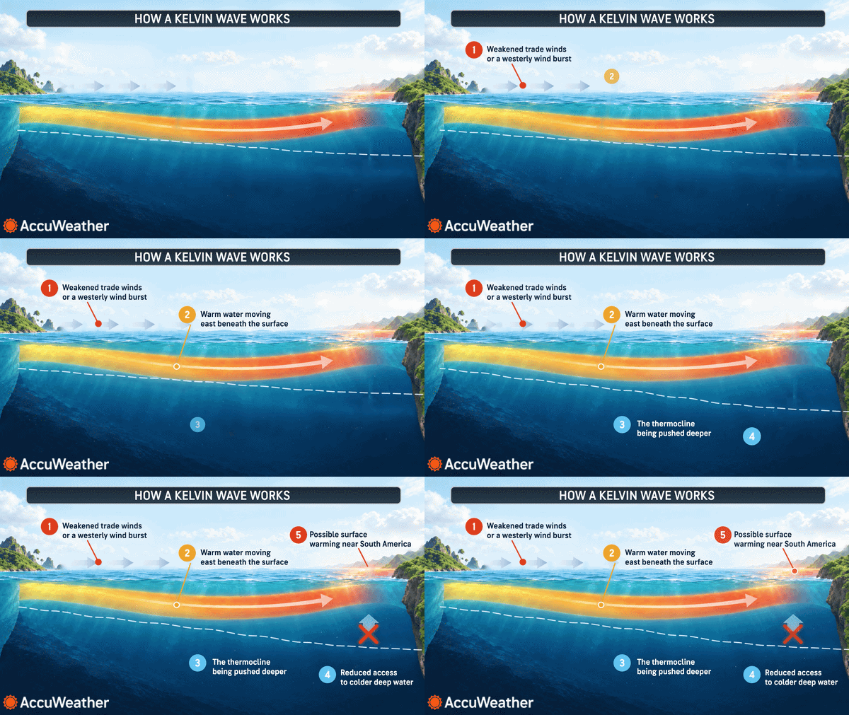
How Kelvin waves form: Kelvin waves develop when winds in the western Pacific near the equator weaken or temporarily reverse direction, blowing from west to east instead of the usual east-to-west. That change allows warm water to pile up in the eastern Pacific, deepening the warm surface layer and suppressing the upwelling of colder water from below. According to current analyses, the Kelvin wave detected on June 8 has reached the western coast of South America.
NASA had already observed other Kelvin waves earlier this year. One was detected near Micronesia in January and faded by mid-February; another emerged in March and had raised sea levels off Peru by mid-May. These repeated pulses of warm water helped tip ocean conditions toward El Niño.
Potential impacts: Changes in sea surface temperature and height can alter atmospheric circulation and influence global weather patterns. El Niño often brings heavier rainfall to the U.S. Southwest, Colombia, Peru and Ecuador, while reducing rains in parts of the western Pacific. The previous El Niño (June 2023–April 2024) contributed to higher global mean temperatures and helped make 2024 the hottest year on record, briefly pushing global averages past the 1.5°C threshold referenced in the Paris Agreement.
“For now, it looks like it's going to be a big one — more so than I would have said last week — but we still need more observations to know what's going to happen,” said Severine Fournier, a sea-level researcher at NASA’s Jet Propulsion Laboratory.
Scientists note the June 8 conditions in the western Pacific resemble patterns seen in 1997, when a particularly strong El Niño occurred. While 2026 has produced fewer Kelvin waves so far than 1997 did at the same stage, researchers caution that the event is still developing and that more observations will be needed to assess its eventual strength and global impacts.
Help us improve.