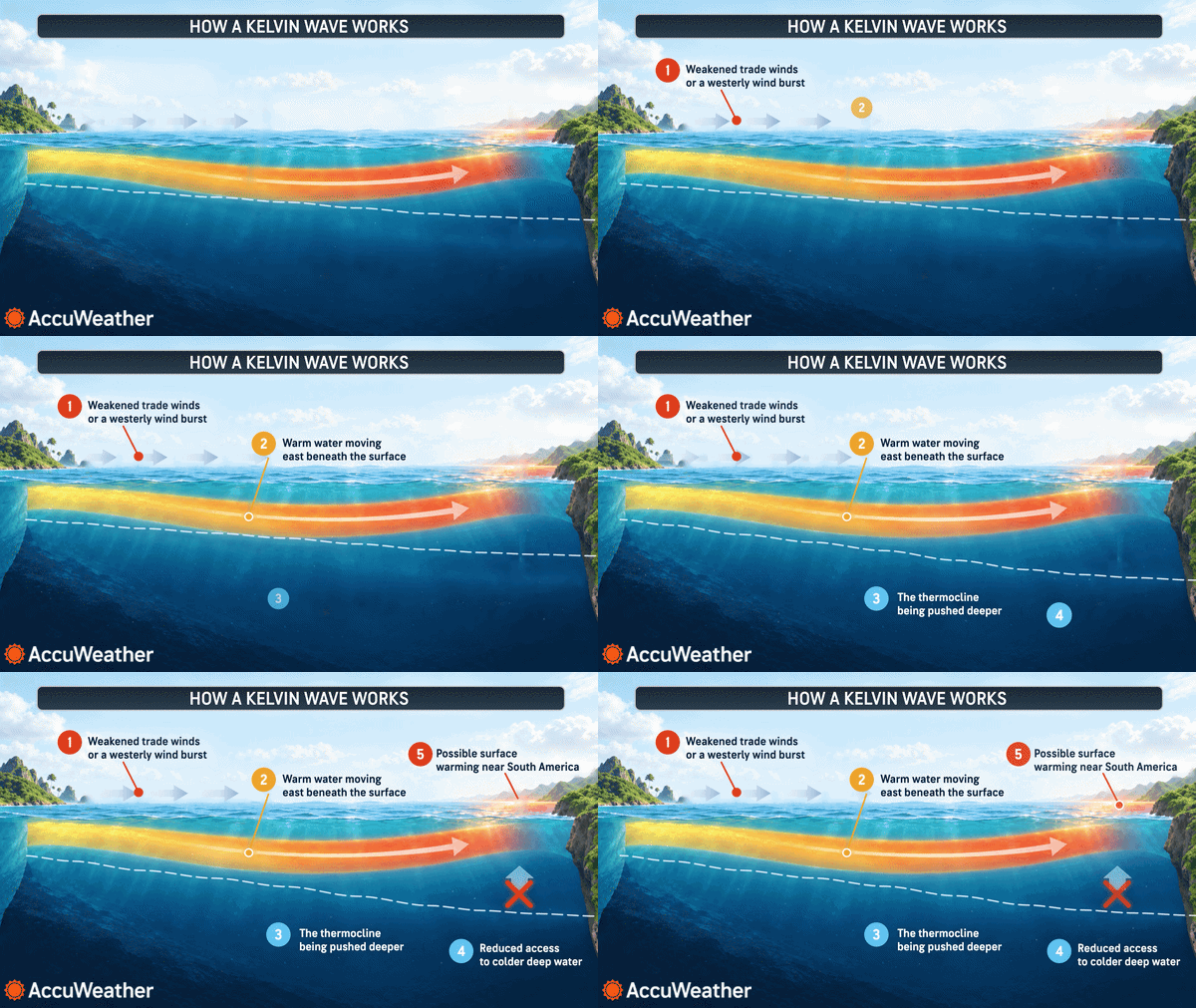
Kelvin waves are subsurface pulses of warm water formed during El Niño that travel east along the equator and can turn northward along the coast. As coastally trapped waves they deepen the thermocline, warm the upper ocean and can temporarily raise coastal sea levels—sometimes by up to a foot—heightening flood and erosion risk. Effects typically begin off Baja and Southern California and can progress north to Northern California, Oregon and Washington; satellite sea-surface-height maps help forecasters track them.
Kelvin Waves: El Niño’s Underwater Pulse That Can Raise West Coast Sea Levels
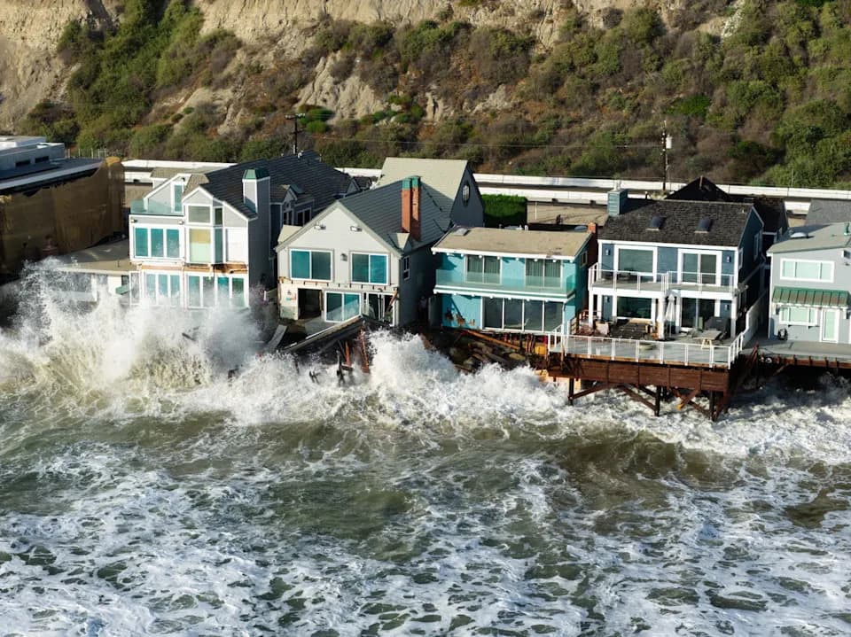
An aerial image of homes damaged by flooding along Beach Road on Tuesday, Sept. 8, 2026 in Dana Point, CA. Homes in the Capistrano Beach community have been severely damaged by recent storms.
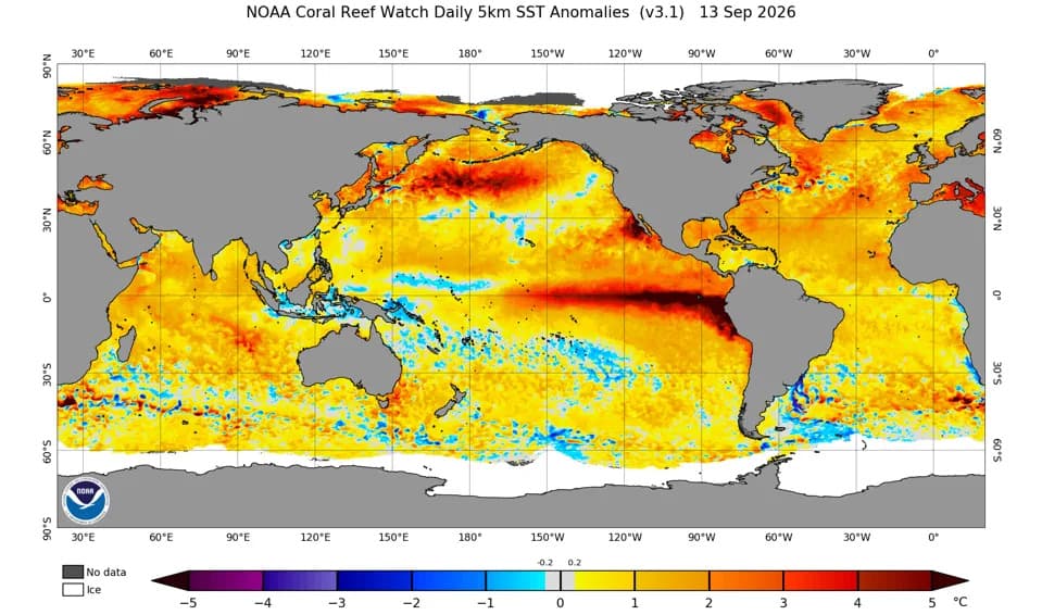
Kelvin waves are large, subsurface pulses of unusually warm water that form during El Niño episodes and can transport heat from the tropical Pacific toward the U.S. West Coast. While these waves travel mostly beneath the surface, their arrival can temporarily raise coastal sea levels, warm nearshore waters and amplify flood and erosion risks for vulnerable shorelines.
What Are Kelvin Waves?
Kelvin waves are generated when bursts of strong westerly winds along the equator push warm surface water eastward. That push creates subsurface, eastward-propagating waves that race along the equator toward Central and South America. When these waves reach the eastern Pacific, part of their energy can turn northward and travel along the coastline as coastally trapped waves, carrying El Niño’s warm-water influence from Baja California up toward California, the Pacific Northwest and sometimes Alaska, according to NOAA.
How Kelvin Waves Affect Coastal Waters
As a coastally trapped Kelvin wave moves north, it deepens the thermocline and warms the upper ocean. These changes can temporarily elevate coastal sea levels—often by several inches and sometimes by as much as a foot—so high tides and storm-driven waves can penetrate farther inland. Elevated waters compound damage on shores already weakened by erosion and can increase the reach and impact of storm surges.
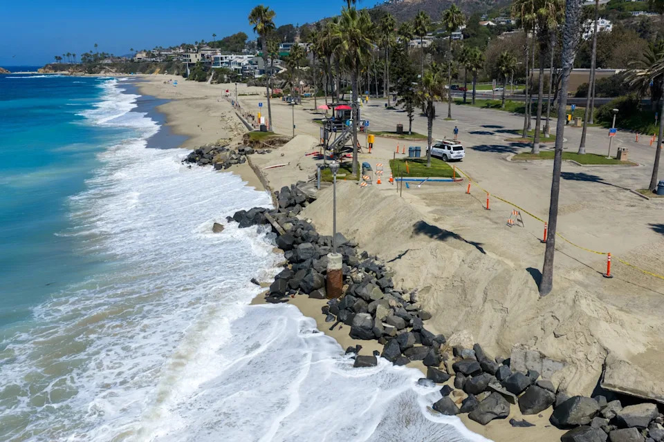
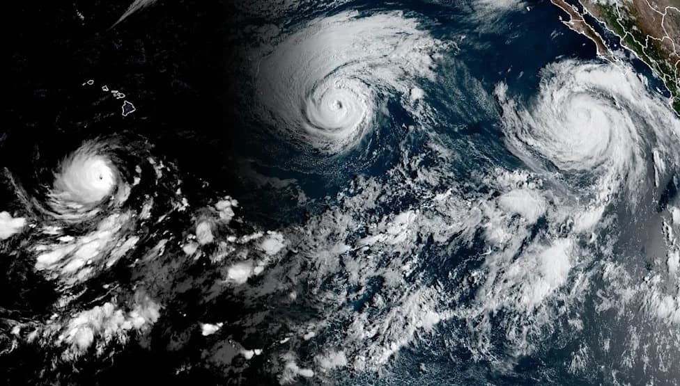
An aerial view of the incoming tide and swell at Aliso Beach in Laguna Beach, where recent storm surges caused damage to the parking lot area and erosion, on Tuesday, Sept. 1, 2026, ahead of the impacts of Hurricane Marie.
Warm upper-ocean conditions also suppress the upwelling of cold, nutrient-rich water. That can disrupt local marine ecosystems and fisheries and allow atypical warm-water species—such as marlin, manta rays or sharks—to appear farther north than usual.
Recent Local Impacts And Why They Matter
Recent storm events in Southern California have illustrated how higher coastal water levels and powerful waves can amplify damage. Reported flooding and property damage in Capistrano Beach (Dana Point) on Sept. 8, 2026, and significant erosion at Aliso Beach in early September 2026 show how elevated seas and strong surf can combine to harm infrastructure and homes.
Tracking Kelvin Waves And What To Watch For
Because Kelvin waves move largely beneath the surface, forecasters rely on satellite measurements of sea-surface height and ocean-observing systems that measure subsurface temperatures and currents. Maps of sea-surface-height anomalies commonly reveal the advancing bands of elevated water along the West Coast and give coastal communities advance notice of increased tide and surge risk.
Practical advice: Coastal managers and residents from Baja California through California, Oregon and Washington should monitor NOAA updates and sea-surface-height maps, watch for warming nearshore temperatures, and prepare for a higher likelihood that high tides and storm waves will reach farther inland while a Kelvin wave progresses north.
Help us improve.