El Niño is intensifying, with sea surface temperatures already about 5°C (over 9°F) above normal. Satellite data from March–May 2026 tracked a Kelvin wave that pushed warmer, higher water toward Peru, raising local sea levels by nearly six inches. These Kelvin waves can travel north as coastal-trapped waves and raise the tidal baseline for weeks to months — increasing flood risk during high tides and storms — but they are not tsunamis. Warmer nearshore waters also alter upwelling and fisheries, allowing warm-water species to extend their ranges along the U.S. West Coast.
Kelvin Waves From Strengthening El Niño Raise Coastal Baselines — But Don’t Believe The ‘Massive Wave’ Hype
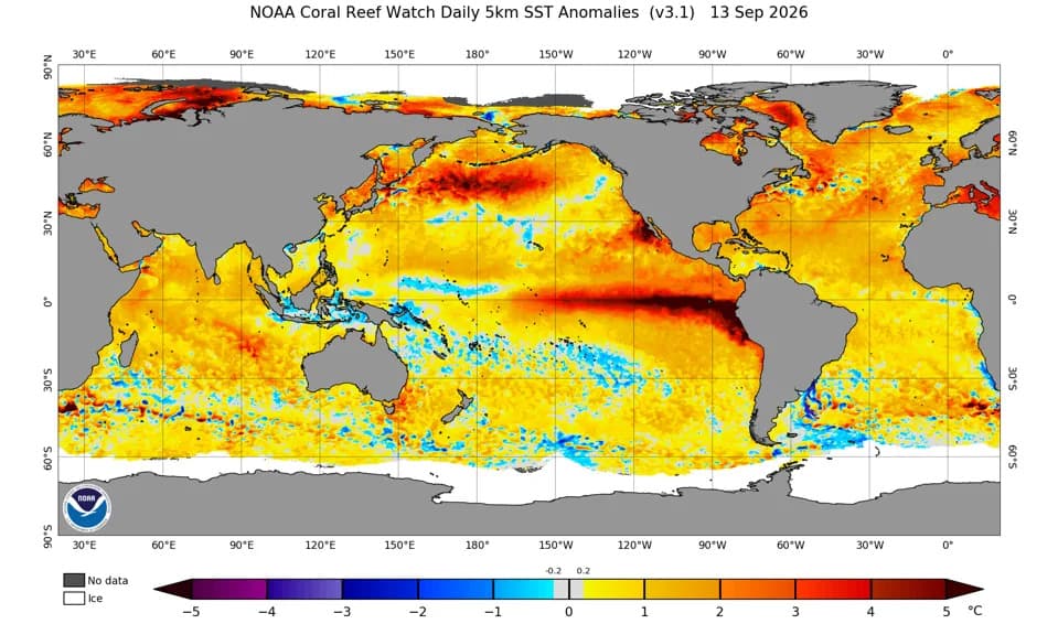
Sea surface temperature anomalies on September 13, 2026.NOAA
El Niño is continuing to strengthen across the tropical Pacific and will likely peak in the coming months. Sea surface temperatures are already about 5°C (over 9°F) above normal in places, and satellite observations show large-scale ocean changes that merit careful attention — and a measured response to sensational headlines.
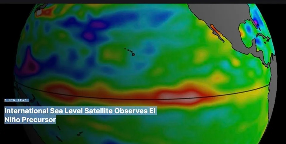
Satellites tracked the emerging Kelvin wave in the spring of 2026.
What Are Kelvin Waves and Why They Matter
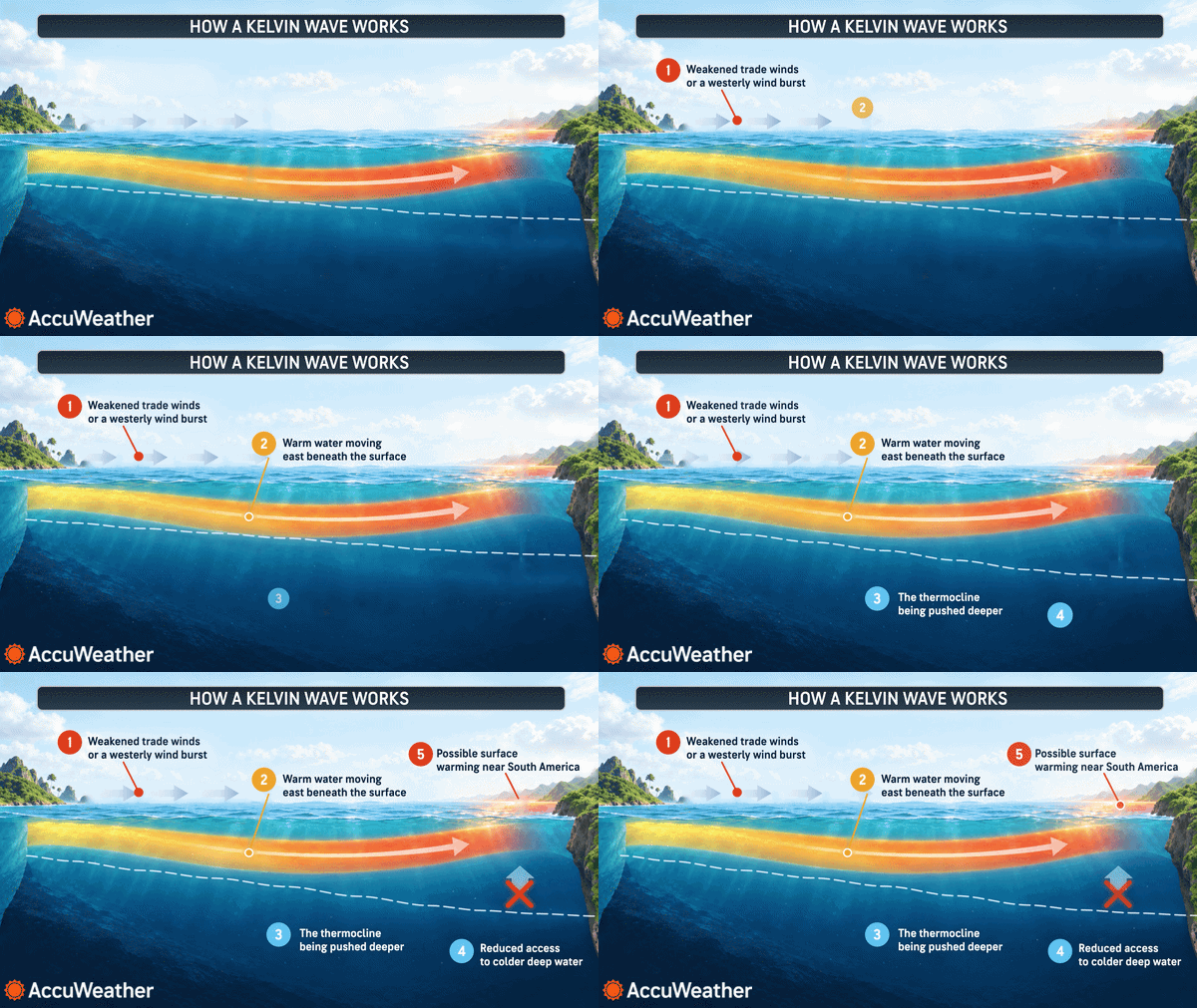
Westerly wind bursts along the equator can trigger oceanic Kelvin waves, which propagate eastward across the Pacific. After they reach Central and South America, parts of that signal can turn northward as coastal-trapped waves that move along the North American coast. These waves do not "break" like surf; instead, they produce broad changes in sea surface height and the depth of the thermocline.
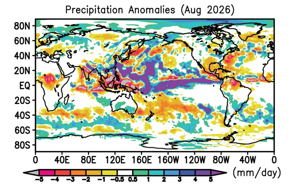
August precipitation anomalies show increased rainfall along the equatorial and western Pacific.
Key point: Kelvin waves lift the baseline sea level for weeks to months, increasing the risk of coastal flooding when high tides or storms occur — but they are not tsunamis and do not suddenly crash ashore.
Satellite Evidence And Recent Observations
Satellites including Sentinel-6 Michael Freilich tracked a sizable Kelvin wave crossing the Pacific during March–May 2026. Sea-level measurements showed warmer, elevated water moving from the western Pacific toward waters off Colombia, Ecuador and Peru. By May, sea surface height near Peru was nearly six inches (about 15 cm) above average, largely due to thermal expansion of the warmed upper ocean, according to NASA and international satellite data.
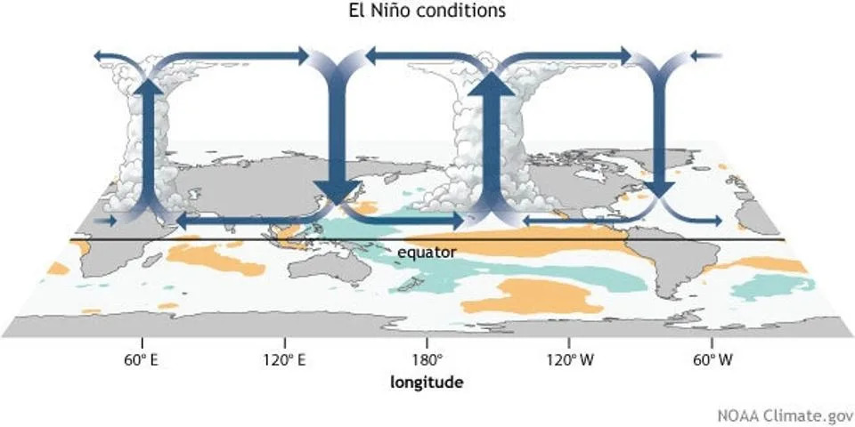
Precipitation patterns, sea surface temperatures, and the Walker Circulation under El Nino conditions.
Atmospheric Connections: Walker Circulation And Rainfall
The extra ocean heat has modified regional circulation and rainfall patterns. Observed precipitation anomalies in August align with a shifted Walker Circulation, the east–west tropical atmospheric cell that organizes where heavy rain falls. These coupled changes in sea surface temperature, sea surface height, precipitation and Kelvin waves help explain observed weather and ocean conditions across the Pacific.
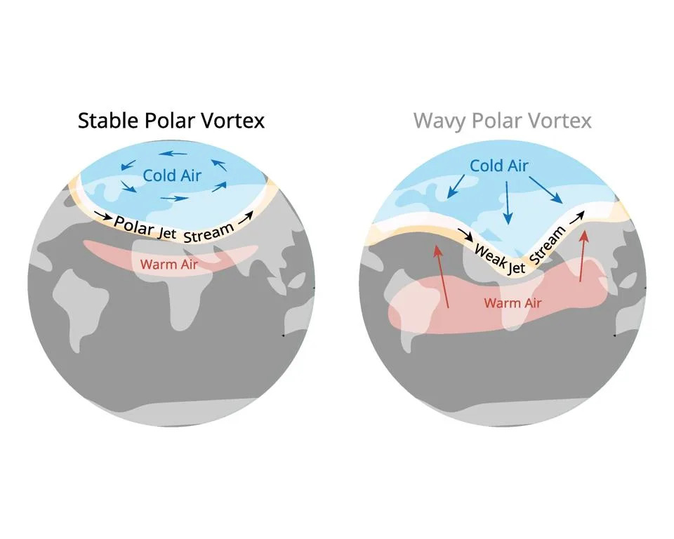
The polar vortex is a large area of low pressure and cold air surrounding both of the Earth poles
Coastal Impacts For The U.S. West Coast
As Kelvin waves propagate northward along the coastline they deepen the thermocline — the subsurface boundary where temperature drops rapidly with depth. El Niño-related atmospheric teleconnections over the North Pacific can then alter winds and upwelling. Reduced upwelling brings warmer, less nutrient-rich water nearshore from southern California to Alaska, which can stress some fisheries while favoring warm-water species.
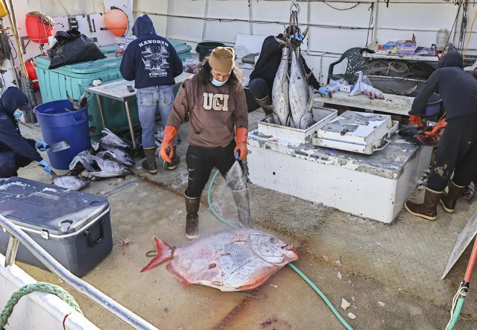
SAN DIEGO, CA - FEBRUARY 26: Yellowfin tuna, Big Eye tuna and Opa as well as other fish are cut up on the deck of the Pacific Horizon fishing vessel for sale to the public at DriscollOs Wharf on Friday, Feb. 26, 2021 in San Diego, CA. (Photo by Eduardo Contreras / The San Diego Union-Tribune via Getty Images)
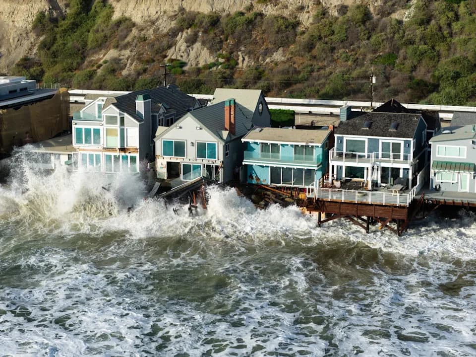
Journalistic images showing single, giant breaking waves striking California misrepresent the mechanism and scale of the risk. As Sean Macaday wrote in The Sacramento Bee, "A few inches of extra ocean may not sound like much, but coastal flooding is a game of margins stacked on margins." The danger is cumulative: a raised baseline plus a spring high tide or a strong storm can create higher-than-normal coastal flooding for extended periods.
Ecological Shifts And Historical Context
Warm periods and marine heatwaves already have allowed subtropical and tropical species to range northward along the West Coast. NOAA notes that dorado, striped marlin and yellowfin tuna have appeared farther north during warm events. A prolonged warm period from 2014–2018, which began with a large marine heatwave known as "The Blob" and ended with El Niño, saw scientists record 36 unusual species off California, including giant manta rays and blue marlin.
What Communities Should Watch For
- Elevated coastal sea levels for weeks to months (higher tidal baselines).
- Greater odds of nuisance and damaging coastal flooding during high tides and storms.
- Changes in local fisheries and potential shifts in marine species distributions.
- Altered rainfall patterns and broader weather impacts tied to the evolving El Niño.
This is a developing situation. Coastal managers, fisheries stakeholders and communities should monitor official advisories from NOAA, regional coastal services, and trusted scientific updates rather than sensational images. Understanding Kelvin waves and their role helps separate real risks from misleading visuals: the concern is a raised baseline and prolonged influence, not a single giant wave striking the shore.
Sources: NOAA, NASA, University of Maryland precipitation analyses, and regional fisheries observations.
Help us improve.