Archaeologists combining satellite radar imagery with ground-based electrical resistivity tomography (ERT) have uncovered a previously unknown mudbrick structure beneath the ancient site of Tell el‑Fara'in in the northwest Nile Delta. The discovery—confirmed by excavation—dates to the Saite period (around 2,600 years ago) and produced a rich assemblage of ritual objects that suggest a religious function.
Geophysical Survey Cuts Through Layers of History
The site, known in antiquity as Per‑Wadjet and later as Buto, accumulated nearly 6,000 years of human occupation. Repeated building, destruction, and infilling created complex deposits that make traditional excavation difficult: thick mud, high groundwater, and deep stratigraphy all limit full-scale digs.
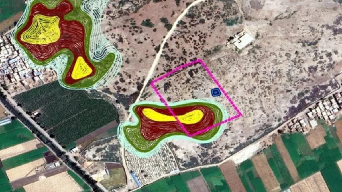
Site geometry and layout of the ERT survey. (Abouarab et al.,Acta Geophys., 2026)
To target promising areas, a team led by Mohamed Abouarab of Kafrelsheikh University combined Sentinel‑1 radar imagery with on‑the‑ground electrical resistivity tomography. Sentinel‑1 data from 2018 highlighted large‑scale surface anomalies across the site. From those patterns the team selected 15 high‑priority locations at a sector called Kom C for detailed ERT profiling.
How ERT Worked Here
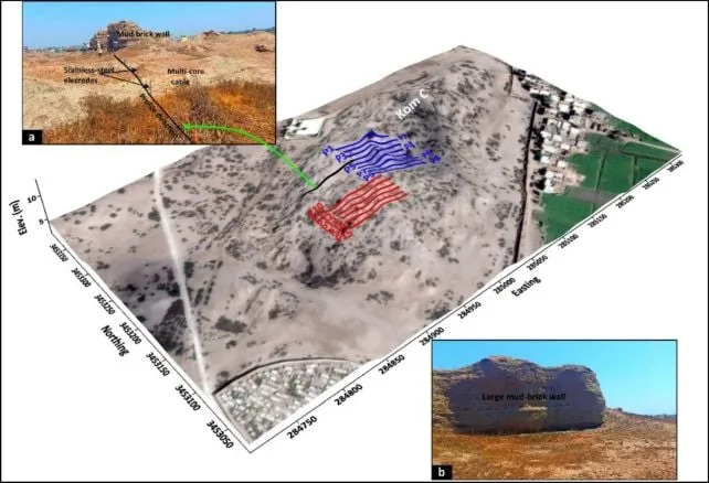
At each target the team deployed 24 stainless‑steel electrodes along a 69‑meter cable. The electrodes injected currents into the subsurface and recorded resistivity contrasts; 1,332 resistivity measurements were collected across Kom C. Using 3D inversion algorithms, the researchers converted those data into subsurface images—comparable to a large‑scale CT scan of the buried layers—which highlighted the outlines of walls and architectural features.
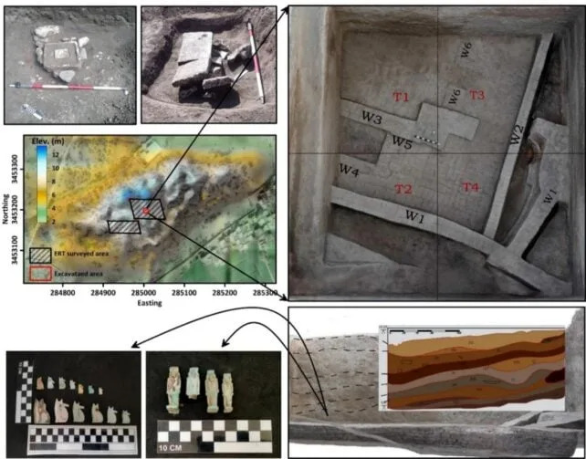
3D map for the Kom C area, the full surveyed region by ERT, the successive layers of a vertical section for the excavated area, and some of the artifacts found in the excavated square. (Abouarab et al.,Acta Geophys., 2026)
Discovery and Excavation
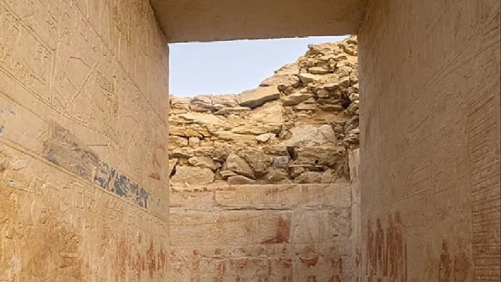
ERT results revealed a partially buried mudbrick structure roughly 25 by 20 meters (about 82 by 65 feet) situated 3–6 meters below the modern surface beneath layers of crushed pottery and rubble deposited during Ptolemaic and Roman phases (circa 332 BCE–395 CE). Subsequent excavation confirmed the presence of mudbrick walls and associated artifacts dating to the Saite (26th) dynasty—the final native Egyptian dynasty before the Persian conquest of 525 BCE.
Excavators recovered a concentration of amulets and ritual objects, including depictions of Isis, Horus, Taweret, and the local goddess Wadjet of Buto. Of particular interest was an unusual hybrid figurine combining features of a baboon, a falcon, and a Patikos (a dwarf deity). An altar and other ritual paraphernalia were also documented in association with the structure.
Subscribe to ScienceAlert's free fact-checked newsletter
Interpretation: The density and nature of the finds suggest a religious purpose: a temple, a service complex with possible mortuary functions, or a priestly residence. The team emphasizes that a definitive interpretation will require further excavation and analysis.
Methodological Significance and Future Work
The study demonstrates the value of integrating remote sensing and geophysical techniques in complex, deeply stratified archaeological landscapes. The team reports that the approach provided a highly accurate view of buried settlements and that further measurements will target deeper, older layers—raising the possibility that additional temples or structures remain beneath thick clay deposits.
The results were published in Acta Geophysica. Researchers plan to expand their geophysical survey and excavation in future seasons to clarify the function of the newly revealed structure and to explore earlier phases of occupation at Tell el‑Fara'in.