An ISS astronaut photographed Emi Koussi’s summit caldera on Dec. 29, 2024, revealing a brilliant white crust of natron that is often mistaken for snow. The deposit, up to about 3,300 ft (1,000 m) across, is the mineral remnant of an ancient saline lake in the Era Kohor pit. Emi Koussi is an extinct pyroclastic shield volcano rising to 11,204 ft (3,415 m) and hosts deep ravines that can retain water despite extremely low annual rainfall. Satellite and historical photos, including Apollo 7’s 1968 imagery, continue to document the volcano’s dramatic geology.
Bright White Salt, Not Snow: Natron Slab Glitters at Sahara’s Highest Peak
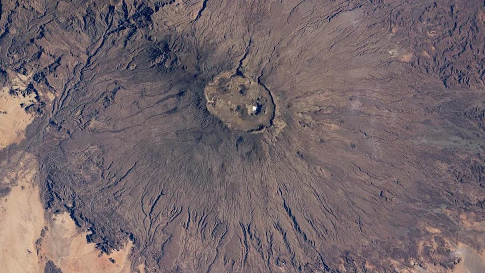
An astronaut on board the ISS snapped this striking shot of the Emi Koussi volcano in northern Chad. Nestled in the lofty peak's caldera is a giant slab of salt that astronauts frequently mistake for snow. | Credit: NASA/ISS program
An astronaut aboard the International Space Station captured a striking image of Emi Koussi — the Sahara’s tallest volcano — revealing a brilliant white salt crust in its summit caldera that is often mistaken for snow.
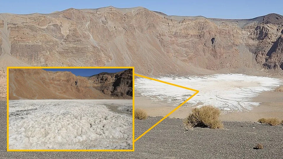
The salty slab within the secondary Era Kohor crater is up to 3,300 feet (1,000 m) across and several feet thick. It was left behind by an ancient lake that once filled the caldera. | Credit: Stefan Thüngen/wikimedia
Quick facts
Location: Emi Koussi, Chad [19.825520656, 18.551560720]
Photo Date: Dec. 29, 2024
Photographer: Unnamed ISS astronaut
Elevation: 11,204 ft (3,415 m)
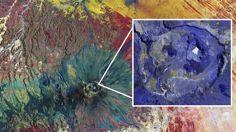
False-color satellite images, captured by ESA's Copernicus satellite (main) and NASA's Terra satellite (inset), show off the convoluted topography of Emi Koussi and its summit caldera. | Credit: Main: ESA/Copernicus Sentinel data (2017); second: NASA/ASTER/GLOVIS
What You’re Looking At
Emi Koussi (also spelled Emi Koussou) is a broad pyroclastic shield volcano in the Tibesti Massif on the Chad–Libya border. The volcano forms a dome roughly 43 miles (69 km) across and rises to 11,204 feet (3,415 m), making it the highest summit in the Sahara, according to NASA’s Earth Observatory.
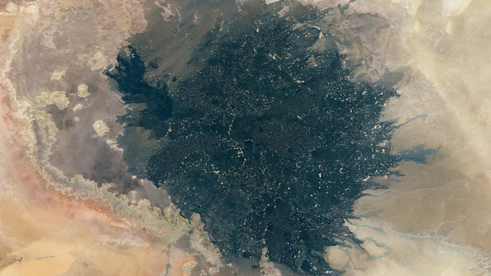
A satellite photo of a giant patch of black lava in a desert
The Surprising White Patch
Inside a smaller pit at the southern edge of the summit caldera, called Era Kohor, a thick, brilliant-white crust of natron covers the lowest portion of the floor. The crust spans up to about 3,300 feet (1,000 m) across and reaches several feet in thickness. Its reflective surface frequently leads astronauts to confuse it for snow in a region where snowfall is exceedingly rare.
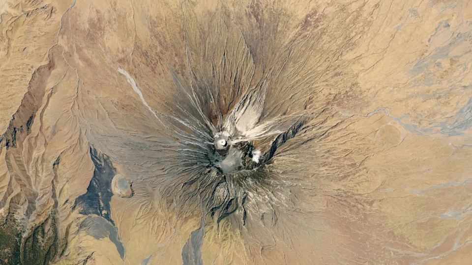
A satellite photo of a volcano surrounded by barren plains. Light colored lava flows can be seen on its flanks and a bright white cone at its summit
What Is Natron?
Natron is a naturally occurring mixture of sodium carbonate decahydrate, sodium bicarbonate, sodium chloride and sodium sulfate. This deposit is the mineral residue left behind when an ancient saline lake that once filled Era Kohor evaporated. Similar natron deposits occur elsewhere in the Tibesti Massif, including the striking Trou au Natron caldera about 150 miles (240 km) northwest.
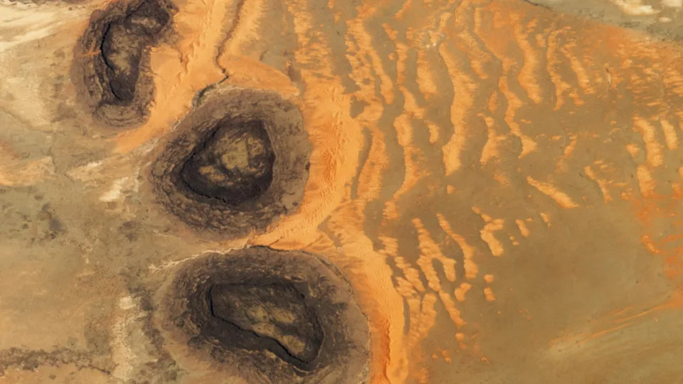
An astronaut photo of three dark mesas, partially surrounded by orange sand dunes
Volcanic History and Hidden Water
Emi Koussi is classified as extinct by the Smithsonian Institution’s Global Volcanism Program and has no recorded historic eruptions. Its gentle slopes are blanketed with ancient lava flows, some of which may be on the order of 2 million years old and flowed with unusually low viscosity — "more like motor oil than toothpaste," as described by Earth Observatory researchers.
Despite the region’s extreme aridity (annual rainfall can be as low as ~0.8 in / 20 mm), narrow, deep ravines carved between Emi Koussi and nearby plateaus remain in near-permanent shadow. Their cooler microclimates often allow liquid water to persist; two of the largest canyons contain perennial waterways that flow east and west of the volcano.
Evidence of a Wetter Past
Dry stream channels carved into the volcano’s flanks point to much wetter conditions in the past. A 2025 study comparing the ancient lakes of Era Kohor and Trou au Natron suggests that during the mid-Holocene the region’s average rainfall was at least ten times higher than it is today, accounting for the formation of now-dry lake beds and channels.
From Apollo To The ISS
Emi Koussi has attracted the attention of space observers for decades; Apollo 7 astronauts photographed the peak in October 1968, and recent astronaut and satellite imagery continues to highlight its caldera structure, lava fields and unusual mineral deposits.
Image credits: ISS/NASA (main photo); Stefan Thüngen (natron deposit photo); ESA/Copernicus Sentinel (2017) and NASA/ASTER/GLOVIS (satellite imagery).
Help us improve.