Key Points: The August 26 floods that killed at least 1,400 people and left more than 5,300 missing were triggered by an ice‑rock avalanche from Langtang Lirung, experts say. Satellite imagery and seismic records show a bedrock and glacier collapse produced a short, sediment‑rich debris flow that devastated river valleys and towns. Independent analysis finds it physically impossible for the Medog hydropower project on a different river system to have caused the observed surge. Broader questions about climate change, infrastructure and exposure require further study.
Ice‑Rock Avalanche, Not Dam Failure: How the Langtang Collapse Triggered the Deadly China–Nepal Floods
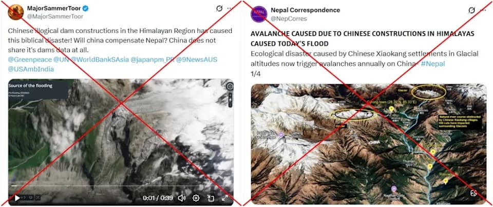
Screenshots of false posts captured on September 11, 2026, with red crosses added by AFP
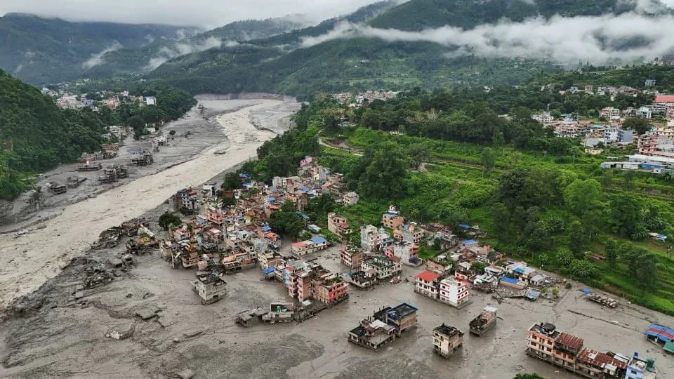
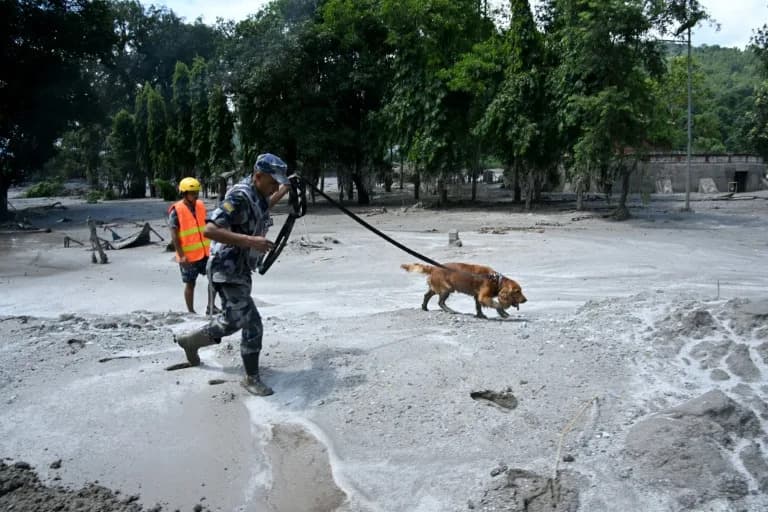
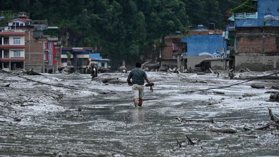
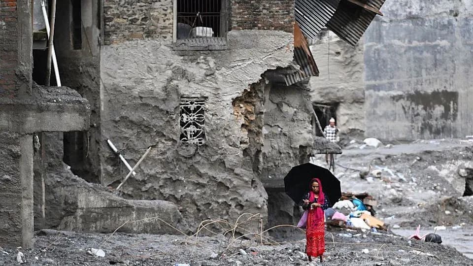
At least 1,400 people were reported dead and more than 5,300 listed as missing after catastrophic floods swept through parts of the Himalayas on August 26. As rescue teams searched mud and wreckage for survivors, false social media claims blamed a Chinese dam collapse. Independent experts and satellite and seismic data instead point to an ice‑rock avalanche from Langtang Lirung in Nepal as the trigger for the fast, sediment‑rich debris flow.
What Happened
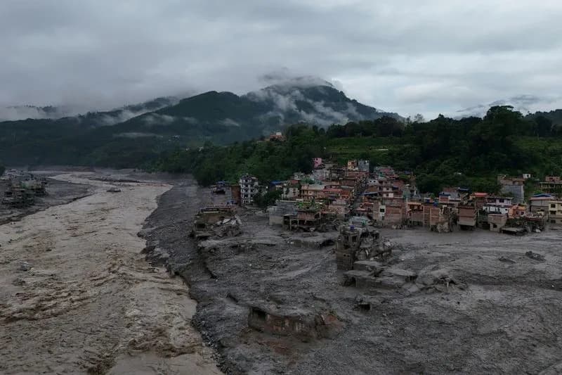
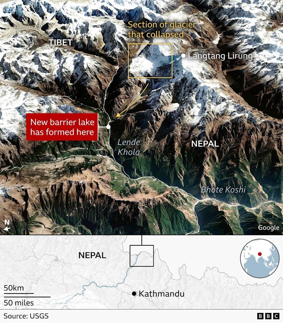
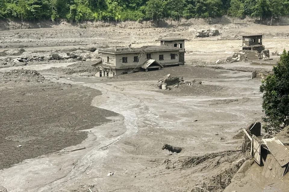
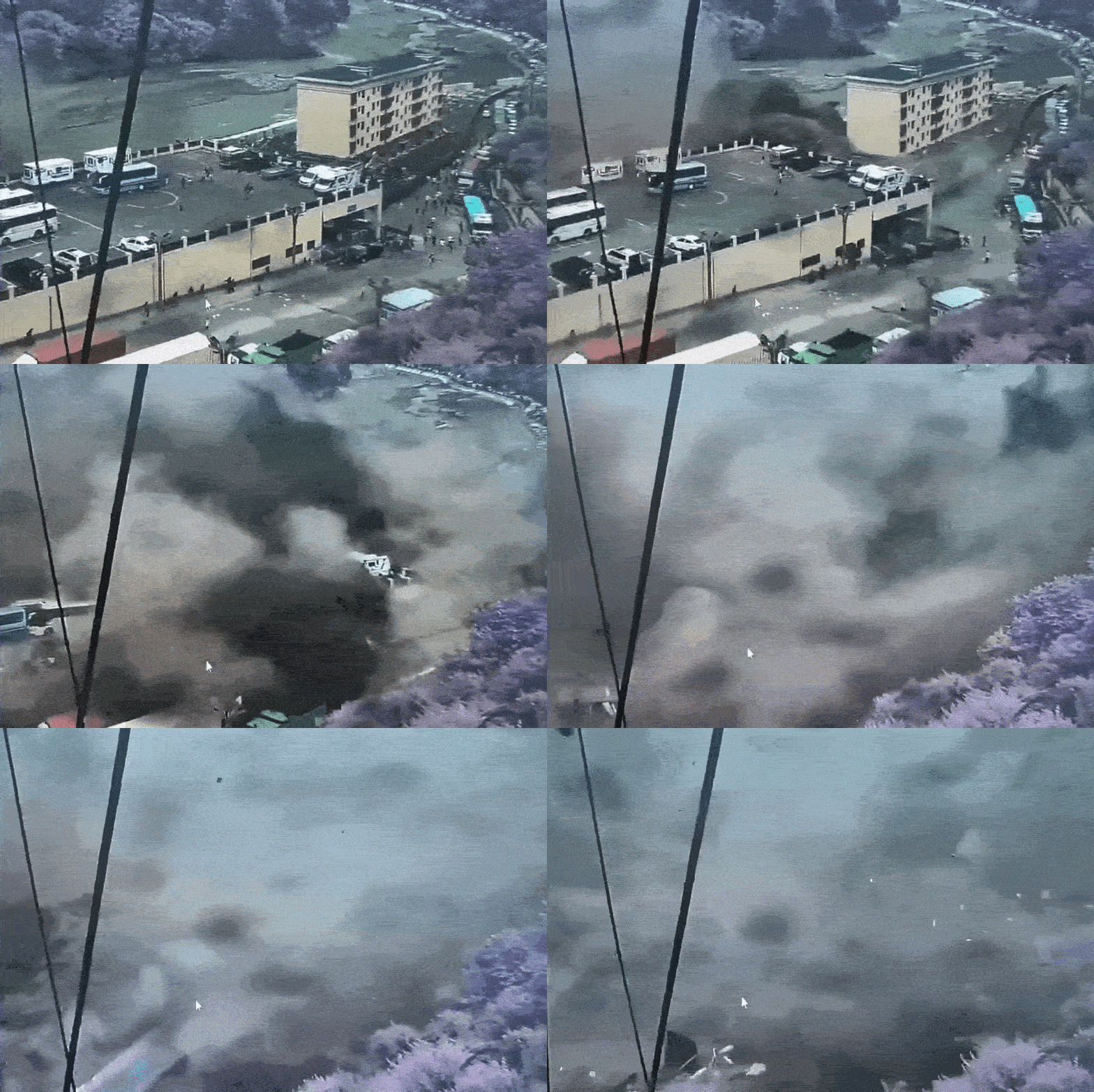
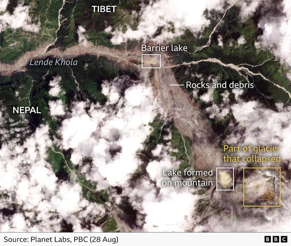
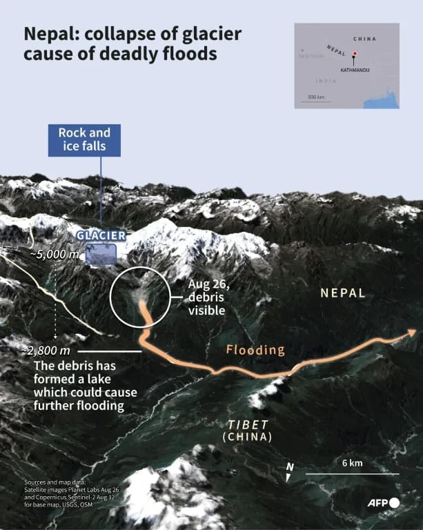
Researchers reconstructed a rapid sequence of events that began with a collapse on the north face of Langtang Lirung. Satellite imagery and field reports show a wedge of bedrock and glacial ice broke away and fell thousands of metres into the Lhende Khola valley. The pulverised mix of rock, ice, water and sediment formed a dense debris flow that rushed downstream, devastating villages, hydropower sites and infrastructure in Nepal and reaching Gyirong Port on the Tibetan side.
How Scientists Traced The Cause
Multiple lines of evidence support the ice‑rock avalanche explanation:
- Seismic records: The US Geological Survey initially registered a magnitude‑4.4 event and later characterized the signal as a slope failure whose energy was comparable to an approximate magnitude‑5.2 landslide.
- Satellite imagery: Commercial images (Planet Labs and others) show the pre‑collapse glacier, a growing crack, a fresh scar on the mountain and rapid downstream sediment plumes beginning hours before and immediately after the collapse.
- Ground observations and expert analysis: Geoscientists documented accelerating slope creep in the days before August 26 and rapid flow behavior consistent with an ice‑rock avalanche evolving into a high‑density debris flow.
"We can confidently trace the source of the disaster to a landslide composed mostly of bedrock, with some glacial ice," said Daniel Shugar, a geomorphologist investigating the event.
Why A Dam Collapse Is Unlikely
Numerous experts told AFP and other outlets that a Medog hydropower collapse could not have produced the observed torrent. Key reasons:
- The Medog project sits on a different river system, separated from the affected Lhende Khola by mountain ranges; water released there would not have flowed toward Nepal’s impacted valleys.
- A breached reservoir typically generates a longer-duration, sediment‑poor surge, unlike the short, violent, sediment‑rich pulse documented in this event.
- Satellite and mapping data show no dam structure in the impacted catchment; major dam construction is normally visible in remote sensing imagery.
Timeline (Selected)
Aug 24: Imagery shows brown meltwater and a crack propagating into bedrock.
Aug 26, 08:37 local: Bedrock and glacier wedge collapsed; seismic signal recorded.
Next 7 minutes: Avalanche descended into Lhende Khola and transformed into a fast debris flow.
Within hours: Flood reached and damaged settlements downstream, struck Timure and Syabrubesi, destroyed hydropower installations, and inundated areas as far as Gyirong Port in Tibet.
Context: Climate, Development And Risk
Experts warn the event highlights wider risks in the Himalayas: accelerating glacier retreat exposes unstable slopes, and rapid infrastructure and hydropower development have concentrated people and assets in hazardous valleys. Although these trends raise overall vulnerability, scientists caution that attributing a single collapse directly to climate change requires detailed analysis and time.
What Remains Unclear
Key questions remain about how local land use, infrastructure siting and changing glacier dynamics influenced the scale of the disaster. Investigations are ongoing to quantify contributions from natural slope instability, seasonal melt, and human factors, and to assess lessons for hazard planning in high‑mountain regions.
Bottom line: Current evidence strongly indicates a rapid ice‑rock avalanche on Langtang Lirung triggered the deadly August 26 floods. Claims that a distant Chinese dam collapse caused the torrent are not supported by seismic, satellite or hydrological data.
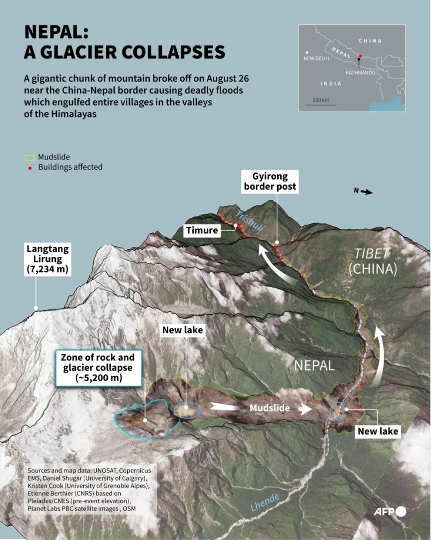
Infographic with 3D representation of satellite images showing Langtang Lirung mountain peak in Nepal, where a glacial and mountain collapse caused deadly floods in Tibet and Nepal on August 26, according to scientistsSophie RAMISLuca MATTEUCCIAFP
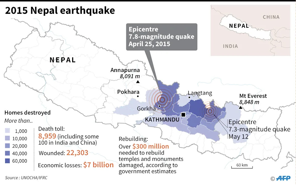
Map and factfile on the 7.8-magnitude quake that hit Nepal on April 25, 2015Gal ROMAAFP AFP
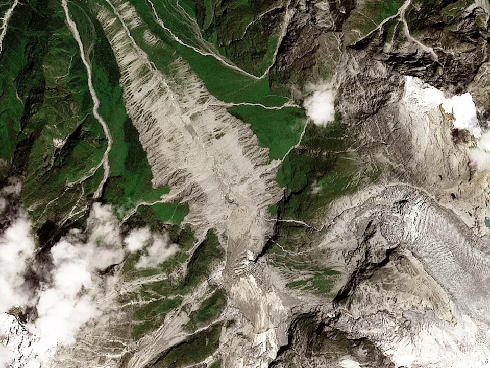
This handout satellite image taken by Planet Labs on August 12, 2026 and released on August 28, 2026 shows the glacier on Mount Langtang Lirung in Nepal before its collapseHandout2026 Planet Labs PBC
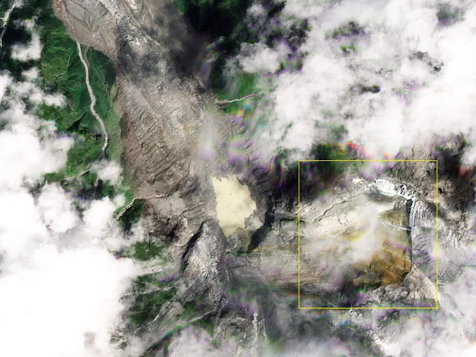
This handout satellite image released by Planet Labs on August 28, 2026 shows the chunk of glacier that collapsed near Langtang Lirung peak, with the newly formed scar highlighted in yellow by AFPHandout2026 Planet Labs PBC
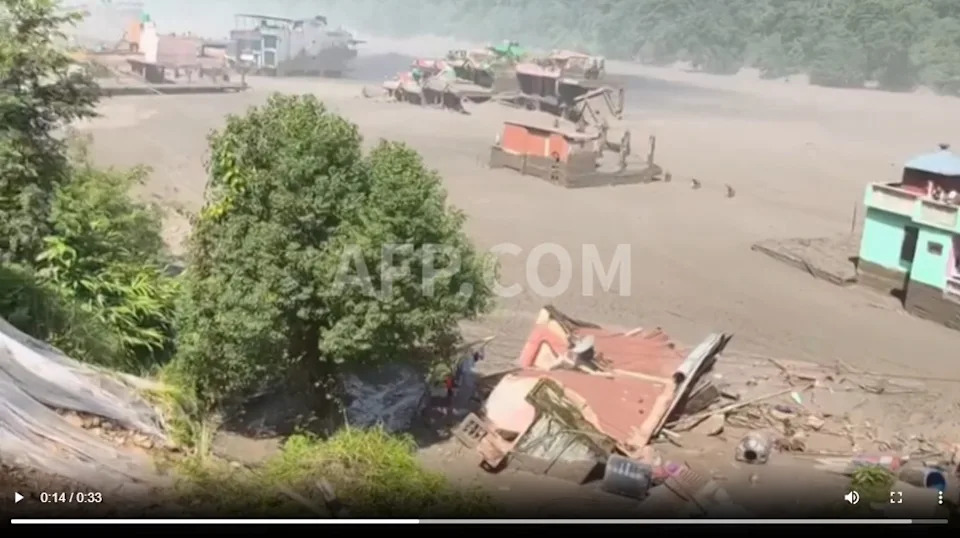
Screenshot of UGC footage from Newsflare showing a greenhouse surrounded by floodwaters in the town of Nuwakot in Nepal's Bagmati province on August 26, 2026
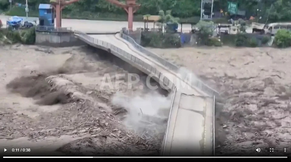
Screenshot of UGC footage from Newsflare showing a bridge collapsing in Nepal's Dhading District on August 26, 2026
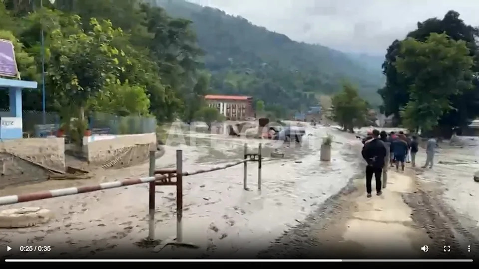
Screenshot of UGC footage from Newsflare depicting devastation in the town of Devghat in Nepal's Nuwakot district on August 26, 2026
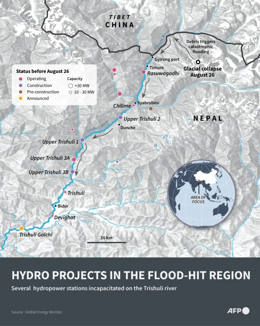
Infographic map showing hydropower projects along Nepal's flood-hit Trishuli river and the surrounding regionJohn SAEKIAFP
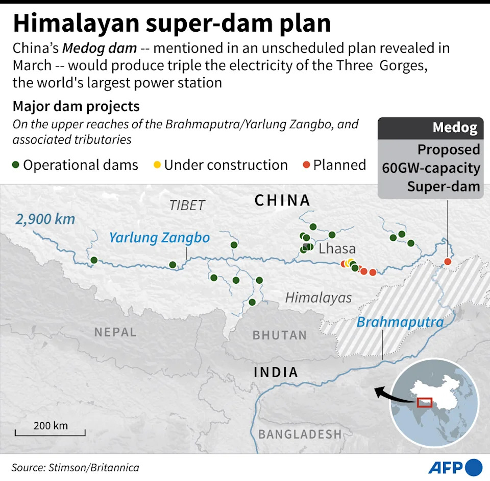
Map showing major dam projects on the upper stream of the Brahmaputra River, Yarlung Zangbo as of April 2021Laurence CHUAFP
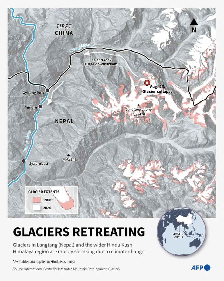
Infographic showing the retreat of glaciers in the Hindu Kush Himalaya region using 1980 and 2020 data from ICIMODNicholas SHEARMANAFP
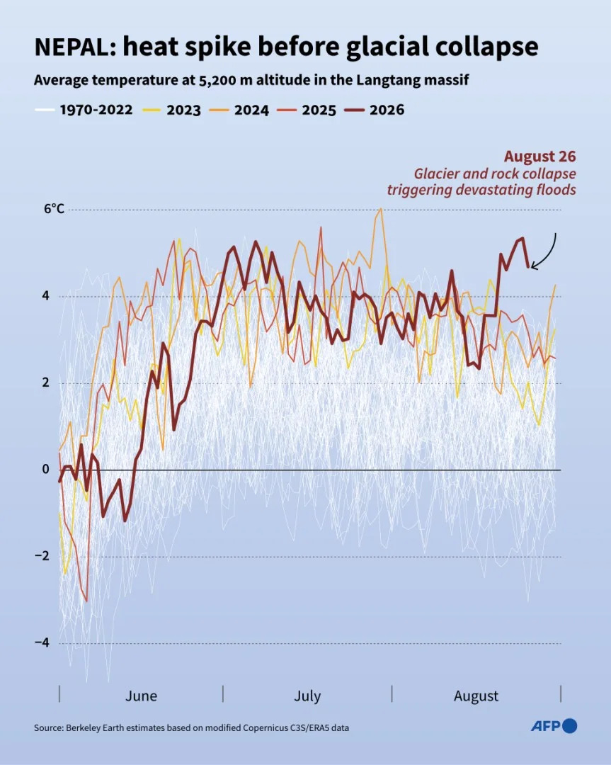
Infographic showing the estimated average summer temperatures from 1970 to 2026 at the site of the August 26 glacial collapse, based on data compiled by Berkeley Earth from the European Copernicus program and a network of 14 high-altitude weather stationsPaz PIZARROLuca MATTEUCCIAFP
Help us improve.