The northern Cascadia subduction zone off Vancouver Island appears to be fragmenting rather than ending in a single catastrophic failure. High-resolution seismic imaging from the 2021 CASIE21 campaign reveals a ~20 km–wide deformation zone at the Nootka Fault, two slab tears aligned with ~35 km earthquake lineations, and alternating active and quiet segments along a ~75 km rupture. The study suggests subduction termination can proceed episodically—segment by segment—and, if Explorer fully detaches, could create a slab window and shorten the trench by about 75 km.
Seismic Images Show Cascadia Subduction Is Fragmenting Offshore Vancouver Island
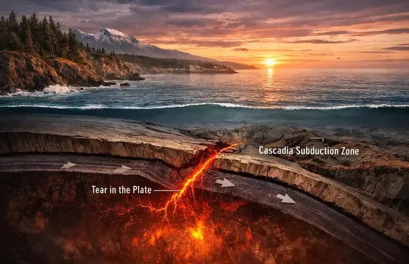
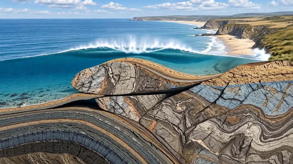
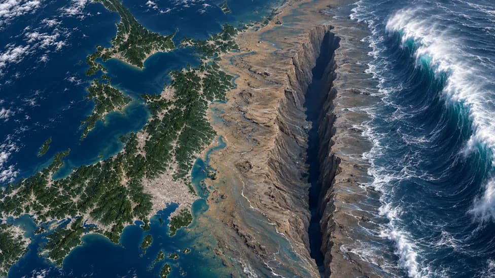
Cascadia’s Seafloor Is Tearing Apart, Offering a Rare Glimpse of How Subduction Zones End (CREDIT: AI-generated image / CC BY-SA 4.0)
New high-resolution seismic images and earthquake data indicate the northern Cascadia subduction zone offshore Vancouver Island is fragmenting rather than ending in a single catastrophic failure. Researchers combine results from the 2021 CASIE21 seismic campaign with regional earthquake catalogs and focal-mechanism analyses to document a 20-kilometer–wide deformation zone, two slab tears, and a network of faults that are progressively breaking the downgoing plates into smaller pieces.
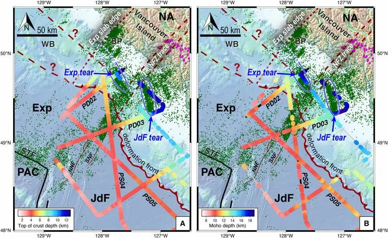
Map view of imaged slab structure and seismicity in the northern Vancouver Island region. (CREDIT: Science Advances)
What the Study Found
The study area sits where the Juan de Fuca and Explorer plates dive beneath North America and where several plate-boundary features converge: the Queen Charlotte Fault, the Cascadia trench, and nearby spreading ridges. That crowded geometry appears central to the process the authors describe as subduction termination, where interaction with a mid-ocean ridge produces young, warm, buoyant lithosphere that resists being pulled into the mantle.
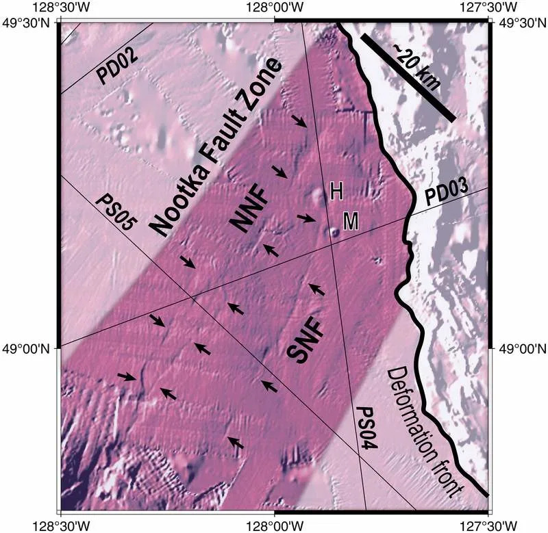
Seafloor expression of the NFZ in northern Cascadia. (CREDIT: Science Advances)
Using controlled-source seismic reflection data collected aboard the research vessel Marcus G. Langseth (CASIE21), the team imaged faults that cut sediments, crust, and into the upper mantle. Those images, combined with earthquake distributions and focal mechanisms, reveal two major slab tears—one under the Explorer plate and one under Juan de Fuca—each aligned with ~35 km earthquake lineations and with abrupt steps in slab geometry and the oceanic Moho.
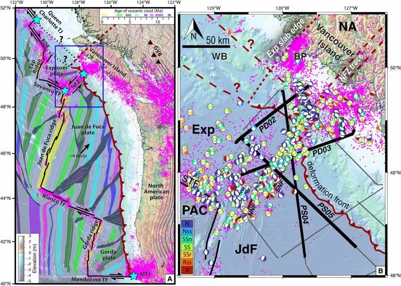
Tectonic structure of the Cascadia margin and subducting oceanic plates. Thick black lines show primary tectonic boundaries and triple junctions are marked with cyan stars. (CREDIT: Science Advances)
"This is the first time we have a clear picture of a subduction zone caught in the act of dying," said Brandon Shuck, lead author. "Rather than shutting down all at once, the plate is ripping apart piece by piece, creating smaller microplates and new boundaries."
Key Structures and Their Roles
A primary locus of deformation is the Nootka Fault Zone, a roughly 20 km–wide shear belt between the Explorer and Juan de Fuca plates. Seismic profiles show a complex fault network seaward of the deformation front; earthquakes cluster within this zone, and some faults appear to be inherited from earlier spreading-center normal faults that were later reactivated and narrowed into the modern transform boundary.
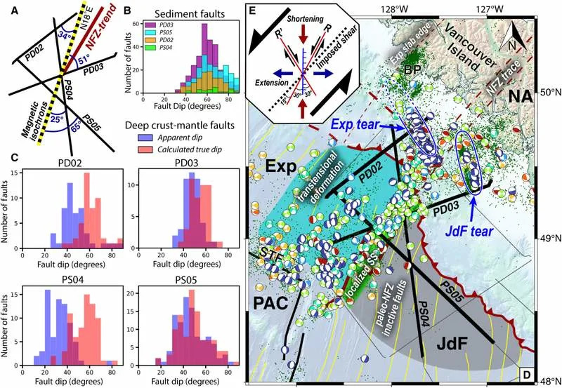
Analysis of paleo- and modern-NFZ faults within the incoming oceanic lithosphere. (CREDIT: Science Advances)
Landward of the trench, the Explorer-side slab tear appears more mature—sharper vertical offsets, steeper dip, and focused seismicity forming an almost vertical wall—while the Juan de Fuca-side break is broader and less developed. Along a ~75 km span of rupture, alternating active and quiet segments suggest some sections may already have detached and therefore no longer produce earthquakes.
Implications
Geodetic data support partial decoupling: convergence between the Explorer plate and North America is about 2 cm/yr, roughly half the >4 cm/yr convergence measured for Juan de Fuca. If the Explorer slab fully detaches, the authors project a potential slab window could form, shortening the Cascadia subduction zone by ~75 km (about one-twelfth of its current length).
Beyond local geometry, the findings suggest transform faults and ridge–trench encounters can drive piecewise subduction termination by segmenting slabs and fostering microplate formation. The process may help explain fossil microplates tied to the old Farallon system and has practical consequences for seismic hazard modeling: slab tears and transform segmentation could influence how rupture propagates and how seismic energy transmits during large earthquakes.
Limitations and Future Work
The authors note uncertainties: the northernmost seismic line did not extend far enough landward to definitively trace the Explorer tear toward Brooks Peninsula, and more robust 3D geodynamic modeling is needed—especially for settings where ridges intersect trenches at oblique angles. Volcanic responses in British Columbia could reflect either direct upwelling through slab tears or mantle flow around slab edges; distinguishing these requires further work.
Overall, the results—published in Science Advances—provide a rare, near-real-time view of a potential shutdown mechanism for a subduction zone: gradual tearing, fragmentation, and decoupling rather than a single catastrophic collapse.
Help us improve.