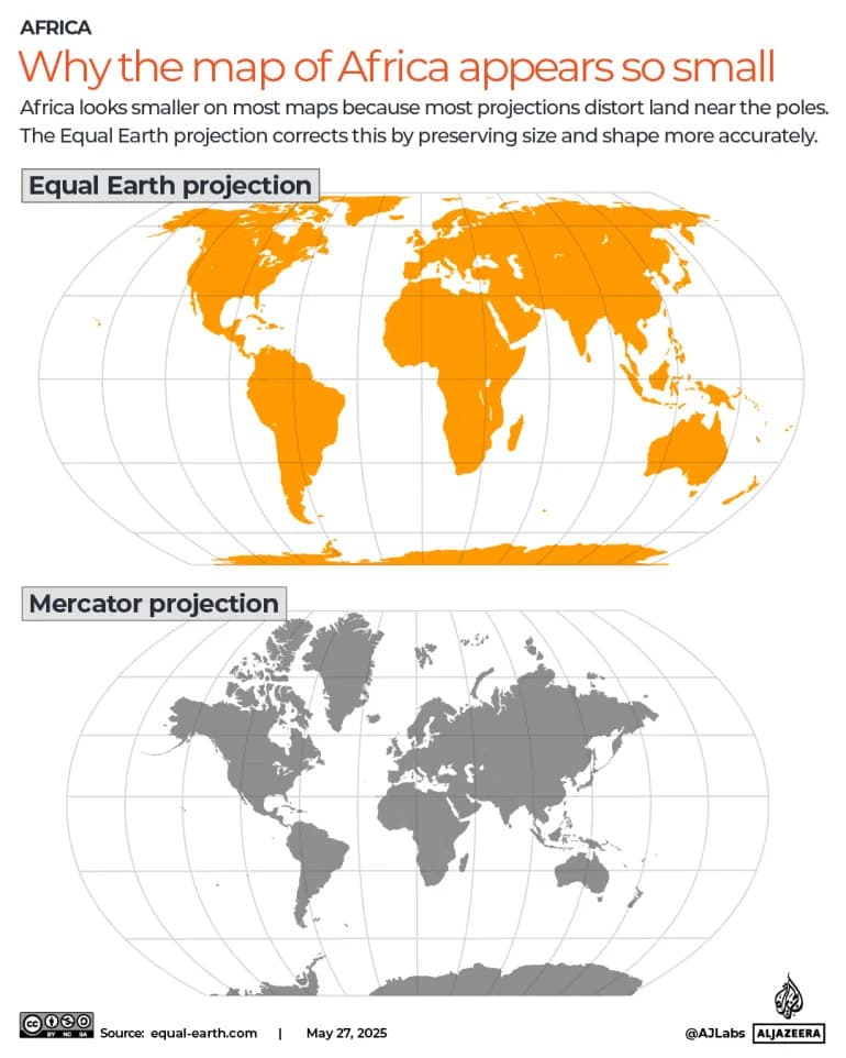
On Sept. 4, 2026, the UN General Assembly passed the non-binding "Correct the Map" resolution (164-1), endorsing the Equal Earth equal-area projection and urging its use where continent-size comparisons matter. Equal Earth preserves true land area—correcting Mercator’s tendency to inflate northern landmasses such as Canada and Greenland. The resolution is symbolic and aimed at classrooms, textbooks and media; web maps are unlikely to change soon because they rely on Web Mercator tiling.
UN Votes to 'Correct the Map': Equal Earth Projection Endorsed to Fix Continental Distortion
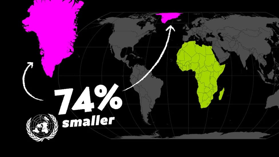
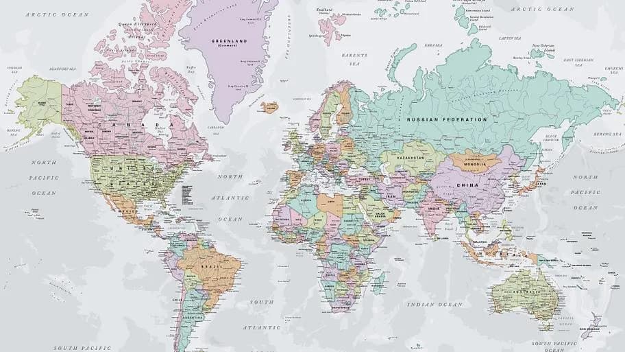
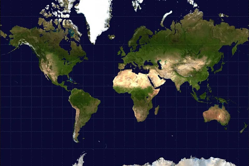
Visual comparison of new UN world map projection Equal Earth and how Greenland's size changes compared to mercator projection.
On Sept. 4, 2026, the United Nations General Assembly adopted the non-binding resolution "Correct the Map" by a 164-1 vote, formally endorsing the Equal Earth equal-area projection and urging its use where comparisons of continental size matter.
Why This Matters
The resolution promotes equal-area maps to correct long-standing visual distortions produced by projections such as Mercator, which inflate landmasses the farther they are from the equator. While Mercator preserved compass bearings—making it invaluable for navigation and later convenient for many online maps—it greatly exaggerates the size of high-latitude regions. At about 60° north (near Oslo or Anchorage), Mercator can render land roughly four times too large; by 80° north it may exaggerate size by some 33 times.
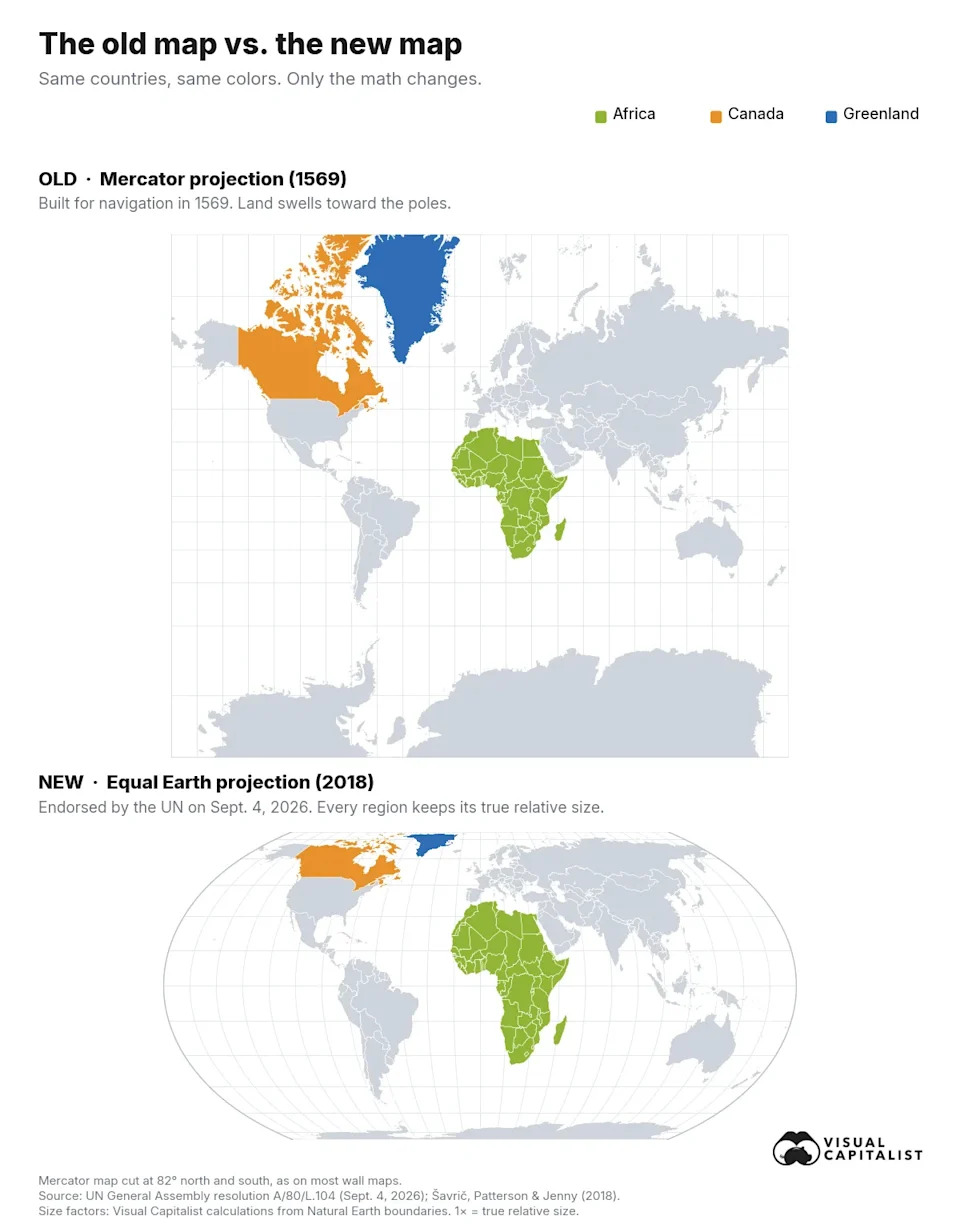
Two world maps stacked: the Mercator projection above and the Equal Earth projection below, with Africa, Canada and Greenland highlighted in the same colors on both.
What Equal Earth Does
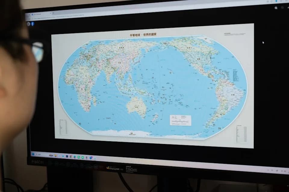
Equal Earth, published in 2018 by Bojan Šavrič (Esri), Tom Patterson (U.S. National Park Service) and Bernhard Jenny (Monash University), is an equal-area projection that preserves true land area while keeping a familiar, rounded outline similar to the Robinson projection. That makes the map feel visually balanced while showing continents at their actual proportions.
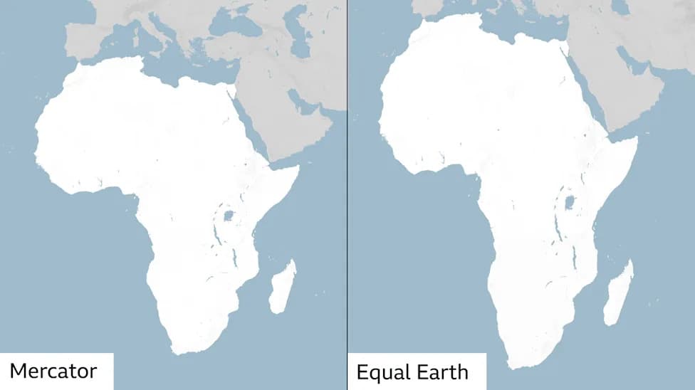
Measured at the same scale, Africa covers about 30.4 million km², Canada just under 10 million km², and Greenland roughly 2.17 million km². On Equal Earth those relationships are preserved: Africa is about 14 times the size of Greenland and three times the size of Canada. By contrast, Mercator’s distortion can make Canada appear roughly 50% larger than Africa and Greenland look nearly as large as the entire continent.
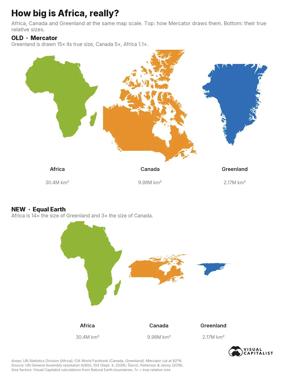
Silhouettes of Africa, Canada and Greenland drawn at the same scale, first as the Mercator projection shows them and then at their true relative sizes on the Equal Earth projection.
How This Affects the UN and the Public
Ironically, the UN’s official Map of the World does not use Mercator either: it typically uses the Robinson projection, a visual compromise that is not equal-area. By the article’s calculation, the UN’s map renders Greenland at roughly 1.5 times its true size and draws Canada and Russia at about 1.2 times their true areas, while Africa appears near 0.85 times. Relative to Africa, Canada and Russia therefore look roughly 40% larger and Greenland about 80% larger than they should.
The resolution was introduced by Togo on behalf of the African Group and passed 164-1 with six abstentions. The United States cast the lone No vote, calling the initiative a "radical ideological project," while Estonia, Georgia, Lithuania, Moldova, Serbia and Ukraine abstained. The text is non-binding: it does not ban Mercator or affect navigation charts, but it declares Equal Earth the more accurate choice when comparative area matters and urges governments, schools, international organizations and global technology platforms to adopt it.
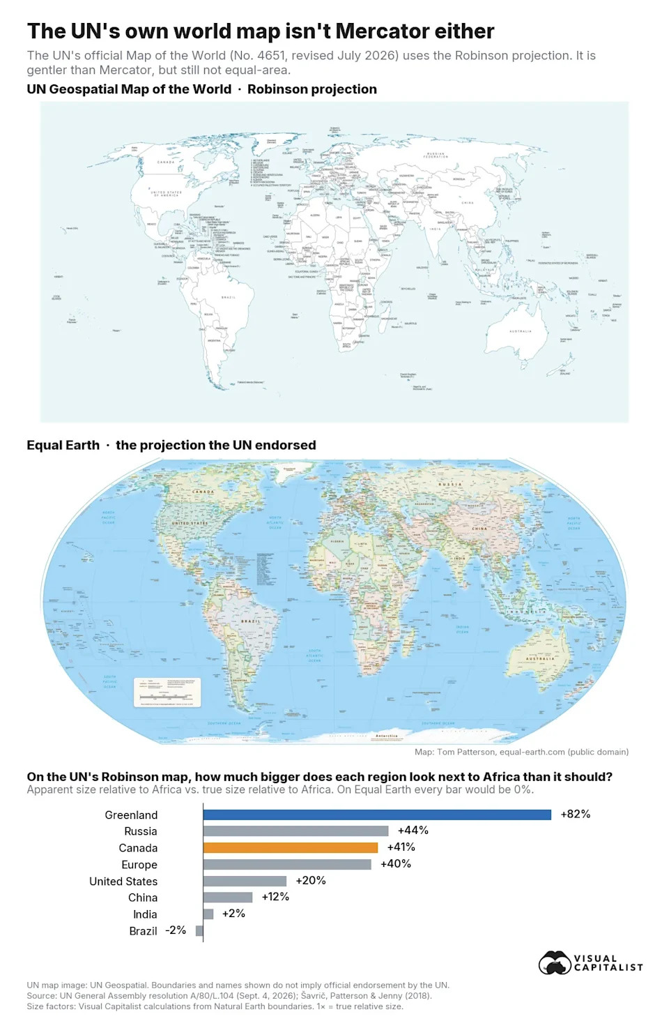
The United Nations official Map of the World in the Robinson projection above the Equal Earth map, with a bar chart showing how much larger regions appear relative to Africa on the UN map than they really are.
Practical Limits And Potential Impact
Web maps are unlikely to change soon: Google Maps, Apple Maps and most online mapping systems rely on Web Mercator because it tiles neatly at every zoom level. The vote will likely matter most in classrooms, textbooks, newsrooms and official communications—the exact arenas targeted by the "Correct the Map" campaign, backed by the African Union.
Several institutions have already signaled change: the African Union has adopted Equal Earth; France has said it will remove Mercator from certain official communications; and Togo plans to update its textbooks and convene UNESCO, the AU and technology companies in early 2027 to coordinate next steps.
As Togo’s foreign minister Robert Dussey told the Assembly: "A fair map does not change the geography of the world, it changes how we see it."
Graphics distributed with the resolution use the free Equal Earth wall map published by cartographer Tom Patterson, paired with vote details from UN resolution A/80/L.104 and UN meeting records.
Help us improve.