The European Commission JRC's Fire Weather Index anomaly map warns that 29 July–2 August could bring some of the season's highest wildfire risk across western and central Europe. Very extreme conditions are concentrated over France, the Alpine arc into northern Italy, and the British Isles, while extreme to very high danger extends across Iberia, the Balkans, North Africa, southern Scandinavia, eastern Europe and Türkiye. NASA visualizations highlight widespread smoke and PM2.5 risks, which can travel thousands of miles and threaten respiratory and cardiovascular health. UK and Spanish ministers have linked the fires to climate change and called the situation a national security emergency.
Urgent Map Warns Europe Could Face Peak Wildfire Risk 29 July–2 August
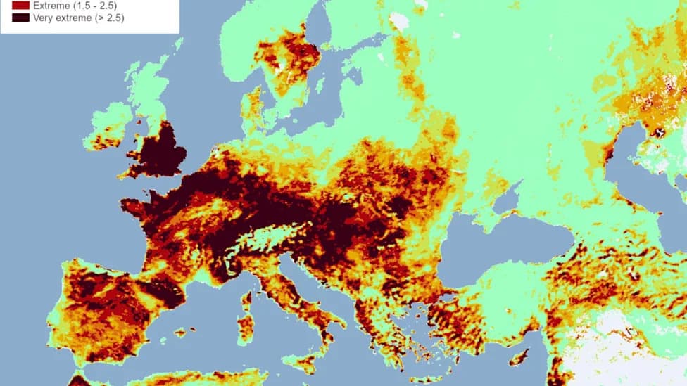
Median Fire Weather Index (FWI) anomaly map. Anomalies are computed as a standard deviation from the 30-year historical mean. (© EU, 2026. Licensed under CC BY 4.0. Source: EU Forest Fires Information System (EFFIS), Copernicus Emergency Management Service)
This summer has been marked by extreme heat and widespread fires — from record-breaking heatwaves to massive blazes in Canada and an ongoing wildfire wave across Europe. A new graphic from the European Commission's Joint Research Centre (JRC) highlights a near-term escalation in danger that demands attention.
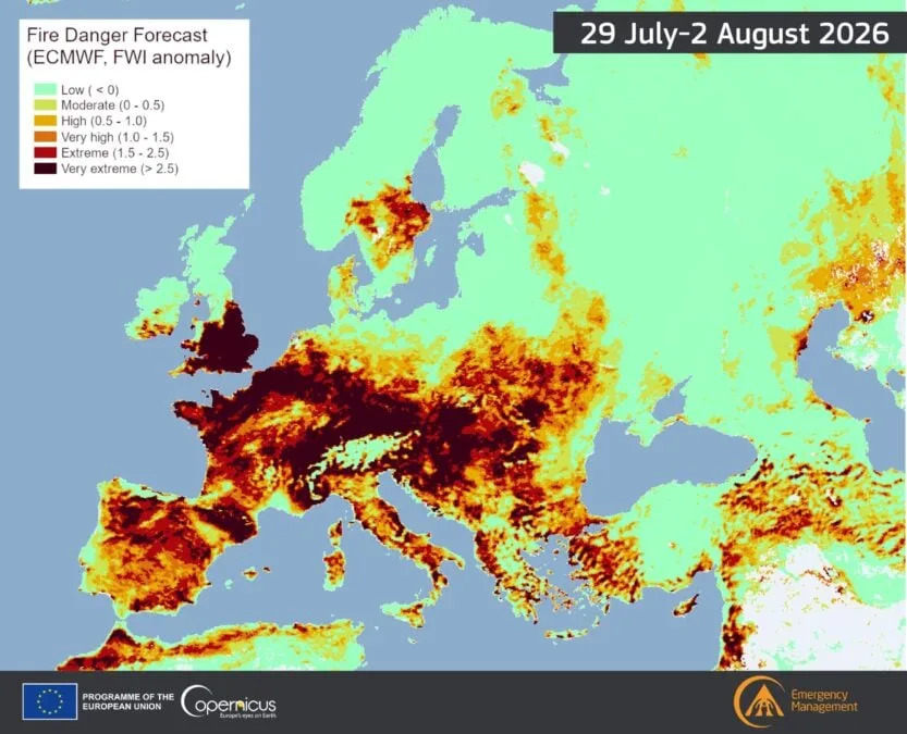
Median Fire Weather Index (FWI) anomaly map. Anomalies are computed as a standard deviation from the 30-year historical mean. (© EU, 2026. Licensed under CC BY 4.0. Source:EU Forest Fires Information System (EFFIS), Copernicus Emergency Management Service)
JRC Fire Weather Index Projection
The JRC's median Fire Weather Index (FWI) anomaly map indicates that the period from 29 July through 2 August may include some of the most severe fire-risk days of the season. The anomalies on the map are expressed as standard deviations from the 30-year historical mean. (© EU, 2026. Licensed under CC BY 4.0. Source: EU Forest Fires Information System (EFFIS), Copernicus Emergency Management Service.)
YouTube Thumbnail
“Very extreme conditions dominate a large area of western and central Europe, with the heaviest concentration across France and the Alpine arc extending into northern Italy, along with the British Isles and Ireland.”
“Extreme conditions surround these areas, covering the wider Iberian Peninsula, the Balkans, and parts of North Africa. Very high danger stretches across southern Scandinavia, parts of eastern Europe, and further pockets in North Africa. High to moderate danger covers scattered patches of eastern Europe and Türkiye.”
Smoke, Health, And Environmental Impacts
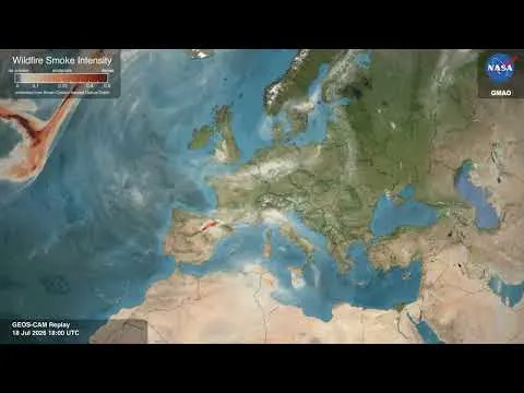
NASA visualizations show the fires' spread and the extensive smoke plumes already affecting large areas. Wildfire smoke is more than an irritation: it carries toxic gases and fine particulate matter (PM2.5) that can penetrate deep into lungs and enter the bloodstream, increasing the risk of pulmonary and cardiovascular problems.

Subscribe to ScienceAlert's free fact-checked newsletter
Although PM2.5 concentrations are generally highest near the fire source, smoke can travel thousands of miles and degrade air quality far from burn zones, posing public-health and environmental risks across borders.
Policy Response
In a notable development, ministers from the United Kingdom and Spain explicitly linked the recent fires to climate change and issued a joint statement calling the situation a national security emergency. Their statement read in part: “This summer's wildfires demonstrated that climate change was now a national security emergency facing Europe and threatening our way of life.”
What To Do Now
Given the JRC's projection and the cross-border reach of smoke, authorities and the public should prepare for heightened fire danger in the coming days. Precautions include following local evacuation orders, limiting outdoor activity during heavy smoke, and using air purifiers or masks (N95/FFP2) when advised.
This story was fact-checked and edited by Michael Irving. Sources include the European Commission JRC, EFFIS, Copernicus Emergency Management Service, and NASA Scientific Visualization Studio.
Help us improve.