A new airborne LIDAR survey of 4,497 km² in southwestern Amazonia revealed 432 geometric earthworks (396 previously unknown), indicating the Aquiry cultural network was far larger than previously believed. Researchers estimate the Aquiry may have occupied up to 183,000 km² and supported 1.2–3 million people at its peak around 200 CE, with as many as 24,000–30,000 earthworks. The discovery challenges the idea of an untouched Amazon and highlights centuries of human landscape management; key questions about the civilization's decline remain.
LIDAR Reveals Hundreds Of Hidden Earthworks Beneath The Amazon, Rewriting Its Human History
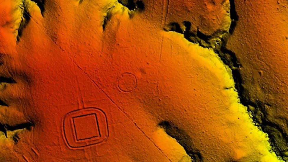
LIDAR image of the Aquiry geoglyph site at Piloto. (© Martti Pärssinen and Fabio de Novaes, supplied)
The Amazon rainforest is often presented as one of the planet's last pristine wildernesses. New airborne LIDAR data, however, reveals a very different past: between roughly 600 BCE and 850 CE, a network of communities archaeologists call the Aquiry reshaped large areas of southwestern Amazonia with monumental geometric earthworks.
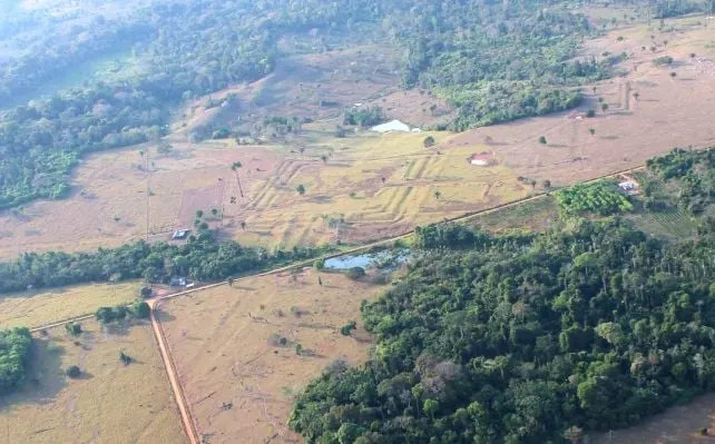
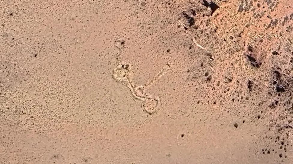
Aerial photo of earthworks at the Tequinho site in Acre, Brazil. The Aquiry culture is named for the word Indigenous peoples used for the Acre River, which flows from Peru and Bolivia to Acre, passing through the heart of the ancient civilization. (Martti Pärssinen, supplied)
A recent survey covering 4,497 square kilometres (1,736 sq mi) uncovered 432 earthworks, 396 of which were previously unknown. By mapping these features beneath the canopy, researchers show the Aquiry network may have been far larger and more complex than assumed.
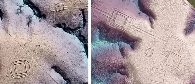
LIDAR images of earthworks. (Pärssinen et al.,Nature, 2026)
What the LIDAR Shows
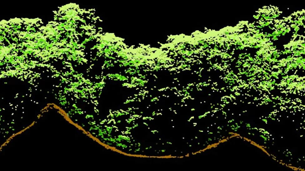
LIDAR (Light Detection and Ranging) transmits laser pulses from aircraft; some pulses pass through canopy gaps and return from the ground, allowing reconstruction of the buried or obscured terrain without disturbing the forest. The team flew long transects totaling roughly 450 kilometres (280 miles) over the study area and processed the returns to reveal the lost landscape.

Subscribe to ScienceAlert's free fact-checked newsletter
The dataset exposed geometric enclosures—ditched and embanked spaces sometimes linked by straight roads—likely used for ceremonies, gatherings and political events. These earthworks are often several meters deep and were surrounded by clearings that probably supported houses, fields and orchards.
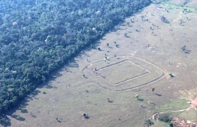
Aerial photo of earthworks at Piloto. (Martti Pärssinen, supplied)
"It completely transformed my understanding and made me realize how mistaken earlier assumptions had been," said archaeo-anthropologist Martti Pärssinen of the University of Helsinki, recalling early aerial surveys over sites in Acre, Brazil. He added that recent LIDAR results suggest there may be up to ten times more earthworks in the region than previously thought.
Scale and Implications
Combining the new survey with earlier work, the researchers extrapolated that the Aquiry cultural network could have spanned as much as 183,000 square kilometres. Within that footprint the landscape may once have supported between about 1.2 and 3 million people at its peak (around 200 CE) and contained an estimated 24,000–30,000 earthworks.
These findings challenge the long-held notion of an untouched Amazon. Instead, many parts of the basin appear to have been managed and shaped by substantial human populations for centuries, with cultivated fields, managed fruit- and nut-bearing trees, and built ceremonial centers interwoven with forested areas.
Open Questions
Much remains unknown. The Aquiry left no written records, and their dwellings have long decayed. A central mystery is why these communities declined between roughly 850 and 1000 CE. The new LIDAR evidence offers the clearest regional picture so far, but archaeologists emphasize the need for targeted excavations, paleoecological studies and collaboration with Indigenous knowledge to fill in the story.
The findings are published in Nature and include aerial imagery from sites such as Tequinho and Piloto in Acre, Brazil, illustrating the scale and geometry of the surviving earthworks.
Help us improve.