NASA’s Black Marble analysis of VIIRS satellite data from 2014–2022 finds a ~34% rise in global nighttime radiance, but changes are uneven across regions. Maps reveal "bidirectional" trends: some places grew brighter with electrification and urban growth, while others dimmed due to LEDs, conservation policies, economic decline or conflict. The daily-processed dataset helps track urbanization, disaster recovery, power outages and light pollution; the findings were published April 8 in Nature.
NASA Black Marble Reveals Earth's Night Lights Are Brighter — But Unevenly So
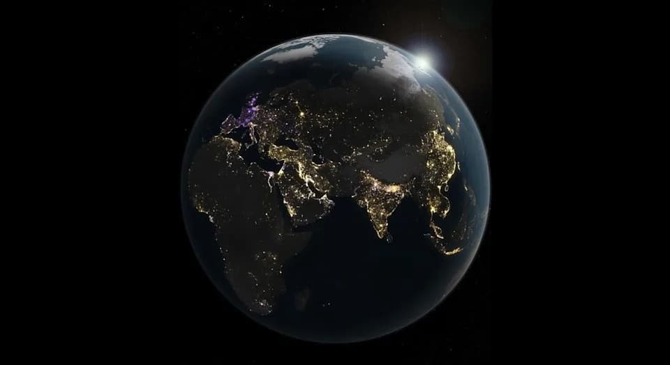
An analysis of nearly a decade of nighttime lights data (2014-2022) from NASA's Black Marble product revealed areas of brightening (gold) and dimming (purple) shown here across the Eastern Hemisphere. | Credit: NASA Earth Observatory/Michala Garrison
A NASA analysis of nearly a decade of satellite observations shows that Earth’s nights are changing — overall brighter, but in complex and often opposing patterns across regions.
New findings from the Black Marble project use daily-processed data from the Visible Infrared Imaging Radiometer Suite (VIIRS) sensors aboard Suomi-NPP, NOAA-20 and NOAA-21 to isolate human-produced light at night. Researchers compared observations from 2014 through 2022 and found global nighttime radiance increased by about 34%, even as many individual populated areas became darker.
Uneven, “Bidirectional” Changes
Instead of a simple, uniform brightening, the study documents what NASA calls “bidirectional changes”: neighboring regions can brighten or dim simultaneously depending on local conditions. This patchwork of change reflects a mix of urban growth, electrification, energy-saving technology, economic trends, policy decisions and conflict.
Regional Examples
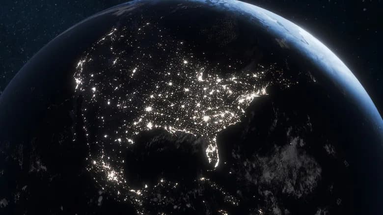
In the United States, many West Coast cities grew brighter with population and development, while large sections of the East Coast dimmed — trends the authors link in part to the widespread adoption of energy-efficient LED lighting and broader economic restructuring.
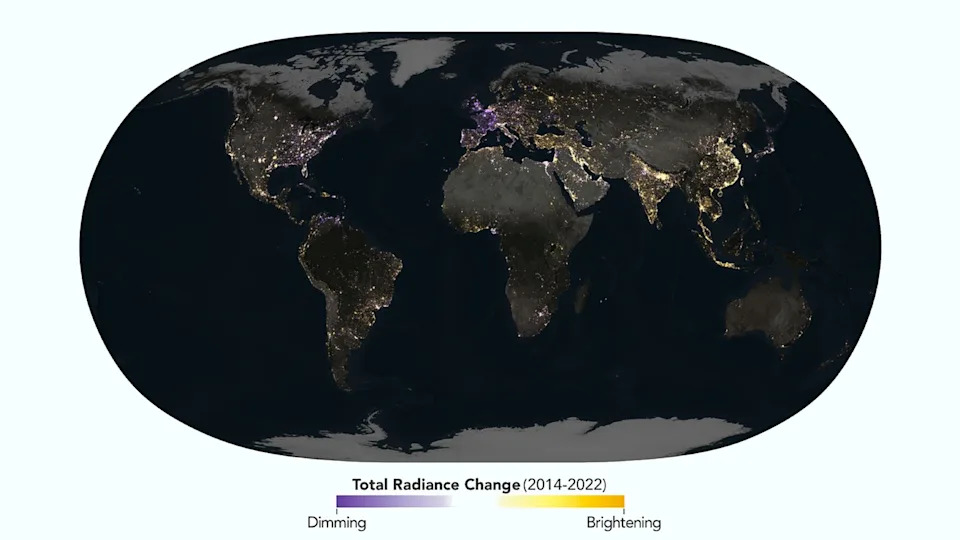
Some parts of the planet are shown to brighten (gold) and some dim (purple) in an analysis of nearly a decade of nighttime lights data from NASA's Black Marble product. | Credit: NASA Earth Observatory/Michala Garrison
Europe showed notable declines in nighttime brightness driven by conservation policies, energy-saving measures and dark-sky initiatives; France was highlighted for aggressive efforts to reduce light pollution. Conversely, parts of sub-Saharan Africa, Southeast Asia, China and northern India saw substantial brightening as electrification and infrastructure projects extended into previously dark areas.
The satellite maps also captured the impacts of conflict and economic collapse: sharp dimming appears in parts of Ukraine, Lebanon, Yemen, Afghanistan and Venezuela, consistent with war damage, infrastructure failure and severe economic distress.
About The Data And Why It Matters
Black Marble processing removes interference from moonlight, clouds, snow and atmospheric effects so the VIIRS day-night band can more reliably identify human-generated illumination across wavelengths from green to near-infrared. Because Black Marble produces daily-processed observations (rather than multi-year composites), it offers a dynamic, high-resolution record of how Earth’s nightscape evolves.
Researchers and policymakers use nighttime-light data to track urban growth and electrification, monitor disaster recovery and power outages, detect industrial activity, and study migration patterns. The data are also critical for assessing light pollution, which affects astronomy, ecosystems and human health — from disrupted animal behavior to potential impacts on human circadian rhythms and reduced visibility of the night sky.
Study publication: The analysis was published April 8 in the journal Nature.
Help us improve.