Planet Labs will withhold satellite imagery of Iran and much of the Middle East indefinitely after a U.S. government request, extending an earlier 14-day delay. The company says imagery dating to March 9 will remain restricted until the conflict ends, with rare case-by-case exceptions for urgent needs. Experts warn the decision limits public transparency and could impede humanitarian, agricultural and disaster-response uses of commercial satellite data. Other providers appear to have introduced controls over parts of the region as well.
Planet Labs Will Withhold Iran Satellite Imagery — Expert Warns of a Troubling Transparency Precedent
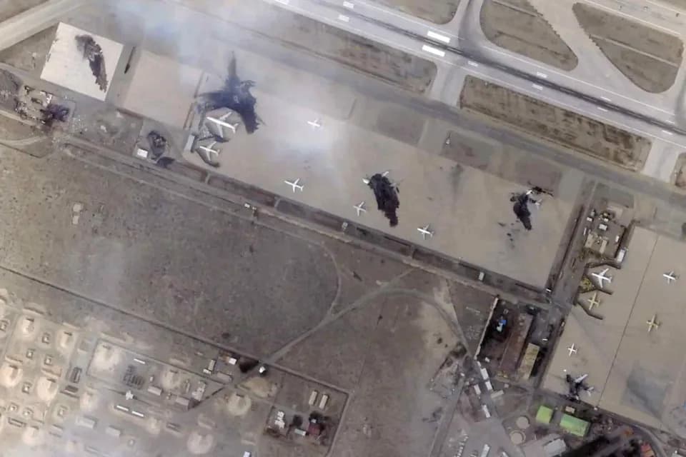
A satellite image of Mehrabad International Airport in Tehran, Iran following airstrikes. Damage as well as a variety of planes and runways can be seen. | Credit: Planet Labs PBC/AP
Planet Labs, a major Earth-observation company, has announced it will withhold satellite imagery of Iran and the broader Middle East indefinitely after receiving a request from the U.S. government, the company told customers in an April 5 notice. The California-based firm had earlier instituted a 14-day delay on Middle East imagery; the new policy suspends public access to images dating back to March 9 and will remain in place until the conflict ends, with limited case-by-case exceptions for urgent needs.
Why Planet Labs acted
Planet Labs said the measure was taken in response to national-security concerns and to reduce the risk of attacks on U.S. forces and allied personnel. The company emphasized that it will consider extraordinary releases if an urgent humanitarian or public-safety need is demonstrated.
Expert concerns
Not everyone supports the decision. Victoria Samson, chief director of space security and stability at the nonprofit Secure World Foundation, told Space.com the move could harm public understanding of what is happening on the ground.
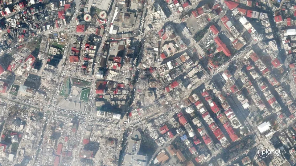
Devastation in central Kahramanmaraş, Turkey, from an earthquake was captured by satellites operated by San Francisco-based company Planet on Feb. 7, 2023. | Credit: Planet
“It seems that it's a way to impact the American public's ability to understand what's happening as opposed to having an impact on the battlefield,” Samson said. “It probably will start a precedent that I don't think will be good for overall transparency.”
Why satellite imagery matters beyond the military
Commercial satellite imagery serves many civilian purposes: humanitarian response, tracking refugee movements, documenting damage to civilian infrastructure, agricultural monitoring and planning, and independent verification of events during crises. Samson noted that imagery from Planet Labs earlier in the conflict helped clarify the scale of damage to a struck Iranian school in early March, illustrating how such data can inform both reporting and aid efforts.
Broader industry response
Planet Labs is one of several private providers of high-resolution Earth imagery. Space.com reported that Vantor (formerly Maxar Intelligence) has also implemented controls over parts of the Middle East, though it said those controls were not implemented in direct response to a specific U.S. government request. It remains unclear how many other companies have adopted comparable restrictions.
Transparency and public access
Restrictions on imagery are not entirely new — mapping platforms have long obscured some sensitive military sites — but observers say this appears to be among the largest region-wide public-access restrictions by a commercial imagery provider. Critics warn the move may reduce independent verification of incidents, hinder humanitarian response and set a precedent that could erode public transparency about conflicts and disasters.
Space.com reached out to Planet Labs for comment, but the company did not respond before the publication deadline.
Help us improve.