This year's El Niño is on track to be one of the strongest on record and could temporarily push global temperatures far higher, likely making 2027 the hottest year by a wide margin. Sea-surface anomalies in the Nino 3.4 region are already about 2.6°C above a 30-year average, and models point to a possible 3.9°C peak. Experts estimate the event could add ~0.3°C to annual global temperatures and intensify extreme rainfall, drought and wildfire risks, with evidence suggesting climate change may be amplifying the cycle.
Record-Breaking El Niño Poised To Make 2027 Much Hotter — What It Means
El Nino is on track to be the strongest on record in 2026 (Sabrina BLANCHARD)
This year's El Niño is tracking toward potentially the strongest event on record and could push global temperatures sharply higher for a year or more. Stacked on top of long-term human-caused warming, the surge offers a preview of conditions scientists expect later this decade and raises the risk of more intense storms, droughts and fires worldwide.
What Is El Niño?
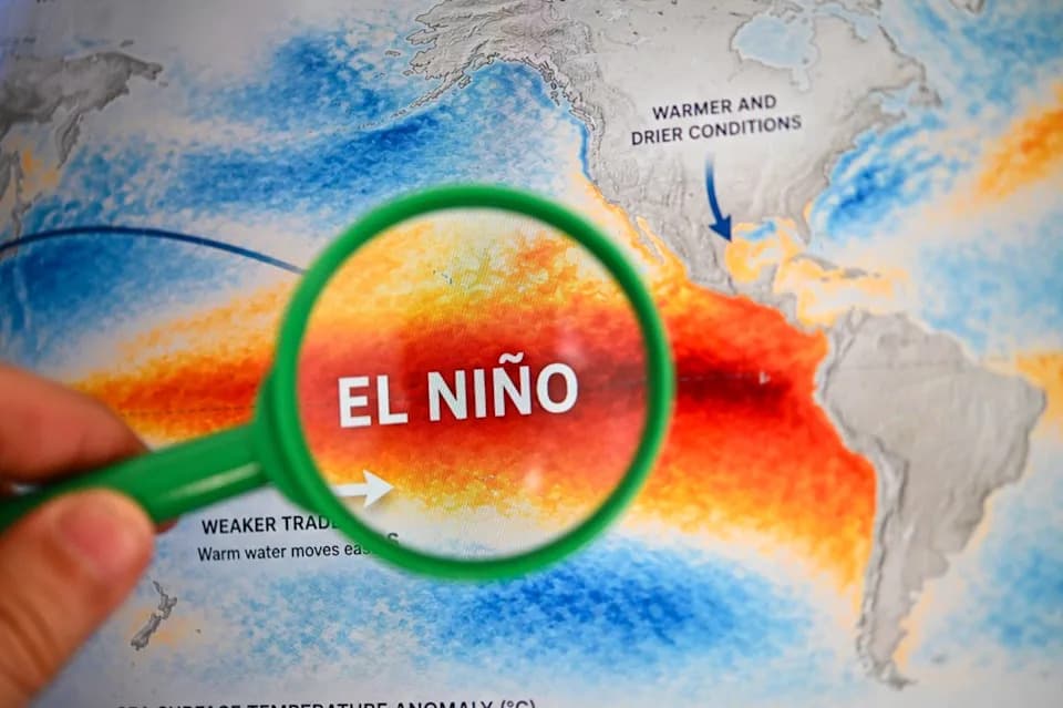
El Niño is the warm phase of the El Niño–Southern Oscillation (ENSO), a natural climate rhythm in the tropical Pacific. It begins when the east-to-west trade winds weaken, allowing warm water that normally accumulates in the western Pacific to flow back east and upwell at the surface. When these warmer-than-average surface temperatures persist for months, they alter storm patterns and atmospheric circulation, producing ripple effects around the globe.
Current Outlook
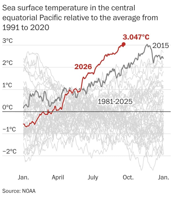
Daily sea-surface temperatures in the Nino 3.4 region — an index box in the central Pacific used to monitor ENSO — are currently about 2.6°C above a rolling 30-year average, according to the Climate Brink dashboard that synthesizes NOAA satellite and buoy data. Model guidance compiled there points to a possible peak anomaly near 3.9°C this November, substantially above the roughly 3.0°C anomaly seen in the 2015 event.
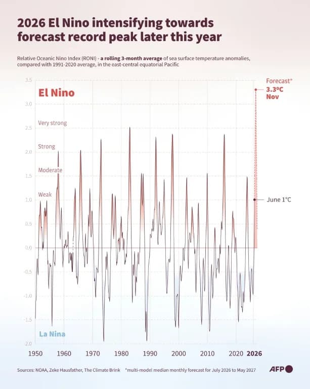
Forecasters estimate this El Niño could temporarily add roughly 0.3°C to global mean temperatures. Climate researchers Zeke Hausfather and Andrew Dessler calculate that, if forecasts verify, 2027 could reach about 1.76°C above preindustrial levels — roughly the warming otherwise expected around 2037 compressed into a single year. NOAA's Relative Oceanic Nino Index (RONI), which compares Nino 3.4 warming to the whole tropical belt, gives a 69% chance this will be the strongest event in its dataset back to 1950.
Impacts And The Role Of Climate Change
El Niño reshuffles weather patterns: some regions get hotter and drier, others cooler and wetter. Because a warmer atmosphere can hold more moisture, El Niño-linked rains tend to become heavier, while soils can dry out more rapidly in regions that experience suppressed rainfall. Those combined effects increase the risk of floods, landslides, droughts, crop losses and wildfires. Indonesia's recent prolonged dry season and large wildfires are already an example of how these impacts can unfold.
Scientists broadly agree that human-caused climate change amplifies El Niño's impacts. There is still ongoing research into whether climate change is making El Niño events themselves intrinsically stronger, but paleo records, extended instrument records and climate models suggest El Niño amplitude may have increased by roughly 10% over the past century, implying the cycle could be intensifying as the planet warms.
What To Watch
Key uncertainties remain: model spreads and the exact timing and spatial pattern of impacts mean not every expected effect will occur everywhere. Watch updates from NOAA, regional meteorological services and climate scientists as forecasts refine through the coming months. Even so, societies should prepare for elevated risks to water supplies, agriculture, wildfire seasons and infrastructure resilience if this El Niño peaks as projected.
Help us improve.