
Sentinel-6B launched on November 17, 2025, from Vandenberg as part of an international NASA-led effort with ESA, EUMETSAT and NOAA to continue a 30+-year sea-level record. The satellite will fly in tandem with Sentinel-6 Michael Freilich for about a year to cross-calibrate instruments and ensure data continuity. Equipped with Poseidon-4, AMR-C, GNSS, DORIS and a laser retroreflector, Sentinel-6B will survey roughly 90% of the ice-free oceans every 10 days and support coastal forecasting, climate research, and astronaut mission safety.
Sentinel-6B Launches to Preserve 30+ Years of Global Sea-Level Data — International NASA-Led Mission Begins Tandem Handover

Sentinel-6B satellite, encapsulated in the SpaceX Falcon 9 - NASA Kennedy Space Center/USSF 30th Space Wing/Jeremiah Fi/Wikimedia Commons
Sentinel-6B, a new Earth-observing satellite launched on November 17, 2025, from Vandenberg Space Force Base, begins a mission to continue and sharpen global sea-level monitoring. The project is an international effort led by NASA in partnership with the European Space Agency (ESA), EUMETSAT, and NOAA.
Why Sentinel-6B Matters
Sentinel-6B (also known as Jason-CS B) succeeds Sentinel-6 Michael Freilich (launched in 2020) to ensure an uninterrupted, 30+-year record of global sea-level measurements. As oceans warm and polar ice melts, even small increases in sea level can worsen storm surges and coastal flooding, making precise, continuous observations essential for climate science and community resilience.
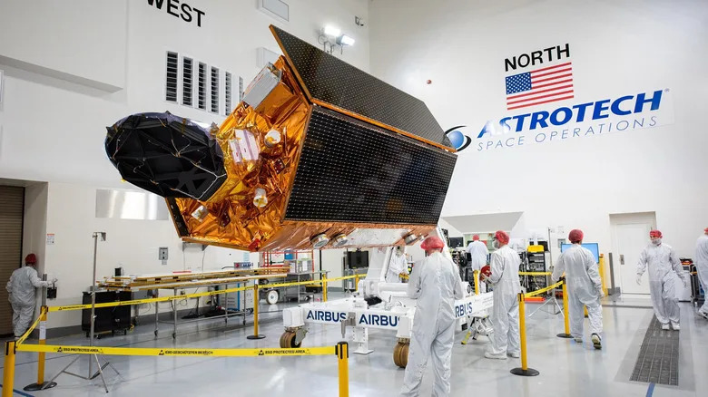
Sentinel-6B spacecraft on a work stand surrounded by technicians - NASA Kennedy Space Center/USSF 30th Space Wing/Roy Allison/Wikimedia Commons
Tandem Handover: Calibration and Continuity
The new satellite will fly in tandem with Sentinel-6 Michael Freilich for approximately one year, following nearly identical ground tracks. This overlap allows engineers and scientists to cross-calibrate instruments and validate measurements so the incoming data align seamlessly with the established baseline, preserving the integrity of long-term records.
"Understanding tidal patterns down to the inch is critical in protecting how we use our oceans every day on Earth," said Nicky Fox, Associate Administrator for NASA's Science Mission Directorate.
What’s On Board
Sentinel-6B carries proven and upgraded instruments designed for centimeter-level accuracy in sea-surface height measurements:
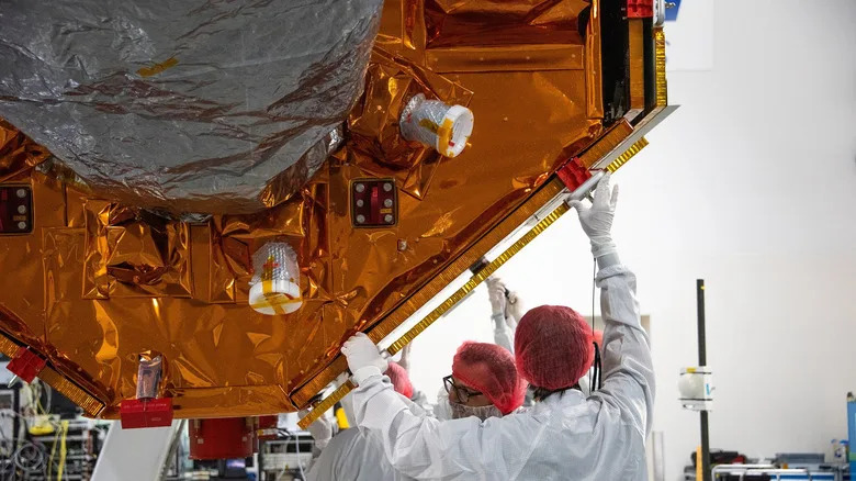
Technicians installing solar array covers for the Sentinel-6B - NASA Kennedy Space Center / USSF 30th Space Wing/Roy Allison
- Poseidon-4 Radar Altimeter: High-precision sea-surface height measurements.
- Advanced Microwave Radiometer for Climate (AMR-C): Corrects for atmospheric water vapor effects.
- Enhanced Orbit-Determination Suite: GNSS receivers, DORIS, and a laser retroreflector for improved positioning and measurement fidelity.
These systems enable Sentinel-6B to survey roughly 90% of Earth's ice-free oceans about every ten days.
Operations and Impact
After the handover, EUMETSAT will lead routine operations with its European and U.S. partners, and Sentinel-6B will become the primary satellite for global sea-level monitoring. The mission's data are critical for climate research, coastal forecasting, infrastructure planning, and operational needs such as supporting safe re-entry trajectories for astronaut missions, including future Artemis flights.
International Collaboration
The Sentinel-6 series exemplifies cooperation across agencies: pooling scientific expertise, technical infrastructure, and decades of ocean-observing experience produced a mission beyond the reach of any single nation. Sentinel-6B is both a direct successor and a meaningful upgrade—extending continuity while improving measurement reliability.
Bottom line: Sentinel-6B secures nearly three decades of continuous sea-level observations and strengthens the global ability to forecast coastal hazards and monitor long-term climate change.


