Scientists have launched four autonomous Saildrone Explorers to the equatorial Pacific as NOAA warns there is a 75% chance this El Niño could be the strongest since 1950. The saildrones will collect ocean and atmospheric measurements for about five months in a region where sea surface temperatures are the warmest on record for this time of year. Researchers hope the new data will improve forecasts, clarify short-term triggers like twin cyclones and Kelvin waves, and reveal how El Niño may change in a warming climate.
Historic El Niño Watch: Saildrone Fleet Deployed as Scientists Race to Understand a Warming Pacific
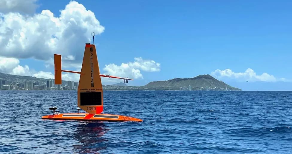
A Saildrone Explorer SD-1090 departs from Honolulu on August 21, 2026 on a multi-month mission to the equatorial Pacific 1,500 miles to the south. Four Saildrones will capture ocean and atmospheric data for scientists at NOAA’s Pacific Marine Environmental Laboratory.(Provided by Saildrone/NOAA)
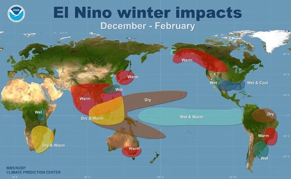
A potentially historic El Niño developing along the equator has prompted an international push to collect detailed ocean and atmospheric observations. NOAA's Sept. 10 update put the probability at about 75% that this event could exceed the strength of any El Niño since 1950, and scientists have deployed new tools to capture data in real time.
Why Scientists Are Watching
Rising sea surface temperatures in the central and eastern equatorial Pacific are already the warmest on record for this time of year, a key indicator of El Niño's development. Researchers say this is a rare opportunity to study how El Niño behaves in a warmer climate and to refine forecasts that affect water supplies, agriculture, energy systems and global weather patterns.
The Saildrone Mission
NOAA launched four autonomous Saildrone Explorers off Honolulu bound for the equatorial Pacific. The 23-foot, wind-propelled and solar-powered uncrewed surface vehicles carry 15 meteorological and oceanographic sensors that continuously measure temperature, salinity, carbon dioxide and ocean currents. Operators temporarily steered the drones away from the Hawaiian Islands when Hurricane Lowell approached, then resumed the mission. Once in place, the craft will collect observations for roughly five months.
What New Data Will Tell Us
Meghan Cronin, who leads the Ocean Climate Stations group at NOAA's Pacific Marine Environmental Laboratory, said the Saildrones will provide "a lot more information than we could see in any other way" about the air-sea processes fueling this El Niño. The mission is a collaboration among NOAA, the University of Washington and the Cooperative Institute for Climate, Ocean & Ecosystem Studies.
Lessons From the Past—and Open Questions
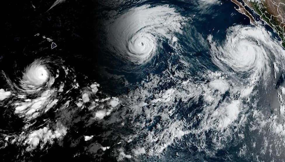
Michael McPhaden, a longtime El Niño researcher, recalls the surprise 1982 event that led to a decade-long push to build a sustained observing system. That network—now expanded and redesigned with satellites and ocean platforms—gives scientists continuous data streams they did not have in the early 1980s. Still, key questions remain about the short-term "sparks" that trigger an El Niño: why trade winds relax or shift, the role of twin cyclones or Kelvin waves, and how the Madden-Julian Oscillation and other disturbances contribute.
El Niño and Climate Change
Researchers including Emily Becker and Ben Kirtman emphasize that understanding how El Niño behaves in a warming world is a major unresolved problem. Jhordanne Jones of Penn State likens the global climate system to a melody: with climate change, that melody is shifting, and scientists need to know whether natural variability and extreme events are changing in character.
Why it matters: Better observations and forecasts can reduce societal impacts by improving preparedness for extreme weather, protecting food and water supplies, and informing energy and fisheries management around the world.
Reporting by Dinah Voyles Pulver for USA TODAY. Contact: [email protected].
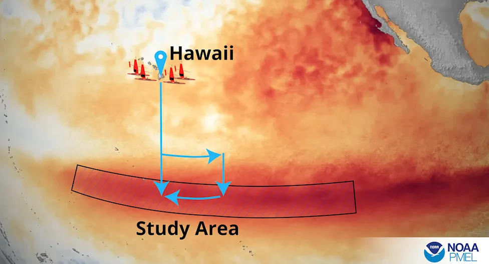
A small fleet of Saildrones are headed into the El Niño region of the Pacific Ocean on a mission for NOAA's Pacific Marine Environmental Laboratory to learn more about conditions during the event.(Provided by NOAA/Pacific Marine Environmental Laboratory)
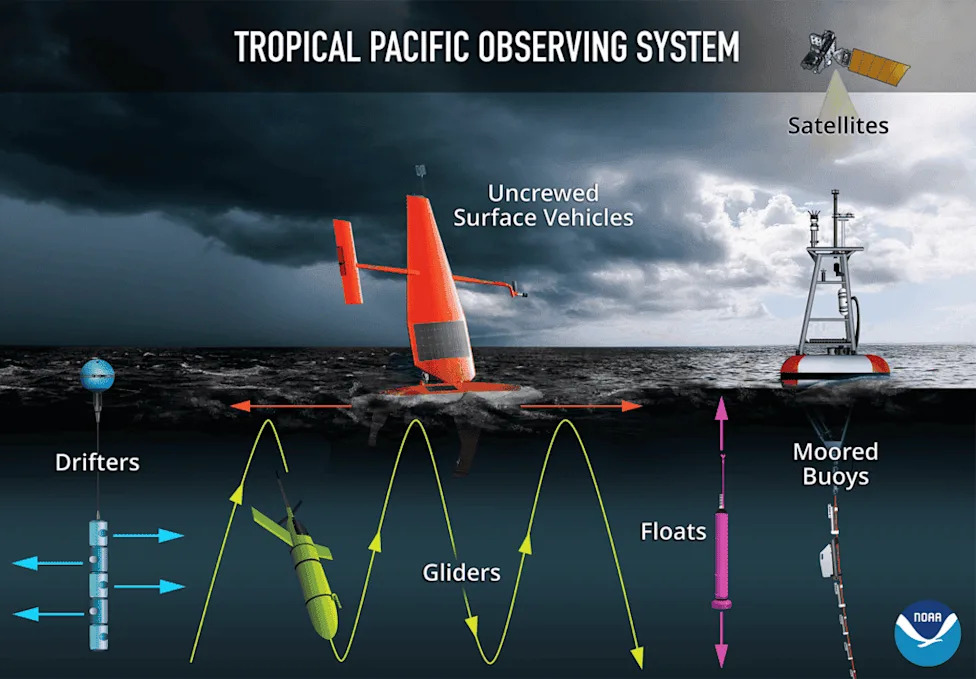
A depiction of the instruments used in the Tropical Pacific Observing System to help monitor El Niño and La Niña events.(Provided by NOAA/Pacific Marine Environmental Laboratory)
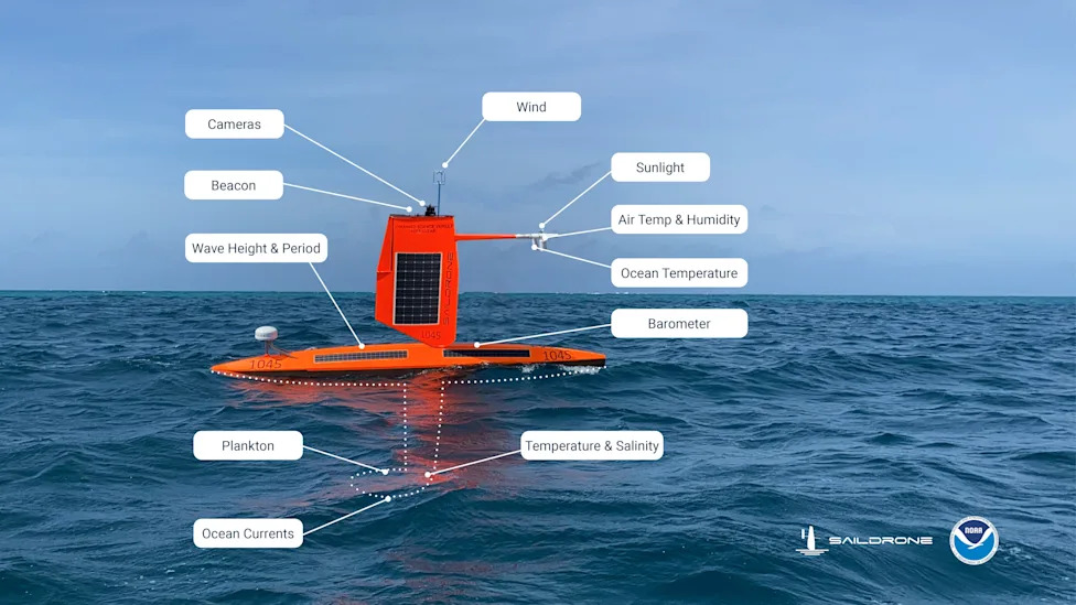
This graphic illustration shows the sensors carried by Saildrone explorers during their research missions.(Provided by Saildrone and NOAA)
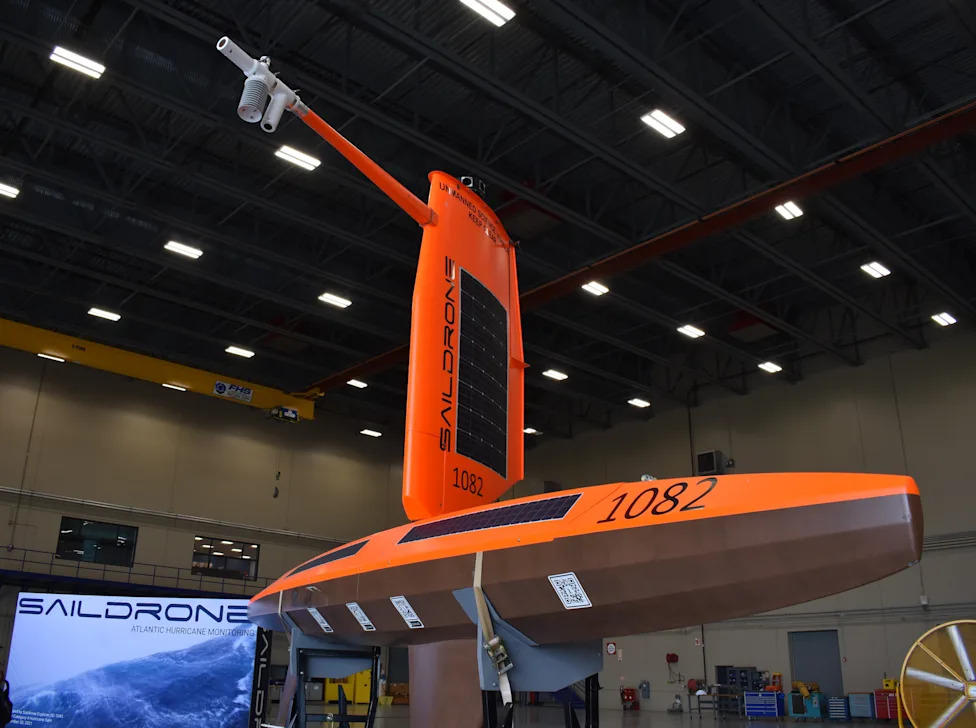
A Saildrone on display in NOAA's aviation hangar in Lakeland, Florida.(Dinah Voyles Pulver)
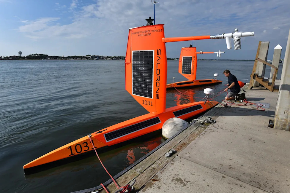
Richard Jenkins, founder and CEO of Saildrone, readies two drones to be towed into the Atlantic Ocean from a dock in Florida on July 23, 2021, hoping to measure conditions at the ocean's surface inside the eye of a hurricane in the Atlantic Ocean.(Bob Self/Florida Times-Union)
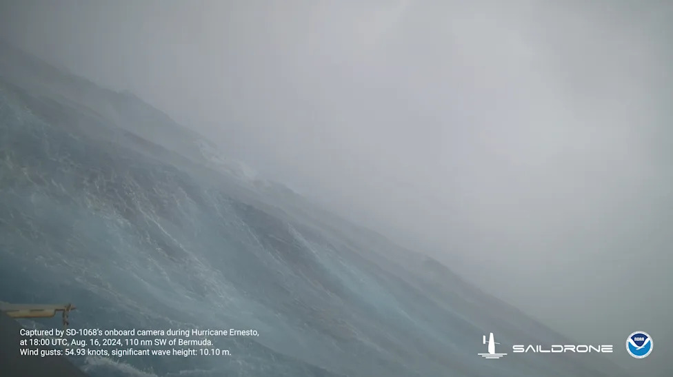
Hurricane Ernesto's big waves are captured on camera August 16 by a Saildrone Explorer about 126 miles south of Bermuda. Significant wave height (average height of the highest third of the waves) was more than 33 feet and wind gusts were roughly 63 mph.(Provided by Saildrone and NOAA.)
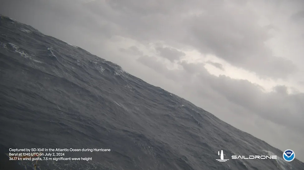
This Saildrone, sometimes called a robot surfboard, was sent to intercept the northern edge of powerful Hurricane Beryl on July 2, about 115 miles south of Puerto Rico.(Provided by Saildrone and NOAA)
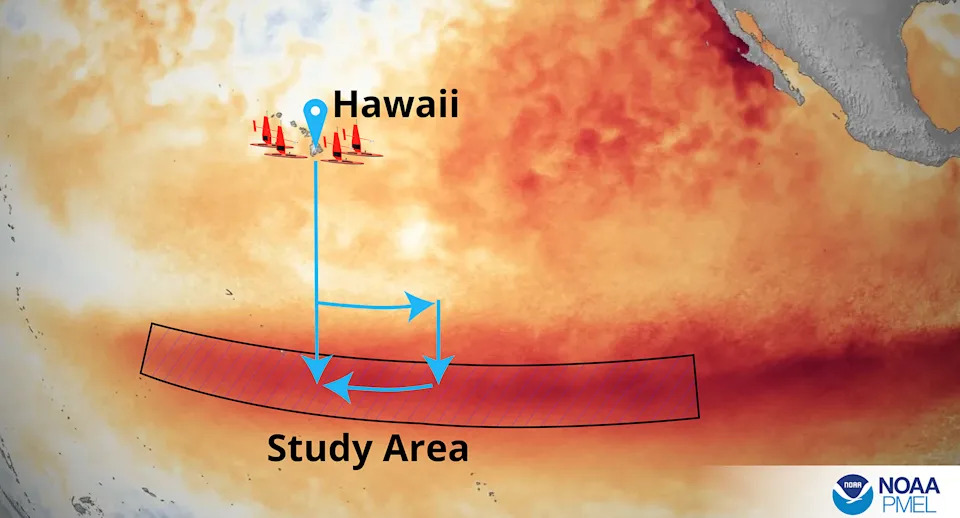
A small fleet of Saildrones are headed into the El Niño region of the Pacific Ocean on a mission for NOAA's Pacific Marine Environmental Laboratory to learn more about conditions during the event.
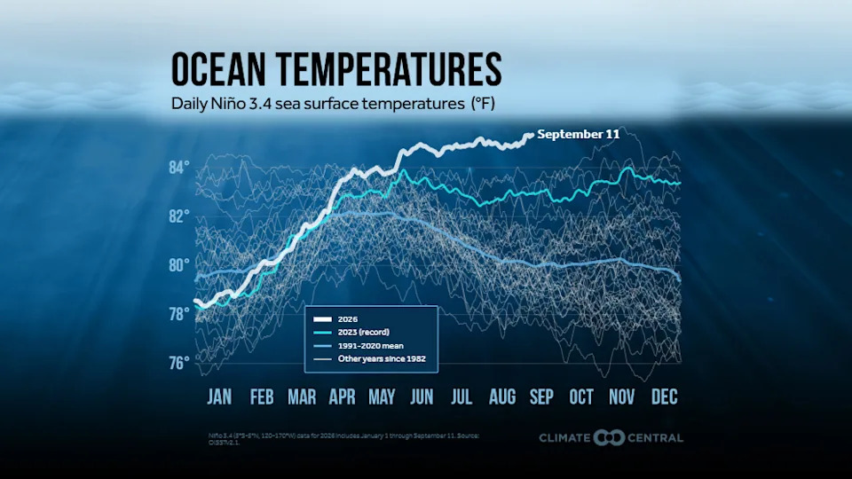
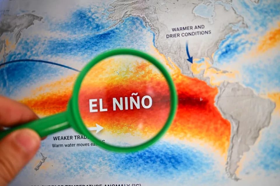
Sea surface temperatures are warmer than ever in the equatorial region of the Pacific Ocean where an El Niño is strengthening.
Help us improve.