A seven‑mile geometric pattern near the Bermuda Triangle, visible in Seabed 2030 products, has been shared as a "sunken city" but most likely reflects interpolation or rendering artifacts in bathymetric data. Scott C. Waring promoted the claim without providing archaeological or geological evidence, and no experts have verified the site. NOAA rejects sensational Bermuda Triangle explanations, noting documented incidents have conventional explanations. Independent sonar surveys, underwater imaging, and recovered artifacts would be required to confirm any true discovery.
Seven‑Mile 'Sunken City' Near the Bermuda Triangle Is Almost Certainly a Mapping Artifact
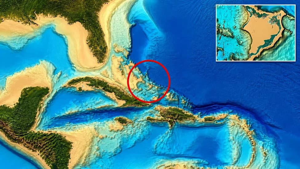
Image: Seabed2030 via Dailymail
A striking seven‑mile geometric pattern visible in Seabed 2030 ocean maps off Cuba and Haiti has been shared online as evidence of a "sunken city." The most likely explanation, however, is far less cinematic: the pattern appears to be a rendering or interpolation artifact in processed bathymetric data, not an archaeological site.
What Was Claimed
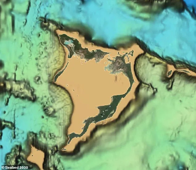
Scott C. Waring, who describes himself as a UFO researcher, posted images showing faint parallel and intersecting lines that form a roughly seven‑to‑eight‑mile by three‑mile pattern on public Seabed 2030 material. He suggested the lines could mark a submerged human settlement — or even an alien structure — possibly exposed after seismic activity. He offered no archaeological finds, field surveys, or geological analysis to support those ideas.
Why The Pattern Probably Isn't A City
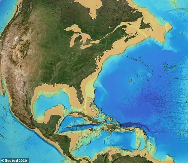
Seabed 2030 is an important global effort to map the world’s seafloor by 2030 using a combination of direct sonar surveys, satellite-derived estimates and computer interpolation to fill gaps where high‑resolution sonar is lacking. Those interpolation and smoothing methods can produce unnaturally straight lines, grid patterns and other geometric artifacts that reflect the mathematics behind the maps rather than physical features on the seabed. In other words: sometimes you're looking at the math, not rock or ruins.
What Would Be Needed To Verify A Real Discovery
- High-resolution, independent multibeam sonar surveys of the site
- Underwater video or photography from remotely operated vehicles (ROVs) or submersibles
- Physical artifacts (worked stone, pottery, tools) recovered and analyzed by qualified archaeologists
Official Response And Context
NOAA has pushed back against sensational Bermuda Triangle framing: there is no evidence that disappearances are more frequent in the Bermuda Triangle than in other busy ocean areas, and incidents are better explained by storms, the Gulf Stream, shallow shoals and human error.
No credentialed archaeologists or marine scientists have publicly examined Waring's site in a way that validates the claim. That absence of expert, on‑site verification is the central fact to bear in mind.
Why This Still Matters
About eighty percent of the ocean floor remains poorly mapped, and genuine discoveries are being made as coverage improves. That makes seafloor science an exciting frontier — and also a place where visually compelling but misleading map artifacts can spread quickly online. Developing a critical eye for how bathymetric data are produced is essential: as mapping improves, distinguishing real submerged features from algorithmic artifacts will become easier and more important.
Help us improve.