New modeling by Cotality, supported by Headwaters Economics, shows neighborhoods themselves can carry wildfire risk: structure-to-structure spread can push exposure deep into cities and suburbs. More than 2.5 million U.S. properties face moderate or greater risk, representing nearly $1.4 trillion in reconstruction value. Experts say home hardening helps dramatically, but communitywide building codes, land-use policies and adequate insurance are essential to close the protection gap.
The $1.4 Trillion Wildfire Risk Hiding Inside American Neighborhoods
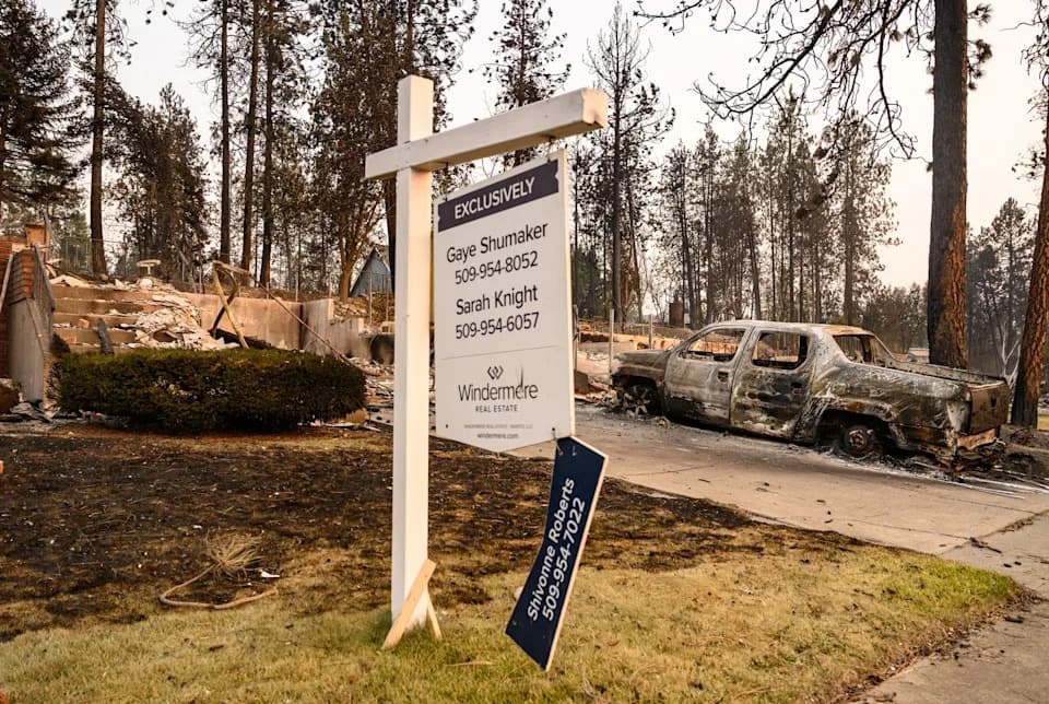
Spokane, WA, is among roughly 1,100 U.S. communities identified by Headwaters Economics as having conditions that could leave them vulnerable to an urban conflagration, where fire can spread from structure to structure. (AFP via Getty Images)
Claire O'Connor could not imagine her Pacific Palisades, Calif., home burning — even after her insurer canceled her policy in November 2024. "I mean, as if our house is going to burn down," the Los Angeles real estate agent recalled. The house sat in a conventional suburban block, not at the edge of a forest. Two months later, O'Connor lost her home in the Palisades fire — one of more than 4,700 properties partially or completely destroyed.
Neighborhoods As Fuel
New analysis from Cotality in its 2026 Wildfire Risk Report, reinforced by research from Headwaters Economics, reveals a sobering reality: developed neighborhoods themselves can become conduits for wildfire. Once flames or embers reach built-up areas, structures can ignite one another and drive risk deep into places many homeowners assume are safe.
"Homes are fuel for fire," said Ryan Handy, a wildfire and land-use expert and program manager for Headwaters Economics' Community Planning Assistance for Wildfire program. "They spread wildfire through communities — in some cases, much more effectively than trees do."
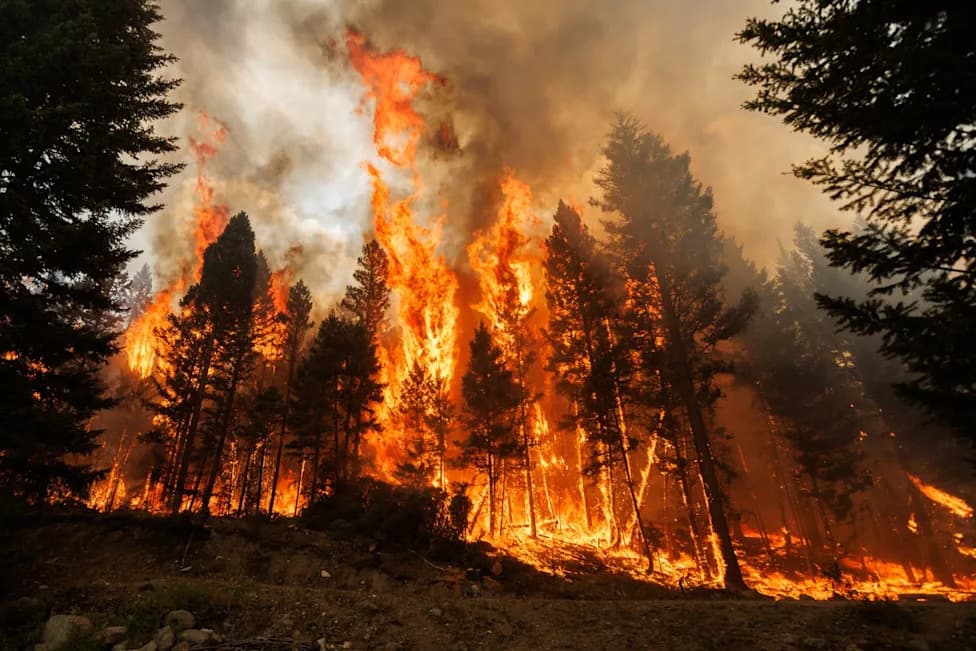
Wind-blown embers can travel miles ahead of the main fire front and land on highly flammable surfaces — roofs, decks, woodpiles, and porch furniture — igniting structures before the blaze's perimeter arrives. That helps explain why entire blocks are sometimes reduced to foundations while nearby trees remain standing.
How Big Is the Exposure?
Cotality finds that across the 10 states with the largest counts of properties at moderate or greater wildfire risk, more than 2.5 million parcels meet that threshold. Together, those properties account for nearly $1.4 trillion in combined reconstruction cost value.
When Cotality added "conflagration potential" — the chance that fire will spread from structure to structure — some parcel risk scores rose by as much as 40 points. That shift can push meaningful wildfire exposure deeper into urban and suburban blocks that legacy models might label relatively safe.
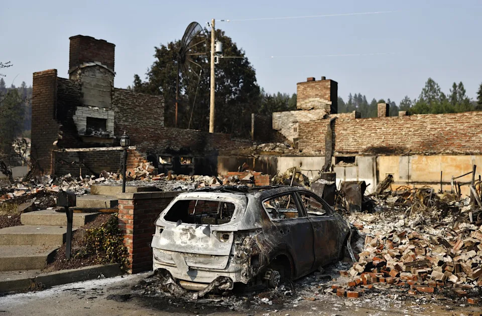
As of Aug. 10, the three major Spokane-area fires were no longer spreading after the blazes scorched roughly 10,000 acres and damaged or destroyed more than 900 homes. (Mario Tama/Getty Images)
Metro Hot Spots
California dominates the list: six of the 10 metropolitan areas with the largest numbers of exposed properties are in the state. Los Angeles leads with nearly 250,000 properties representing more than $209 billion in reconstruction cost value. Riverside and San Diego are also high on the list; Sacramento, San Francisco and Oxnard also appear among the top ten. Outside California, Austin, Texas, ranks fourth overall, with over 100,000 exposed properties totaling roughly $49.2 billion in reconstruction value.
Community Scale Solutions Matter
Individual home hardening helps. Cotality's analysis of 6.8 million single-family homes shows the top 10% of mitigated homes had expected losses roughly 78% below the statewide average, while the bottom 10% faced expected losses more than 10 times the average. Key measures include maintaining a 0–5 foot noncombustible zone around a foundation and installing a verified Class A roof.
But Handy and Cotality emphasize limits to what one property owner can do. Wildfire behaves like a community-scale hazard: a neighbor's burning home can expose yours to radiant heat, flames, and embers that travel far beyond the immediate block. For that reason, building codes, landscaping rules, defensible-space standards and other communitywide land-use policies are essential parts of resilience.
Financial Risk And The Protection Gap
Cotality warns of a widening "protection gap" between insurance limits and true replacement costs. Years of construction inflation can leave policy limits trailing actual rebuilding costs, while post-disaster surges in demand for labor and materials can push prices still higher. O'Connor, after being dropped by a private insurer, obtained coverage through the California FAIR Plan with a supplemental wraparound policy. It helped, but displacement and rental costs left her and her family undercovered — a frequent outcome for many homeowners after large fires.
What Homeowners And Communities Should Do
- Assess Structure Risk: Look beyond vegetation and evaluate how nearby homes, roofs and decking could act as fuels.
- Harden Homes: Prioritize Class A roofing, ember-resistant vents, and a noncombustible perimeter around foundations.
- Push For Community Standards: Support codes and landscaping regulations that reduce structure-to-structure spread.
- Review Insurance: Check replacement-cost limits and consider affordability of post-loss living expenses.
O'Connor's story is a stark reminder: rows of houses that once felt like a buffer can, under the wrong conditions, become a pathway that carries fire to your street. Addressing that risk requires both household actions and coordinated, neighborhood-scale policies.
Help us improve.