NASA released paired panoramic mosaics from Curiosity and Perseverance that highlight starkly different Martian terrains. Curiosity’s 1,031-image panorama shows younger foothill landscapes and boxwork ridges near Mount Sharp, while Perseverance’s 980-image mosaic focuses on ancient rocks around Jezero Crater’s rim. Perseverance reported a potential biosignature in Sept. 2025, and Curiosity has drilled 42 powdered samples as it climbs Mount Sharp. Together the rovers help reconstruct Mars’ change from a wetter world to the dry planet seen today.
Two Rovers, Two Worlds: NASA’s Curiosity and Perseverance Reveal Contrasting Martian Landscapes
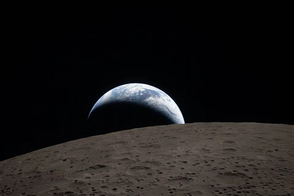
The crew of Artemis II captured a breathtaking image of a celestial event known as an "Earthset," in which the Earth dropped below the lunar horizon. The image is reminiscent of the iconic "Earthrise" photo that NASA astronaut Bill Anders captured in 1968 during the Apollo 8 mission that showed our planet rising on the lunar horizon.
NASA currently operates two car-sized robotic explorers on Mars — Curiosity and Perseverance — and recent side-by-side panoramas highlight how different the terrains they are studying truly are. Though both rovers search for clues about Mars’ past habitability, they traverse landscapes separated by some 2,300 miles and by billions of years of geologic history.
Panoramas Capture Contrasting Terrains
To showcase those differences, NASA released paired panoramic mosaics created from hundreds of images taken between late 2025 and early 2026. Curiosity’s 360-degree panorama was assembled from 1,031 images shot between Nov. 9 and Dec. 7, 2025, revealing foothill terrain marked by intricate boxwork ridges. Perseverance’s mosaic, composed of 980 images taken between Dec. 18, 2025, and Jan. 25, 2026, focuses on "Lac de Charmes" just outside the rim of Jezero Crater and highlights the crater rim’s very ancient rocks.
Perseverance: Jezero Crater Rim
Launched in 2020, Perseverance completed a roughly 200-day, 300-million-mile cruise and landed in Jezero Crater in February 2021. Scientists estimate Jezero formed about 3.9 billion years ago and likely once hosted water. At the end of 2024, after exploring lower areas inside Jezero, Perseverance climbed onto the crater rim to sample higher, older rocks. The rover’s investigations target signs of ancient microbial life and other relics from Mars’ earliest epochs; it has also observed atmospheric features such as dust devils. In September 2025, NASA reported that Perseverance collected a rock sample containing a potential biosignature, a discovery that has driven further study and excitement in the scientific community.
Curiosity: Gale Crater and Mount Sharp
Curiosity launched in November 2011 and landed in Gale Crater in August 2012. Gale lies at the boundary between the cratered southern highlands and smoother northern plains and is believed to have formed roughly 3.7 billion years ago. Over more than a decade, Curiosity has climbed the slopes of Mount Sharp (about three miles high) and has collected 42 powdered rock samples with its drill. Its recent panorama highlights boxwork formations and other features that help scientists reconstruct younger episodes of Martian geology and the planet’s past habitability, including detections of previously unseen organic compounds.
Why These Missions Matter
Although modern Mars is cold and dry, geological evidence shows it once had water and environments that might have supported life. By sampling diverse terrain — from Jezero’s ancient rim to Gale’s layered foothills — Perseverance and Curiosity provide complementary windows into Mars’ transformation from a wetter world to the arid planet we see today. The new panoramas give scientists and the public striking visual context for the different scientific questions each rover is addressing.
What’s next: Both rovers continue methodical exploration, imaging and caching samples for future studies. Their combined datasets will refine our understanding of Martian environments and help prepare for future missions, including sample return and eventual crewed exploration.
Article source: USA TODAY (reporting by Eric Lagatta) and NASA mission releases.
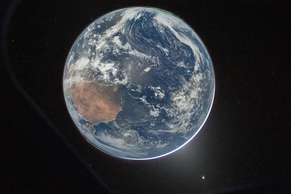
Artemis II Commander Reid Wiseman of NASA took this stunning photograph of Earth from the Orion spacecraft's window on April 2. The image is reminiscent of the iconic "blue marble" image captured during the Apollo 17 mission in 1972.
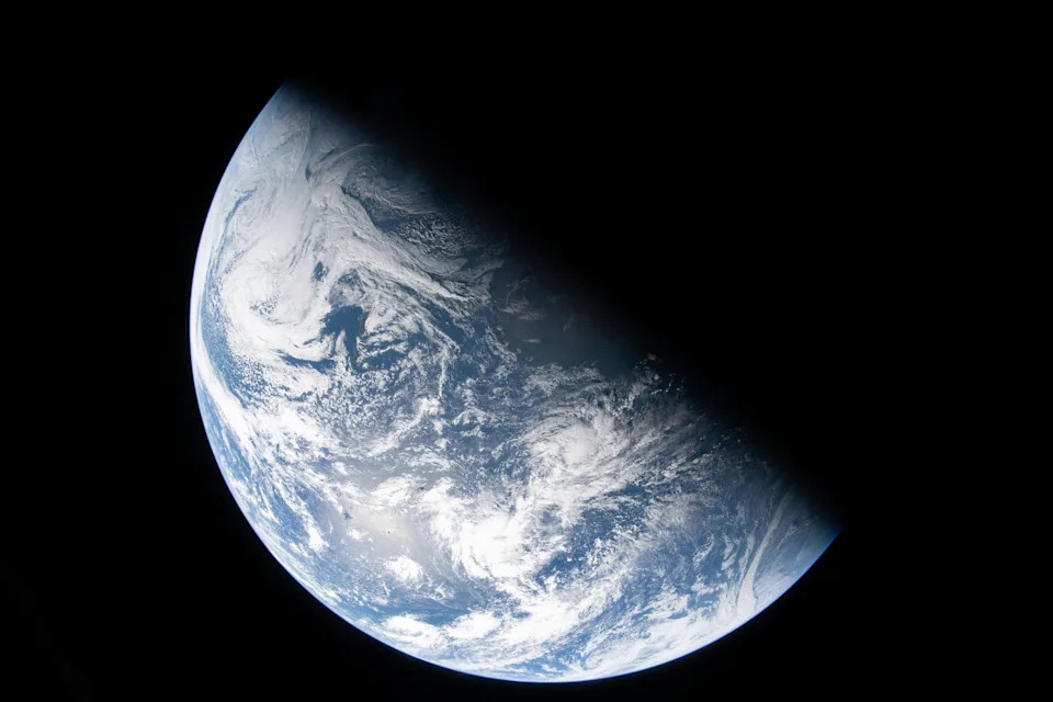
In this new image from the Artemis II crew, NASA explains that what is depicted is the "divide between night and day, known as the terminator, cutting across Earth."
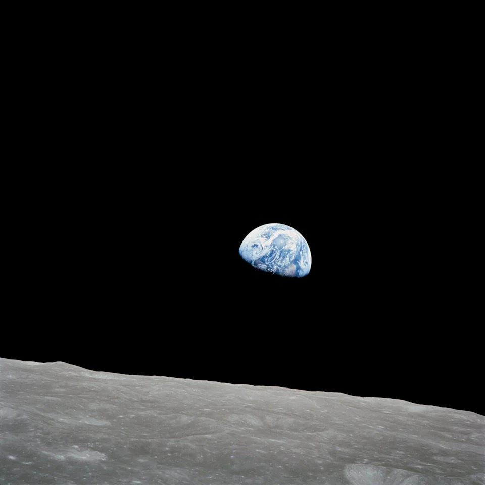
William Anders, a NASA astronaut on the historic Apollo 8 mission around the moon, took the iconic “Earthrise” photo while in lunar orbit on Dec. 24, 1968.
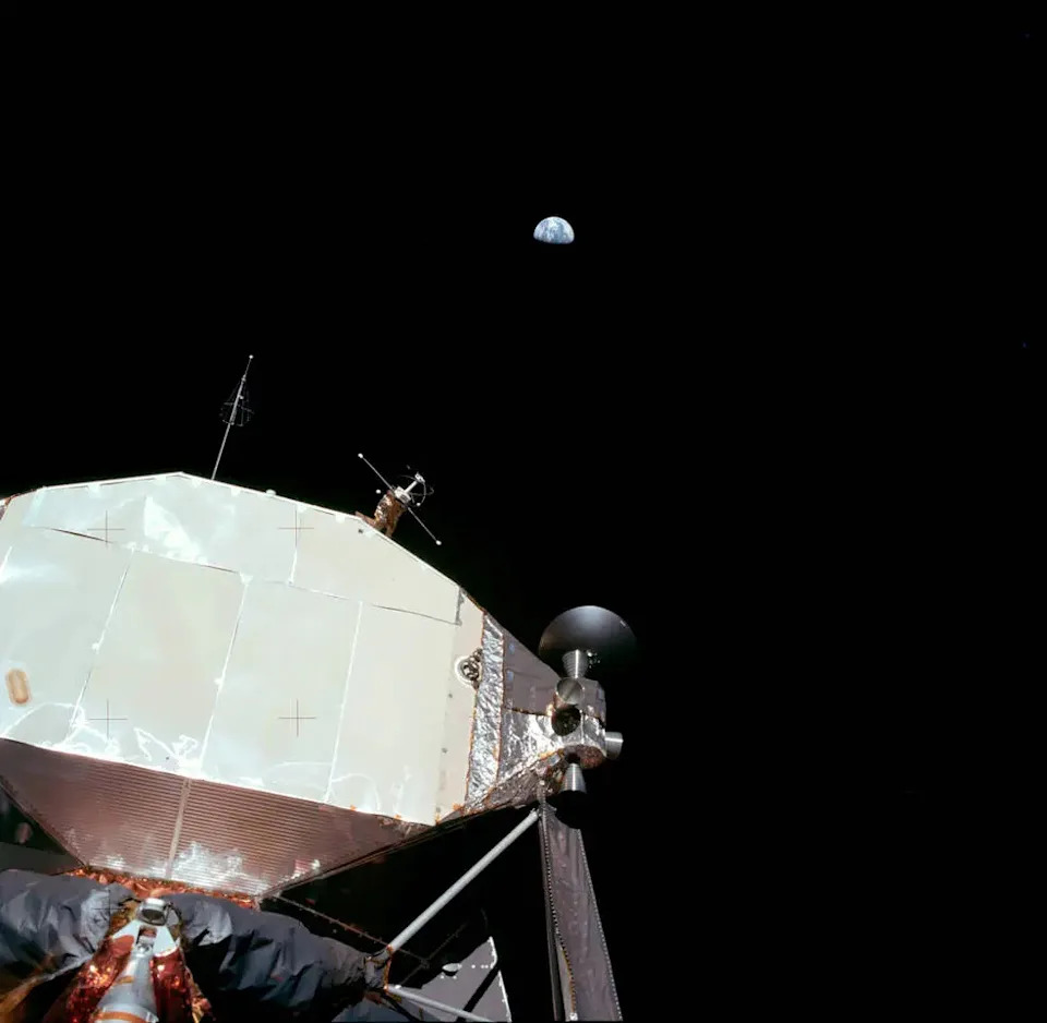
The first photograph of the Earth taken by an astronaut standing on the lunar surface, taken during the Apollo 11 Moon landing in 1969.

One of the most well-known photographs of Earth, the "blue marble" image was taken by the crew of the final Apollo mission (Apollo 17) as the crew made its way to the moon in 1972.
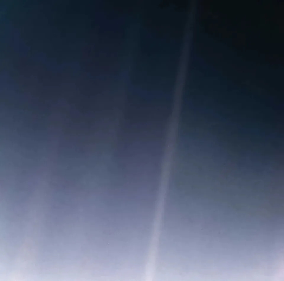
Voyager 1's 1990 photo of Earth, widely referred to as the "pale blue dot," was taken at a distance of 3.7 billion miles from the sun, making it the first photo taken beyond all the planets in our solar system. This image was created in 2020 or the 30th anniversary of the iconic picture using modern image-processing software and techniques to revisit the well-known Voyager view.
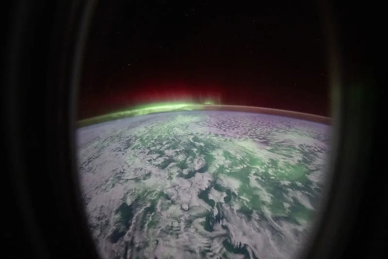
Because the International Space Station orbits so close to Earth's atmosphere (about 250 miles high,) the outpost and the astronauts who have lived aboard it have been the source of plenty of spectacular photos of our planet for 25 years. This recent photo, taken April 6, 2026, shows auroras glowing over the Indian Ocean.

NASA astronaut Chris Williams is pictured outside the International Space Station during a March 18, 2026 spacewalk with Earth in the background.

The devastating Hurricane Milton, a Category 4 storm at the time of this photograph, is pictured Oct. 8, 2024 in the Gulf of Mexico (renamed the Gulf of America) off the coast of Yucatan Peninsula from the International Space Station as it orbited 257 miles above.
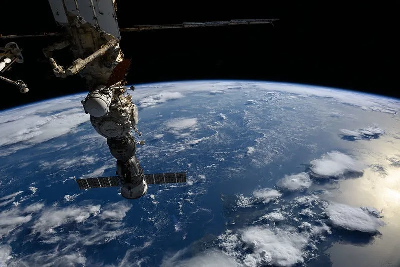
The Soyuz MS-27 crew spacecraft is pictured Sept. 14, 2025 docked to the International Space Station's Prichal module as the orbital outpost soared 257 miles above a gleaming blue Atlantic Ocean, north of the Dominican Republic.
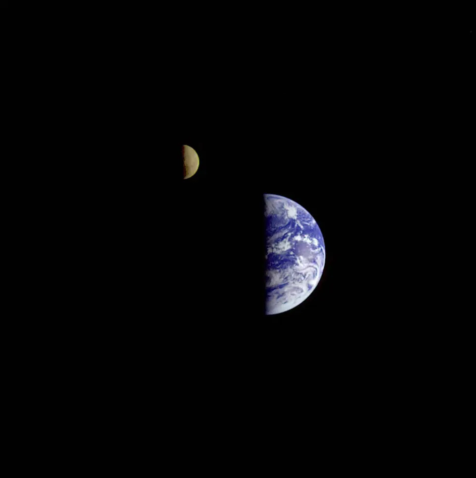
On December 16, 1992, eight days after its encounter with Earth, the Galileo spacecraft looked back from a distance of about 3.9 million miles to capture this remarkable view of the moon in orbit about Earth.
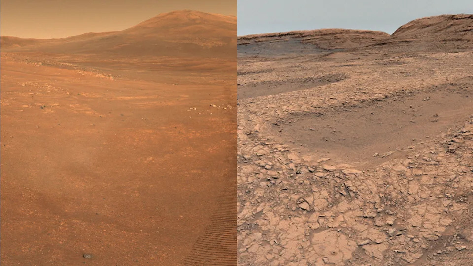
A side-by-side image shows two areas of Mars taken by NASA's two rovers on the planet about 2,300 miles apart. On the left is a panorama taken by the Perseverance rover as it travels on the rim of the Jezero Crater. On the right is an image from the Curiosity rover as it roams the Gale Crater.
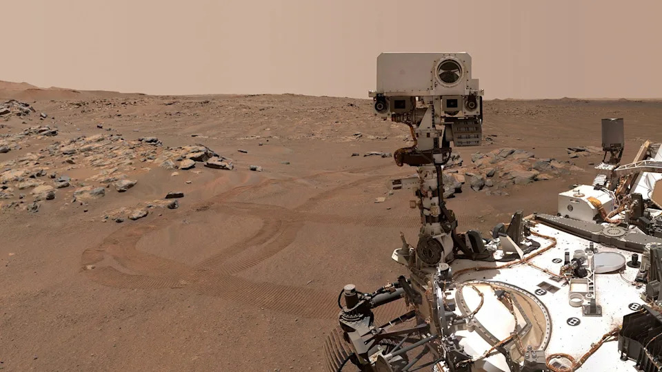
NASA’s Perseverance Mars rover is seen in a "selfie" that it took over on Sept. 10, 2021. Perseverance rover, along with Curiosity, is one of the agency's two car-sized robots exploring the Martian surface for signs that the planet was once habitable. And in September, NASA officials confirmed that one of the rovers’ finds contained a potential biosignature.
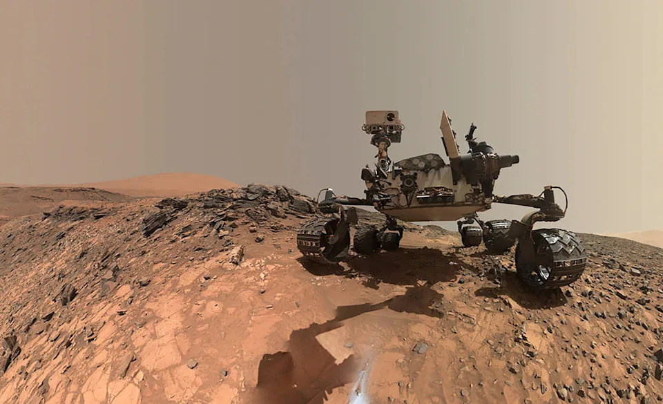
NASA's Curiosity Mars rover is seen at the site from which it reached down to drill into a rock target called 'Buckskin' on lower Mount Sharp in this low-angle self-portrait taken August 5, 2015 and released August 19, 2015. The selfie combines several component images taken by Curiosity's Mars Hand Lens Imager (MAHLI).
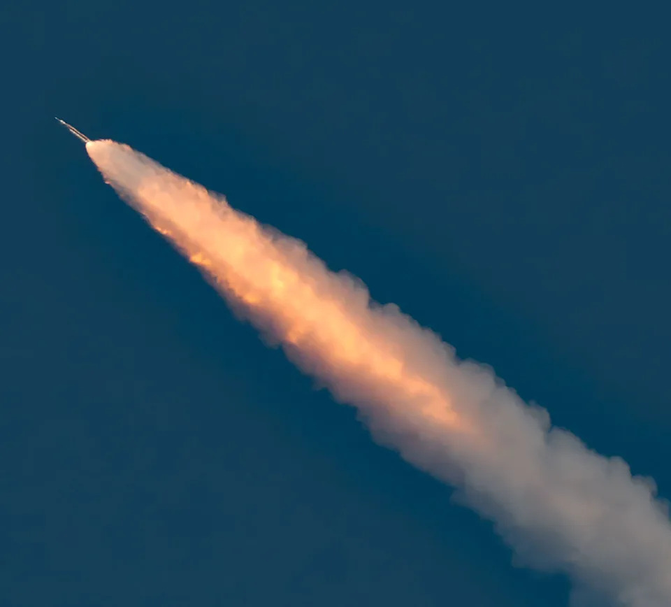
The Artemis II mission launches April 1 from the Kennedy Space Center in Cape Canaveral, Florida. The four-person crew aboard the Orion spacecraft hitched a ride to orbit atop NASA's giant 322-foot Space Launch System rocket. Launching atop 8.8 million pounds of thrust, the SLS is the most powerful rocket NASA ever launched, about 17% more powerful than the iconic Saturn V rocket used during the Apollo era.
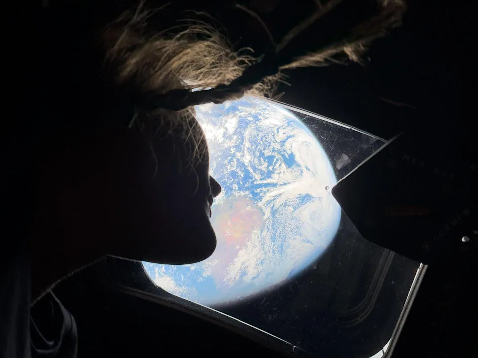
NASA astronaut Christina Koch, a mission specialist on Artemis II, gazes out the windows of the Orion vehicle back at Earth as she and the crew head toward the moon. Koch, who already holds several NASA records from her first spaceflight in 2019 to the International Space Station, became the first woman to fly on a lunar mission.
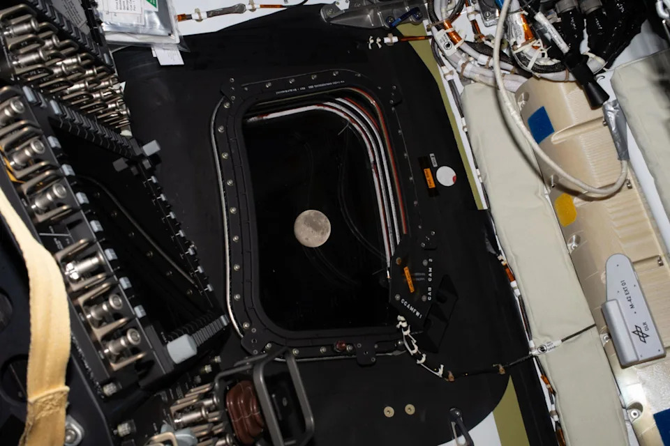
Before going to sleep April 5, the Artemis II crew snapped one more photo of the moon, as it drew close in the window of the Orion spacecraft. Shortly after, the astronauts entered the lunar sphere of influence, where the pull of the moon's gravity became stronger than Earth's.
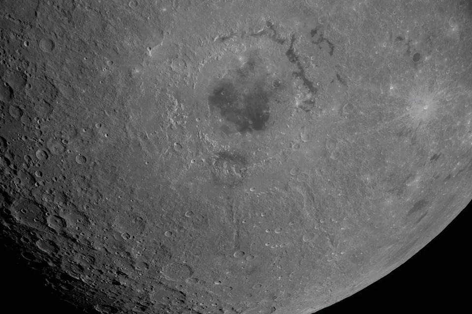
Of the impact craters, ancient lava flows and other lunar features the Artemis II astronauts observed during an April 6 flyby, a crater known as the Orientale basin was perhaps the most prominent. Spanning nearly 600 miles, the 3.8 billion year old crater (seen in the upper center of this photo) had never been seen with the naked eye prior to the mission.
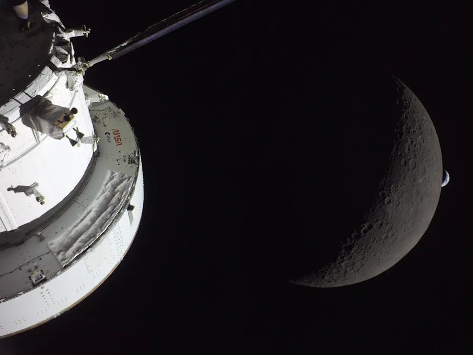
The Orion spacecraft the Artemis II astronauts were aboard is captured in the same frame as both the moon and Earth in this photo captured about four hours into the historic April 6 flyby.
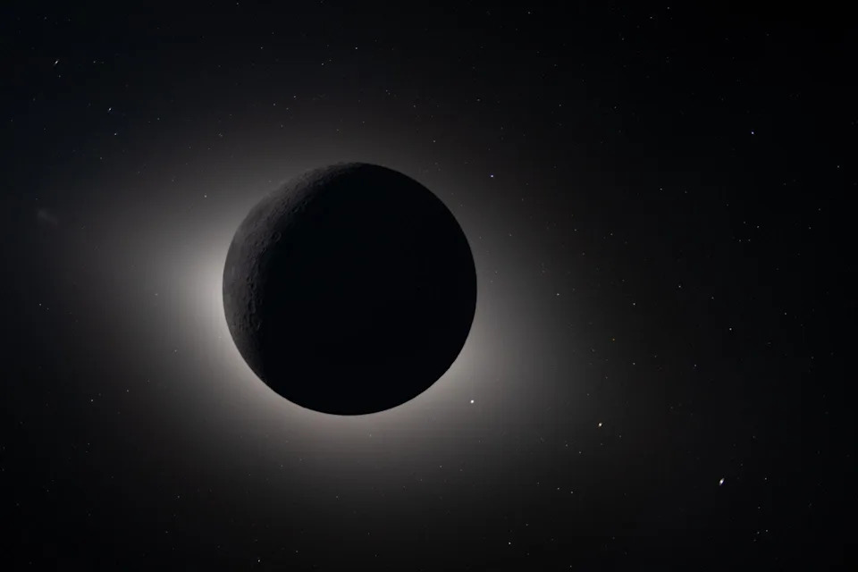
This image shows the moon fully eclipsing the sun from the vantage of the Orion spacecraft, not unlike what millions of people witnessed in April 2024 from Earth. From the crew’s perspective, the moon appeared large enough to completely block the sun, creating nearly 54 minutes of totality and revealing our star's elusive outermost layer, known as the corona.

The crew members of Artemis II embrace following the historic lunar flyby April 6, during which the astronauts flew farther from Earth than anyone in human history while seeing sights of the moon's far side never seen in person.
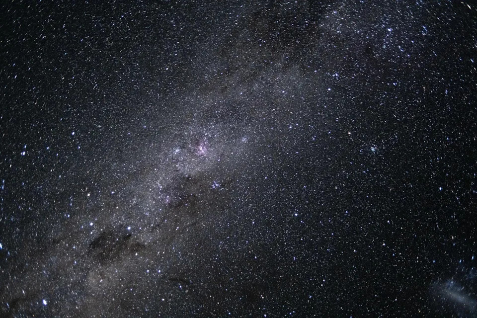
The Artemis II crew captured this breathtaking photo of our galaxy, the Milky Way. Spanning more than 100,000 light-years, Earth is located along one of the galaxy’s spiral arms, about halfway from the center.
Help us improve.