
Nearly 5 trillion gallons (≈19 trillion liters) of rain fell across parts of Washington in one week, driven by atmospheric rivers strengthened by warm Pacific waters and a chain of unusual weather patterns stretching back to tropical cyclone flooding near Indonesia. The heaviest rains are expected to linger into late Thursday or early Friday, and the West Coast may face continuing moisture through the week of Christmas. Scientists say a strong Madden–Julian Oscillation, a northward push from a California ridge, and temperature anomalies from Russia to Alaska focused the storms on Washington—while climate change is making such events larger and wetter.
Unprecedented Atmospheric Rivers Dump Nearly 5 Trillion Gallons of Rain on Washington

Maery Schine, 11, is helped out of a rescue boat by rescue workers with Chehalis Fire after evacuating with her father Patric, second from left, following flooding after heavy rains in the region Tuesday, Dec. 9, 2025, in Chehalis, Wash. (AP Photo/Lindsey Wasson)(ASSOCIATED PRESS)
Warm seas and a chain of unusual weather patterns have supercharged atmospheric rivers that dumped nearly 5 trillion gallons (about 19 trillion liters) of rain across parts of Washington state in the past week, meteorologists said.
The heaviest, most persistent downpours are expected to continue soaking the same areas into late Thursday and early Friday morning before the main river of moisture weakens and shifts. Officials warn the broader West Coast could remain under a near-continuous stream of moisture—described by forecasters as a 'fire hose'—through the week of Christmas.
What Are Atmospheric Rivers? Atmospheric rivers are long, narrow corridors of water vapor that form over the ocean and transport tropical moisture to higher latitudes. The Pacific Northwest typically sees a couple dozen each year, more than much of the rest of the U.S. West Coast, but this recent sequence has been unusually large and sustained.
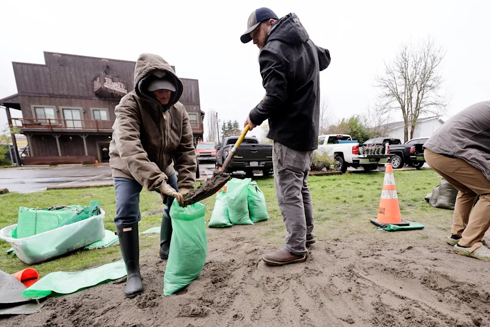
Deanna and Troy Thomas fill sandbags for their home to keep out water from potential flooding due to heavy rains, Wednesday, Dec. 10, 2025, in Orting, Wash. (AP Photo/John Froschauer)(ASSOCIATED PRESS)
Rains on Wednesday, combined with heavy precipitation earlier in the week, prompted forecasts of potential record flooding, particularly along the Skagit River, which flows through northern Washington into Puget Sound, said Washington state climatologist Guillaume Mauger.
“The atmospheric rivers are continually reloading,” said former NOAA chief scientist Ryan Maue, now a private meteorologist. He estimated rainfall over a recent three-week span could reach roughly 20 to 30 inches (51 to 76 cm), calling that amount “quite extreme.”
Using rain-gauge data, Maue calculated that nearly 5 trillion gallons fell across the region in the past week—enough to fill Oregon's Crater Lake or more than 18,000 Empire State Buildings. One weather station on Mount Rainier recorded 21 inches (53 cm) of rain since Thursday, according to the National Weather Service's western region acting science chief Matt Jeglum.
Meteorologist Jeff Masters (Weather Underground/Yale Climate Connections) said much of the moisture feeding these storms originated a few hundred miles north of Hawaii, where sea-surface temperatures have been a couple of degrees warmer than normal. Warmer ocean and air temperatures allow atmospheric rivers to carry and drop more moisture, meaning more rain rather than snow at elevations that would normally see snowfall.
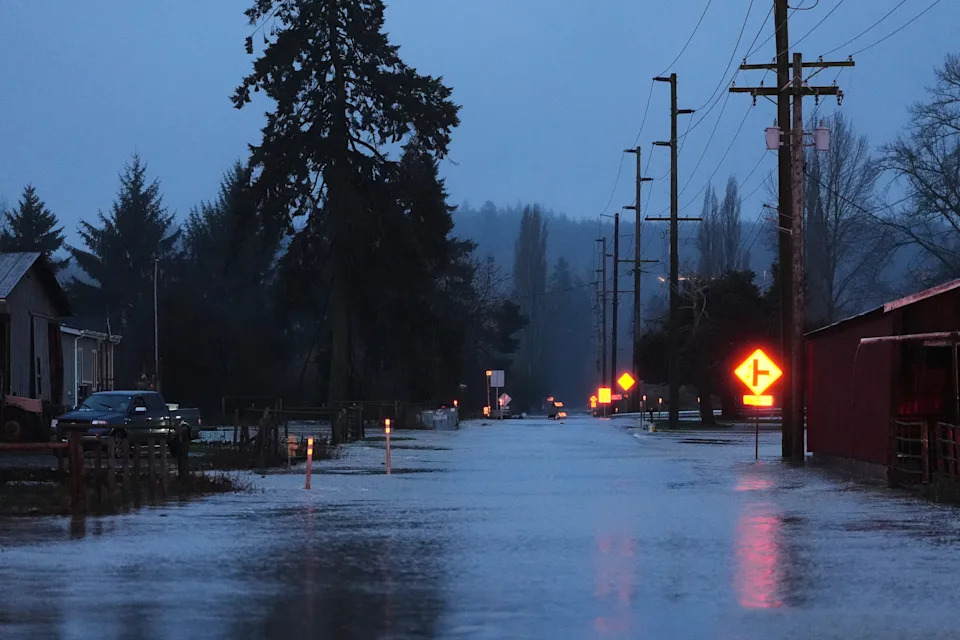
A flooded road is seen after heavy rains in the region, Tuesday, Dec. 9, 2025, in Chehalis, Wash. (AP Photo/Lindsey Wasson)(ASSOCIATED PRESS)
Scientists say the chain of events began farther west. Deadly tropical cyclone flooding near Indonesia combined with an unusually strong Madden–Julian Oscillation (a roughly 30-day shifting tropical weather pattern) helped send an unbroken line of moisture and energy eastward. A high-pressure ridge off California pushed the rivers northward, while an unusual pattern of warmth over Russia and cold over Alaska further funneled the system into Washington, making the state a meteorological bullseye.
Climate Context. Studies and climate models indicate that in a warmer world driven by burning fossil fuels, atmospheric rivers tend to become larger and wetter. A recent study found that, since 1980, these storms in the region have increased the area they soak by about 6%–9%, increased in frequency by 2%–6%, and become slightly wetter. A Climate Central analysis found ocean temperatures beneath these atmospheric rivers are roughly 10 times more likely to be warmer than normal because of human-caused climate change; air temperatures over the Pacific Northwest are four to five times more likely to be unusually warm for the same reason.
Impacts and Safety. Authorities warn of flooding, high river levels—particularly on the Skagit River—and the potential for damage to homes and infrastructure. Residents in affected areas should follow updates and evacuation guidance from the National Weather Service and local emergency officials. Scientists continue to monitor the evolving pattern and its downstream impacts on flood risk and reservoirs.
Reporting includes meteorological analysis and published studies cited by the National Weather Service, state climatologists, and independent climate groups.


