
An Arctic air mass moved south from Canada into the northern United States, causing a sharp drop in temperatures. Simultaneously, parts of the Pacific Northwest are coping with slowly receding floodwaters and elevated risks of mudslides and levee breaches. This AP photo gallery documents the cold snap in the north and the waterlogged, vulnerable landscapes in the West.
Photos: Arctic Blast Chills Northern US While Pacific Northwest Battles Flood Aftermath

Haji Higa, right, and Lydia Heglin, left, walk through floodwaters at their front door after heavy rains led to historic flooding in the region Saturday, Dec. 13, 2025, in Burlington, Wash. (AP Photo/Lindsey Wasson)(ASSOCIATED PRESS)
An Arctic air mass pushed south from Canada into the northern United States, bringing a sharp plunge in temperatures and a blast of cold air. At the same time, communities across the Pacific Northwest are grappling with slowly receding floodwaters and heightened risks to hillsides and levees.
What the Photos Show
This curated photo gallery from AP editors documents contrasting scenes: the arrival of frigid conditions in northern states and the wet, vulnerable landscapes of the Pacific Northwest. Images include frozen streets and fields, swollen rivers and saturated slopes, and efforts by local residents and authorities to shore up defenses against further water damage.
Impacts to Watch: The Arctic influx has led to noticeably colder conditions in affected states, while the Pacific Northwest continues recovery efforts as officials warn about potential mudslides and levee breaches as waters recede.
These photographs capture both the immediate bite of winter air in the north and the lingering consequences of heavy water in the West — a striking visual of weather extremes occurring at the same time.
Browse the gallery for a visual account of how two very different weather threats — extreme cold and lingering floodwater — are affecting communities across the United States.
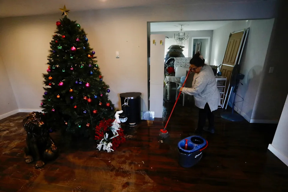
Francis Tarango mops inside her daughters' home damaged by floodwaters in Burlington, Wash., Saturday, Dec. 13, 2025. (AP Photo/Manuel Valdes)(ASSOCIATED PRESS)
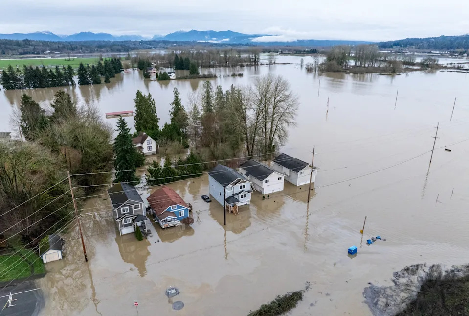
An aerial view shows homes surrounded by floodwaters in Snohomish, Wash., Thursday, Dec. 11, 2025. (AP Photo/Stephen Brashear)(ASSOCIATED PRESS)
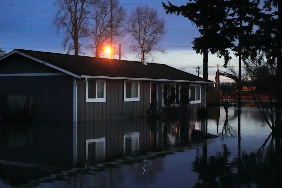
Floodwaters surround a home after heavy rains led to historic flooding in the region Saturday, Dec. 13, 2025, in Burlington, Wash. (AP Photo/Lindsey Wasson)(ASSOCIATED PRESS)
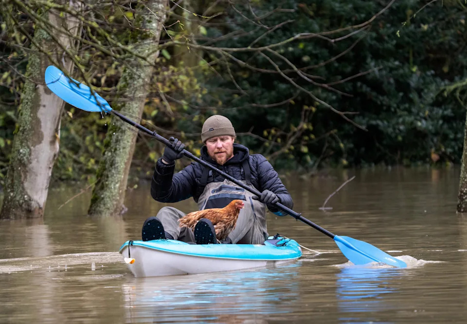
Eric Gustin paddles to dry land after rescuing one of several chickens from a flooded coop, Friday, Dec. 12, 2025, in Burlington, Wash. (AP Photo/Stephen Brashear)(ASSOCIATED PRESS)
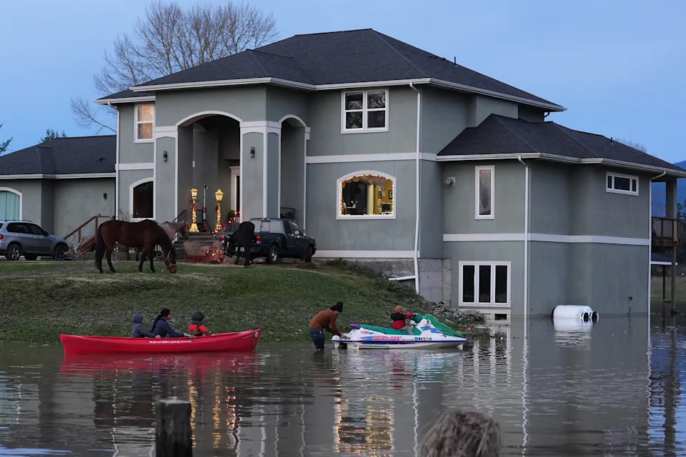
"E-man" Trujillo, center, uses a jet-ski to tow a canoe with his children Liam, 6, far left, Julissa, 15, and Benjamin, 5, third from left, as their horses take refuge on the high ground at their front door after heavy rains led to historic flooding in the region Saturday, Dec. 13, 2025, in Burlington, Wash. (AP Photo/Lindsey Wasson)(ASSOCIATED PRESS)
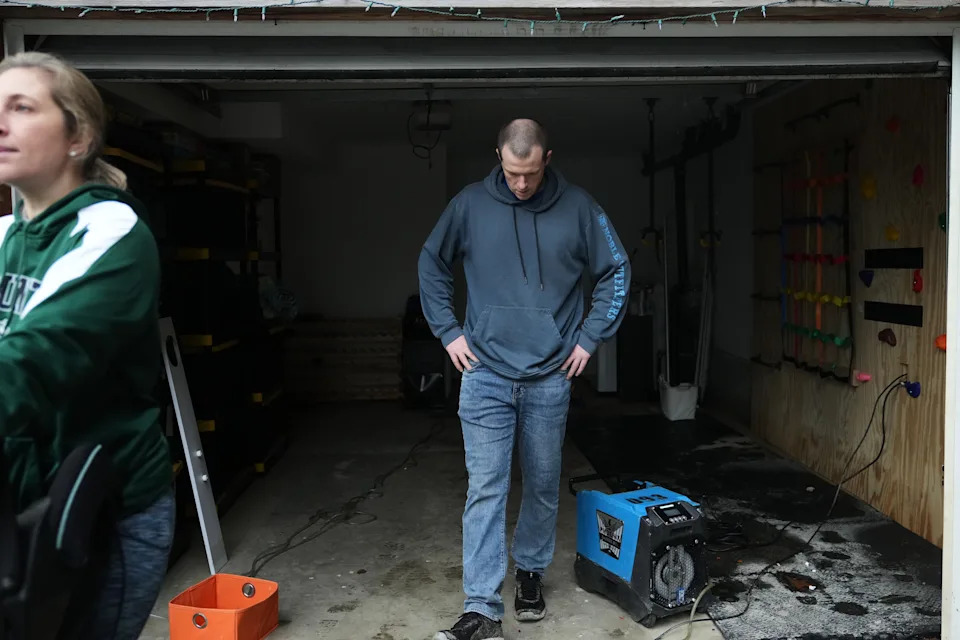
Todd Hinderman, right, and wife Marielle Hinderman, left, walk out of their garage after the lower level of their home flooded after heavy rains in the region Saturday, Dec. 13, 2025, in Burlington, Wash. (AP Photo/Lindsey Wasson)(ASSOCIATED PRESS)
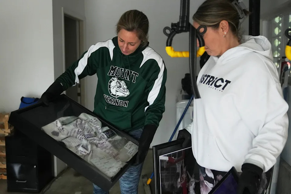
Mandy McColl, right, looks over as friend Marielle Hinderman shows a jersey signed by kids coached by her husband, Todd, after it was caught in floodwaters that reached their home in the region Saturday, Dec. 13, 2025, in Burlington, Wash. (AP Photo/Lindsey Wasson)(ASSOCIATED PRESS)
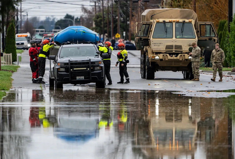
Emergency crews, including National Guard soldiers, wort in a neighborhood flooded by the Skagit River on Friday, Dec. 12, 2025, in Burlington, Wash. (AP Photo/Stephen Brashear)(ASSOCIATED PRESS)
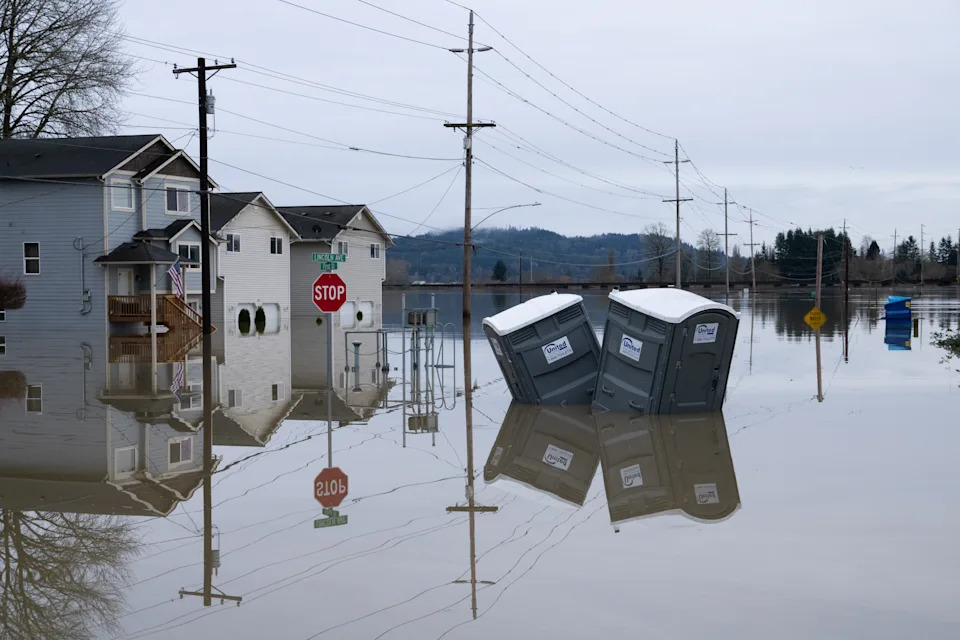
Partially inundated residences and portable toilets sit in floodwaters in Snohomish, Wash., Thursday, Dec. 11, 2025. (AP Photo/Stephen Brashear)(ASSOCIATED PRESS)

A cow drinks from the flooded Snohomish River in Snohomish, Wash., Thursday, Dec. 11, 2025. (AP Photo/Stephen Brashear)(ASSOCIATED PRESS)


