A new structural analysis of roughly 190,000 miles (300,000 km) of Roman roads shows that Constantinople (Istanbul) was more central to empire-wide overland travel than Rome. The study, published in Nature Communications, finds that Roman engineers favored straight roads where topography allowed, that many routes remain aligned with modern highways, and that provincial capitals were strategically located for administration. The Roman network shaped movement of armies, goods and ideas for centuries and left a persistent imprint on later transport corridors.
How Roman Roads Shaped a Continent: New Study Shows Constantinople, Not Rome, Was the Overland Hub
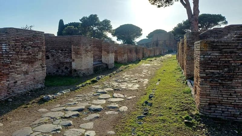
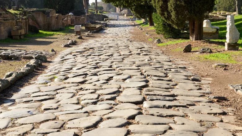
A street in Ostia, the ancient seaport of Rome, Italy, at the mouth of the river Tiber, is pictured in this photograph released on September 14, 2026. Tom Brughmans/Handout via REUTERS
Augustus marked the symbolic starting point of Rome's vast road network with the Milliarium Aureum (Golden Milestone) in the Roman Forum in 20 BC. That network grew into a continent-spanning transport system linking Europe, the Middle East and North Africa. A new structural analysis of roughly 190,000 miles (300,000 km) of ancient routes, published in Nature Communications, reveals surprising patterns in how those roads were organized and how they persist in modern transport corridors.
Key Findings From the Study
The researchers found that the old proverb "all roads lead to Rome" is not strictly true for overland travel across the entire empire. While Rome remained central for Mediterranean shipping and regional travel, Constantinople (modern Istanbul) — moved to by Emperor Constantine in the early fourth century AD — proved to be a far more central hub for empire-wide overland routes. The city's position on the Bosporus and evidence for ancient ferry crossings helped link European and Asian road traffic.
"All roads lead to Rome? Not really," said Tom Brughmans, a classical archaeologist at Aarhus University and a lead author of the study. "Provincial capitals were often exceptionally well placed on their province's roads, facilitating administration and tax collection."
Engineering, Topography and Daily Life
Roman engineers aimed for straight alignments — the Via Appia remains a classic example — but they did not "move mountains" to achieve straightness. In flat regions such as parts of Belgium, northern France and Italy's Po Valley, roads tend to be quite straight; in rugged terrain, routes bend to accommodate the landscape.
Many Roman roads were constructed to last, using layered techniques and materials such as crushed stone, lime mortar, gravel and paving slabs. Traffic was mostly pedestrian and animal-powered: walkers, riders on horses, donkeys, mules and camels, and goods hauled by pack animals and carts. While the network enabled strategic military movements and the spread of ideas like early Christianity, the heaviest day-to-day use was often local — journeys between farms, fields and nearby markets.
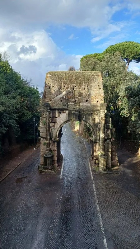
The so-called Arch of Drusus, near the start of the ancient road Via Appia, is pictured in Rome, Italy, in this photograph released on September 14, 2026. The ancient road is still in use today. Tom Brughmans/Handout via REUTERS
Long-Term Legacy
The study documents the persistence of Roman routes: many remained primary thoroughfares through the medieval period and influenced the layout of 19th- and 20th-century railways and highways. Examples include the Via Augusta in Spain, which largely follows the modern N-340 motorway and passes beneath the Arc de Bera between Tarragona and Barcelona.
Co-author Adam Pazout of the Autonomous University of Barcelona emphasized the geographic reach and longevity of the network: "The persistency of the Roman road network can be demonstrated for many regions, from Britain to the Near East." Many provincial capitals identified as especially central on their local networks include Ankara (Ancyra), London (Londinium) and Corinth.
Why This Matters
Beyond engineering, the Roman road network created a continent-scale platform for the movement of people, goods, animals and ideas — shaping economic, military and cultural life for centuries. The new analysis helps historians, archaeologists and planners understand how ancient infrastructure organized space and how echoes of that organization survive in modern transport systems.
Reporting based on the Reuters story by Will Dunham and the research published in Nature Communications. Quotes from Tom Brughmans (Aarhus University) and Adam Pazout (Autonomous University of Barcelona).
Help us improve.