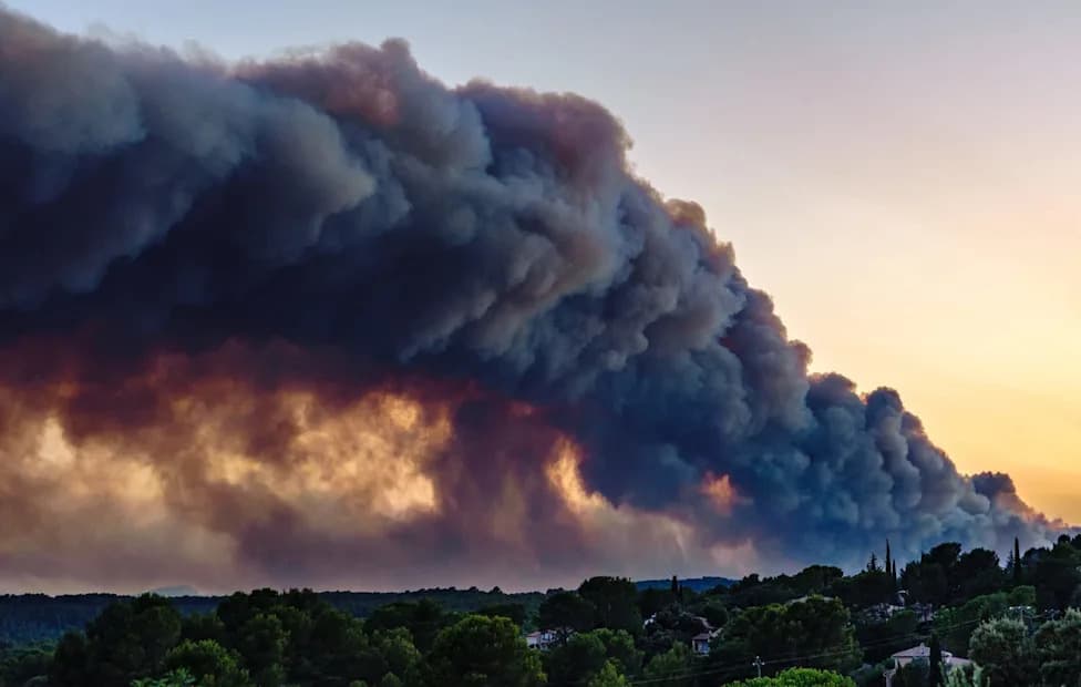
France has recorded its first-ever pyrocumulonimbus — a towering 'fire-cloud' seen near Bordeaux — amid an unprecedented wildfire season that has forced mass evacuations and caused major economic disruption. These clouds form when extreme heat drives smoke, ash and vapour high into the atmosphere and can create powerful winds, lightning and dangerous plume collapses that spread burning debris. Meteorologists can spot conditions that favour their formation but cannot predict exactly when or where they will occur, complicating emergency planning. Experts warn Western Europe should prepare for more such events as severe fires become more common.
Explainer: France Records Its First 'Fire-Cloud' — What Is a Pyrocumulonimbus?
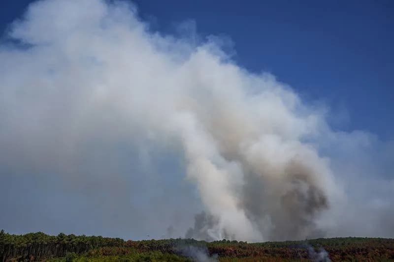
Smoke rises from a wildfire in Le Grand Crohot amid drought conditions following a heatwave and water shortages across much of France, Lege-Cap-Ferret, Gironde department, France, July 28, 2026. REUTERS/Florion Goga
France is facing an unprecedented wildfire season that has forced the evacuation of hundreds of thousands of people and inflicted heavy economic damage during the peak tourist period. Alongside the scale of the blazes, scientists and emergency services say the fires are behaving in new and dangerous ways — including the country's first recorded pyrocumulonimbus, commonly called a 'fire-cloud'.
What Is a 'Fire-Cloud'?
A pyrocumulonimbus is a type of thundercloud produced by extremely intense wildfire heat. Strong updrafts lift smoke, ash and water vapour high into the atmosphere, sometimes pushing material almost to the stratosphere. The column can resemble a chimney, carrying combustion products skyward and forming a towering cloud above the blaze.
'You can think of it as like a chimney, which is a fire at the bottom and the smoke going straight up a chimney into the stratosphere,' said David Bowman, professor of pyrogeography and fire science at the University of Tasmania.
How Do Fire-Clouds Make Fires Worse?
Pyrocumulonimbus clouds can make wildfires far more dangerous and unpredictable. They may generate strong, localized winds that abruptly change a fire's direction, and their convective activity can produce lightning that ignites new fires downwind. When the convective column weakens or collapses in a 'plume collapse', burning embers and debris can shower back onto the landscape, creating fresh ignition points.
'When the plume collapses, it's a showering of debris, burning debris,' Bowman said, stressing how a collapsing column can spawn new blazes below the original fire.
What Happened In France — And What It Means For Europe
French authorities reported that a pyrocumulonimbus was observed near Bordeaux — the first confirmed instance in France. Local emergency officials say the erratic behaviour associated with these columns complicates evacuation planning and can force wider precautionary evacuation zones to protect residents and responders.
Jean-Christophe Vincendon, wildfire coordinator at France's national meteorological service, noted that while meteorologists can identify conditions that favour fire-cloud formation, they cannot precisely predict when or where one will form. Marc Vermeulen, head of the Gironde fire and rescue service, warned that the added uncertainty presents a significant operational challenge for crews working to protect communities and infrastructure.
Experts say that Western Europe may see more pyrocumulonimbus events as extreme fires become more frequent in large wildland areas around the world. 'This is a very gravely serious milestone,' Bowman said. 'It is fascinating, but it is also absolutely disastrous and terrible, and we just don't want more of these things.'
Reporting by Coralie Lamarque; editing by Gabriel Stargardter and Ros Russell.
Help us improve.