Scientists warn a rapidly strengthening El Niño in the equatorial Pacific is setting daily sea surface temperature records and may become the strongest event on record. Combined with long-term human-driven warming, it raises the odds that 2026 or 2027 will be the warmest year globally. Expected consequences include altered hurricane patterns, wetter winters in some U.S. regions, droughts and floods worldwide, and significant economic costs.
‘Mind-Blowing’ El Niño May Shatter Records — What It Means for Weather, Heat and the Global Economy
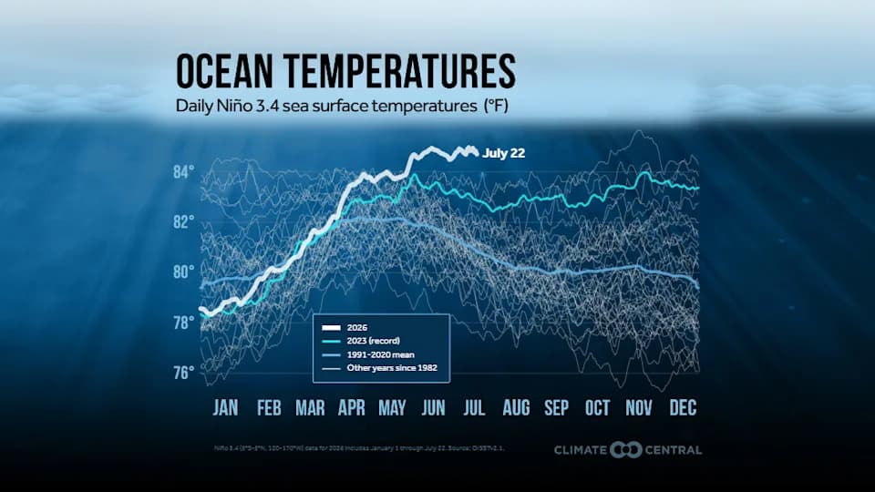
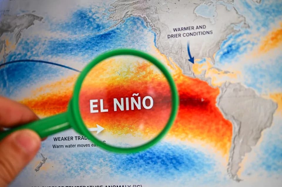
A sea surface temperature graphic by Climate Central, using NOAA data displayed by the University of Maine's Climate Reanalyzer, shows just how warm water temperatures have been this summer.
The equatorial Pacific is heating up at an extraordinary rate as a strengthening El Niño sets daily sea surface temperature records. Scientists warn the event could become the strongest on record, and its effects, combined with long-term human-driven warming, raise the odds that 2026 or 2027 will be the warmest year globally.
Why Scientists Are Alarmed
Berkeley Earth researchers Zeke Hausfather and Robert Rohde report that sea surface temperatures in the El Niño region have already crossed thresholds typically associated with a very strong event and are warming faster than during the notorious 1997–98 El Niño. NOAA data indicate July water temperatures in the key Pacific region are the hottest in the modern record for that month.
What we are seeing is an unprecedented combination of a very strong El Niño and elevated background warmth from human-caused climate change — Daniel Swain, University of California
How El Niño Interacts With Global Warming
El Niño is a natural climate pattern, but its impacts are being amplified by a warmer baseline climate. Historically, strong El Niño events temporarily raise global temperatures by roughly 0.54°F; this time, that boost would be added to already elevated global temperatures driven by greenhouse gas emissions, increasing the chance of record-breaking years.
What Models and Observations Show
Most leading climate models now predict an El Niño exceeding the 2015–2016 event even after accounting for background ocean warming. Climate Central reports sea surface temperatures in the El Niño region are up to 6°F warmer than normal for the date — an anomaly made several times more likely by human-caused warming. Still, scientists note that models are operating in uncharted territory and that teleconnections and local details will shape the real-world impacts.
Expected Impacts
- Global Heat: An extra push to global temperatures, increasing the likelihood of record-warm years.
- U.S. Weather: A stronger subtropical jet stream can mean wetter, stormier winters for California, the interior Southwest and parts of the southern tier of states.
- Hurricanes: Higher activity in the eastern Pacific but suppressed Atlantic hurricane activity, including a likely tamer 2026 Atlantic season.
- Hydrology and Ecosystems: Regionally divergent impacts — catastrophic floods in some places, severe drought and wildfire risk in others; fisheries and agriculture are vulnerable.
- Economic Risk: Early forecasts and historical comparisons suggest this could be among the costliest El Niño events on record.
Uncertainties Remain
Experts including Michael Mann emphasize that El Niño is part of a chaotic climate system. Small differences in where the strongest ocean warming occurs, or in wind patterns, can substantially alter regional outcomes. Scientists stress that while many models converge on a very strong event, the precise impacts will depend on complex atmospheric teleconnections.
Researchers and public agencies are watching evolving observations and model runs closely. Governments, farmers, emergency managers and businesses are being urged to prepare for a range of outcomes, from intense winter storms and flooding to drought and heat extremes, depending on the region.
Source: Analysis and reporting synthesized from Berkeley Earth, NOAA, Climate Central, the World Meteorological Organization, and expert commentary from university climate scientists and economic impact researchers.
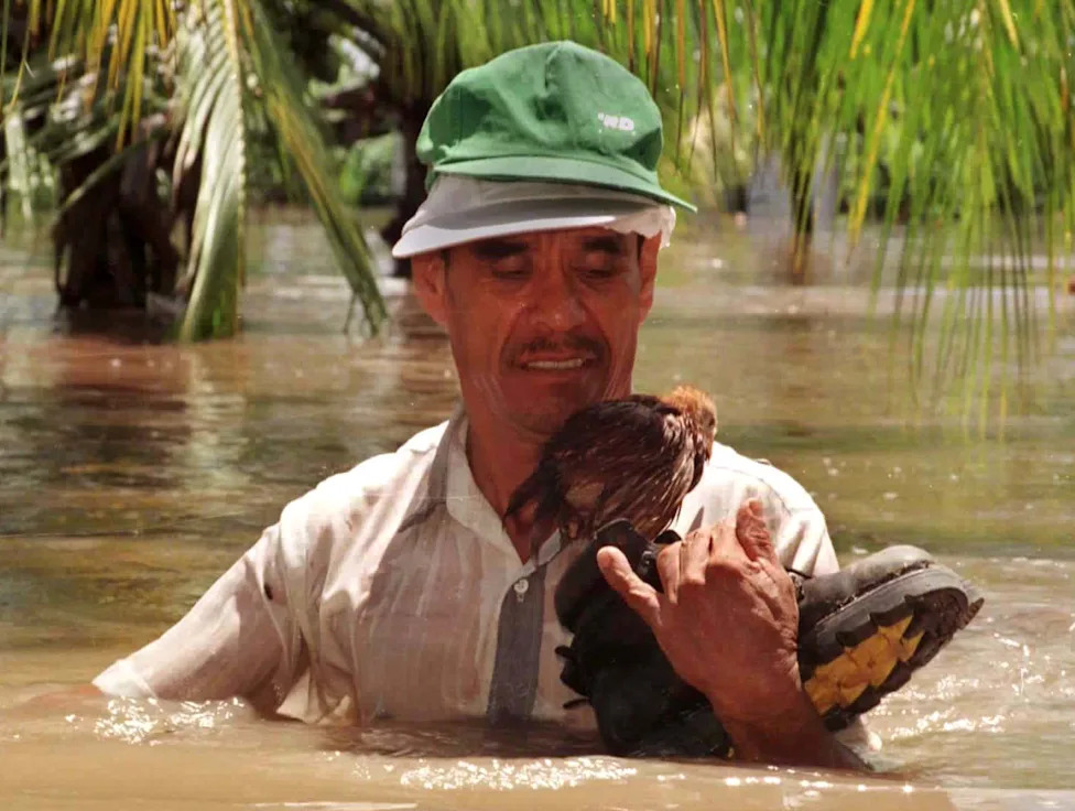
A man carries a small chicken, perched on a shoe, from his flooded home in the village of Gomera, Escuintla, south of Guatemala's capital, on Sept. 30, 1997. Two rivers in the Escuintla area overflowed after heavy rain during El Niño, flooding over 800 homes. Another El Niño is strengthening in the Central and Eastern Pacific in June 2026, and likely to affect weather patterns around the globe in the months ahead. See impacts from previous events in the U.S. and worldwide in the following photos.(Reuters)
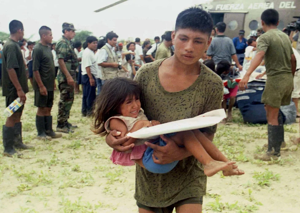
A Peruvian soldier evacuates a child victim of flooding in Piura, north of Lima, Peru, on Jan. 10, 1997, during flooding influenced by El Niño.(Silvia Izquierdo, Reuters)
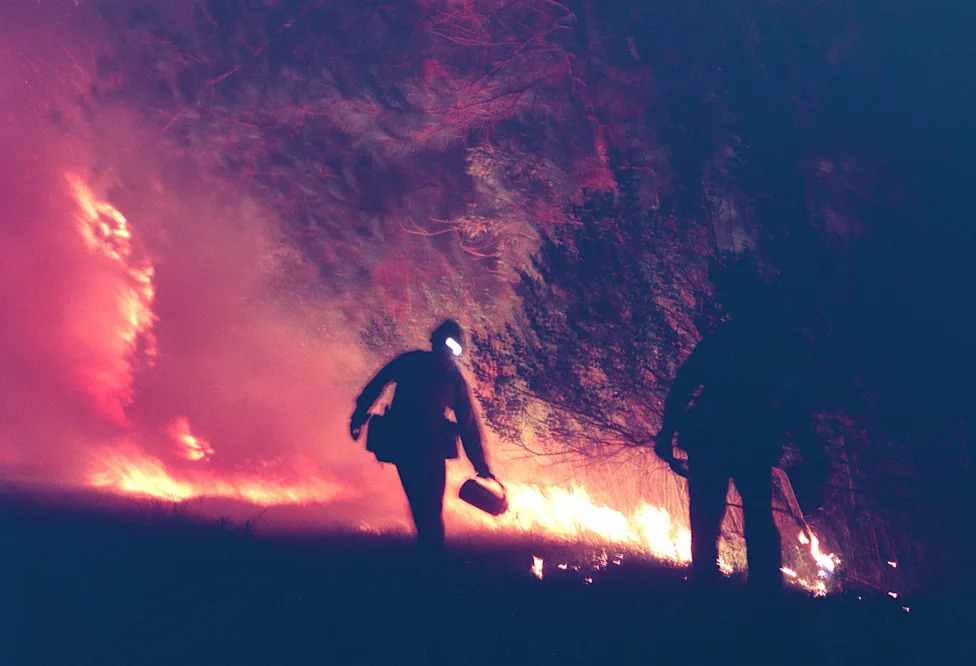
Lorenzo Macias and Darren Davis with the Stanislaus Hot Shots from California start a back fire along Clyde Morris Boulevard in Daytona Beach on July 1, 1998 to stop a large fire burning toward the city. Research later linked the 1998 firestorms in Florida to the exceptional El Niño that suddenly halted and transitioned to a La Niña.(David Tucker, Daytona Beach News-Journal)
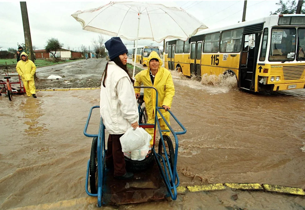
A woman uses a cycle-cart to cross a rain-flooded street in the outskirts of Santiago, June 23, 1997. At least 18 people died and more than 50,000 people nationwide were left homeless after heavy rain, a side effect of El Nino.(Reuters)
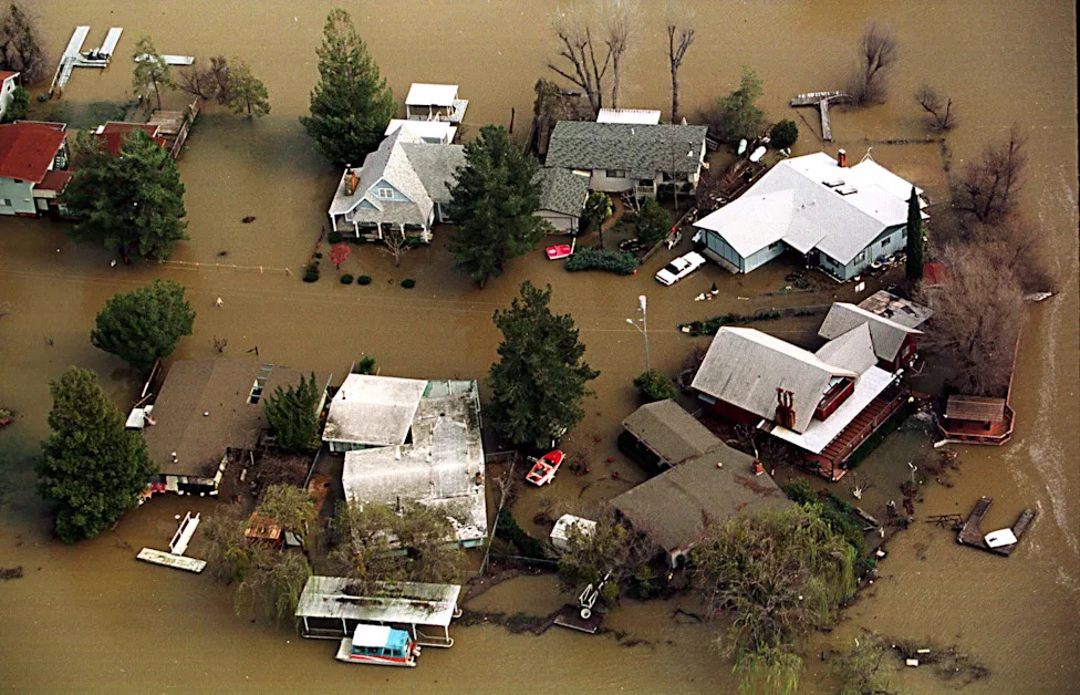
A cul-de-sac of homes is partially submerged in flood waters as Clear Lake continues to rise on February 24, 1998. El Niño influenced rains caused the lake to rise to its highest levels since 1914.(Sean Ramsey)
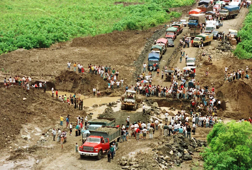
Construction crews try to repair a road destroyed by flooding due to El Niño on May 5, 1998. Authorities reported the country had suffered $1.925 million in damage due to the storms.(Reuters)
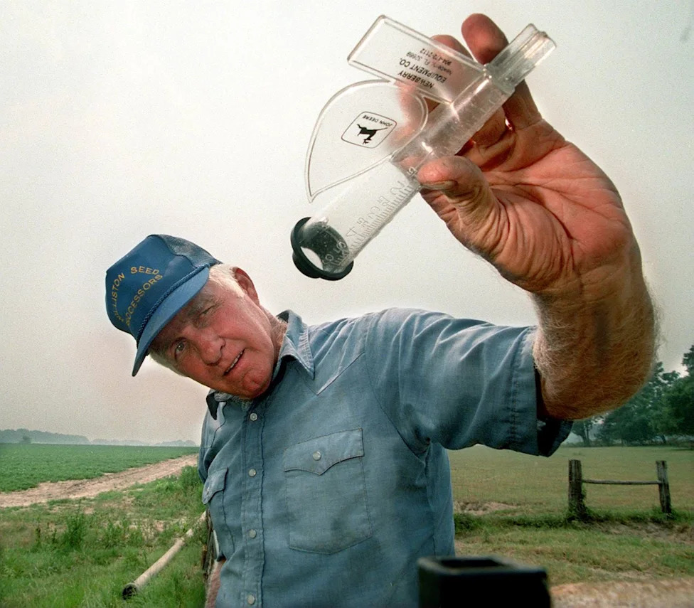
D.A. Lewis checks his rain gauge after irrigating his 40 acres of peanuts in Marion County, Florida on June 23, 1998. "Yup, no rain," Lewis said sarcastically. Lewis only planted half of what he normally plants because of the dry conditions. "I don't call this El Nino, I call it Hell Nino."(Doug Engle, Star-Banner)
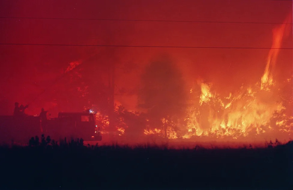
Firefighters direct a water cannon at the head of a wildfire trying to slow its approach toward the evacuated Cedar Highlands subdivision in Daytona Beach, Florida, on the morning of July 2, 1998.(Sam Cranston, Daytona Beach News-Journal)
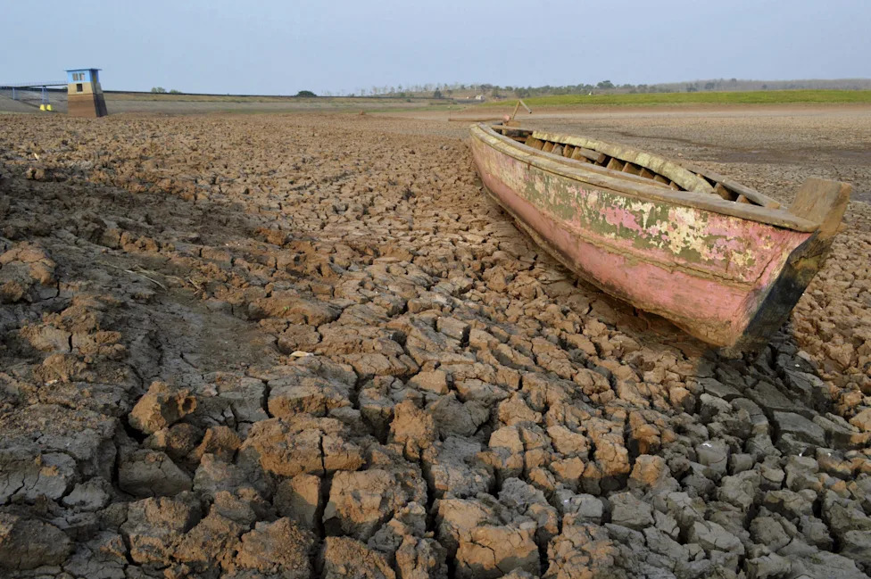
The influence of El Niño was blamed for a drought in Indonesia's East Java province that left this boat stranded on a dry, cracked riverbed of the Dawuhan Dam during drought season in Madiun on Oct. 5, 2015.(Antara Foto, Reuters)
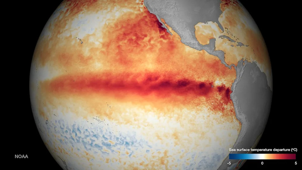
Sea surface temperature departure is seen in an undated NOAA image released Oct. 9, 2015 as El Niño strengthens.(Reuters / NOAA)
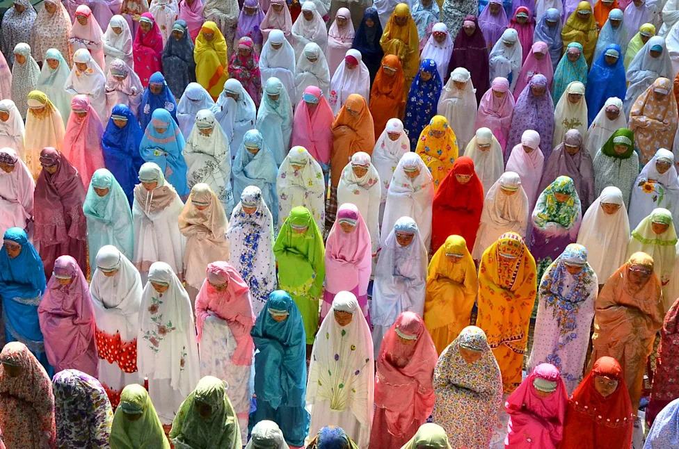
Female students attend a mass prayer session to ask for rain, in Kudus, Indonesia's Central Java province on Oct. 17, 2015.(Yusuf Nugroho, Antara Foto, Reuters)
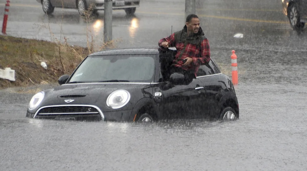
A driver climbs out of a window of his car after driving onto a flooded road in Van Nuys, California, Jan. 5, 2016. An El Nino-strengthened storm brought widespread rain to drought-stricken California, triggering flooding that clogged roadways, and authorities warned residents about possible mud slides.(Gene Blevins, Reuters)
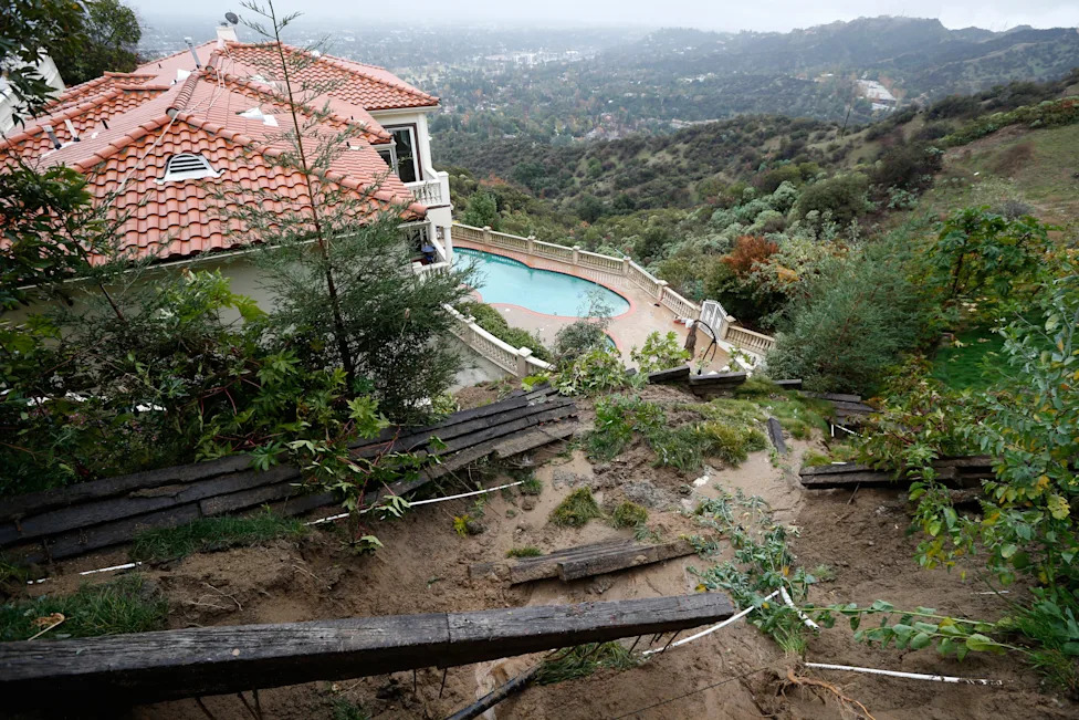
A home with a fence destroyed by a mudslide is seen on Jan. 6, 2016, after an El Nino-strengthened storm brought rain to Pasadena, California.(Lucy Nicholson, Reuters)
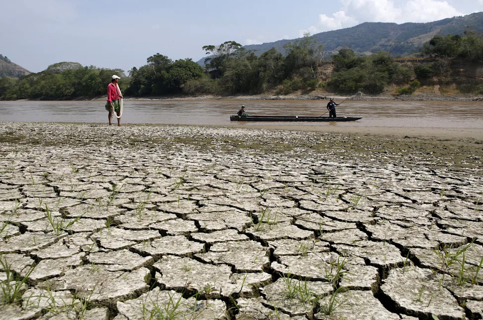
Fisherman Gabriel Barreto stands on the shore of the Magdalena river, the longest and most important river in Colombia, in the city of Honda, Jan. 14, 2016.(John Vizcaino, Reuters)
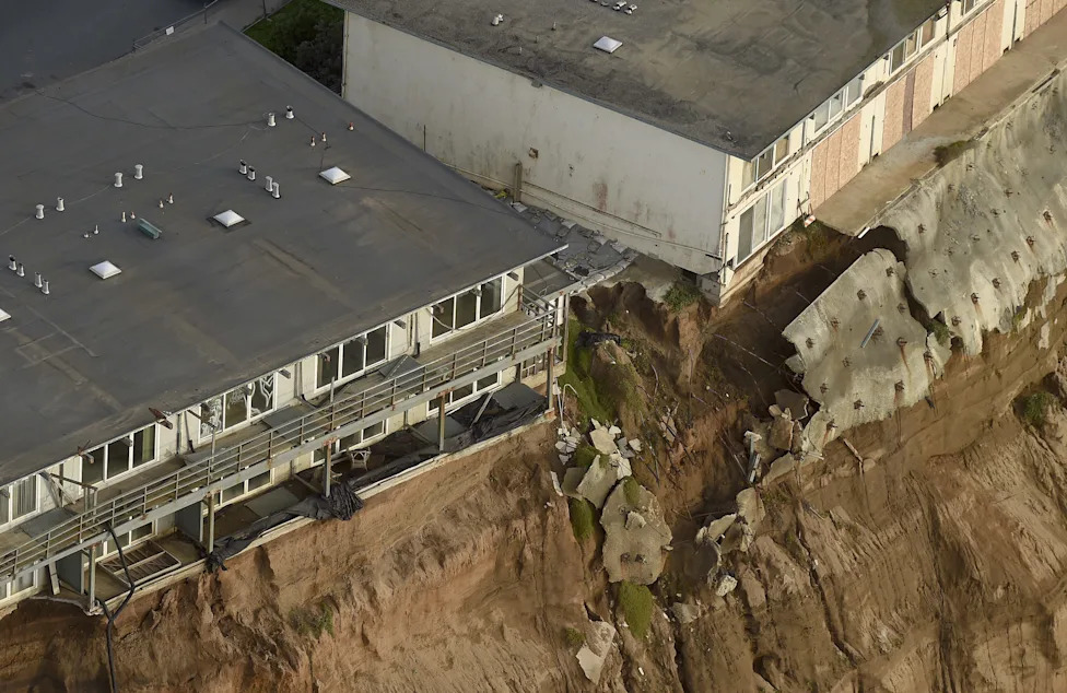
Uninhabitable apartments, in danger of collapsing into the Pacific Ocean, line Esplanade Ave. in Pacifica, California on Jan. 26, 2016.(Noah Berger, Reuters)
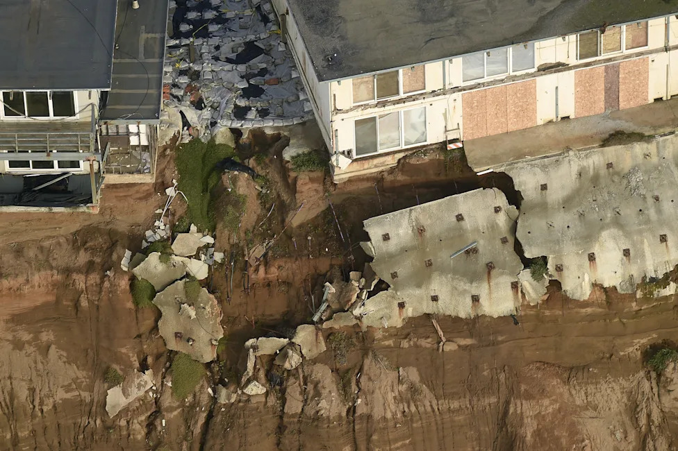
Uninhabitable apartments, in danger of collapsing into the Pacific Ocean, line Esplanade Ave. in Pacifica, California on Jan. 26, 2016.(Noah Berger, Reuters)
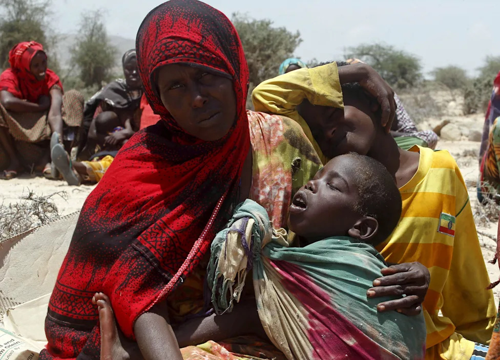
A displaced woman and her children wait for assistance at Habaas town of Awdal region, Somaliland on April 9, 2016. Across the Horn of Africa, millions were hit by the severe El Nino-related drought.(Reuters / Feisal Omar)
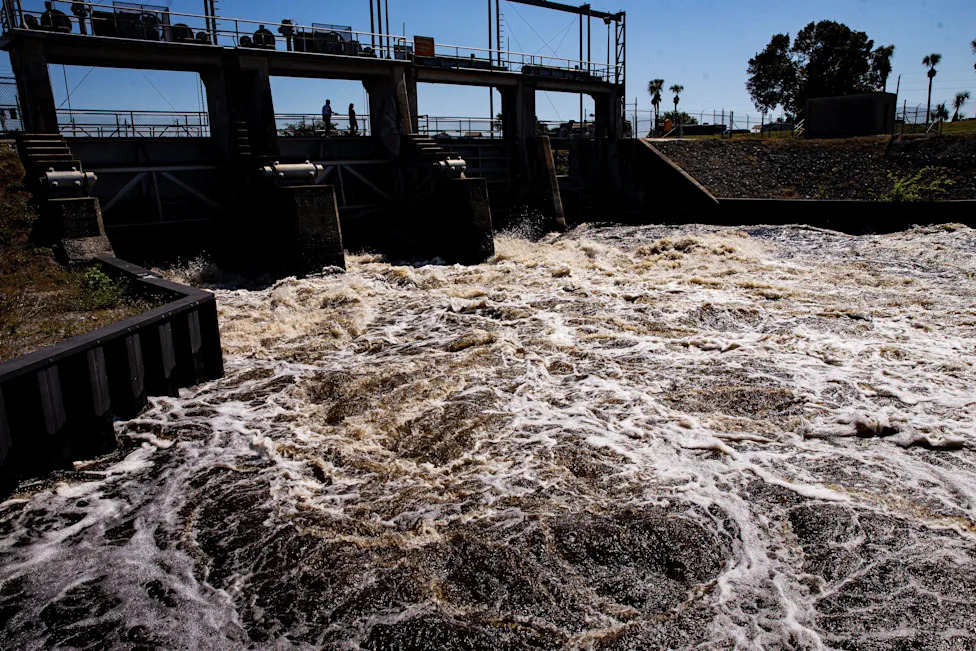
Water rushes through the Ortona Locks on the Caloosahatchee River on Monday, Feb. 26, 2024, as the Army Corp of Engineers releases water from Florida's Lake Okeechobee during continued El Nino conditions.(Andrew West/The News-Press, USA TODAY Network)
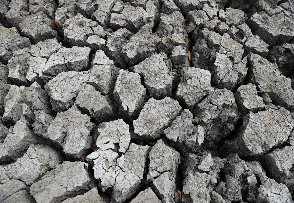
A view of cracked ground at a dam in Mudzi, Zimbabwe on July 2, 2024, during an El Nino-influenced drought, resulting in malnutrition among children under the age of five, pregnant and lactating women, and adolescents.(Philimon Bulawayo, REUTERS)
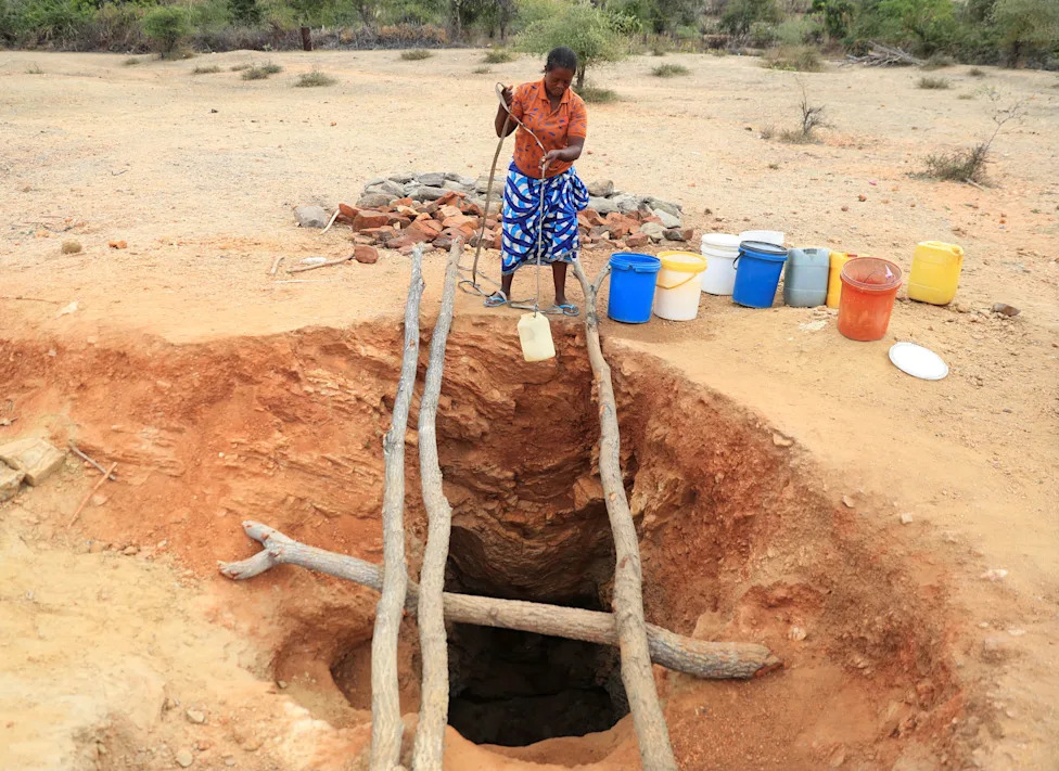
A woman fetches drinking water from an unprotected well on July 2, 2024 in Kotwa, in the Mudzi district of Zimbabwe during an El Nino-influenced drought.(Philimon Bulawayo, REUTERS)
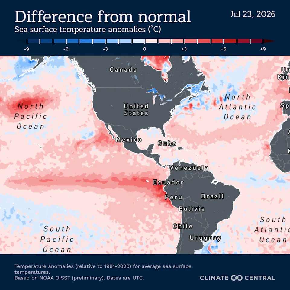
Sea surface temperatures in the El Niño region and in other locations of the Pacific Ocean are several degrees warmer than normal, as illustrated in this anomalies map from Climate Central, based on data from the National Oceanic and Atmospheric Administration.
Help us improve.